Parsonage Wood

Wood, Forest in Devon Torridge

England

Parsonage Wood

View towards Chiddlecombe
View towards Chiddlecombe Credit: Roger Cornfoot

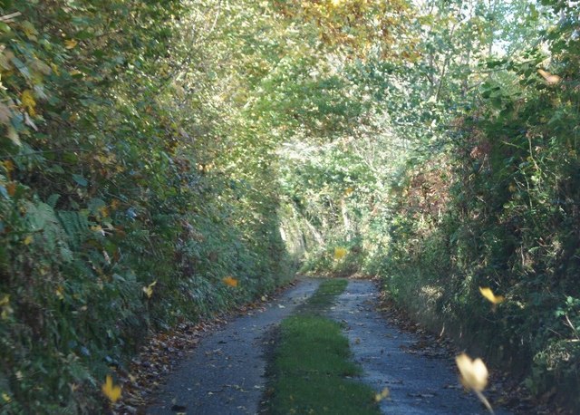
Parsonage Wood is a picturesque woodland located in Devon, England. Situated near the village of Newton Abbot, this woodland is a haven for nature enthusiasts and those seeking a peaceful retreat away from the hustle and bustle of city life.

Covering an area of approximately 50 acres, Parsonage Wood is characterized by its diverse array of trees, plants, and wildlife. The woodland is predominantly made up of native broadleaf species such as oak, beech, and ash trees. These majestic trees provide a canopy of shade during the summer months and a beautiful display of colors during the autumn season.

Walking through Parsonage Wood, one can explore a network of well-maintained footpaths, leading visitors through the different sections of the woodland. These paths offer the opportunity to immerse oneself in the natural beauty of the area, with occasional benches and picnic spots providing a perfect place to rest and admire the surroundings.

The woodland is home to a rich variety of flora and fauna, making it an excellent spot for wildlife observation. Bird enthusiasts can spot species such as woodpeckers, nuthatches, and various songbirds, while lucky visitors may even catch a glimpse of elusive deer or foxes roaming the forest floor.

Parsonage Wood is open to the public year-round, and visitors can enjoy the changing seasons and the different sights and sounds that come with them. Whether it's a leisurely stroll, a family picnic, or birdwatching, this tranquil woodland offers a serene escape into nature.

If you have any feedback on the listing, please let us know in the comments section below.

Parsonage Wood Images

Images are sourced within 2km of 50.986954/-4.2590955 or Grid Reference SS4123. Thanks to Geograph Open Source API. All images are credited.

View towards Chiddlecombe
Houses at Spanny Hone
Alwington : Atlantic Highway A39 Looking along the Atlantic Highway.
Alwington : Atlantic Highway A39
Looking along the Atlantic Highway.
Alwington : Road A road heads off from the Atlantic Highway A39.
Alwington : Road
A road heads off from the Atlantic Highway A39.
Lane to Goldworthy
Lane to Goldworthy
Lane to Goldworthy
Lane to Goldworthy
A39 eastbound
A39 eastbound
Two side roads off the A39 near Fairy Cross These minor roads lead to farms and small villages south of the through road.  Clouds have formed over the higher ground further from the sea.
Two side roads off the A39 near Fairy Cross
These minor roads lead to farms and small villages south of the through road. Clouds have formed over the higher ground further from the sea.
Bend in the A39 near Spanny Hone The road has its very own website; <span class="nowrap"><a title="http://www.atlantic-highway.co.uk/" rel="nofollow ugc noopener" href="http://www.atlantic-highway.co.uk/">Link</a><img style="margin-left:2px;" alt="External link" title="External link - shift click to open in new window" src="https://s1.geograph.org.uk/img/external.png" width="10" height="10"/></span>
Bend in the A39 near Spanny Hone
The road has its very own website; LinkExternal link
A windswept tree near Spanny Hone
The A39 near Spanny Hone
Hedge and fields near Spanny Hone
Alwington Methodist Church Situated in the hamlet of Ford
Alwington Methodist Church
Situated in the hamlet of Ford
Alwington Methodist Church Actually in Ford in Alwington Parish
Alwington Methodist Church
Actually in Ford in Alwington Parish
Fairy Cross Bus Shelter Travellers heading South do not have quite the same grandeur as those heading North <a href="https://www.geograph.org.uk/photo/207026">SS4024 : Fairy Cross Bus Shelter</a>. Could it be because they are heading out of Devon into Cornwall?
Fairy Cross Bus Shelter
Travellers heading South do not have quite the same grandeur as those heading North SS4024 : Fairy Cross Bus Shelter. Could it be because they are heading out of Devon into Cornwall?
Fairy Cross Bus Shelter A fantastic construction for travellers heading North on the A39
Fairy Cross Bus Shelter
A fantastic construction for travellers heading North on the A39
Alwington Church Tower A 15c tapered tower complete with gargoyles
Alwington Church Tower
A 15c tapered tower complete with gargoyles
Alwington Parish Church Dedicated to St Andrew,this is mainly 15c with the porch rebuilt in the 17c
Alwington Parish Church
Dedicated to St Andrew,this is mainly 15c with the porch rebuilt in the 17c
Show me another place!

Parsonage Wood is located at Grid Ref: SS4123 (Lat: 50.986954, Lng: -4.2590955)

Administrative County: Devon

District: Torridge

Police Authority: Devon and Cornwall

What 3 Words

///streamers.promotes.itself. Near Bideford, Devon

Related Wikis

Alwington

Alwington is a village and civil parish in the Torridge district of Devon, England. The parish is on the coast and includes the hamlets of Alwington, Fairy...
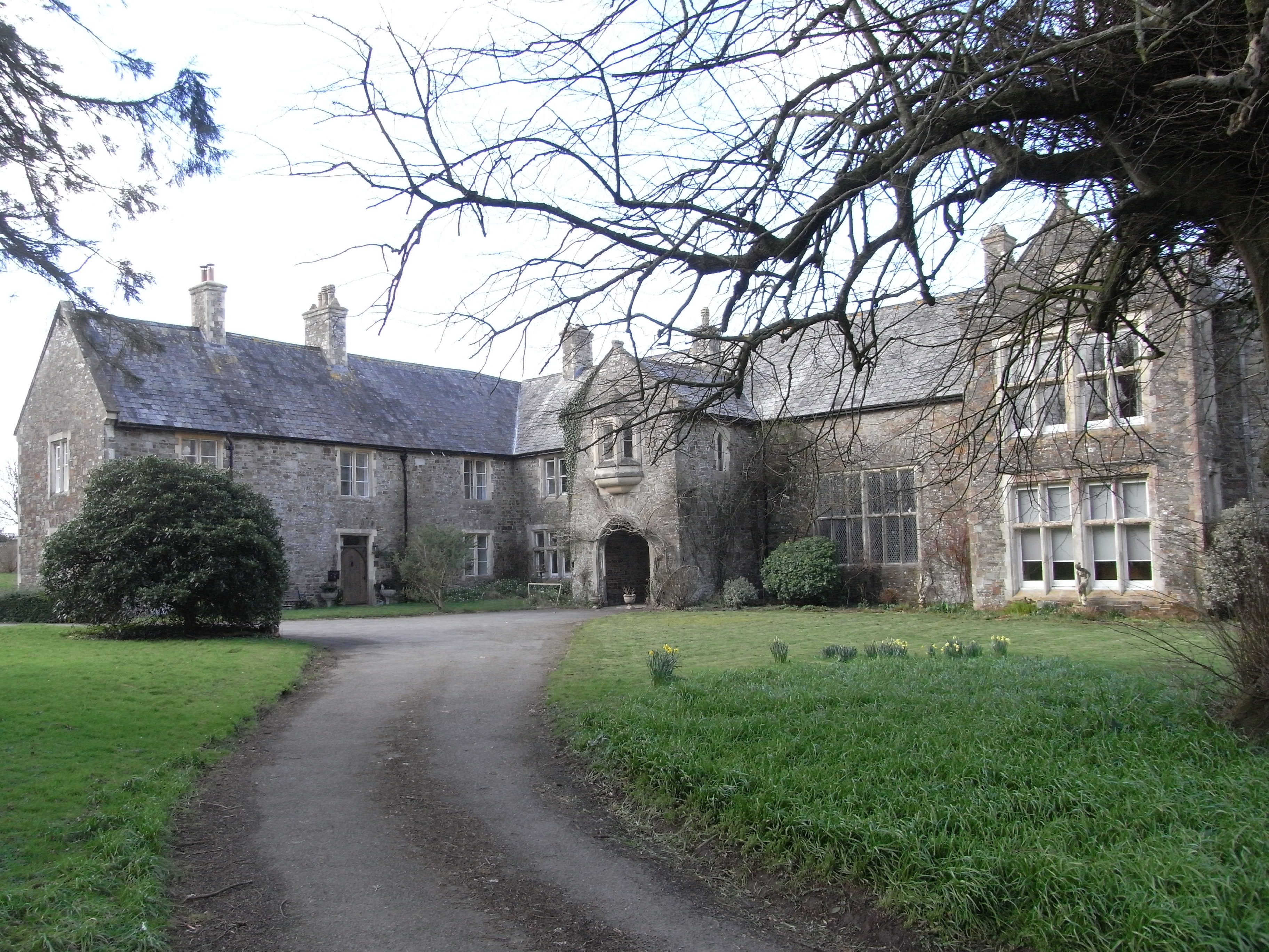
Orleigh Court

Orleigh Court is a late medieval manor house in the parish of Buckland Brewer about 4 miles (6.4 km) south-west of Bideford, North Devon, England. It is...

Manor of Orleigh

Orleigh is a historic manor in the parish of Buckland Brewer, situated 4 miles to the south west of Bideford, North Devon, England. The manor house is...

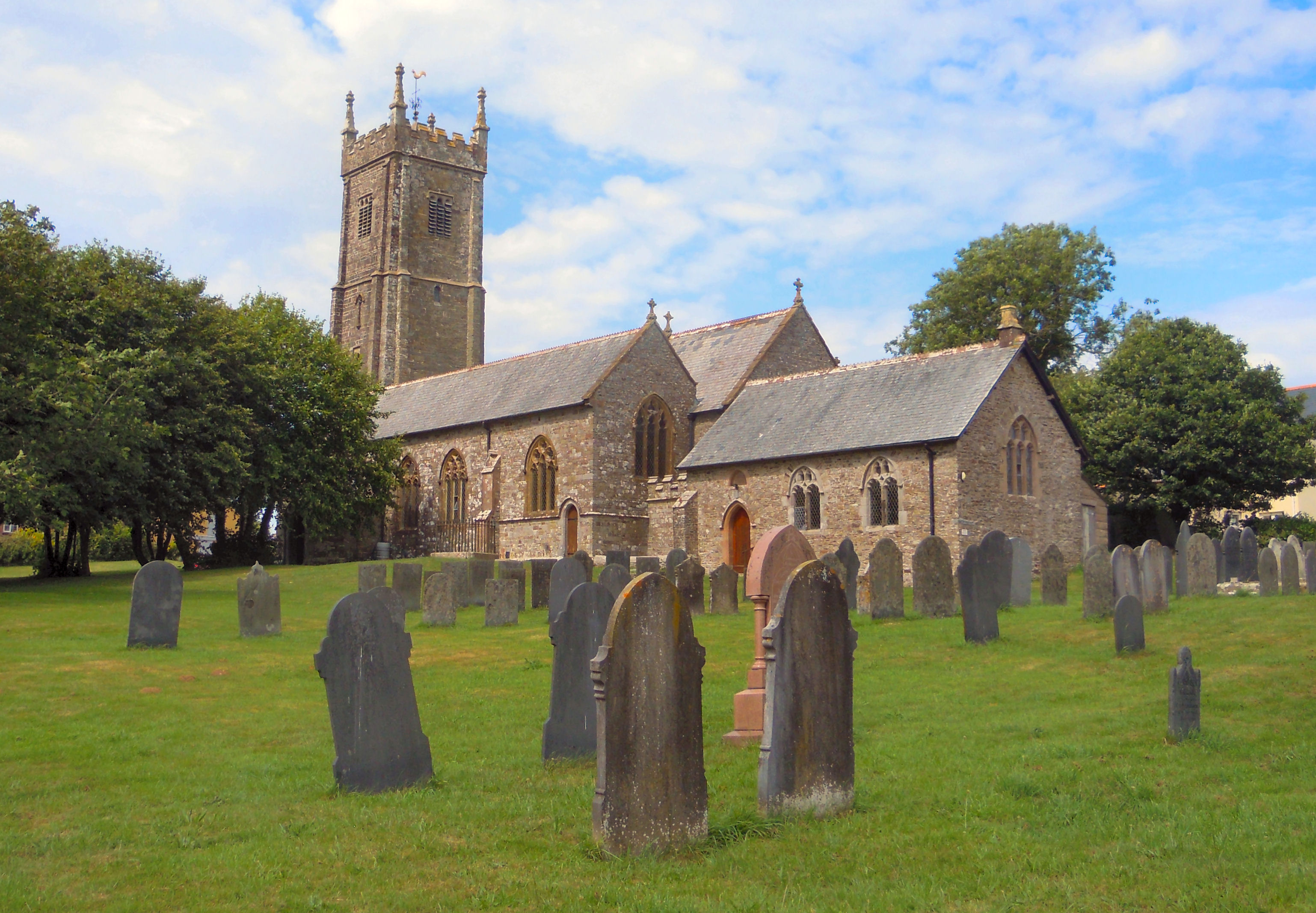
Church of St Mary and St Benedict, Buckland Brewer

St Mary and St Benedict is the Church of England parish church for the village of Buckland Brewer near Bideford in North Devon. It is part of the benefice...

Related Videos

"Cherry Bomb" by Tattooed Balloon #shorts

https://open.spotify.com/album/7LUOdEOs3jiMeR6h4LwHHK?si=he91-WEnRi2hyS3WBSsHLg.

VLOG Holiday in Bideford, Premier Inn - Back at the hotel after dinner

I'm on holiday in Bideford! Staying at the Premier Inn at Atlantic Village. Join me on a quick walk around as I get back to the hotel ...

Nearby Amenities

Located within 500m of 50.986954,-4.2590955
Woodtown
Is In: Devon
Place: hamlet
Source: OS_OpenData_StreetView
Lat/Long: 50.9893763/-4.2607898
Barrier: stile
Lat/Long: 50.9907891/-4.2605708
Power: pole
Lat/Long: 50.9910881/-4.2602491
Power: pole
Lat/Long: 50.9907758/-4.2583528
Power: pole
Lat/Long: 50.9904921/-4.2567006
Power: pole
Lat/Long: 50.9907049/-4.2552012
Direction: 280
Generator Method: photovoltaic
Generator Output Electricity: yes
Generator Solar Modules: 2
Generator Source: solar
Generator Type: solar_photovoltaic_panel
Location: roof
Power: generator
Lat/Long: 50.9901916/-4.261554
Direction: 190
Generator Method: photovoltaic
Generator Output Electricity: yes
Generator Solar Modules: 3
Generator Source: solar
Generator Type: solar_photovoltaic_panel
Location: roof
Power: generator
Lat/Long: 50.9901996/-4.2614789
Direction: 280
Generator Method: photovoltaic
Generator Output Electricity: yes
Generator Solar Modules: 5
Generator Source: solar
Generator Type: solar_photovoltaic_panel
Location: roof
Power: generator
Lat/Long: 50.9902435/-4.2614494
Defibrillator
Booth: K6
Covered: booth
Defibrillator Location: inside old red phone box in Woodtown
Disused Amenity: telephone
Emergency: defibrillator
Man Made: telephone_box
Lat/Long: 50.9886669/-4.2600866
Post Box
Post Box Type: lamp
Royal Cypher: EIIR
Royal Cypher Wikidata: Q33102113
Lat/Long: 50.9892048/-4.2611357
Give Way
Direction: backward
Lat/Long: 50.9894962/-4.2616317
Information: guidepost
Tourism: information
Lat/Long: 50.9894831/-4.2615658
The data included in this document is from www.openstreetmap.org. The data is made available under ODbL.

Have you been to Parsonage Wood?

Leave your review of Parsonage Wood below (or comments, questions and feedback).