Binney's Plantation

Wood, Forest in Cornwall

England

Binney's Plantation

The village of Antony Taken at the junctions of the A374 to Liskeard and B3247 to Milbrook and Seaton
The village of Antony Credit: John Baker

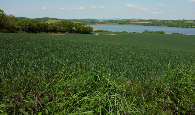
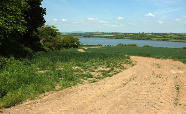
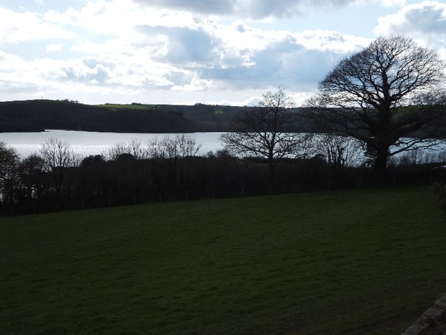
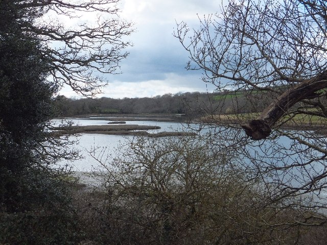
Binney's Plantation is a picturesque forest located in Cornwall, England. Spanning an area of approximately 500 acres, it is a renowned natural haven that attracts visitors from far and wide. The plantation, nestled in the heart of the county, is home to a diverse range of plant and animal species, making it a significant ecological treasure.

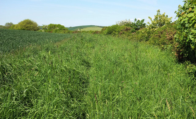
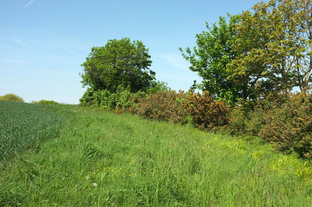
The woodland is primarily composed of deciduous trees, such as oak, beech, and birch, which create a stunning canopy during the summer months. The forest floor is adorned with a rich carpet of vibrant wildflowers, adding to the beauty and biodiversity of the area. Additionally, a small river meanders through the plantation, enhancing the serene atmosphere and providing a habitat for various aquatic creatures.

Binney's Plantation is a popular destination for nature enthusiasts and outdoor enthusiasts alike. The forest offers a plethora of recreational activities, including hiking, bird-watching, and picnicking. Well-maintained trails wind through the woodland, allowing visitors to explore its hidden corners and discover its natural wonders. The plantation also features designated camping areas for those seeking a more immersive experience.

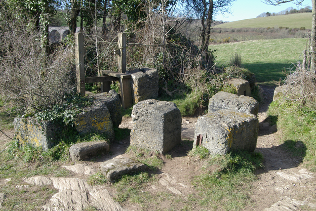
History buffs will be intrigued by the historical significance of Binney's Plantation. It was originally established as a hunting ground for the local gentry in the 17th century. Over the years, the woodland has witnessed numerous changes, including the construction of a manor house that once stood in its vicinity. Though the manor no longer exists, remnants of its foundations and gardens can still be found, adding an element of mystery and intrigue to the plantation's allure.

Binney's Plantation, with its breathtaking scenery and rich history, stands as a testament to the natural wonders that Cornwall has to offer. It is a place where visitors can immerse themselves in the beauty of nature and appreciate the importance of preserving such precious ecosystems.

If you have any feedback on the listing, please let us know in the comments section below.

Binney's Plantation Images

Images are sourced within 2km of 50.379604/-4.2304688 or Grid Reference SX4155. Thanks to Geograph Open Source API. All images are credited.

The village of Antony Taken at the junctions of the A374 to Liskeard and B3247 to Milbrook and Seaton
The village of Antony
Taken at the junctions of the A374 to Liskeard and B3247 to Milbrook and Seaton
B3247, Antony With the Carew Arms on the right and the grade I listed <span class="nowrap"><a title="https://www.historicengland.org.uk/listing/the-list/list-entry/1140708" rel="nofollow ugc noopener" href="https://www.historicengland.org.uk/listing/the-list/list-entry/1140708">Link</a><img style="margin-left:2px;" alt="External link" title="External link - shift click to open in new window" src="https://s1.geograph.org.uk/img/external.png" width="10" height="10"/></span> church of St James on the left.
B3247, Antony
With the Carew Arms on the right and the grade I listed LinkExternal link church of St James on the left.
B3247, Antony The main village street passing cottages and the grade I listed <span class="nowrap"><a title="https://www.historicengland.org.uk/listing/the-list/list-entry/1140708" rel="nofollow ugc noopener" href="https://www.historicengland.org.uk/listing/the-list/list-entry/1140708">Link</a><img style="margin-left:2px;" alt="External link" title="External link - shift click to open in new window" src="https://s1.geograph.org.uk/img/external.png" width="10" height="10"/></span> church of St James.
B3247, Antony
The main village street passing cottages and the grade I listed LinkExternal link church of St James.
Field by the St Germans River A view from Abbotscourt Lane, looking towards and up the estuary also referred to as the Lynher River.
Field by the St Germans River
A view from Abbotscourt Lane, looking towards and up the estuary also referred to as the Lynher River.
Field by the St Germans River The estuary is just over the hedge on the right.
Field by the St Germans River
The estuary is just over the hedge on the right.
Field by the St Germans River A view from Abbotscourt Lane, looking down a track parallel to the tree-lined field boundary, with the St Germans River beyond.
Field by the St Germans River
A view from Abbotscourt Lane, looking down a track parallel to the tree-lined field boundary, with the St Germans River beyond.
Hedge by St Germans River A little further east than <a href="https://www.geograph.org.uk/photo/5782884">SX3955 : Field by the St Germans River</a>.
Hedge by St Germans River
A little further east than SX3955 : Field by the St Germans River.
Antony : The A374 Heading along the A374 through Antony.
Antony : The A374
Heading along the A374 through Antony.
St Germans River north of Antony from Ince Castle
Inlet north of Ince This inlet on the north, and the St Germans River on the south and east, create a peninsula over one kilometre long
Inlet north of Ince
This inlet on the north, and the St Germans River on the south and east, create a peninsula over one kilometre long
Entrance to Antony
Entrance to Antony
Grazing, Antony Off the A374.
Grazing, Antony
Off the A374.
Entering Antony Heading south east on the A374.
Entering Antony
Heading south east on the A374.
Ring O' Bells, Antony Closed pub on the A374.
Ring O' Bells, Antony
Closed pub on the A374.
Sign for the Ring O' Bells, Antony
Torpoint Fire Station Torpoint Fire Station, Antony Road, Torpoint, Cornwall, built to replace the fire station in Fore Street (see <a href="https://www.geograph.org.uk/photo/56180">SX4355 : Torpoint Old Fire Station</a>).
Torpoint Fire Station
Torpoint Fire Station, Antony Road, Torpoint, Cornwall, built to replace the fire station in Fore Street (see SX4355 : Torpoint Old Fire Station).
Barrage Balloon Mountings World War 2 Concrete Barrage Balloon Mountings, Point Field, Wearde, Saltash. The site now forms part of the Churchtown Farm Nature Reserve.
Barrage Balloon Mountings
World War 2 Concrete Barrage Balloon Mountings, Point Field, Wearde, Saltash. The site now forms part of the Churchtown Farm Nature Reserve.
Parade Ground Parade Ground at H.M.S.Raleigh, Torpoint.
Parade Ground
Parade Ground at H.M.S.Raleigh, Torpoint.
Show me another place!

Binney's Plantation is located at Grid Ref: SX4155 (Lat: 50.379604, Lng: -4.2304688)

Unitary Authority: Cornwall

Police Authority: Devon and Cornwall

What 3 Words

///promoted.tried.playroom. Near Torpoint, Cornwall

Related Wikis

HMS Raleigh (shore establishment)

HMS Raleigh is a stone frigate (shore establishment), serving as the basic training facility of the Royal Navy at Torpoint, Cornwall, United Kingdom. It...

A374 road

The A374 is a main road in the United Kingdom, one of six A-roads making the border crossing between Devon and Cornwall. It is the most southerly of the...

Maryfield, Cornwall

Maryfield is a hamlet north of Torpoint and east of Antony House in southeast Cornwall, England. == References ==

Antony Passage

Antony Passage is a hamlet in south-east Cornwall, England, UK. It stands beside the tidal section of the River Lynher (a tributary of the River Tamar...

Nearby Amenities

Located within 500m of 50.379604,-4.2304688
Bus Stop
Trevol Business Park
Bus: yes
Naptan AtcoCode: 0800FWX38752
Naptan Bearing: E
Naptan CommonName: Trevol Business Park
Naptan NaptanCode: cordwtdt
Naptan PlusbusZoneRef: PLYMTH
Naptan Street: Fisgard Way
Naptan Verified: no
Public Transport: platform
Source: naptan_import
Lat/Long: 50.3764792/-4.2260637
Horson Farm
Place: hamlet
Lat/Long: 50.3801069/-4.2318833
Man Made: mast
Tower Type: communication
Lat/Long: 50.3786073/-4.2242298
Power: pole
Lat/Long: 50.379117/-4.230718
Power: pole
Lat/Long: 50.3785663/-4.232043
Power: pole
Lat/Long: 50.3779915/-4.2333788
Power: pole
Lat/Long: 50.3773758/-4.2344624
Power: pole
Lat/Long: 50.3767283/-4.2355393
The data included in this document is from www.openstreetmap.org. The data is made available under ODbL.

Have you been to Binney's Plantation?

Leave your review of Binney's Plantation below (or comments, questions and feedback).