Higher Swingdon Plantation

Wood, Forest in Devon Torridge

England

Higher Swingdon Plantation

View of Higher Broadpark Triangulation Pillar Looking south-eastward. This roadside ivy covered pillar stands on top of the field boundary.
View of Higher Broadpark Triangulation Pillar Credit: Peter Wood

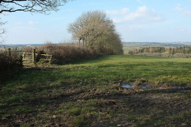
Higher Swingdon Plantation is a picturesque woodland located in Devon, England. Nestled within the rolling hills of the county, it covers an expansive area and is renowned for its natural beauty and rich biodiversity. The plantation consists primarily of deciduous trees, including oak, beech, and birch, which create a stunning canopy of vibrant colors throughout the seasons.

The woodland is a haven for wildlife, with numerous species calling it home. Visitors to Higher Swingdon Plantation may be fortunate enough to spot deer, foxes, badgers, and a wide variety of bird species, making it a popular destination for nature enthusiasts and birdwatchers alike.

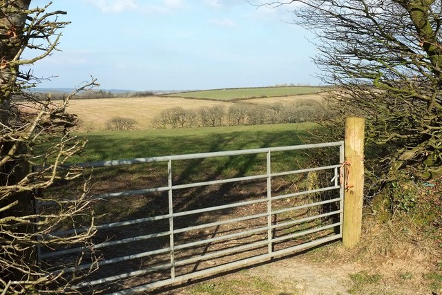
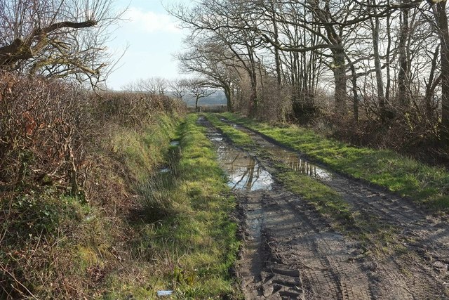
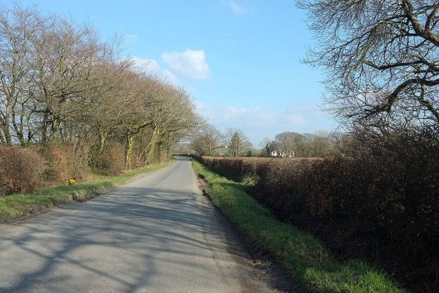
The plantation offers a network of well-maintained walking and hiking trails, providing ample opportunities for outdoor recreation. These trails wind through the woodland, taking visitors past tranquil streams, enchanting glades, and hidden clearings. Picnic areas are dotted throughout the plantation, allowing visitors to relax and enjoy the peaceful surroundings.

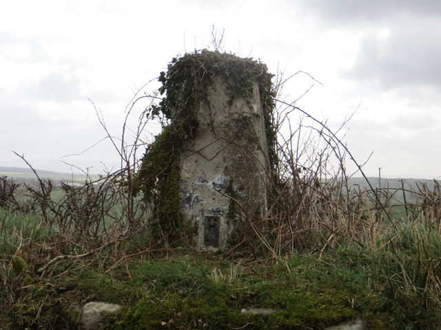
In addition to its natural beauty, Higher Swingdon Plantation has historical significance. It has been managed as a working forest for centuries, with traditional forestry practices still in place today. The plantation is also home to several ancient monuments, including a Bronze Age burial mound, adding an air of mystery and intrigue to the area.

Overall, Higher Swingdon Plantation offers a tranquil escape into nature, with its stunning woodland scenery, diverse wildlife, and historical significance. It is a cherished destination for both locals and tourists seeking solace and a connection to the natural world.

If you have any feedback on the listing, please let us know in the comments section below.

Higher Swingdon Plantation Images

Images are sourced within 2km of 50.760209/-4.2991313 or Grid Reference SX3798. Thanks to Geograph Open Source API. All images are credited.

View of Higher Broadpark Triangulation Pillar Looking south-eastward. This roadside ivy covered pillar stands on top of the field boundary.
View of Higher Broadpark Triangulation Pillar
Looking south-eastward. This roadside ivy covered pillar stands on top of the field boundary.
Bendibus Hill Cross I took <a href="https://www.geograph.org.uk/photo/468663">SX3899 : Bendibus Hill Cross</a> on a miserable summer day nearly nine years ago; here it is on a lovely day with winter just turning into spring. I didn't notice before that the name on the signpost is just "Bendibus Cross"; maps disagree with each other. Bendibus Hill is the lane opposite which drops to cross a tributary of the Claw. The name "bendibus" is used also for a wood to the northwest, and was obviously created by a precognitive clairvoyant whose only mistake was to assume that the articulated bus would find its way to this remote area of Devon rather than its usual urban environment.
Bendibus Hill Cross
I took SX3899 : Bendibus Hill Cross on a miserable summer day nearly nine years ago; here it is on a lovely day with winter just turning into spring. I didn't notice before that the name on the signpost is just "Bendibus Cross"; maps disagree with each other. Bendibus Hill is the lane opposite which drops to cross a tributary of the Claw. The name "bendibus" is used also for a wood to the northwest, and was obviously created by a precognitive clairvoyant whose only mistake was to assume that the articulated bus would find its way to this remote area of Devon rather than its usual urban environment.
Countryside west of Buckhorn From a ridge lane east of Clawton, looking across a side valley of the Claw valley.
Countryside west of Buckhorn
From a ridge lane east of Clawton, looking across a side valley of the Claw valley.
Track near North Beer A green lane seen from the road between Clawton and Spry's Shop.
Track near North Beer
A green lane seen from the road between Clawton and Spry's Shop.
Road from Clawton to Spry's Shop The farm is Higher Northbeer. <a href="https://www.geograph.org.uk/photo/4873244">SX3699 : Track near North Beer</a> looks to the right from this spot, while <a href="https://www.geograph.org.uk/photo/4865751">SX3699 : Countryside west of Buckhorn</a> was taken from the other side of this stretch of road.
Road from Clawton to Spry's Shop
The farm is Higher Northbeer. SX3699 : Track near North Beer looks to the right from this spot, while SX3699 : Countryside west of Buckhorn was taken from the other side of this stretch of road.
Field near Higher Northbeer From the gate shown in <a href="https://www.geograph.org.uk/photo/4865751">SX3699 : Countryside west of Buckhorn</a>, looking more to the left.
Field near Higher Northbeer
From the gate shown in SX3699 : Countryside west of Buckhorn, looking more to the left.
Sprys Shop, road junction
Sandymoor Cross, road junction
Thorney Cross, road junction
Sandymoor Cross A major lane, from Holsworthy to Broadwoodwidger, crosses a minor lane from Chapmans Well to Halwill. In spite of the sunshine, this was taken in pouring rain.
Sandymoor Cross
A major lane, from Holsworthy to Broadwoodwidger, crosses a minor lane from Chapmans Well to Halwill. In spite of the sunshine, this was taken in pouring rain.
Buckhorn Methodist Church No date visible for the building. The lane goes from Sandymoor Cross to Claw Bridge.
Buckhorn Methodist Church
No date visible for the building. The lane goes from Sandymoor Cross to Claw Bridge.
Bendibus Hill Cross A lane junction at the top of Bendibus Hill, which is the lane straight ahead. The lane across links Clawford Cross and Halwill. The lane to the left of the camera has come from Sandynoor Cross.
Bendibus Hill Cross
A lane junction at the top of Bendibus Hill, which is the lane straight ahead. The lane across links Clawford Cross and Halwill. The lane to the left of the camera has come from Sandynoor Cross.
Sandymoor Cross A close-up of the signpost seen in <a href="https://www.geograph.org.uk/photo/468585">SX3898 : Sandymoor Cross</a>, kneedeep in long wet grass.
Sandymoor Cross
A close-up of the signpost seen in SX3898 : Sandymoor Cross, kneedeep in long wet grass.
Thorney Cross The main lane leads from Ashmill to Sandymoor Cross; the lane to the left has come from Ashwater. The farm is Southlands.
Thorney Cross
The main lane leads from Ashmill to Sandymoor Cross; the lane to the left has come from Ashwater. The farm is Southlands.
Bassetts One of several straight stretches on the road between Ashmill and Sandymoor Cross. The corrugated iron on the farm outbuildings sports an attractive shade of green.
Bassetts
One of several straight stretches on the road between Ashmill and Sandymoor Cross. The corrugated iron on the farm outbuildings sports an attractive shade of green.
East Venn Crows fly over the farm buildings at the end of a very white concrete road which leads past a couple of modern bungalows. East Venn is on the side of a shallow valley which drains (left) into the Dury Water.
East Venn
Crows fly over the farm buildings at the end of a very white concrete road which leads past a couple of modern bungalows. East Venn is on the side of a shallow valley which drains (left) into the Dury Water.
Farm road to Braddon A concrete road with grass down the middle leads away from the fork with the road to <a href="https://www.geograph.org.uk/photo/488342">SX3997 : East Venn</a>. Maps show plantations on the right, which have long been cleared.
Farm road to Braddon
A concrete road with grass down the middle leads away from the fork with the road to SX3997 : East Venn. Maps show plantations on the right, which have long been cleared.
Field near Little Swingdon The three trees (sycamores, possibly) are a remnant of a vanished field boundary across this gently undulating plateau. Across the field is Higher Swingdon Plantation. Seen from the lane southwest of Sandymoor Cross.
Field near Little Swingdon
The three trees (sycamores, possibly) are a remnant of a vanished field boundary across this gently undulating plateau. Across the field is Higher Swingdon Plantation. Seen from the lane southwest of Sandymoor Cross.
Show me another place!

Higher Swingdon Plantation is located at Grid Ref: SX3798 (Lat: 50.760209, Lng: -4.2991313)

Administrative County: Devon

District: Torridge

Police Authority: Devon and Cornwall

What 3 Words

///leotard.raven.printouts. Near Holsworthy, Devon

Nearby Locations

Higher Swingdon Plantation

Related Wikis

Clawton

Clawton is a village and civil parish in the far west of Devon, England. It forms part of the local government district of Torridge. The village lies about...

Quoditch

Quoditch is a hamlet in the parish of Ashwater, part of the Torridge district of Devon, England. Its nearest town is Holsworthy, which lies approximately...

Ashwater railway station

Ashwater railway station was a railway station that served the hamlets of Ashwater and Ashmill in Devon, England. It was located on the North Cornwall...

Ashwater

Ashwater is a village and civil parish in the Torridge district of Devon, England. According to the 2001 census it had a population of 651 that had risen...

Nearby Amenities

Located within 500m of 50.760209,-4.2991313
The data included in this document is from www.openstreetmap.org. The data is made available under ODbL.

Have you been to Higher Swingdon Plantation?

Leave your review of Higher Swingdon Plantation below (or comments, questions and feedback).