Bearah Wood

Wood, Forest in Cornwall

England

Bearah Wood

Blunts  Methodist Church Dating from 1843.
Blunts Methodist Church Credit: Paul Barnett

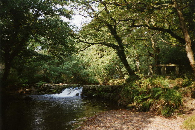
Bearah Wood is a picturesque forest located in Cornwall, England. Covering an area of approximately 100 acres, the wood is home to a variety of native tree species including oak, beech, and chestnut. The forest is known for its dense canopy and lush undergrowth, creating a tranquil and secluded atmosphere for visitors to enjoy.

Visitors to Bearah Wood can explore a network of walking trails that wind through the trees, offering opportunities to observe the local wildlife such as deer, squirrels, and a variety of bird species. The wood is also home to a diverse range of plant life, including wildflowers, ferns, and mosses.

Bearah Wood is a popular destination for nature lovers, hikers, and birdwatchers seeking a peaceful retreat from the hustle and bustle of modern life. The forest provides a sanctuary for those looking to connect with nature and immerse themselves in the beauty of the natural world.

Overall, Bearah Wood is a hidden gem in Cornwall, offering a serene and enchanting escape for those looking to experience the tranquility of a traditional British woodland.

If you have any feedback on the listing, please let us know in the comments section below.
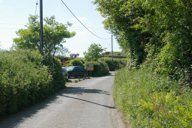
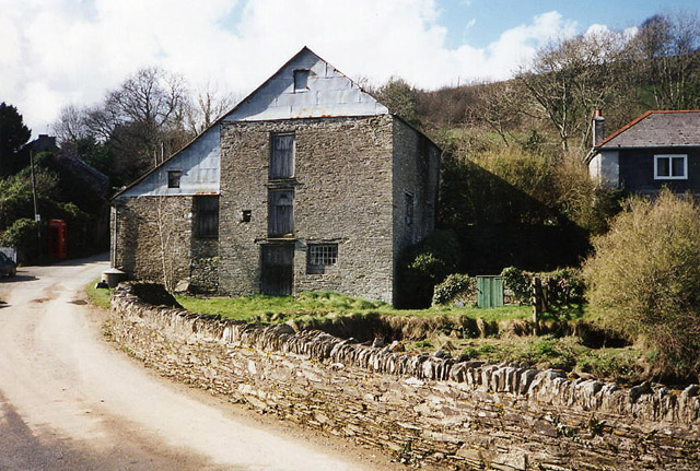
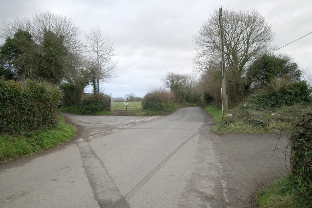
Bearah Wood Images

Images are sourced within 2km of 50.442344/-4.3131657 or Grid Reference SX3562. Thanks to Geograph Open Source API. All images are credited.

Blunts  Methodist Church Dating from 1843.
Blunts Methodist Church
Dating from 1843.
St Odolphus's Church
Old Milestone at Pillatonmill Carved stone post by the UC road, in parish of PILLATON (CARADON District), Pillatonmill, on Y-junction, at the end of an old wall, on North East side of road. Square stone erected by the parish in the 19th century. 

Inscription reads:-
: CALLINGTON 4 M / PILLATON 1½ M : : BOTUS FLEMING 3 M / LANDULPH 4½ M :  

Grade II Listed. List Entry Number: 1140186
<span class="nowrap"><a title="https://historicengland.org.uk/listing/the-list/list-entry/1140186" rel="nofollow ugc noopener" href="https://historicengland.org.uk/listing/the-list/list-entry/1140186">Link</a><img style="margin-left:2px;" alt="External link" title="External link - shift click to open in new window" src="https://s1.geograph.org.uk/img/external.png" width="10" height="10"/></span>

Milestone Society National ID: CW_CLLD04.
Old Milestone at Pillatonmill
Carved stone post by the UC road, in parish of PILLATON (CARADON District), Pillatonmill, on Y-junction, at the end of an old wall, on North East side of road. Square stone erected by the parish in the 19th century. Inscription reads:- : CALLINGTON 4 M / PILLATON 1½ M : : BOTUS FLEMING 3 M / LANDULPH 4½ M : Grade II Listed. List Entry Number: 1140186 LinkExternal link Milestone Society National ID: CW_CLLD04.
Kernock Cottages Holiday cottages at Kernock
Kernock Cottages
Holiday cottages at Kernock
Old Direction Sign - Signpost north of Blunts, Quethiock Parish Raised finial - G; by the UC road, in parish of Quethiock (Caradon District), North West of Blunts at crossroads, on top of hedge.

To be surveyed

Milestone Society National ID: CW_SX3463
Old Direction Sign - Signpost north of Blunts, Quethiock Parish
Raised finial - G; by the UC road, in parish of Quethiock (Caradon District), North West of Blunts at crossroads, on top of hedge. To be surveyed Milestone Society National ID: CW_SX3463
Old Direction Sign - Signpost in Pillaton Raised finial - by the UC road, in parish of Pillaton (Caradon District), Pillaton village centre, on corner opposite The Weary Friar Hotel.

Cornwall and Scilly HER.
HER Number: MCO56953 <span class="nowrap"><a title="https://www.heritagegateway.org.uk/Gateway/Results_Single.aspx?uid=MCO56953&resourceID=1020" rel="nofollow ugc noopener" href="https://www.heritagegateway.org.uk/Gateway/Results_Single.aspx?uid=MCO56953&resourceID=1020">Link</a><img style="margin-left:2px;" alt="External link" title="External link - shift click to open in new window" src="https://s1.geograph.org.uk/img/external.png" width="10" height="10"/></span>

To be surveyed

Milestone Society National ID: CW_SX3664
Old Direction Sign - Signpost in Pillaton
Raised finial - by the UC road, in parish of Pillaton (Caradon District), Pillaton village centre, on corner opposite The Weary Friar Hotel. Cornwall and Scilly HER. HER Number: MCO56953 LinkExternal link To be surveyed Milestone Society National ID: CW_SX3664
Old Milestone near Pillatonmill Carved stone post by the UC road, in parish of PILLATON (CARADON District), Pillaton Mill, on Y-junction, at the end of an old wall, on Northeast side of road. Square, erected by the parish in the 19th century. 

Inscription reads:-
: CALLINGTON 4 M / PILLATON 1½ M : : BOTUS FLEMING 3 M / LANDULPH 4½ M : 

Grade II listed. 
List Entry Number: 1140186 <span class="nowrap"><a title="https://historicengland.org.uk/listing/the-list/list-entry/1140186" rel="nofollow ugc noopener" href="https://historicengland.org.uk/listing/the-list/list-entry/1140186">Link</a><img style="margin-left:2px;" alt="External link" title="External link - shift click to open in new window" src="https://s1.geograph.org.uk/img/external.png" width="10" height="10"/></span>

Milestone Society National ID: CW_CLLD04.
Old Milestone near Pillatonmill
Carved stone post by the UC road, in parish of PILLATON (CARADON District), Pillaton Mill, on Y-junction, at the end of an old wall, on Northeast side of road. Square, erected by the parish in the 19th century. Inscription reads:- : CALLINGTON 4 M / PILLATON 1½ M : : BOTUS FLEMING 3 M / LANDULPH 4½ M : Grade II listed. List Entry Number: 1140186 LinkExternal link Milestone Society National ID: CW_CLLD04.
Direction Sign – Signpost Located on top of a hedge on the east side of a crossroads northwest of Blunts in Quethiock parish. 3 arms and pineapple finial. An earlier photo of <a title="https://www.geograph.org.uk/photo/6042998" href="https://www.geograph.org.uk/photo/6042998">Link</a> when it had three arms.

Milestone Society National ID: CW_SX3463
Direction Sign – Signpost
Located on top of a hedge on the east side of a crossroads northwest of Blunts in Quethiock parish. 3 arms and pineapple finial. An earlier photo of Link when it had three arms. Milestone Society National ID: CW_SX3463
Old Boundary Marker County Bridge Marker on the east side of a minor road 80 metres southwest of Pillaton Bridge, River Lynher. Quethiock parish. Inscribed C. The stone marks the extent of roadway adjoining the bridge that the County was obliged to maintain.

Milestone Society National ID: CW_QUET02br
Old Boundary Marker
County Bridge Marker on the east side of a minor road 80 metres southwest of Pillaton Bridge, River Lynher. Quethiock parish. Inscribed C. The stone marks the extent of roadway adjoining the bridge that the County was obliged to maintain. Milestone Society National ID: CW_QUET02br
St Mellion: Pillaton Mill Weir A weir on the river Lynher which fed the 1.5 mile long leat to Pillaton Mill
St Mellion: Pillaton Mill Weir
A weir on the river Lynher which fed the 1.5 mile long leat to Pillaton Mill
St Odolphus' Church and Weary Friar Hotel The 'Weary Friar' - believed to have been a resting place for monks building the church. The church dates back to mid 13th century.
St Odolphus' Church and Weary Friar Hotel
The 'Weary Friar' - believed to have been a resting place for monks building the church. The church dates back to mid 13th century.
Road junction north of Blunts Road junction north of the curiously named Blunts, Cornwall.
Road junction north of Blunts
Road junction north of the curiously named Blunts, Cornwall.
Blunts The eastern end of Blunts village, Cornwall.
Blunts
The eastern end of Blunts village, Cornwall.
New crop of black bales, Trevashmond A new crop of black bales just harvested in a field near Trevashmond Farm, Blunts, Cornwall.
New crop of black bales, Trevashmond
A new crop of black bales just harvested in a field near Trevashmond Farm, Blunts, Cornwall.
Farm track at Holwood Farm track and rusty farm trailer near Holwood, Blunts, Cornwall.
Farm track at Holwood
Farm track and rusty farm trailer near Holwood, Blunts, Cornwall.
Cornish dual carriageway A stretch of 'Cornish dual carriageway' leading to Trewandra fishing lake, near Landrake, Cornwall.
Cornish dual carriageway
A stretch of 'Cornish dual carriageway' leading to Trewandra fishing lake, near Landrake, Cornwall.
Dolbeare Caravan Park, Landrake The entrance to Dolbeare Caravan Park, Landrake, Cornwall.
Dolbeare Caravan Park, Landrake
The entrance to Dolbeare Caravan Park, Landrake, Cornwall.
Field near Pillatonmill Field near Pillatonmill, close to the bridge over the River Lynher.
Field near Pillatonmill
Field near Pillatonmill, close to the bridge over the River Lynher.
Show me another place!

Bearah Wood is located at Grid Ref: SX3562 (Lat: 50.442344, Lng: -4.3131657)

Unitary Authority: Cornwall

Police Authority: Devon and Cornwall

What 3 Words

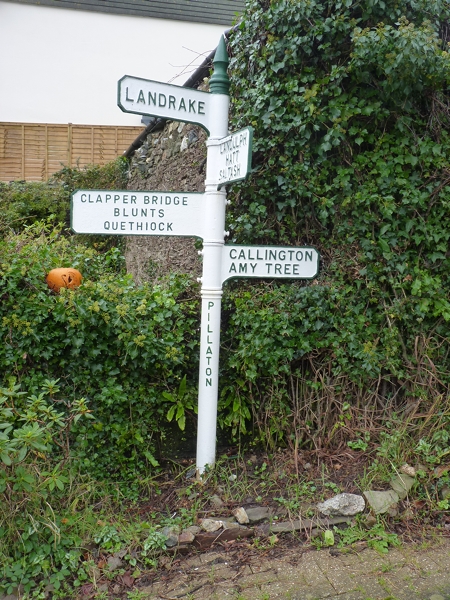
///luckier.abstracts.enter. Near Pillaton, Cornwall

Nearby Locations

Bearah Wood

Related Wikis

Blunts, Cornwall

Blunts (Cornish: Shoppa Blunt) is a hamlet southeast of Quethiock in the civil parish of Quethiock in east Cornwall, England, United Kingdom. It is situated...
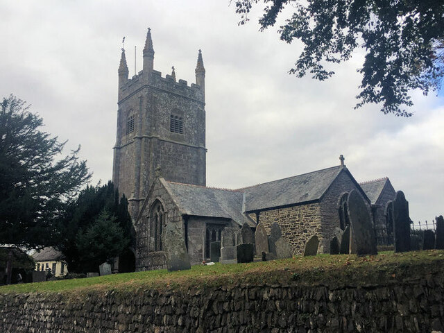
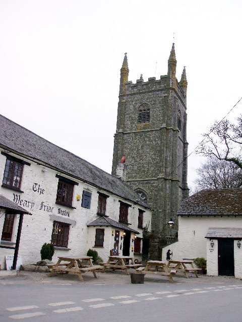
Pillaton

Pillaton (Cornish: Trebeulyow) is a village and civil parish in south east Cornwall, England, United Kingdom. The parish extends to approximately 4.6 square...

Penpoll

Penpoll is a farm in the parish of Quethiock, Cornwall, England, UK. It is near the hamlet of Blunts and north of Tideford Cross. The meaning of Penpoll...

Tideford Cross

Tideford Cross is a hamlet in Cornwall, England, United Kingdom. It is about one mile north of Tideford. == References ==

Nearby Amenities

Located within 500m of 50.442344,-4.3131657
Turning Loop
Lat/Long: 50.4412729/-4.3069558
The data included in this document is from www.openstreetmap.org. The data is made available under ODbL.

Have you been to Bearah Wood?

Leave your review of Bearah Wood below (or comments, questions and feedback).