Eavermoor Plantation

Wood, Forest in Cornwall

England

Eavermoor Plantation

Treburley Garage
Treburley Garage Credit: David Smith

Eavermoor Plantation is a picturesque woodland located in Cornwall, England. Situated amidst the lush greenery of the county, this plantation is known for its enchanting beauty and rich biodiversity. Spanning over an area of approximately 100 acres, Eavermoor Plantation is a haven for nature enthusiasts and those seeking tranquility in the midst of nature.

The plantation is predominantly covered with a variety of deciduous trees, including oak, beech, and ash, which create a dense canopy overhead. The forest floor is adorned with a colorful carpet of wildflowers, creating a stunning display of nature's splendor. The diverse flora in the plantation provides a habitat for a wide range of wildlife, including squirrels, deer, and numerous bird species.

Eavermoor Plantation offers several walking trails that wind through the woodland, allowing visitors to explore its natural wonders. The trails provide breathtaking views of the surrounding countryside and lead to hidden gems such as small streams and ponds that are home to various aquatic species.

The plantation is also home to a small visitor center, where visitors can learn more about the local flora and fauna. The center provides educational resources and hosts workshops and guided nature walks to enhance visitors' understanding of the plantation's ecological significance.

Eavermoor Plantation is open to the public throughout the year, and its natural beauty makes it a popular destination for hikers, photographers, and nature lovers. Whether one seeks solace in the tranquility of the forest or wishes to immerse themselves in the wonders of nature, Eavermoor Plantation is sure to captivate and leave a lasting impression.

If you have any feedback on the listing, please let us know in the comments section below.

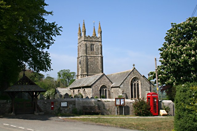
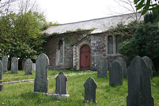
Eavermoor Plantation Images

Images are sourced within 2km of 50.589186/-4.3249213 or Grid Reference SX3579. Thanks to Geograph Open Source API. All images are credited.

Treburley Garage
Treburley Garage
Bus shelter in Treburley
St Briochus's Church and a rainbow
Former United Methodist Chapel
Access road to Hardstone Farm
B3362 entering a tunnel-like wood Hardstone Wood borders the Tamar. There is a sudden transition from light to the darkness of the overhanging trees
B3362 entering a tunnel-like wood
Hardstone Wood borders the Tamar. There is a sudden transition from light to the darkness of the overhanging trees
Lezant Ford This ford is found beside St Lawrence House near Lezant.
Lezant Ford
This ford is found beside St Lawrence House near Lezant.
Barn, Trekenner By the lane shown in <a href="https://www.geograph.org.uk/photo/4434143">SX3478 : Lane approaching Trekenner</a>.
Barn, Trekenner
By the lane shown in SX3478 : Lane approaching Trekenner.
Old Milestone by the A388, south of Penscombe Farm Carved stone post by the A388, in parish of LEZANT (NORTH CORNWALL District), just South of Pencombe Farm, on the verge on bend, on East side of road. Lanson stone pillar, erected by the Launceston turnpike trust in the 19th century. 

Inscription reads:-
LANSON
4
MILE
CALL
6½
MILE

Grade II Listed. List Entry Number: 1291435
<span class="nowrap"><a title="https://historicengland.org.uk/listing/the-list/list-entry/1291435" rel="nofollow ugc noopener" href="https://historicengland.org.uk/listing/the-list/list-entry/1291435">Link</a><img style="margin-left:2px;" alt="External link" title="External link - shift click to open in new window" src="https://s1.geograph.org.uk/img/external.png" width="10" height="10"/></span>

Milestone Society National ID: CW_LACL04.
Old Milestone by the A388, south of Penscombe Farm
Carved stone post by the A388, in parish of LEZANT (NORTH CORNWALL District), just South of Pencombe Farm, on the verge on bend, on East side of road. Lanson stone pillar, erected by the Launceston turnpike trust in the 19th century. Inscription reads:- LANSON 4 MILE CALL 6½ MILE Grade II Listed. List Entry Number: 1291435 LinkExternal link Milestone Society National ID: CW_LACL04.
Old Milestone by the A388, north of Treburley Carved stone post by the A388, in parish of LEZANT (NORTH CORNWALL District), just North of Treburley, set into bank at road edge, on East side of road. Lanson stone pillar, erected by the Launceston turnpike trust in the 19th century. 

Inscription reads:-
LANSON
5
MILE
CALL
5½
MILE

Grade II Listed. List Entry Number: 1219496
<span class="nowrap"><a title="https://historicengland.org.uk/listing/the-list/list-entry/1219496" rel="nofollow ugc noopener" href="https://historicengland.org.uk/listing/the-list/list-entry/1219496">Link</a><img style="margin-left:2px;" alt="External link" title="External link - shift click to open in new window" src="https://s1.geograph.org.uk/img/external.png" width="10" height="10"/></span>

Milestone Society National ID: CW_LACL05.
Old Milestone by the A388, north of Treburley
Carved stone post by the A388, in parish of LEZANT (NORTH CORNWALL District), just North of Treburley, set into bank at road edge, on East side of road. Lanson stone pillar, erected by the Launceston turnpike trust in the 19th century. Inscription reads:- LANSON 5 MILE CALL 5½ MILE Grade II Listed. List Entry Number: 1219496 LinkExternal link Milestone Society National ID: CW_LACL05.
Old Milestone by the A388, north of Treburley Carved stone post by the A388, in parish of LEZANT (NORTH CORNWALL District), just North of Treburley, set into bank at road edge, on East side of road. Lanson stone pillar, erected by the Launceston turnpike trust in the 19th century. 

Inscription reads:-
LANSON
5
MILE
CALL
5½
MILE
(To Launceston and Callington)

Grade II listed. 
List Entry Number: 1219496 <span class="nowrap"><a title="https://historicengland.org.uk/listing/the-list/list-entry/1219496" rel="nofollow ugc noopener" href="https://historicengland.org.uk/listing/the-list/list-entry/1219496">Link</a><img style="margin-left:2px;" alt="External link" title="External link - shift click to open in new window" src="https://s1.geograph.org.uk/img/external.png" width="10" height="10"/></span>

Milestone Society National ID: CW_LACL05.
Old Milestone by the A388, north of Treburley
Carved stone post by the A388, in parish of LEZANT (NORTH CORNWALL District), just North of Treburley, set into bank at road edge, on East side of road. Lanson stone pillar, erected by the Launceston turnpike trust in the 19th century. Inscription reads:- LANSON 5 MILE CALL 5½ MILE (To Launceston and Callington) Grade II listed. List Entry Number: 1219496 LinkExternal link Milestone Society National ID: CW_LACL05.
Old Milestone, broken by the A388, near Penscombe Farm Carved stone post by the A388, in parish of LEZANT (NORTH CORNWALL District), just South of Penscombe Farm, on the verge on bend, on East side of road. Lanson stone pillar, erected by the Launceston turnpike trust in the 19th century. 

Inscription reads:-
LANDSON
4
MILE
CALL
6½
MILE 
(To Launceston and Callington)

Grade II listed. 
List Entry Number: 1291435 <span class="nowrap"><a title="https://historicengland.org.uk/listing/the-list/list-entry/1291435" rel="nofollow ugc noopener" href="https://historicengland.org.uk/listing/the-list/list-entry/1291435">Link</a><img style="margin-left:2px;" alt="External link" title="External link - shift click to open in new window" src="https://s1.geograph.org.uk/img/external.png" width="10" height="10"/></span>

Milestone Society National ID: CW_LACL04.
Old Milestone, broken by the A388, near Penscombe Farm
Carved stone post by the A388, in parish of LEZANT (NORTH CORNWALL District), just South of Penscombe Farm, on the verge on bend, on East side of road. Lanson stone pillar, erected by the Launceston turnpike trust in the 19th century. Inscription reads:- LANDSON 4 MILE CALL 6½ MILE (To Launceston and Callington) Grade II listed. List Entry Number: 1291435 LinkExternal link Milestone Society National ID: CW_LACL04.
Old Boundary Marker County Bridge Marker on the west side of the A388 100 metres north-northeast of Landue Bridge, Lowley Brook. Lezant parish. Inscribed C. The stone marks the extent of roadway adjoining the bridge that the County was obliged to maintain.

Milestone Society National ID: CW_LEZ05br
Old Boundary Marker
County Bridge Marker on the west side of the A388 100 metres north-northeast of Landue Bridge, Lowley Brook. Lezant parish. Inscribed C. The stone marks the extent of roadway adjoining the bridge that the County was obliged to maintain. Milestone Society National ID: CW_LEZ05br
House by Greystone Bridge A former tollhouse close to the bridge across the Tamar
House by Greystone Bridge
A former tollhouse close to the bridge across the Tamar
Greystone Bridge This  arch bridge is grade I listed.  Dating back to 1439, it was built with money raised by Bishop Lacey.  The name is derived from the grey stone found locally (and still quarried at Greystone Quarry)
Greystone Bridge
This arch bridge is grade I listed. Dating back to 1439, it was built with money raised by Bishop Lacey. The name is derived from the grey stone found locally (and still quarried at Greystone Quarry)
River Tamar below Greystone Bridge
Car park area in Greystone Quarry
The final crushing plant at Greystone Quarry This quarry produces material for road surfacing.  This plant produces stones of under 10mm and the products are used for roads in Cornwall, Devon and as far east as the Isle of Wight
The final crushing plant at Greystone Quarry
This quarry produces material for road surfacing. This plant produces stones of under 10mm and the products are used for roads in Cornwall, Devon and as far east as the Isle of Wight
Show me another place!

Eavermoor Plantation is located at Grid Ref: SX3579 (Lat: 50.589186, Lng: -4.3249213)

Unitary Authority: Cornwall

Police Authority: Devon and Cornwall

What 3 Words

///workers.unafraid.headrest. Near Launceston, Cornwall

Related Wikis

Treburley

Treburley is a village in Cornwall, England, UK, split by the A388 road leading from Callington to Launceston. Treburley is in the valley of the River...

Lezant

Lezant (Cornish: Lannsant) is a civil parish and village in east Cornwall, England, United Kingdom. Lezant village is about five miles (8 kilometres) south...

Rezare

Rezare is a hamlet in east Cornwall, England. It is one mile east of Treburley on a minor road from Lewannick to Stoke Climsland. == References ==

Little Comfort

Little Comfort is a hamlet in the parish of Lezant in east Cornwall, England, UK. Little Comfort is on the A388 road approximately 2.5 miles (4.0 km)...

Nearby Amenities

Located within 500m of 50.589186,-4.3249213
The data included in this document is from www.openstreetmap.org. The data is made available under ODbL.

Have you been to Eavermoor Plantation?

Leave your review of Eavermoor Plantation below (or comments, questions and feedback).