Blogsters Wood

Wood, Forest in Cornwall

England

Blogsters Wood
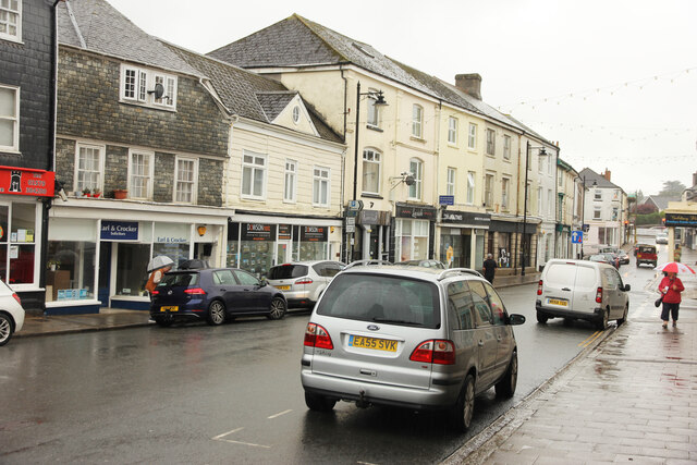
Fore Street Fore Street on a very wet September afternoon
Fore Street Credit: Richard Croft

Blogsters Wood is a picturesque forest located in Cornwall, a county in southwestern England. Covering an area of approximately 100 acres, this wood is a haven for nature enthusiasts and outdoor lovers. The wood is situated near the small village of Blogsters, contributing to its name.

The wood boasts a diverse range of flora and fauna, making it a significant ecological site in the region. The canopy is predominantly composed of oak and beech trees, which provide ample shade during the summer months. Interspersed among these towering giants are smaller trees such as birch, hazel, and rowan, adding to the wood's rich biodiversity.

Blogsters Wood is home to a variety of wildlife, including deer, foxes, badgers, and numerous bird species. Birdwatchers can spot woodpeckers, owls, and a variety of songbirds within the wood's boundaries. The wood's peaceful ambiance and natural beauty make it a popular spot for photographers and nature enthusiasts alike.

Visitors can explore the wood by following a network of well-maintained walking trails that wind through the forest. These trails allow visitors to immerse themselves in the tranquil surroundings and discover the hidden gems within the wood. Along the way, there are informative signposts providing details about the wood's history, wildlife, and conservation efforts.

Blogsters Wood offers a serene escape from the hustle and bustle of everyday life, providing visitors with an opportunity to connect with nature. Whether it's a leisurely walk, birdwatching, or simply enjoying a picnic amidst the lush greenery, Blogsters Wood is an enchanting destination for all nature lovers in Cornwall.

If you have any feedback on the listing, please let us know in the comments section below.

Blogsters Wood Images

Images are sourced within 2km of 50.509083/-4.3347631 or Grid Reference SX3470. Thanks to Geograph Open Source API. All images are credited.

Fore Street Fore Street on a very wet September afternoon
Fore Street
Fore Street on a very wet September afternoon
Church Street Damp view down Church Street
Church Street
Damp view down Church Street
Parish boundary marker, Kelly Bray Inscription:
KB / N 1

Milestone Society ID: CW_LACL09pb
Parish boundary marker, Kelly Bray
Inscription: KB / N 1 Milestone Society ID: CW_LACL09pb
Old Milestone by the A388, north of Callington Carved stone post by the A388, in parish of Callington (Caradon District), Launceston Road, by No. 128, by Callington town sign, by Venning's fountain, on East side of road. Callington 'HB' stone, erected by the Local Highways Board in the 19th century. 

Inscription reads:-
: C / ½ : : L / 10 : 
Carved benchmark and rivet on top.

Grade II listed.
List Entry Number: 1392530  

Milestone Society National ID: CW_LACL10.
Old Milestone by the A388, north of Callington
Carved stone post by the A388, in parish of Callington (Caradon District), Launceston Road, by No. 128, by Callington town sign, by Venning's fountain, on East side of road. Callington 'HB' stone, erected by the Local Highways Board in the 19th century. Inscription reads:- : C / ½ : : L / 10 : Carved benchmark and rivet on top. Grade II listed. List Entry Number: 1392530 Milestone Society National ID: CW_LACL10.
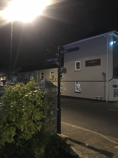
Signpost in Callington town centre Callington Community College
Town Hall
Pannier Market
Signpost in Callington town centre
Callington Community College Town Hall Pannier Market
Signpost Callington Pannier Market Oxfam
The Barber Shop
Signpost Callington Pannier Market
Oxfam The Barber Shop
A388, Saltash Road, Callington The A388 runs 49 miles north to south across Cornwall, from Saltash to Landcross.
<span class="nowrap"><a title="https://www.sabre-roads.org.uk/wiki/index.php?title=A388" rel="nofollow ugc noopener" href="https://www.sabre-roads.org.uk/wiki/index.php?title=A388">Link</a><img style="margin-left:2px;" alt="External link" title="External link - shift click to open in new window" src="https://s1.geograph.org.uk/img/external.png" width="10" height="10"/></span>
A388, Saltash Road, Callington
The A388 runs 49 miles north to south across Cornwall, from Saltash to Landcross. LinkExternal link
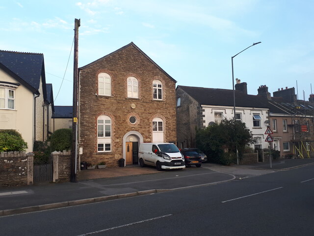
Escomber on the corner of Back Lane and Tanyard Lane Possibly a former Bible Christian chapel.
Escomber on the corner of Back Lane and Tanyard Lane
Possibly a former Bible Christian chapel.
Former Ebenezer chapel on Tavistock Road
Mustard Seed Evangelical Church (formerly a Bible Christian chapel)
Chapel Court (former Plymouth Brethren chapel)
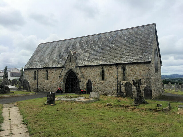
Mortuary chapel
Mortuary chapel
Frogwell Chapel
Frogwell Chapel
Sheep in a field off the A388
Footpath across the junction of Launceston Road and South Hill Road
Chapel Cottage, Liskeard Road Formerly Chapel Court, a former Plymouth Brethren chapel, see <a href="https://www.geograph.org.uk/photo/7392027">SX3569 : Chapel Court (former Plymouth Brethren chapel)</a>.
Chapel Cottage, Liskeard Road
Formerly Chapel Court, a former Plymouth Brethren chapel, see SX3569 : Chapel Court (former Plymouth Brethren chapel).
Old Milestone by Bearland Bridge Carved stone post by the UC road, in parish of CALLINGTON (CARADON District), Bearland Bridge, Haye Farm; East end of bridge parapet, on South side of road. Callington C tombstone, erected by the Callington turnpike trust in the 18th century. 

Inscription reads:-
C
6 Furlos
25 Poles   

Grade II Listed. List Entry Number: 1329414
<span class="nowrap"><a title="https://historicengland.org.uk/listing/the-list/list-entry/1329414" rel="nofollow ugc noopener" href="https://historicengland.org.uk/listing/the-list/list-entry/1329414">Link</a><img style="margin-left:2px;" alt="External link" title="External link - shift click to open in new window" src="https://s1.geograph.org.uk/img/external.png" width="10" height="10"/></span>

Milestone Society National ID: CW_CL01A.
Old Milestone by Bearland Bridge
Carved stone post by the UC road, in parish of CALLINGTON (CARADON District), Bearland Bridge, Haye Farm; East end of bridge parapet, on South side of road. Callington C tombstone, erected by the Callington turnpike trust in the 18th century. Inscription reads:- C 6 Furlos 25 Poles Grade II Listed. List Entry Number: 1329414 LinkExternal link Milestone Society National ID: CW_CL01A.
Old Milestone by the A388, north of Callington Carved stone post by the A388, in parish of CALLINGTON (CARADON District), Launceston Road, by No. 128, by Callington town sign, by Venning's fountain, on East side of road. Callington HB stone, erected by the Local Highways Board in the 19th century. 

Inscription reads:-
: C / ½ : : L / 10 :
Carved benchmark and rivet on top.

Grade II Listed. List Entry Number: 1392530
<span class="nowrap"><a title="https://historicengland.org.uk/listing/the-list/list-entry/1392530" rel="nofollow ugc noopener" href="https://historicengland.org.uk/listing/the-list/list-entry/1392530">Link</a><img style="margin-left:2px;" alt="External link" title="External link - shift click to open in new window" src="https://s1.geograph.org.uk/img/external.png" width="10" height="10"/></span>

Milestone Society National ID: CW_LACL10.
Old Milestone by the A388, north of Callington
Carved stone post by the A388, in parish of CALLINGTON (CARADON District), Launceston Road, by No. 128, by Callington town sign, by Venning's fountain, on East side of road. Callington HB stone, erected by the Local Highways Board in the 19th century. Inscription reads:- : C / ½ : : L / 10 : Carved benchmark and rivet on top. Grade II Listed. List Entry Number: 1392530 LinkExternal link Milestone Society National ID: CW_LACL10.
Show me another place!

Blogsters Wood is located at Grid Ref: SX3470 (Lat: 50.509083, Lng: -4.3347631)

Unitary Authority: Cornwall

Police Authority: Devon and Cornwall

What 3 Words

///mysteries.lines.introduce. Near Callington, Cornwall

Nearby Locations

Blogsters Wood

Related Wikis

Trevigro

Trevigro is a hamlet in Cornwall, England, United Kingdom. It is about two miles west of Callington. == References ==

Maders

Maders is a hamlet west of Kelly Bray in the parish of South Hill (where the population of the 2011 census was included) in east Cornwall, England. �...

East Cornwall Mineral Railway

The East Cornwall Mineral Railway was a 1,067 mm (3 ft 6 in) gauge railway line, opened in 1872 to connect mines and quarries in the Callington and Gunnislake...

Callington

Callington (Cornish: Kelliwik) is a civil parish and town in east Cornwall, England, United Kingdom about 7 miles (11 km) north of Saltash and 9 miles...

Have you been to Blogsters Wood?

Leave your review of Blogsters Wood below (or comments, questions and feedback).