Affaland Wood

Wood, Forest in Devon Torridge

England

Affaland Wood

Farmland near Affaland Cross From the lane to North Tamerton, looking over a side valley of the Claw.
Farmland near Affaland Cross Credit: Derek Harper

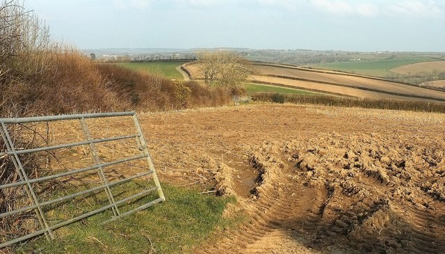
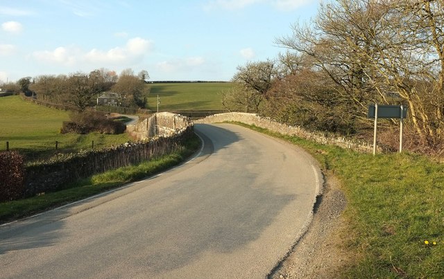
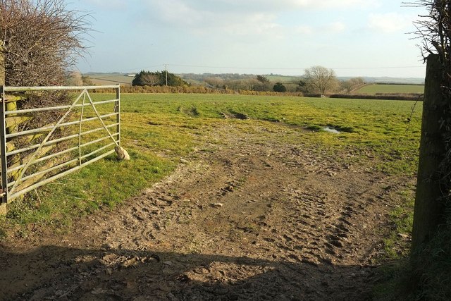
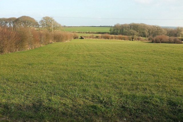
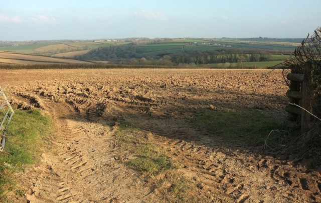
Affaland Wood is a picturesque forest located in the county of Devon, England. Spanning over a vast area, this woodland is a haven for nature enthusiasts and hikers alike. The wood is situated in the heart of the beautiful Dartmoor National Park, surrounded by rolling hills, lush greenery, and stunning landscapes.

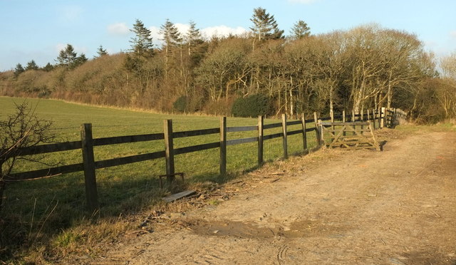
The forest boasts a diverse range of flora and fauna, with ancient oak, beech, and birch trees dominating the woodland. The canopy of the trees provides a tranquil and serene atmosphere, making it a perfect spot for those seeking solace in nature. Bluebells and wildflowers carpet the forest floor during spring, adding a burst of color to the surroundings.

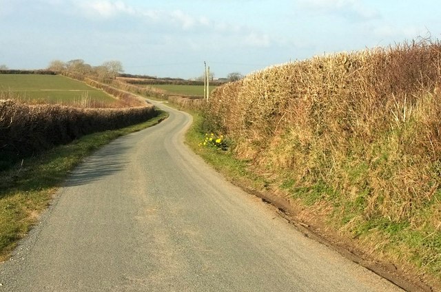
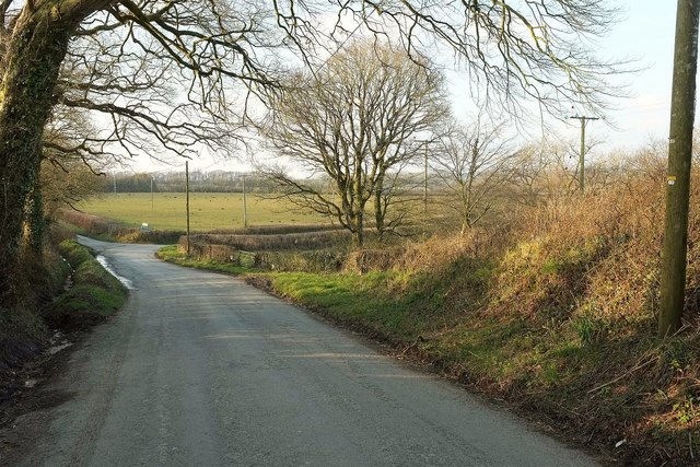
Affaland Wood is crisscrossed by a network of well-maintained walking trails, allowing visitors to explore its beauty at their own pace. These paths lead to hidden gems within the forest, such as babbling brooks, hidden waterfalls, and breathtaking viewpoints. The wood is also home to an array of wildlife, including deer, badgers, foxes, and a variety of bird species, making it a haven for wildlife enthusiasts and birdwatchers.

Additionally, the wood offers camping facilities for those who wish to immerse themselves in the natural surroundings and spend a night under the stars. There are designated camping areas equipped with basic amenities, ensuring a comfortable and enjoyable experience for visitors.

Affaland Wood, with its idyllic charm and natural splendor, is a must-visit destination for anyone seeking a peaceful retreat in the heart of Devon's countryside.

If you have any feedback on the listing, please let us know in the comments section below.

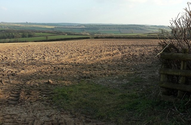
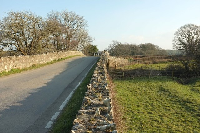
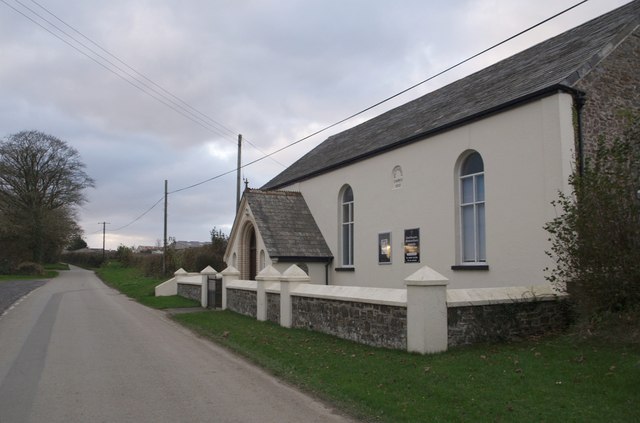
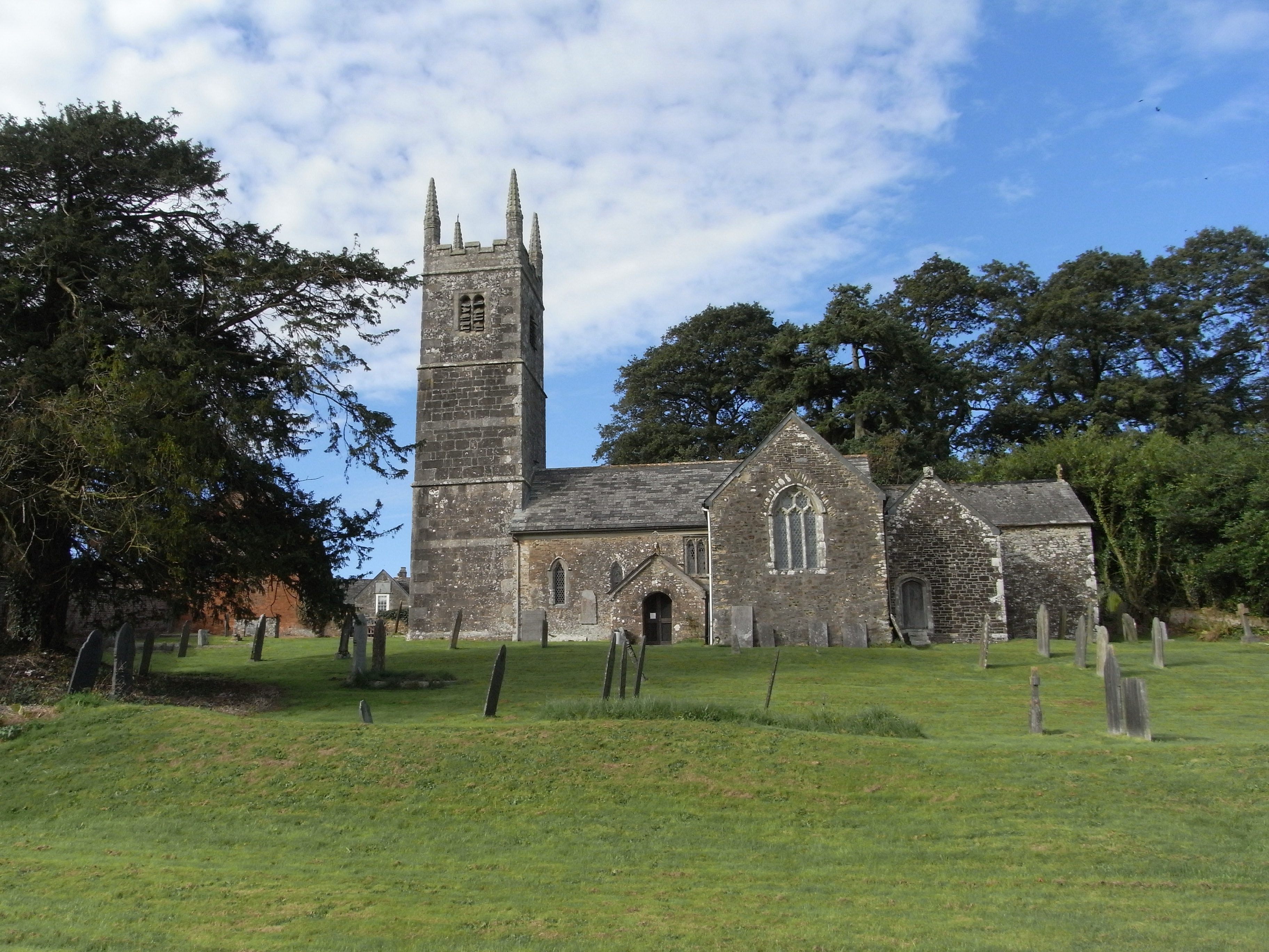
Affaland Wood Images

Images are sourced within 2km of 50.76312/-4.3852537 or Grid Reference SX3198. Thanks to Geograph Open Source API. All images are credited.

Farmland near Affaland Cross From the lane to North Tamerton, looking over a side valley of the Claw.
Farmland near Affaland Cross
From the lane to North Tamerton, looking over a side valley of the Claw.
Lane near Layhay The lane from North Tamerton to Affaland Cross briefly crosses the square; by the time it reaches the junction ahead on the right, the turn into the farm at Fernhill, it has crossed into <a href="https://www.geograph.org.uk/gridref/SX3398">SX3398</a>.
Lane near Layhay
The lane from North Tamerton to Affaland Cross briefly crosses the square; by the time it reaches the junction ahead on the right, the turn into the farm at Fernhill, it has crossed into SX3398.
Farm lane to Higher Horslett The private farm road seen from its junction with the lane up Horslett Hill, and with attractive beeches on the bank.
Farm lane to Higher Horslett
The private farm road seen from its junction with the lane up Horslett Hill, and with attractive beeches on the bank.
Elger Wood A track (not a right of way - there aren't many around here) leads from the road from North Tamerton to Holsworthy into the wood, which lies along the slopes of the Deer valley.
Elger Wood
A track (not a right of way - there aren't many around here) leads from the road from North Tamerton to Holsworthy into the wood, which lies along the slopes of the Deer valley.
Junction north of Venton I was more fortunate than Robert with the weather - see <a href="https://www.geograph.org.uk/photo/599292">SX3199 : Road junction north of Hollafrench</a> - but then I only came here because it was sunny.
Junction north of Venton
I was more fortunate than Robert with the weather - see SX3199 : Road junction north of Hollafrench - but then I only came here because it was sunny.
Lane at Horslett From the same spot as <a href="https://www.geograph.org.uk/photo/4865794">SX3297 : Farm lane to Higher Horslett</a>, looking to the right up the lane past the group of cottages shown from the other direction in <a href="https://www.geograph.org.uk/photo/599203">SX3297 : Wits End Cottage</a>.
Lane at Horslett
From the same spot as SX3297 : Farm lane to Higher Horslett, looking to the right up the lane past the group of cottages shown from the other direction in SX3297 : Wits End Cottage.
Lambs at Horslett And ... they're off. Number 50 has some ground to make up but there's certainly a spring in its step. This is across the lane from <a href="https://www.geograph.org.uk/photo/4865794">SX3297 : Farm lane to Higher Horslett</a>.
Lambs at Horslett
And ... they're off. Number 50 has some ground to make up but there's certainly a spring in its step. This is across the lane from SX3297 : Farm lane to Higher Horslett.
Tamerton Bridge Across the River Tamar; also shown in <a href="https://www.geograph.org.uk/photo/1195673">SX3197 : Bridge over River Tamar.</a>, and probably date from soon after 1847, when a flood destroyed the medieval bridge here<span class="nowrap"><a title="https://www.historicengland.org.uk/listing/the-list/list-entry/1142438" rel="nofollow ugc noopener" href="https://www.historicengland.org.uk/listing/the-list/list-entry/1142438">Link</a><img style="margin-left:2px;" alt="External link" title="External link - shift click to open in new window" src="https://s1.geograph.org.uk/img/external.png" width="10" height="10"/></span> .
Tamerton Bridge
Across the River Tamar; also shown in SX3197 : Bridge over River Tamar., and probably date from soon after 1847, when a flood destroyed the medieval bridge hereLinkExternal link .
Tamerton Bridge Another view of the listed C19 bridge over the Tamar shown in <a href="https://www.geograph.org.uk/photo/4873724">SX3197 : Tamerton Bridge</a> and <a href="https://www.geograph.org.uk/photo/1195673">SX3197 : Bridge over River Tamar.</a>, and very similar to the latter.
Tamerton Bridge
Another view of the listed C19 bridge over the Tamar shown in SX3197 : Tamerton Bridge and SX3197 : Bridge over River Tamar., and very similar to the latter.
Field by Herdicott Cross Looking lengthwaya down a field that is much longer than it is wide. The roof of a barn at Higher Sellick can be made out in the centre over a hedge,
Field by Herdicott Cross
Looking lengthwaya down a field that is much longer than it is wide. The roof of a barn at Higher Sellick can be made out in the centre over a hedge,
Field, Corfcott Green The view is across the head of a shallow side valley of the Claw, with clusters of trees, on the right, around the stream; on the left, unexplained.
Field, Corfcott Green
The view is across the head of a shallow side valley of the Claw, with clusters of trees, on the right, around the stream; on the left, unexplained.
Towards the Claw valley From the road between Corfcott Green and Commons Gate. The distant farms across the valley are Kennicott (left) and Gunnacott. <a href="https://www.geograph.org.uk/photo/4865762">SX3398 : Farmland near Affaland Cross</a> looks more to the left from the same gateway.
Towards the Claw valley
From the road between Corfcott Green and Commons Gate. The distant farms across the valley are Kennicott (left) and Gunnacott. SX3398 : Farmland near Affaland Cross looks more to the left from the same gateway.
Towards the Claw valley From the same gateway as <a href="https://www.geograph.org.uk/photo/5001303">SX3398 : Towards the Claw valley</a> and <a href="https://www.geograph.org.uk/photo/4865762">SX3398 : Farmland near Affaland Cross</a>, looking to the right.
Towards the Claw valley
From the same gateway as SX3398 : Towards the Claw valley and SX3398 : Farmland near Affaland Cross, looking to the right.
Farmland at Circuit House A cross-grid from the lane shown in <a href="https://www.geograph.org.uk/photo/4865790">SX3298 : Lane near Layhay</a>, looking across a side valley of the Deer.
Farmland at Circuit House
A cross-grid from the lane shown in SX3298 : Lane near Layhay, looking across a side valley of the Deer.
Hawkes Place Houses on Horslett Hill; the lane is climbing steadily from the Deer valley.
Hawkes Place
Houses on Horslett Hill; the lane is climbing steadily from the Deer valley.
Road near Tamerton Bridge In the foreground is the junction with the lane to Corfcott Green. The cottage on the left is just beyond the entrance lane to Bridge Farm.
Road near Tamerton Bridge
In the foreground is the junction with the lane to Corfcott Green. The cottage on the left is just beyond the entrance lane to Bridge Farm.
Tamerton Bridge The parapets leading up to the bridge <span class="nowrap"><a title="https://www.historicengland.org.uk/listing/the-list/list-entry/1142438" rel="nofollow ugc noopener" href="https://www.historicengland.org.uk/listing/the-list/list-entry/1142438">Link</a><img style="margin-left:2px;" alt="External link" title="External link - shift click to open in new window" src="https://s1.geograph.org.uk/img/external.png" width="10" height="10"/></span> on the north side of the Tamar. See also <a title="https://www.geograph.org.uk/search.php?i=63908981" href="https://www.geograph.org.uk/search.php?i=63908981">Link</a> .
Tamerton Bridge
The parapets leading up to the bridge LinkExternal link on the north side of the Tamar. See also Link .
Tamar at Tamerton Bridge Looking downstream: the river is approaching the confluence with the Deer. Near the bend ahead the calm river breaks into rapids; could this be a nick point?
Tamar at Tamerton Bridge
Looking downstream: the river is approaching the confluence with the Deer. Near the bend ahead the calm river breaks into rapids; could this be a nick point?
Show me another place!

Affaland Wood is located at Grid Ref: SX3198 (Lat: 50.76312, Lng: -4.3852537)

Administrative County: Devon

District: Torridge

Police Authority: Devon and Cornwall

What 3 Words

///outgoing.diplomats.swerves. Near Holsworthy, Devon

Related Wikis

River Deer

The River Deer is river in Devon, a tributary of the River Tamar, joining it at North Tamerton. == Toponymy == The root of the name is uncertain, since...

North Tamerton

North Tamerton (Cornish: Tre war Damer) is a village and civil parish in east Cornwall, England, UK. The village is situated approximately eight miles...

Tetcott

Tetcott is a civil parish, small settlement and former manor (once the home of the Arscotts of Tetcott) in Devon, England. The parish lies about five miles...

Clawton

Clawton is a village and civil parish in the far west of Devon, England. It forms part of the local government district of Torridge. The village lies about...

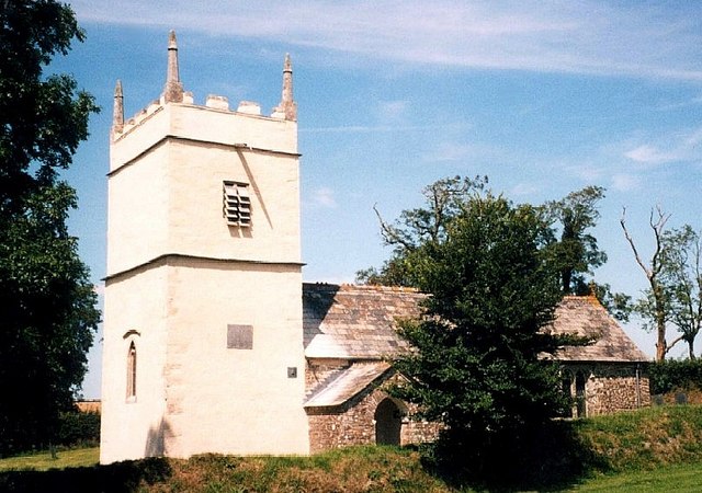
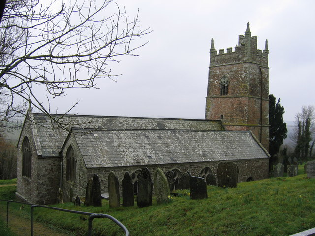
St James's Church, Luffincott

St James's Church in Luffincott, Devon, England was built in the 15th century. It is recorded in the National Heritage List for England as a designated...

Pyworthy

Pyworthy is a village and civil parish in the far west of Devon, England. It forms part of the local government district of Torridge. The parish lies to...

Whitstone

Whitstone is a village and civil parish in east Cornwall, England, United Kingdom. It is roughly halfway between the towns of Bude and Launceston. The...

Luffincott

Luffincott is a civil parish in the far west of Devon, England. It forms part of the local government district of Torridge and lies about six miles south...

Have you been to Affaland Wood?

Leave your review of Affaland Wood below (or comments, questions and feedback).