Chelmer Village

Settlement in Essex Chelmsford

England

Chelmer Village

White Hart Lane, Chelmsford
White Hart Lane, Chelmsford Credit: David Howard

Chelmer Village is a suburban area located in the county of Essex, in the East of England. Situated on the outskirts of Chelmsford, the village is known for its residential developments and convenient amenities.

The village was established in the late 1980s as part of a larger development project aimed at providing affordable housing to accommodate the growing population of Chelmsford. Today, it is home to a diverse community of families, professionals, and retirees.

Chelmer Village offers a range of housing options, including detached and semi-detached houses, as well as apartment complexes. The area is well-planned with wide roads and ample green spaces, providing a pleasant environment for residents.

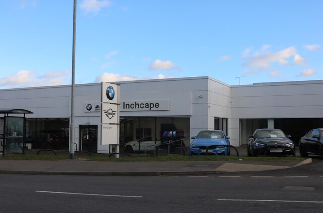
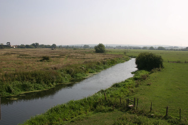
Residents of Chelmer Village benefit from a variety of amenities within the area. There is a small shopping center that includes a supermarket, pharmacy, and several retail outlets. Additionally, there are several parks and recreational areas, providing opportunities for outdoor activities and relaxation.

The village is well-served by public transportation, with regular bus services connecting it to Chelmsford city center and surrounding areas. The nearby A12 road provides convenient access to other parts of Essex and beyond.

Chelmer Village is also within close proximity to a number of schools, making it an attractive location for families with children. The area boasts a strong sense of community, with various social and recreational activities organized throughout the year.

In summary, Chelmer Village is a suburban area in Essex offering a range of housing options, convenient amenities, and a strong community spirit.

If you have any feedback on the listing, please let us know in the comments section below.

Chelmer Village Images

Images are sourced within 2km of 51.739126/0.51023 or Grid Reference TL7307. Thanks to Geograph Open Source API. All images are credited.

White Hart Lane, Chelmsford
Pedestrian crossing on White Hart Lane, Chelmsford
Inchcape BMW on Colchester Road, Chelmsford
Springfield Parish Village Sign
Victorian post box Embedded in the wall of an old farm building
Victorian post box
Embedded in the wall of an old farm building
Old Boundary Marker on Sanford Road, Chelmsford Prison Commission Boundary Marker set in the front garden wall of No. 32  on the south side of Sandford Road, Chelmsford. Marking the northeast boundary of Chelmsford Prison.

Milestone Society National ID: EX_PCCHEL15Bem
Old Boundary Marker on Sanford Road, Chelmsford
Prison Commission Boundary Marker set in the front garden wall of No. 32 on the south side of Sandford Road, Chelmsford. Marking the northeast boundary of Chelmsford Prison. Milestone Society National ID: EX_PCCHEL15Bem
Old Boundary Marker on the B1137 Springfield Road, Chelmsford Prison Commission Boundary Marker behind railings on the southeast side of the B1137 Springfield Road, Chelmsford. Marking the northeast boundary of Chelmsford Prison.

Milestone Society National ID: EX_PCCHEL22em
Old Boundary Marker on the B1137 Springfield Road, Chelmsford
Prison Commission Boundary Marker behind railings on the southeast side of the B1137 Springfield Road, Chelmsford. Marking the northeast boundary of Chelmsford Prison. Milestone Society National ID: EX_PCCHEL22em
Old Boundary Marker on Sanford Road, Chelmsford Prison Commission Boundary Marker set in the front garden wall of No. 26  on the south side of Sandford Road, Chelmsford. Marking the northeast boundary of Chelmsford Prison.

Milestone Society National ID: EX_PCCHEL17em
Old Boundary Marker on Sanford Road, Chelmsford
Prison Commission Boundary Marker set in the front garden wall of No. 26 on the south side of Sandford Road, Chelmsford. Marking the northeast boundary of Chelmsford Prison. Milestone Society National ID: EX_PCCHEL17em
Old Boundary Marker on Sanford Road, Chelmsford Prison Commission Boundary Marker set in the midpoint of the front garden wall between Nos. 24 and 26 on the south side of Sandford Road, Chelmsford. Marking the northeast boundary of Chelmsford Prison.

Milestone Society National ID: EX_PCCHEL18em
Old Boundary Marker on Sanford Road, Chelmsford
Prison Commission Boundary Marker set in the midpoint of the front garden wall between Nos. 24 and 26 on the south side of Sandford Road, Chelmsford. Marking the northeast boundary of Chelmsford Prison. Milestone Society National ID: EX_PCCHEL18em
Old Boundary Marker on Sanford Road, Chelmsford Prison Commission Boundary Marker against a struggling wooden fence fencing off a grass triangle at the foot of the prison wall on the south side of Sandford Road, Chelmsford. Marking the northeast boundary of Chelmsford Prison.

Milestone Society National ID: EX_PCCHEL19em
Old Boundary Marker on Sanford Road, Chelmsford
Prison Commission Boundary Marker against a struggling wooden fence fencing off a grass triangle at the foot of the prison wall on the south side of Sandford Road, Chelmsford. Marking the northeast boundary of Chelmsford Prison. Milestone Society National ID: EX_PCCHEL19em
Old Boundary Marker on Sanford Road, Chelmsford Prison Commission Boundary Marker at the foot of the prison wall on the south side of Sandford Road, Chelmsford. Marking the northeast boundary of Chelmsford Prison.

Milestone Society National ID: EX_PCCHEL20em
Old Boundary Marker on Sanford Road, Chelmsford
Prison Commission Boundary Marker at the foot of the prison wall on the south side of Sandford Road, Chelmsford. Marking the northeast boundary of Chelmsford Prison. Milestone Society National ID: EX_PCCHEL20em
Old Boundary Marker on Sandford Road, Chelmsford Prison Commission Boundary Marker behind railings on the south side of Sandford Road, Chelmsford. Marking the northeast boundary of Chelmsford Prison.

Milestone Society National ID: EX_PCCHEL21em
Old Boundary Marker on Sandford Road, Chelmsford
Prison Commission Boundary Marker behind railings on the south side of Sandford Road, Chelmsford. Marking the northeast boundary of Chelmsford Prison. Milestone Society National ID: EX_PCCHEL21em
Car boot sale near Boreham House Car boot sale at Boreham house, one lazy Sunday in 2021
Car boot sale near Boreham House
Car boot sale at Boreham house, one lazy Sunday in 2021
Grassland near Chelmsford
Jump Street, Chelmsford Jump, Climb, Play, Chelmsford, all sorts of active pursuits indoors, biggest in Essex, see; <span class="nowrap"><a title="https://jumpstreet.co.uk/chelmsford-activity-centre/" rel="nofollow ugc noopener" href="https://jumpstreet.co.uk/chelmsford-activity-centre/">Link</a><img style="margin-left:2px;" alt="External link" title="External link - shift click to open in new window" src="https://s1.geograph.org.uk/img/external.png" width="10" height="10"/></span>
Jump Street, Chelmsford
Jump, Climb, Play, Chelmsford, all sorts of active pursuits indoors, biggest in Essex, see; LinkExternal link
River Chelmer The River Chelmer as it leaves Chelmsford, after heavy rain there is nearly always flooding here.
River Chelmer
The River Chelmer as it leaves Chelmsford, after heavy rain there is nearly always flooding here.
The A1114 The A1114 taken from Great Baddow as it heads up to the Army & Navy roundabout. Works underway for the new Park & Ride bus lane.
The A1114
The A1114 taken from Great Baddow as it heads up to the Army & Navy roundabout. Works underway for the new Park & Ride bus lane.
Sandford Lock Sandford Lock on the 'Chelmer and Blackwater Navigation Canal. Completed in 1797 its 14 mile length from Chelmsford to Heybridge bypassed the River Chelmer and The Blackwater. It drops 77' through 12 locks.
Sandford Lock
Sandford Lock on the 'Chelmer and Blackwater Navigation Canal. Completed in 1797 its 14 mile length from Chelmsford to Heybridge bypassed the River Chelmer and The Blackwater. It drops 77' through 12 locks.
Show me another place!

Chelmer Village is located at Grid Ref: TL7307 (Lat: 51.739126, Lng: 0.51023)

Administrative County: Essex

District: Chelmsford

Police Authority: Essex

What 3 Words

///will.bumpy.chef. Near Chelmsford, Essex

Nearby Locations

Chelmer Village

Related Wikis

Chelmer Village

Chelmer Village is a housing, retail and industrial development in the east of Chelmsford, Essex. The development was started by Countryside Residential...

Chancellor Park, Essex

Chancellor Park is a housing development in the east of Chelmsford, Essex, England inside the ward and area of Chelmer Village. It is in the very east...

Essex County Football Association

The Essex County Football Association, also simply known as the Essex FA, is the governing body of football in the county of Essex. == References... ==

Springfield, Essex

Springfield is a civil parish of the Borough of Chelmsford in Essex, England, which is now a north-eastern suburb of the city of Chelmsford. == History... ==

Nearby Amenities

Located within 500m of 51.739126,0.51023
Bus Stop
Brook End Road
Bus: yes
Naptan AtcoCode: 15003404601
Naptan Bearing: SW
Naptan CommonName: Brook End Road
Naptan Crossing: Brook End Road
Naptan Indicator: Adj
Naptan Landmark: Brook End Road
Naptan NaptanCode: esxdtpwt
Naptan PlusbusZoneRef: CHLMSFD
Naptan Street: Chelmer Village Way
Naptan Verified: no
Public Transport: platform
Shelter: yes
Source: naptan_import
Lat/Long: 51.7410524/0.5107482
Bus Stop
Brook End Road
Bus: yes
Naptan AtcoCode: 15003404602
Naptan Bearing: NE
Naptan CommonName: Brook End Road
Naptan Crossing: Brook End Road
Naptan Indicator: Opp
Naptan Landmark: Brook End Road
Naptan NaptanCode: esxdtwad
Naptan PlusbusZoneRef: CHLMSFD
Naptan Street: Chelmer Village Way
Naptan Verified: no
Public Transport: platform
Shelter: yes
Source: naptan_import
Lat/Long: 51.7411398/0.5106297
Bus Stop
Sheppard Drive
Bus: yes
Naptan AtcoCode: 15003404603
Naptan Bearing: N
Naptan CommonName: Sheppard Drive
Naptan Crossing: Henniker Gate
Naptan Indicator: Adj
Naptan Landmark: Sheppard Drive
Naptan NaptanCode: esxdtwag
Naptan PlusbusZoneRef: CHLMSFD
Naptan Street: Chelmer Village Way
Naptan Verified: no
Public Transport: platform
Source: naptan_import
Lat/Long: 51.7392253/0.510085
Bus Stop
Henniker Gate
Bus: yes
Naptan AtcoCode: 15003404604
Naptan Bearing: SE
Naptan CommonName: Henniker Gate
Naptan Crossing: Henniker Gate
Naptan Indicator: Opp
Naptan Landmark: Henniker Gate
Naptan NaptanCode: esxdtwaj
Naptan PlusbusZoneRef: CHLMSFD
Naptan Street: Chelmer Village Way
Naptan Verified: no
Public Transport: platform
Source: naptan_import
Lat/Long: 51.7380741/0.5110232
Bus Stop
Henniker Gate
Bus: yes
Naptan AtcoCode: 15003404605
Naptan Bearing: N
Naptan CommonName: Henniker Gate
Naptan Crossing: Henniker Gate
Naptan Indicator: Adj
Naptan Landmark: Henniker Gate
Naptan NaptanCode: esxdtwam
Naptan PlusbusZoneRef: CHLMSFD
Naptan Street: Chelmer Village Way
Naptan Verified: no
Public Transport: platform
Shelter: yes
Source: naptan_import
Lat/Long: 51.737614/0.5110986
Bus Stop
Barlows Reach
Bus: yes
Naptan AtcoCode: 15003404702
Naptan Bearing: S
Naptan CommonName: Barlows Reach
Naptan Crossing: Chancellor Avenue
Naptan Indicator: Opp
Naptan Landmark: Barlows Reach
Naptan NaptanCode: esxdtwdg
Naptan PlusbusZoneRef: CHLMSFD
Naptan Street: Chelmer Village Way
Public Transport: platform
Source: naptan_import
Lat/Long: 51.7428364/0.5123371
Bus Stop
Barlows Reach
Bus: yes
Naptan AtcoCode: 150034047Y2
Naptan Bearing: N
Naptan BusStopType: CUS
Naptan CommonName: Barlows Reach
Naptan Crossing: Chancellor Avenue
Naptan Indicator: o/s
Naptan Landmark: Barlows Reach
Naptan NaptanCode: esxgwgjm
Naptan PlusbusZoneRef: CHLMSFD
Naptan Street: Chelmer Village Way
Public Transport: platform
Source: naptan_import
Lat/Long: 51.7428829/0.5120904
Bus Stop
Eglinton Drive
Bus: yes
Naptan AtcoCode: 1500CHANCEPK
Naptan Bearing: NE
Naptan CommonName: Eglinton Drive
Naptan Crossing: Chancellor Avenue
Naptan Indicator: NE-bound
Naptan Landmark: Eglinton Drive
Naptan NaptanCode: esxgpagm
Naptan Street: Eglinton Drive
Naptan Verified: no
Public Transport: platform
Source: naptan_import
Lat/Long: 51.7412114/0.5143887
Bus Stop
Eglinton Drive
Bus: yes
Naptan AtcoCode: 1500CPARK
Naptan Bearing: SW
Naptan CommonName: Eglinton Drive
Naptan Crossing: Chancellor Avenue
Naptan Indicator: SW-bound
Naptan Landmark: Eglinton Drive
Naptan NaptanCode: esxjdapg
Naptan Street: Eglinton Drive
Naptan Verified: no
Public Transport: platform
Source: naptan_import
Lat/Long: 51.7408868/0.5140085
Bus Stop
Shopping Centre
Bus: yes
Naptan AtcoCode: 1500IM2
Naptan Bearing: NE
Naptan CommonName: Shopping Centre
Naptan Crossing: Hollis Lock
Naptan Indicator: NE-bound
Naptan Landmark: Shopping Centre
Naptan NaptanCode: esxdtwaw
Naptan PlusbusZoneRef: CHLMSFD
Naptan Street: Chelmer Village Way
Naptan Verified: no
Public Transport: platform
Source: naptan_import
Lat/Long: 51.7346892/0.509435
Bus Stop
Shopping Centre
Bus: yes
Naptan AtcoCode: 1500IM2B
Naptan Bearing: SW
Naptan CommonName: Shopping Centre
Naptan Crossing: Hollis Lock
Naptan Indicator: SW-bound
Naptan Landmark: Shopping Centre
Naptan NaptanCode: esxdtwap
Naptan Street: Chelmer Village Way
Naptan Verified: no
Public Transport: platform
Source: naptan_import
Lat/Long: 51.7353242/0.5104406
Bus Stop
Chancellor Avenue
Bus: yes
Naptan AtcoCode: 1500JMD027
Naptan Bearing: SE
Naptan CommonName: Chancellor Avenue
Naptan Crossing: Abell Way
Naptan Indicator: SE-bound
Naptan Landmark: Chancellor Avenue
Naptan NaptanCode: esxjdama
Naptan Street: Chancellor Avenue
Naptan Verified: no
Public Transport: platform
Source: naptan_import
Lat/Long: 51.7417008/0.514213
Bus Stop
Portway
Bus: yes
Naptan AtcoCode: 1500KINGDR01
Naptan Bearing: N
Naptan CommonName: Portway
Naptan Crossing: Portway
Naptan Indicator: Opp
Naptan Landmark: Portway
Naptan NaptanCode: esxjdapj
Naptan PlusbusZoneRef: CHLMSFD
Naptan Street: Kingsford Drive
Naptan Verified: no
Public Transport: platform
Source: naptan_import
Lat/Long: 51.7396538/0.5123393
Traffic Signals
Traffic Signals: traffic_lights
Traffic Signals Direction: forward
Lat/Long: 51.7353361/0.5103502
Post Box
Brand: Royal Mail
Brand Wikidata: Q638098
Brand Wikipedia: en:Royal Mail
Check Date Collection Times: 2023-02-25
Collection Times: Mo-Fr 16:00; Sa 12:00
Drive Through: no
Operator: Royal Mail
Operator Wikidata: Q638098
Ref: CM2 472
Royal Cypher: EIIR
Royal Cypher Wikidata: Q33102113
Lat/Long: 51.7362868/0.5068065
Noexit: yes
Lat/Long: 51.7368521/0.5064754
Turning Circle
Lat/Long: 51.7413445/0.5067238
Mini Roundabout
Direction: clockwise
Lat/Long: 51.7408237/0.5163027
Mini Roundabout
Direction: clockwise
Lat/Long: 51.7414405/0.5147608
Mini Roundabout
Direction: clockwise
Lat/Long: 51.7401312/0.5136433
Mini Roundabout
Direction: clockwise
Lat/Long: 51.7419227/0.5135343
Mini Roundabout
Direction: clockwise
Lat/Long: 51.7391905/0.5120609
Chelmer Village
Is In: Chelmsford, Essex, England, UK
Place: suburb
Lat/Long: 51.736321/0.5053338
Direction: both
Traffic Calming: table
Lat/Long: 51.7393129/0.5158694
Noexit: yes
Lat/Long: 51.7387169/0.5159353
Bus Stop
Portway
Bus: yes
Naptan AtcoCode: 1500KINGDR02
Naptan Bearing: S
Naptan CommonName: Portway
Naptan Crossing: Portway
Naptan Indicator: Adj
Naptan Landmark: Portway
Naptan NaptanCode: esxjdapm
Naptan PlusbusZoneRef: CHLMSFD
Naptan Street: Kingsford Drive
Naptan Verified: no
Public Transport: platform
Source: naptan_import
Lat/Long: 51.7394572/0.5123562
Direction: both
Traffic Calming: table;choker
Lat/Long: 51.7391172/0.5138323
Crossing
Crossing: traffic_signals
Crossing Island: yes
Crossing Ref: puffin
Tactile Paving: yes
Lat/Long: 51.7353011/0.5103022
Atm
Cash In: no
Currency GBP: yes
Drive Through: no
Operator Wikipedia: en:Lloyds Bank
Lat/Long: 51.7362014/0.5064843
Atm
Cash In: no
Currency GBP: yes
Drive Through: no
Lat/Long: 51.7361894/0.5064672
Barrier: kerb
Kerb: lowered
Lat/Long: 51.7391376/0.5121644
Direction: both
Traffic Calming: table
Lat/Long: 51.7396802/0.5144288
Bicycle Parking
Access: yes
Fee: no
Lat/Long: 51.7359/0.5069119
Artwork Type: sculpture
Tourism: artwork
Lat/Long: 51.7359116/0.5119944
Bench
Backrest: yes
Lat/Long: 51.7363674/0.5065663
Bench
Backrest: yes
Lat/Long: 51.7364348/0.506415
Bench
Backrest: yes
Lat/Long: 51.7365011/0.5062896
Barrier: cycle_barrier
Note: yes, there is a cycle-barrier on the cycleway.
Lat/Long: 51.7382078/0.5127862
Barrier: cycle_barrier
Note: yes, there is a cycle-barrier on the cycleway.
Lat/Long: 51.7382936/0.5128495
Chancellor Park
Is In: Springfield; Chelmsford; Essex; UK
Place: neighbourhood
Lat/Long: 51.7409796/0.5152303
Entrance: main
Lat/Long: 51.7363947/0.5062391
Entrance: main
Lat/Long: 51.7365578/0.5057993
Turning Circle
Lat/Long: 51.7354206/0.5063514
Crossing
Crossing: unmarked
Crossing Island: no
Crossing Markings: no
Tactile Paving: yes
Lat/Long: 51.7352884/0.5073927
Crossing
Crossing: marked
Crossing Island: no
Crossing Markings: zebra
Tactile Paving: yes
Lat/Long: 51.7356161/0.5068
Crossing
Crossing: traffic_signals
Crossing Island: no
Crossing Ref: toucan
Tactile Paving: yes
Lat/Long: 51.7382911/0.510797
Crossing
Crossing: marked
Crossing Island: no
Crossing Markings: zebra
Tactile Paving: yes
Lat/Long: 51.73487/0.5082485
Barrier: lift_gate
Lat/Long: 51.7380012/0.5131383
Communication Mobile Phone: yes
Man Made: mast
Tower Construction: lattice
Tower Type: communication
Lat/Long: 51.7417707/0.505093
Leisure: picnic_table
Lat/Long: 51.735397/0.5110394
Leisure: picnic_table
Lat/Long: 51.7360273/0.5116425
Leisure: picnic_table
Lat/Long: 51.7355577/0.5112119
Bench
Lat/Long: 51.7357292/0.5117941
Leisure: picnic_table
Lat/Long: 51.7358788/0.5114312
Bench
Lat/Long: 51.7358049/0.5119969
Leisure: picnic_table
Lat/Long: 51.7359122/0.5124838
Bench
Lat/Long: 51.7360594/0.5119408
Bench
Lat/Long: 51.7358057/0.5121352
Leisure: picnic_table
Lat/Long: 51.735806/0.5123464
Bench
Lat/Long: 51.7359403/0.5118311
Bench
Lat/Long: 51.7358642/0.5121666
Bench
Lat/Long: 51.7360401/0.5120833
Crossing
Crossing: unmarked
Crossing Island: yes
Crossing Markings: no
Kerb: lowered
Tactile Paving: yes
Lat/Long: 51.738672/0.5103466
Crossing
Crossing: unmarked
Crossing Island: yes
Crossing Markings: no
Kerb: lowered
Tactile Paving: yes
Lat/Long: 51.738793/0.5109987
Crossing
Crossing: unmarked
Crossing Island: yes
Crossing Markings: no
Kerb: lowered
Tactile Paving: yes
Lat/Long: 51.7388741/0.510918
Crossing
Bicycle: yes
Crossing: unmarked
Crossing Island: yes
Crossing Markings: no
Foot: no
Kerb: flush
Tactile Paving: no
Lat/Long: 51.7365999/0.5113728
Crossing
Crossing: unmarked
Crossing Island: yes
Crossing Markings: no
Foot: yes
Kerb: flush
Tactile Paving: yes
Lat/Long: 51.7365555/0.5113686
Crossing
Crossing: traffic_signals
Crossing Island: no
Crossing Ref: toucan
Kerb: lowered
Tactile Paving: yes
Lat/Long: 51.7412896/0.5109684
Crossing
Crossing: unmarked
Crossing Island: yes
Crossing Markings: no
Tactile Paving: yes
Lat/Long: 51.7425034/0.5122725
Crossing
Crossing: unmarked
Crossing Island: yes
Crossing Markings: no
Tactile Paving: yes
Lat/Long: 51.7424944/0.512138
Crossing
Crossing: unmarked
Crossing Island: yes
Crossing Markings: no
Tactile Paving: yes
Lat/Long: 51.742334/0.5119435
Location Transition: yes
Power: pole
Lat/Long: 51.7349473/0.5110721
Crossing
Crossing: unmarked
Crossing Island: no
Crossing Markings: no
Tactile Paving: yes
Lat/Long: 51.7351592/0.5072106
Crossing
Crossing: uncontrolled
Crossing Island: no
Crossing Markings: surface
Tactile Paving: yes
Lat/Long: 51.7357422/0.5069819
Crossing
Crossing: marked
Crossing Island: no
Crossing Markings: zebra
Tactile Paving: yes
Lat/Long: 51.7354172/0.5065459
Give Way
Direction: backward
Lat/Long: 51.7352704/0.5077129
Give Way
Direction: forward
Lat/Long: 51.7353296/0.5074508
Give Way
Direction: backward
Lat/Long: 51.7350926/0.5071388
Give Way
Direction: backward
Lat/Long: 51.7352144/0.5073032
Give Way
Direction: forward
Lat/Long: 51.7351427/0.5070483
Give Way
Direction: backward
Lat/Long: 51.7355399/0.5067092
Give Way
Direction: backward
Lat/Long: 51.7356787/0.5069087
Give Way
Direction: forward
Lat/Long: 51.7357953/0.5070739
Crossing
Crossing: marked
Crossing Island: no
Crossing Markings: zebra
Tactile Paving: yes
Lat/Long: 51.7358482/0.5071349
Post Box
Brand: Royal Mail
Brand Wikidata: Q638098
Brand Wikipedia: en:Royal Mail
Check Date Collection Times: 2023-02-25
Collection Times: Mo-Fr 16:15; Sa 12:00
Drive Through: no
Operator: Royal Mail
Operator Wikidata: Q638098
Post Box Design: type_a
Post Box Type: pillar
Priority: yes
Ref: CM2 467
Royal Cypher: EIIR
Royal Cypher Wikidata: Q33102113
Lat/Long: 51.7412907/0.5107381
Bicycle Parking
Access: yes
Bicycle Parking: stands
Capacity: 10
Covered: yes
Fee: no
Lat/Long: 51.741809/0.5063662
Barrier: cycle_barrier
Lat/Long: 51.7418282/0.5059972
Traffic Signals
Traffic Signals: traffic_lights
Traffic Signals Direction: backward
Lat/Long: 51.7352691/0.5102613
Traffic Signals
Traffic Signals: traffic_lights
Traffic Signals Direction: backward
Lat/Long: 51.7382539/0.5108177
Traffic Signals
Traffic Signals: traffic_lights
Traffic Signals Direction: forward
Lat/Long: 51.7383312/0.5107897
Crossing
Crossing: unmarked
Crossing Island: no
Crossing Markings: no
Tactile Paving: yes
Lat/Long: 51.7389004/0.5112735
Traffic Signals
Traffic Signals: traffic_lights
Traffic Signals Direction: backward
Lat/Long: 51.7412569/0.5109142
Traffic Signals
Traffic Signals: traffic_lights
Traffic Signals Direction: forward
Lat/Long: 51.7413186/0.5110234
Traffic Sign: yes
Lat/Long: 51.7378489/0.5139696
Colour: red and white
Marker: aerial
Utility: gas
Lat/Long: 51.737859/0.5139614
Entrance: main
Lat/Long: 51.7365505/0.5063413
Post Box
Check Date Collection Times: 2023-02-25
Collection Times: Mo-Fr 09:00; Sa 07:00
Colour: red
Operator: Royal Mail
Operator Wikidata: Q638098
Post Box Type: lamp
Ref: CM2 466D
Royal Cypher: EIIR
Royal Cypher Wikidata: Q33102113
Lat/Long: 51.7389661/0.5082934
Access: yes
Leisure: pitch
Lit: no
Sport: table_tennis
Lat/Long: 51.7365527/0.5051961
The data included in this document is from www.openstreetmap.org. The data is made available under ODbL.

Have you been to Chelmer Village?

Leave your review of Chelmer Village below (or comments, questions and feedback).