Bake Wood

Wood, Forest in Cornwall

England

Bake Wood

A387 near Carracawn Farm The A387 is a 12.5 mile long road in SE Cornwall, between Polbathic and Crumplehorn (Polperro) <a href="https://www.geograph.org.uk/photo/5559278">SX2051 : Mini-roundabout, Crumplehorn</a>, via Looe.
<span class="nowrap"><a title="https://www.sabre-roads.org.uk/wiki/index.php?title=A387" rel="nofollow ugc noopener" href="https://www.sabre-roads.org.uk/wiki/index.php?title=A387">Link</a><img style="margin-left:2px;" alt="External link" title="External link - shift click to open in new window" src="https://s1.geograph.org.uk/img/external.png" width="10" height="10"/></span>
A387 near Carracawn Farm Credit: David Dixon

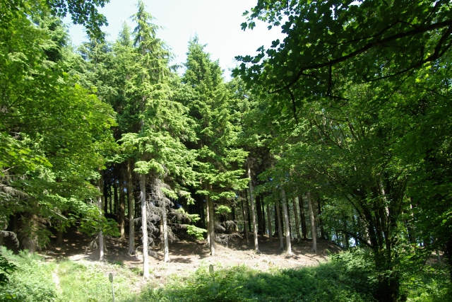
Bake Wood, located in Cornwall, England, is a picturesque forest that holds a significant place in the region's natural landscape. Spanning over a vast area, the wood is known for its dense vegetation, ancient trees, and diverse wildlife. It is a popular destination for nature enthusiasts, hikers, and those seeking tranquility in the great outdoors.

The wood is characterized by a variety of tree species, including oak, beech, and pine, which create a captivating canopy that offers shade and shelter to the woodland creatures. The forest floor is adorned with a rich carpet of ferns, wildflowers, and mosses, adding to the enchanting atmosphere.

Bake Wood boasts a long and storied history. It is believed to have been a hunting ground during medieval times, evidenced by the remnants of deer enclosures that can still be found in the area. The wood has also served as a source of timber for local communities for centuries.

Aside from its natural beauty, Bake Wood is home to a diverse range of wildlife. Visitors might spot various bird species, such as woodpeckers, owls, and jays, as well as mammals like deer, foxes, and badgers. The woodland is also inhabited by numerous insects, amphibians, and reptiles, all contributing to the ecosystem's intricate balance.

Bake Wood offers numerous walking trails and pathways, allowing visitors to explore its hidden corners and discover its hidden treasures. The wood's serene atmosphere and idyllic scenery provide an escape from the hustle and bustle of everyday life, making it the perfect destination for those seeking solace in nature.

If you have any feedback on the listing, please let us know in the comments section below.

Bake Wood Images

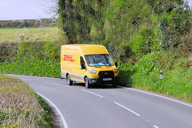
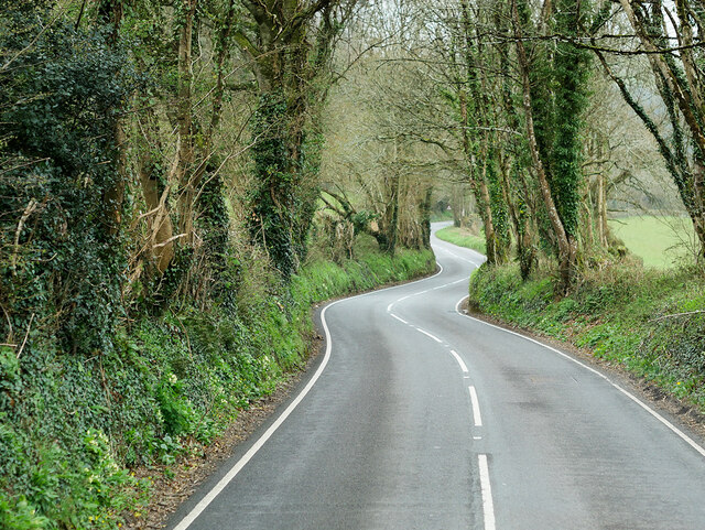
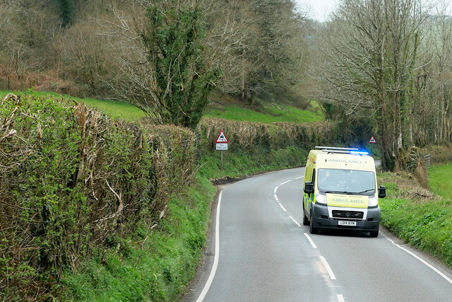
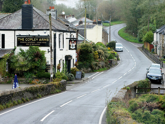
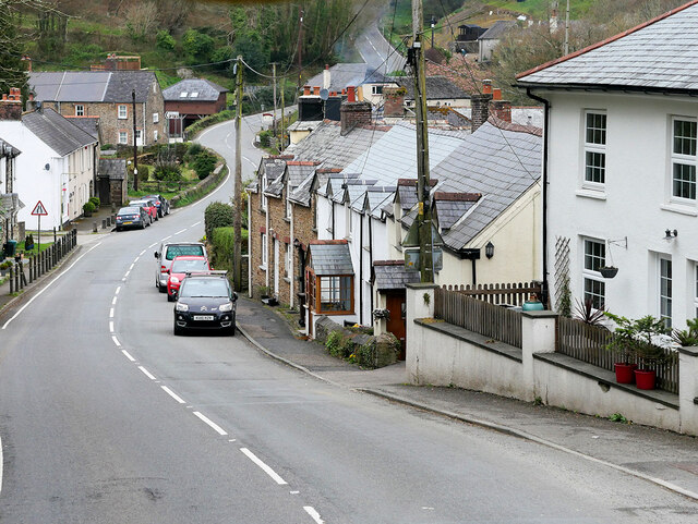
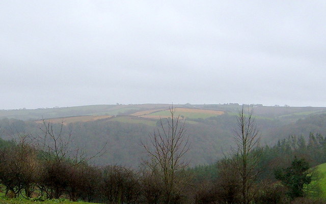
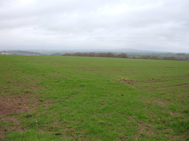
Images are sourced within 2km of 50.397906/-4.3776163 or Grid Reference SX3158. Thanks to Geograph Open Source API. All images are credited.

A387 near Carracawn Farm The A387 is a 12.5 mile long road in SE Cornwall, between Polbathic and Crumplehorn (Polperro) <a href="https://www.geograph.org.uk/photo/5559278">SX2051 : Mini-roundabout, Crumplehorn</a>, via Looe.
<span class="nowrap"><a title="https://www.sabre-roads.org.uk/wiki/index.php?title=A387" rel="nofollow ugc noopener" href="https://www.sabre-roads.org.uk/wiki/index.php?title=A387">Link</a><img style="margin-left:2px;" alt="External link" title="External link - shift click to open in new window" src="https://s1.geograph.org.uk/img/external.png" width="10" height="10"/></span>
A387 near Carracawn Farm
The A387 is a 12.5 mile long road in SE Cornwall, between Polbathic and Crumplehorn (Polperro) SX2051 : Mini-roundabout, Crumplehorn, via Looe. LinkExternal link
Delivery Van on the A387 The A387 is a 12.5 mile long road in SE Cornwall, between Polbathic and Crumplehorn (Polperro) <a href="https://www.geograph.org.uk/photo/5559278">SX2051 : Mini-roundabout, Crumplehorn</a>, via Looe.
<span class="nowrap"><a title="https://www.sabre-roads.org.uk/wiki/index.php?title=A387" rel="nofollow ugc noopener" href="https://www.sabre-roads.org.uk/wiki/index.php?title=A387">Link</a><img style="margin-left:2px;" alt="External link" title="External link - shift click to open in new window" src="https://s1.geograph.org.uk/img/external.png" width="10" height="10"/></span>
Delivery Van on the A387
The A387 is a 12.5 mile long road in SE Cornwall, between Polbathic and Crumplehorn (Polperro) SX2051 : Mini-roundabout, Crumplehorn, via Looe. LinkExternal link
A387 near Carracawn Plantation The A387 is a 12.5 mile long road in SE Cornwall, between Polbathic and Crumplehorn (Polperro) <a href="https://www.geograph.org.uk/photo/5559278">SX2051 : Mini-roundabout, Crumplehorn</a>, via Looe.
<span class="nowrap"><a title="https://www.sabre-roads.org.uk/wiki/index.php?title=A387" rel="nofollow ugc noopener" href="https://www.sabre-roads.org.uk/wiki/index.php?title=A387">Link</a><img style="margin-left:2px;" alt="External link" title="External link - shift click to open in new window" src="https://s1.geograph.org.uk/img/external.png" width="10" height="10"/></span>
A387 near Carracawn Plantation
The A387 is a 12.5 mile long road in SE Cornwall, between Polbathic and Crumplehorn (Polperro) SX2051 : Mini-roundabout, Crumplehorn, via Looe. LinkExternal link
A387, Carracawn Down The A387 is a 12.5 mile long road in SE Cornwall, between Polbathic and Crumplehorn (Polperro) <a href="https://www.geograph.org.uk/photo/5559278">SX2051 : Mini-roundabout, Crumplehorn</a>, via Looe.
<span class="nowrap"><a title="https://www.sabre-roads.org.uk/wiki/index.php?title=A387" rel="nofollow ugc noopener" href="https://www.sabre-roads.org.uk/wiki/index.php?title=A387">Link</a><img style="margin-left:2px;" alt="External link" title="External link - shift click to open in new window" src="https://s1.geograph.org.uk/img/external.png" width="10" height="10"/></span>
A387, Carracawn Down
The A387 is a 12.5 mile long road in SE Cornwall, between Polbathic and Crumplehorn (Polperro) SX2051 : Mini-roundabout, Crumplehorn, via Looe. LinkExternal link
Ambulance on the A387 at Carracawn Down The A387 is a 12.5 mile long road in SE Cornwall, between Polbathic and Crumplehorn (Polperro) <a href="https://www.geograph.org.uk/photo/5559278">SX2051 : Mini-roundabout, Crumplehorn</a>, via Looe.
<span class="nowrap"><a title="https://www.sabre-roads.org.uk/wiki/index.php?title=A387" rel="nofollow ugc noopener" href="https://www.sabre-roads.org.uk/wiki/index.php?title=A387">Link</a><img style="margin-left:2px;" alt="External link" title="External link - shift click to open in new window" src="https://s1.geograph.org.uk/img/external.png" width="10" height="10"/></span>
Ambulance on the A387 at Carracawn Down
The A387 is a 12.5 mile long road in SE Cornwall, between Polbathic and Crumplehorn (Polperro) SX2051 : Mini-roundabout, Crumplehorn, via Looe. LinkExternal link
Hessenford, The Copley Arms Hessenford is a small village in Cornwall, four miles west of St Germans on the A387 Polbathic to Polperro road. Historically, the village grew up around the bridge crossing the River Seaton. A mill was recorded here in 1286; the last mill closed in the mid-20th century.

The Copley Arms is a traditional pub set by the River Seaton. It was originally a coaching house called the "Mug and Glass" in the 17th century; the pub's present name comes from the arms of a local Georgian baronet, Sir Joseph Copley.
Hessenford, The Copley Arms
Hessenford is a small village in Cornwall, four miles west of St Germans on the A387 Polbathic to Polperro road. Historically, the village grew up around the bridge crossing the River Seaton. A mill was recorded here in 1286; the last mill closed in the mid-20th century. The Copley Arms is a traditional pub set by the River Seaton. It was originally a coaching house called the "Mug and Glass" in the 17th century; the pub's present name comes from the arms of a local Georgian baronet, Sir Joseph Copley.
Hessenford, Fore Street Hessenford is a small village in Cornwall, four miles west of St Germans on the A387 Polbathic to Polperro road. Historically, the village grew up around the bridge crossing the River Seaton. A mill was recorded here in 1286; the last mill closed in the mid-20th century.
Hessenford, Fore Street
Hessenford is a small village in Cornwall, four miles west of St Germans on the A387 Polbathic to Polperro road. Historically, the village grew up around the bridge crossing the River Seaton. A mill was recorded here in 1286; the last mill closed in the mid-20th century.
A387, Hessenford Hessenford is a small village in Cornwall, four miles west of St Germans on the A387 Polbathic to Polperro road. Historically, the village grew up around the bridge crossing the River Seaton. A mill was recorded here in 1286; the last mill closed in the mid-20th century.
A387, Hessenford
Hessenford is a small village in Cornwall, four miles west of St Germans on the A387 Polbathic to Polperro road. Historically, the village grew up around the bridge crossing the River Seaton. A mill was recorded here in 1286; the last mill closed in the mid-20th century.
Farmland near Milladon
The Parish Church of Saint Anne,  Hessenford Having passed the church on many occasions it was not until I was researching my family tree and visited the graveyard (on the hill behind) to find buried ancestors (Bray and Carpenter who were farmers), where my quest bore fruition as both families were among the first, and in very prominent positions with excellently preserved headstones.
The church was built by local subscription with labour, material and financial contributions and was dedicated on the 26th September 1833, at that it time was a district chapel of Saint Germans parish, the perpetual curate being appointed by the vicar of Saint Germans however, Hessenford became a parish in its own right by "Order in Council" in 1852. The lych gates were a gift and built in 1905, the original gates being used for the entrance to the church yard.
The Parish Church of Saint Anne, Hessenford
Having passed the church on many occasions it was not until I was researching my family tree and visited the graveyard (on the hill behind) to find buried ancestors (Bray and Carpenter who were farmers), where my quest bore fruition as both families were among the first, and in very prominent positions with excellently preserved headstones. The church was built by local subscription with labour, material and financial contributions and was dedicated on the 26th September 1833, at that it time was a district chapel of Saint Germans parish, the perpetual curate being appointed by the vicar of Saint Germans however, Hessenford became a parish in its own right by "Order in Council" in 1852. The lych gates were a gift and built in 1905, the original gates being used for the entrance to the church yard.
Garage and the A38 near Trerulefoot Looking away from the roundabout in a westerly direction.
Garage and the A38 near Trerulefoot
Looking away from the roundabout in a westerly direction.
Bridge and stream, Lydcott Woods Bridge and stream, Lydcott Woods, near Widegates, Cornwall.
Bridge and stream, Lydcott Woods
Bridge and stream, Lydcott Woods, near Widegates, Cornwall.
Conifers, Lydcott Wood Conifers, Lydcott Wood, near Widegates, Cornwall.
Conifers, Lydcott Wood
Conifers, Lydcott Wood, near Widegates, Cornwall.
View across Valley to Carcoe Woods This image clearly shows the woodland on both sides of the valley that takes the River Seaton down to the sea. The flatter farming land in the distance is as on the OS map.
View across Valley to Carcoe Woods
This image clearly shows the woodland on both sides of the valley that takes the River Seaton down to the sea. The flatter farming land in the distance is as on the OS map.
Large open field near Cathfrench Manor This picture shows a wide open gradually sloping field with no hedges. The contours on the map are far apart.
Large open field near Cathfrench Manor
This picture shows a wide open gradually sloping field with no hedges. The contours on the map are far apart.
Steep field and woods beyond. This picture shows (through the trees) the steeper gradient field as opposed to the field in the central section of the OS grid square. The denser woods seen here up to the left are known as 'Shippingpark Wood'.
Steep field and woods beyond.
This picture shows (through the trees) the steeper gradient field as opposed to the field in the central section of the OS grid square. The denser woods seen here up to the left are known as 'Shippingpark Wood'.
Cottage in Rain near Minard There be a building on the map and begads there be one in real life too - just where it says.... Part of the junction can be seen too.
Cottage in Rain near Minard
There be a building on the map and begads there be one in real life too - just where it says.... Part of the junction can be seen too.
View across valley near Hessenford This picture shows the A387 Road on the other side of the valley climbing up the hill towards Carracawn Cross. The tree plantation on the other side is known as 'Carracawn Plantation'  and the rest - sky, rolling fields and hedges. The picture was taken just above South Bake.
View across valley near Hessenford
This picture shows the A387 Road on the other side of the valley climbing up the hill towards Carracawn Cross. The tree plantation on the other side is known as 'Carracawn Plantation' and the rest - sky, rolling fields and hedges. The picture was taken just above South Bake.
Show me another place!

Bake Wood is located at Grid Ref: SX3158 (Lat: 50.397906, Lng: -4.3776163)

Unitary Authority: Cornwall

Police Authority: Devon and Cornwall

What 3 Words

///slumped.broached.employ. Near Landrake, Cornwall

Nearby Locations

Wilton Wood Bake Wood

Related Wikis

St Anne's Church, Hessenford

St Anne's Church is a parish church in the village of Hessenford in Cornwall. It is dedicated to St Anne, the mother of the Virgin Mary. The church is...

Deviock

Deviock is a coastal civil parish in south-east Cornwall, England, United Kingdom. It is situated approximately three miles (5 km) west of St Germans and...

Hessenford

Hessenford (Cornish: Rys an Gwraghes) is a small village in south-east Cornwall, United Kingdom, four miles west of St Germans on the A387 Polbathic to...

Bake, Cornwall

Bake (Cornish: Pobas) is a hamlet in south-east Cornwall, England, United Kingdom. It is 5 kilometres (3.1 mi) west of St Germans at grid reference SX...

Have you been to Bake Wood?

Leave your review of Bake Wood below (or comments, questions and feedback).