Bloggerheads Wood

Wood, Forest in Cornwall

England

Bloggerheads Wood

Field near Furze Park
Field near Furze Park Credit: Paul Barnett

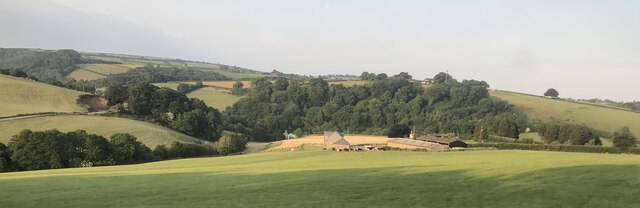
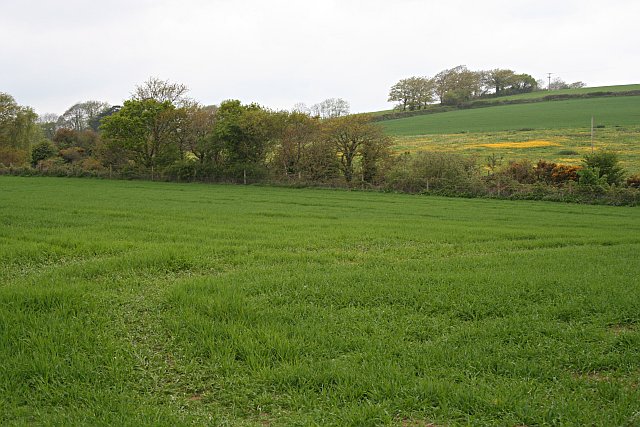
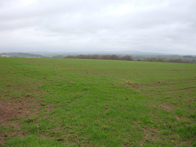
Bloggerheads Wood, located in Cornwall, is a serene and picturesque forest that offers a tranquil escape from the hustle and bustle of daily life. With an area covering approximately 100 acres, this wood is a haven for nature enthusiasts and those seeking an immersive experience in the great outdoors.

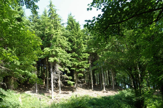
The wood is characterized by its dense canopy of trees, primarily consisting of oak, beech, and pine. These towering giants create a sense of awe and provide shade during the summer months. The forest floor is blanketed with a lush carpet of ferns, mosses, and wildflowers, adding to the natural beauty of the surroundings.

Bloggerheads Wood boasts a diverse range of wildlife, making it an ideal spot for birdwatching and animal spotting. Visitors may encounter various species such as woodpeckers, owls, deer, and foxes, among others. The tranquil atmosphere and the absence of traffic noise provide a perfect setting for wildlife to thrive.

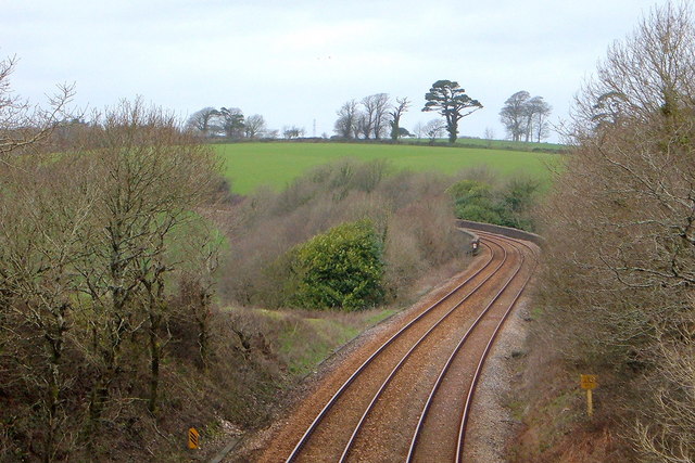
The wood features well-maintained walking trails, allowing visitors to explore the area at their own pace. These paths wind through the forest, offering glimpses of hidden clearings and babbling brooks. The wood is also home to a small lake, where visitors can relax and enjoy a picnic while admiring the reflections of the surrounding trees on the water's surface.

Bloggerheads Wood is open year-round, and its changing seasons bring a different charm to the landscape. Whether visitors are seeking solitude, an opportunity to reconnect with nature, or simply a peaceful retreat, Bloggerheads Wood is a captivating destination that promises an unforgettable experience in the heart of Cornwall's natural beauty.

If you have any feedback on the listing, please let us know in the comments section below.

Bloggerheads Wood Images

Images are sourced within 2km of 50.409826/-4.3954836 or Grid Reference SX2959. Thanks to Geograph Open Source API. All images are credited.

Field near Furze Park
Tresulgan Farm
Tresulgan Farm
Valley and Hillside The line of trees in the valley mark the route of the main railway line.
Valley and Hillside
The line of trees in the valley mark the route of the main railway line.
The Main Railway Line The bridge over the line carries the track to Berry Farm.
The Main Railway Line
The bridge over the line carries the track to Berry Farm.
Electricity Sub Station The transformers step down the high voltage electricity which comes over the wires on the large pylons to a lower voltage more suitable for local distribution via wires on wooden poles.
Electricity Sub Station
The transformers step down the high voltage electricity which comes over the wires on the large pylons to a lower voltage more suitable for local distribution via wires on wooden poles.
Bridge and stream, Lydcott Woods Bridge and stream, Lydcott Woods, near Widegates, Cornwall.
Bridge and stream, Lydcott Woods
Bridge and stream, Lydcott Woods, near Widegates, Cornwall.
Conifers, Lydcott Wood Conifers, Lydcott Wood, near Widegates, Cornwall.
Conifers, Lydcott Wood
Conifers, Lydcott Wood, near Widegates, Cornwall.
Large open field near Cathfrench Manor This picture shows a wide open gradually sloping field with no hedges. The contours on the map are far apart.
Large open field near Cathfrench Manor
This picture shows a wide open gradually sloping field with no hedges. The contours on the map are far apart.
Steep field and woods beyond. This picture shows (through the trees) the steeper gradient field as opposed to the field in the central section of the OS grid square. The denser woods seen here up to the left are known as 'Shippingpark Wood'.
Steep field and woods beyond.
This picture shows (through the trees) the steeper gradient field as opposed to the field in the central section of the OS grid square. The denser woods seen here up to the left are known as 'Shippingpark Wood'.
Railway track towards Penzance This picture clearly shows the railway heading towards the Tresulgan Viaduct - the safety walls of which can be seen as the track veers to the left in the picture.
Railway track towards Penzance
This picture clearly shows the railway heading towards the Tresulgan Viaduct - the safety walls of which can be seen as the track veers to the left in the picture.
Road to Wilton Farm Geographically speaking - the map shows a road should be here, so I went and there was a road - as now shown in the picture. The Wilton Farm is just round the corner - (where the top of a conifer is poking out of the hedge horizon as a marker.)
Road to Wilton Farm
Geographically speaking - the map shows a road should be here, so I went and there was a road - as now shown in the picture. The Wilton Farm is just round the corner - (where the top of a conifer is poking out of the hedge horizon as a marker.)
Fields adjacent to Wilton Farm This pic is slightly off to the right of the previous pic and shows a bit of farmland over the hedge from the road. The field gently slopes away and eventually drops down to where Bake Wood, Wilton Wood, and Bare Lakes are located along the valley in line from right to left.
Fields adjacent to Wilton Farm
This pic is slightly off to the right of the previous pic and shows a bit of farmland over the hedge from the road. The field gently slopes away and eventually drops down to where Bake Wood, Wilton Wood, and Bare Lakes are located along the valley in line from right to left.
Woodland south of the A38
Clay from Cornwall to the North A freight service is seen heading east away from Menheniot out of the county with clay for the Potteries.
Clay from Cornwall to the North
A freight service is seen heading east away from Menheniot out of the county with clay for the Potteries.
Main line looking west Looking west towards Menheniot off a minor road bridge a Penzance to Paddington train is seen heading towards St Germans. The cuttings were once well open here but now trees and scrub have grown up restricting the view.
Main line looking west
Looking west towards Menheniot off a minor road bridge a Penzance to Paddington train is seen heading towards St Germans. The cuttings were once well open here but now trees and scrub have grown up restricting the view.
River Seaton, Hessenford Picture of the river Seaton just north of Hessenford, taken on 1st February 2007.
River Seaton, Hessenford
Picture of the river Seaton just north of Hessenford, taken on 1st February 2007.
The down Leeds to Penzance service nr Berry Farm Standing on one road overbridge it was possible to photograph the afternoon Leeds to Penzance service passing under the Berry farm occupation bridge. This service left Plymouth just after 1400hrs and the next stop would be Liskeard at 1425.
The down Leeds to Penzance service nr Berry Farm
Standing on one road overbridge it was possible to photograph the afternoon Leeds to Penzance service passing under the Berry farm occupation bridge. This service left Plymouth just after 1400hrs and the next stop would be Liskeard at 1425.
Furze Park
Furze Park
Show me another place!

Bloggerheads Wood is located at Grid Ref: SX2959 (Lat: 50.409826, Lng: -4.3954836)

Unitary Authority: Cornwall

Police Authority: Devon and Cornwall

What 3 Words

///emulated.fire.lotteries. Near Liskeard, Cornwall

Related Wikis

Catchfrench

Catchfrench is a hamlet in Cornwall, England. It is about 1.5 miles (2.4 km) north of Hessenford. Catchfrench Manor is a late 18th-century house by Charles...

Lower Clicker

Lower Clicker is a hamlet in the parish of Menheniot, Cornwall, England, UK. Lower Clicker lies on the A38 road approximately 3 miles (4.8 km) south-east...

Bake Fishing Lakes

Bake Fishing Lakes (grid reference SX318587); also known as Bake Lakes, Bake Farm Lakes or Bake Pools; is the name for a group of lakes at Bake Farm, near...

Widegates

Widegates is a village in south-east Cornwall, England, UK, about 4 miles north of Looe. It is on the A387 road about two miles west of Hessenford. The...

Nearby Amenities

Located within 500m of 50.409826,-4.3954836
Power: pole
Lat/Long: 50.4100525/-4.4017839
Power: pole
Lat/Long: 50.4105927/-4.3971813
Power: pole
Lat/Long: 50.4111841/-4.3916076
Power: pole
Lat/Long: 50.4112815/-4.3908888
Power: pole
Lat/Long: 50.411408/-4.3896174
Power: pole
Lat/Long: 50.4111824/-4.4018362
Power: pole
Lat/Long: 50.4113901/-4.3990387
Power: pole
Lat/Long: 50.4120123/-4.3977392
Power: pole
Lat/Long: 50.4126575/-4.3963833
Power: pole
Lat/Long: 50.4139967/-4.3934517
Power: pole
Lat/Long: 50.4122909/-4.3951441
Power: pole
Lat/Long: 50.4128635/-4.3950355
Power: pole
Lat/Long: 50.4134566/-4.3949631
Power: pole
Lat/Long: 50.4128942/-4.3952125
Power: pole
Lat/Long: 50.4133933/-4.3929018
Power: pole
Lat/Long: 50.413554/-4.3922406
The data included in this document is from www.openstreetmap.org. The data is made available under ODbL.

Have you been to Bloggerheads Wood?

Leave your review of Bloggerheads Wood below (or comments, questions and feedback).