Kennacott Copse

Wood, Forest in Devon

England

Kennacott Copse

The road junction south of Langdon Farm A solitary bungalow marks this junction
The road junction south of Langdon Farm Credit: David Smith

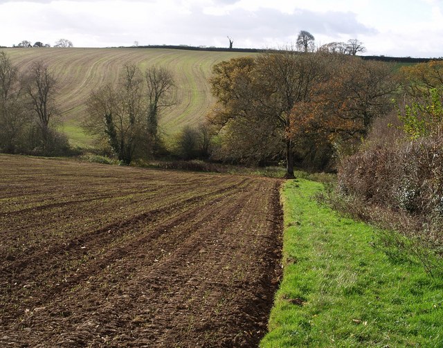
Kennacott Copse is a small woodland area located in the beautiful county of Devon, England. Situated near the village of Kennacott, the copse covers an area of approximately 10 acres and is known for its rich biodiversity and natural beauty.

The copse is primarily composed of broadleaved trees such as oak, beech, and hazel, which create a dense canopy that provides a sanctuary for a variety of wildlife. The forest floor is covered in a lush carpet of ferns, mosses, and wildflowers, adding to its enchanting atmosphere.

The copse is a popular destination for nature lovers, hikers, and birdwatchers due to its diverse ecosystem. It is home to a wide range of bird species, including woodpeckers, owls, and various songbirds. Visitors can often spot deer, foxes, and squirrels roaming through the trees, adding to the sense of tranquility and natural harmony.

Walking trails wind their way through the copse, allowing visitors to explore its wonders at their own pace. These paths lead visitors through ancient stands of trees, past babbling brooks, and to secluded clearings where one can sit and enjoy the peaceful surroundings.

The management of Kennacott Copse is dedicated to preserving its natural beauty and protecting its inhabitants. The copse is carefully maintained to ensure its ecological balance, and efforts are made to educate visitors about the importance of conservation and respecting the natural environment.

Overall, Kennacott Copse is a haven of tranquility and natural beauty in the heart of Devon. Its lush woodland, diverse wildlife, and peaceful atmosphere make it a must-visit destination for nature enthusiasts and those seeking a respite from the hustle and bustle of everyday life.

If you have any feedback on the listing, please let us know in the comments section below.

Kennacott Copse Images

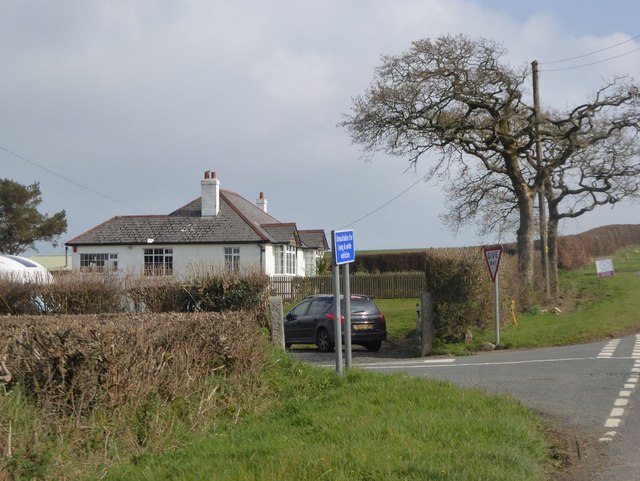
Images are sourced within 2km of 50.677109/-4.4166164 or Grid Reference SX2989. Thanks to Geograph Open Source API. All images are credited.

The road junction south of Langdon Farm A solitary bungalow marks this junction
The road junction south of Langdon Farm
A solitary bungalow marks this junction
Valley south of Hillside on B3254
Lane near Godcott Farm A line of oaks beside the lane as it approaches the farm.
Lane near Godcott Farm
A line of oaks beside the lane as it approaches the farm.
Lane near Godcott Farm Dropping between banks and trees to cross the Bolesbridge Water.
Lane near Godcott Farm
Dropping between banks and trees to cross the Bolesbridge Water.
Lane past Forda At the junction with the entrance to Forda Cottage (right). The farmhouse at Forda, ahead, has fine chimney stacks. "1844 ...  Vestigial Gothic style" <span class="nowrap"><a title="http://list.historicengland.org.uk/resultsingle.aspx?uid=1160350&searchtype=mapsearch" rel="nofollow ugc noopener" href="http://list.historicengland.org.uk/resultsingle.aspx?uid=1160350&searchtype=mapsearch">Link</a><img style="margin-left:2px;" alt="External link" title="External link - shift click to open in new window" src="https://s1.geograph.org.uk/img/external.png" width="10" height="10"/></span> .
Lane past Forda
At the junction with the entrance to Forda Cottage (right). The farmhouse at Forda, ahead, has fine chimney stacks. "1844 ... Vestigial Gothic style" LinkExternal link .
Towards North Petherwin The church tower at North Petherwin can be made out on the right. This gateway is by the lane shown in <a href="https://www.geograph.org.uk/photo/4391351">SX2890 : Lane near Godcott Farm</a>.
Towards North Petherwin
The church tower at North Petherwin can be made out on the right. This gateway is by the lane shown in SX2890 : Lane near Godcott Farm.
Lane near Godcott Farm Looking in the other direction from the same spot as <a href="https://www.geograph.org.uk/photo/4391377">SX2990 : Lane near Godcott Farm</a>.
Lane near Godcott Farm
Looking in the other direction from the same spot as SX2990 : Lane near Godcott Farm.
Towards Forda From the lane shown in <a href="https://www.geograph.org.uk/photo/4391377">SX2990 : Lane near Godcott Farm</a> and <a href="https://www.geograph.org.uk/photo/4568375">SX2990 : Lane near Godcott Farm</a>. The roof of Lower Forda Cottage <span class="nowrap"><a title="http://list.historicengland.org.uk/resultsingle.aspx?uid=1142926&searchtype=mapsearch" rel="nofollow ugc noopener" href="http://list.historicengland.org.uk/resultsingle.aspx?uid=1142926&searchtype=mapsearch">Link</a><img style="margin-left:2px;" alt="External link" title="External link - shift click to open in new window" src="https://s1.geograph.org.uk/img/external.png" width="10" height="10"/></span> can be seen in the centre. The house at Forda <span class="nowrap"><a title="http://list.historicengland.org.uk/resultsingle.aspx?uid=1160350&searchtype=mapsearch" rel="nofollow ugc noopener" href="http://list.historicengland.org.uk/resultsingle.aspx?uid=1160350&searchtype=mapsearch">Link</a><img style="margin-left:2px;" alt="External link" title="External link - shift click to open in new window" src="https://s1.geograph.org.uk/img/external.png" width="10" height="10"/></span> is a little more clearly shown in <a href="https://www.geograph.org.uk/photo/4391383">SX2990 : Lane past Forda</a>.
Towards Forda
From the lane shown in SX2990 : Lane near Godcott Farm and SX2990 : Lane near Godcott Farm. The roof of Lower Forda Cottage LinkExternal link can be seen in the centre. The house at Forda LinkExternal link is a little more clearly shown in SX2990 : Lane past Forda.
B3254 near Langdon Cross The B road dips to cross a tributary of the Tala Water as it approaches Langdon Cross.
B3254 near Langdon Cross
The B road dips to cross a tributary of the Tala Water as it approaches Langdon Cross.
Track by Bolesbridge Water Rather a landscaped feel to this field access track leaving the lane from Langdon Cross to Clubworthy just before the bridge over the stream.
Track by Bolesbridge Water
Rather a landscaped feel to this field access track leaving the lane from Langdon Cross to Clubworthy just before the bridge over the stream.
Bodgate A rather grand farmhouse in an area transferred from Devon to Cornwall in 1974. Seen from the start of the footpath to Godcott Farm.
Bodgate
A rather grand farmhouse in an area transferred from Devon to Cornwall in 1974. Seen from the start of the footpath to Godcott Farm.
Footpath between Godcott Farm and Bodgate A broad field-edge left for footpath 529/4/1 as it drops to cross a tributary of the Bolesbridge Water, lined with trees.
Footpath between Godcott Farm and Bodgate
A broad field-edge left for footpath 529/4/1 as it drops to cross a tributary of the Bolesbridge Water, lined with trees.
Valley side near Bodgate A view along the northern slopes of the valley of a tributary of Bolesbridge Water, seen from footpath 529/7/1 from North Petherwin to the nearby <a href="https://www.geograph.org.uk/photo/608149">SX2890 : Bodgate</a>. The house on the right is on the entrance road to Bodgate from Brazacott.
Valley side near Bodgate
A view along the northern slopes of the valley of a tributary of Bolesbridge Water, seen from footpath 529/7/1 from North Petherwin to the nearby SX2890 : Bodgate. The house on the right is on the entrance road to Bodgate from Brazacott.
In the Bolesbridge Water valley Footpath 529/4/1 passes a small copse as it crosses a tributary of the Bolesbridge Water, and heads upstream along the edge of the flood plain towards Forda Mill. Most of the mature trees visible are along the course of the stream.
In the Bolesbridge Water valley
Footpath 529/4/1 passes a small copse as it crosses a tributary of the Bolesbridge Water, and heads upstream along the edge of the flood plain towards Forda Mill. Most of the mature trees visible are along the course of the stream.
Bolesbridge Water The stream twists and turns its way in tight meanders across this level stretch of valley. Here it has formed a couple of miniature slip-off slopes while undermining the adjacent banks.
Bolesbridge Water
The stream twists and turns its way in tight meanders across this level stretch of valley. Here it has formed a couple of miniature slip-off slopes while undermining the adjacent banks.
Bolesbridge Water Unlike the nearby <a href="https://www.geograph.org.uk/photo/609009">SX2890 : Bolesbridge Water</a>, no slip-off slope is visible on the inside of this meander around a narrow neck of land. In the foreground, a barbed wire fence is gradually being left marooned in mid-air as the bank erodes.
Bolesbridge Water
Unlike the nearby SX2890 : Bolesbridge Water, no slip-off slope is visible on the inside of this meander around a narrow neck of land. In the foreground, a barbed wire fence is gradually being left marooned in mid-air as the bank erodes.
Ford across Bolesbridge Water This looks rather like a large puddle, but is actually the sizeable stream seen in <a href="https://www.geograph.org.uk/photo/609022">SX2990 : Bolesbridge Water</a>, being forded by a track that once provided access to <a href="https://www.geograph.org.uk/photo/608149">SX2890 : Bodgate</a> from the east. Seen from path 529/4/1 which remains firmly on this side of the Water. In the distance is the farm at Forda.
Ford across Bolesbridge Water
This looks rather like a large puddle, but is actually the sizeable stream seen in SX2990 : Bolesbridge Water, being forded by a track that once provided access to SX2890 : Bodgate from the east. Seen from path 529/4/1 which remains firmly on this side of the Water. In the distance is the farm at Forda.
Meadow near Forda Mill A wild meadow that looks a promising wildlife habitat. On the right behind the undergrowth flows Bolesbridge Water - the view is looking upstream. Footpath 529/4/1 makes its way across the meadow to cross a tributary which runs past the isolated oak left of centre, and continues to Forda Mill. Taken only a yard or two from <a href="https://www.geograph.org.uk/photo/609038">SX2990 : Ford across Bolesbridge Water</a>.
Meadow near Forda Mill
A wild meadow that looks a promising wildlife habitat. On the right behind the undergrowth flows Bolesbridge Water - the view is looking upstream. Footpath 529/4/1 makes its way across the meadow to cross a tributary which runs past the isolated oak left of centre, and continues to Forda Mill. Taken only a yard or two from SX2990 : Ford across Bolesbridge Water.
Show me another place!

Kennacott Copse is located at Grid Ref: SX2989 (Lat: 50.677109, Lng: -4.4166164)

Unitary Authority: Cornwall

Police Authority: Devon and Cornwall

What 3 Words

///candle.engraving.surreal. Near Boyton, Cornwall

Nearby Locations

Kennacott Copse

Related Wikis

Petherwin Gate

Petherwin Gate is a hamlet in Cornwall, England. It is about half a mile south of North Petherwin. == References ==

Langdon, Cornwall

Langdon is a hamlet in north Cornwall approximately five miles north of Launceston; it is west of Canworthy. Langdon sits at 50.6839’ latitude and -4.40239954...

North Petherwin

North Petherwin (Cornish: Paderwynn Gledh) is a civil parish and village in the historic county of Devon and the ceremonial county of Cornwall, England...

Bodgate

Bodgate is a farmstead in east Cornwall, England, United Kingdom. It is situated in North Petherwin civil parish about 0.5 miles (0.80 km) south of North...

Nearby Amenities

Located within 500m of 50.677109,-4.4166164
The data included in this document is from www.openstreetmap.org. The data is made available under ODbL.

Have you been to Kennacott Copse?

Leave your review of Kennacott Copse below (or comments, questions and feedback).