Chedworth Laines

Settlement in Gloucestershire Cotswold

England

Chedworth Laines

Overflowing trough opposite the Seven Tuns pub Trough fed by the pond above overflowing after winter storms. See also <a href="https://www.geograph.org.uk/photo/2883726">SP0512 : Small waterfall opposite Seven Tuns</a>
Overflowing trough opposite the Seven Tuns pub Credit: Vieve Forward

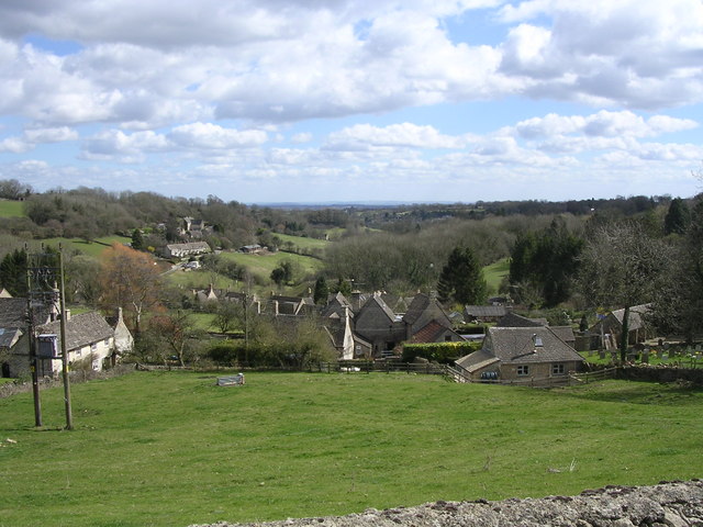
Chedworth Laines is a small village located in the picturesque county of Gloucestershire, England. Situated in the heart of the Cotswolds, it is surrounded by rolling hills, lush green fields, and charming countryside views. The village is part of the larger civil parish of Chedworth and is known for its idyllic setting and historic charm.

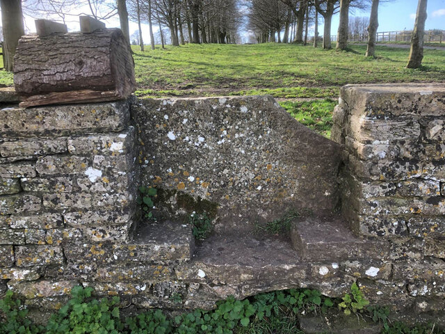
Chedworth Laines is home to a tight-knit community, with a population of around 200 residents. The village is characterized by its traditional Cotswold stone buildings, which lend a timeless and quintessentially English feel to the area. Many of these buildings date back centuries and are well-preserved, adding to the village's historical significance.

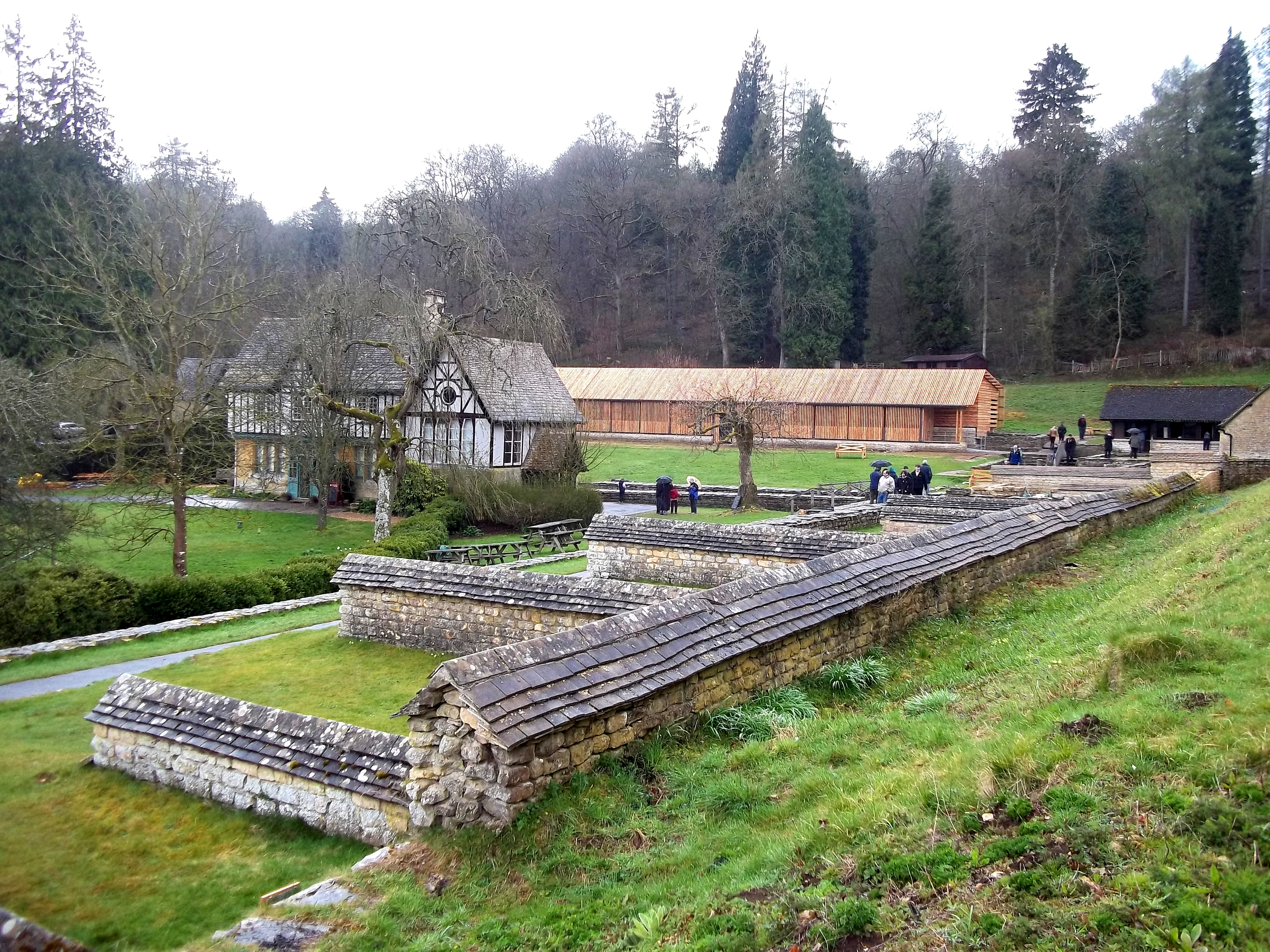
Nature enthusiasts are drawn to Chedworth Laines for its proximity to the Cotswold Area of Outstanding Natural Beauty. The village is surrounded by an array of walking trails, offering visitors the opportunity to explore the stunning countryside and discover hidden gems along the way. One of the notable attractions in the area is Chedworth Roman Villa, a well-preserved Roman site that showcases the remains of a luxurious villa complex. This archaeological site attracts history buffs and tourists alike, providing a glimpse into Roman life in rural England.

Although small, Chedworth Laines has a strong sense of community spirit and offers a range of amenities for its residents. These include a village hall, a local pub, and a primary school. The village also hosts various events throughout the year, such as summer fetes and Christmas markets, fostering a sense of togetherness among its residents.

Overall, Chedworth Laines is a charming village nestled in the scenic Gloucestershire countryside, offering a peaceful and picturesque retreat for both residents and visitors alike.

If you have any feedback on the listing, please let us know in the comments section below.

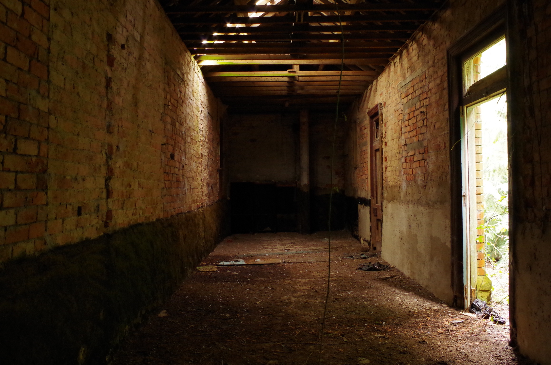
Chedworth Laines Images

Images are sourced within 2km of 51.802536/-1.944133 or Grid Reference SP0311. Thanks to Geograph Open Source API. All images are credited.

Overflowing trough opposite the Seven Tuns pub Trough fed by the pond above overflowing after winter storms. See also <a href="https://www.geograph.org.uk/photo/2883726">SP0512 : Small waterfall opposite Seven Tuns</a>
Overflowing trough opposite the Seven Tuns pub
Trough fed by the pond above overflowing after winter storms. See also SP0512 : Small waterfall opposite Seven Tuns
Road junction, Chedworth
Stone Stile Chedworth GS2556 To the right of the entrance to Manor Farm and playing fields on Gloucestershire footpath KCH21. NW of the village. The view from the field is <a href="https://www.geograph.org.uk/photo/7204899">SP0412 : Stone Stile Chedworth GS2556</a>.
Stone Stile Chedworth GS2556
To the right of the entrance to Manor Farm and playing fields on Gloucestershire footpath KCH21. NW of the village. The view from the field is SP0412 : Stone Stile Chedworth GS2556.
Stone Stile, Chedworth GS2557 Beech Walk, Manor Farm near the cricket pitch. Looking West on Gloucestershire footpath KCH21 near King Stone Dairy, Manor Farm. The view East is <a href="https://www.geograph.org.uk/photo/7198287">SP0512 : Stone Stile, Chedworth GS2557</a>.
Stone Stile, Chedworth GS2557
Beech Walk, Manor Farm near the cricket pitch. Looking West on Gloucestershire footpath KCH21 near King Stone Dairy, Manor Farm. The view East is SP0512 : Stone Stile, Chedworth GS2557.
Stone Stile, Chedworth GS2557 Beech Walk, Manor Farm near the cricket pitch. Looking East on Gloucestershire footpath KCH21 near King Stone Dairy, Manor Farm. The view West is <a href="https://www.geograph.org.uk/photo/7198284">SP0512 : Stone Stile, Chedworth GS2557</a>.
Stone Stile, Chedworth GS2557
Beech Walk, Manor Farm near the cricket pitch. Looking East on Gloucestershire footpath KCH21 near King Stone Dairy, Manor Farm. The view West is SP0512 : Stone Stile, Chedworth GS2557.
Stone Stile Chedworth GS2556 To the side of the entrance to Manor Farm and playing fields on Gloucestershire footpath KCH21. NW of the village. The view from the road is <a href="https://www.geograph.org.uk/photo/7197634">SP0412 : Stone Stile Chedworth GS2556</a>.
Stone Stile Chedworth GS2556
To the side of the entrance to Manor Farm and playing fields on Gloucestershire footpath KCH21. NW of the village. The view from the road is SP0412 : Stone Stile Chedworth GS2556.
Stone Stile Chedworth GS2547 This stile is not on a registered footpath and lies East of the village on the continuation of Queens Street. The view is to the road, an alternative view looking South is <a href="https://www.geograph.org.uk/photo/7251605">SP0512 : Stone Stile Chedworth GS2547</a>.
Stone Stile Chedworth GS2547
This stile is not on a registered footpath and lies East of the village on the continuation of Queens Street. The view is to the road, an alternative view looking South is SP0512 : Stone Stile Chedworth GS2547.
Stone Stile Chedworth GS2547 This stile is not on a registered footpath and lies East of the village on the continuation of Queens Street. The view is from the road, an alternative view looking North is <a href="https://www.geograph.org.uk/photo/7251604">SP0512 : Stone Stile Chedworth GS2547</a>.
Stone Stile Chedworth GS2547
This stile is not on a registered footpath and lies East of the village on the continuation of Queens Street. The view is from the road, an alternative view looking North is SP0512 : Stone Stile Chedworth GS2547.
Stone Stile, Chedworth Off Calves Hill on Gloucestershire footpath KCH26A looking SE, the view from the road is <a href="https://www.geograph.org.uk/photo/7289062">SP0511 : Stone Stile, Chedworth</a>.
Stone Stile, Chedworth
Off Calves Hill on Gloucestershire footpath KCH26A looking SE, the view from the road is SP0511 : Stone Stile, Chedworth.
Stone Stile, Chedworth Off Calves Hill on Gloucestershire footpath KCH26A looking NW from the road, the view back is <a href="https://www.geograph.org.uk/photo/7289061">SP0511 : Stone Stile, Chedworth</a>.
Stone Stile, Chedworth
Off Calves Hill on Gloucestershire footpath KCH26A looking NW from the road, the view back is SP0511 : Stone Stile, Chedworth.
Stone Stile, Chedworth On Gloucestershire footpath KCH26 in fields East of the village, looking NW. The view SE is <a href="https://www.geograph.org.uk/photo/7289084">SP0511 : Stone Stile, Chedworth</a>.
Stone Stile, Chedworth
On Gloucestershire footpath KCH26 in fields East of the village, looking NW. The view SE is SP0511 : Stone Stile, Chedworth.
Stone Stile, Chedworth On Gloucestershire footpath KCH26 in fields East of the village, looking SE. The view NW is <a href="https://www.geograph.org.uk/photo/7289082">SP0511 : Stone Stile, Chedworth</a>.
Stone Stile, Chedworth
On Gloucestershire footpath KCH26 in fields East of the village, looking SE. The view NW is SP0511 : Stone Stile, Chedworth.
Stone Stile, Chedworth On Gloucestershire footpath KCH26 SE of the footbridge over the brook which can just be seen on the right. The view NW, see <a href="https://www.geograph.org.uk/photo/7289088">SP0511 : Stone Stile, Chedworth</a>.
Stone Stile, Chedworth
On Gloucestershire footpath KCH26 SE of the footbridge over the brook which can just be seen on the right. The view NW, see SP0511 : Stone Stile, Chedworth.
Stone Stile, Chedworth On Gloucestershire footpath KCH26 NW of the footbridge over the brook which can just be seen on the view SE, see <a href="https://www.geograph.org.uk/photo/7289087">SP0511 : Stone Stile, Chedworth</a>.
Stone Stile, Chedworth
On Gloucestershire footpath KCH26 NW of the footbridge over the brook which can just be seen on the view SE, see SP0511 : Stone Stile, Chedworth.
Stone Stile, Chedworth On Gloucestershire footpaths KCH26 & KCH29 looking NW at the "Fallen Idle" remains of a stone tile. The view SW is <a href="https://www.geograph.org.uk/photo/7289092">SP0511 : Stone Stile, Chedworth</a>.
Stone Stile, Chedworth
On Gloucestershire footpaths KCH26 & KCH29 looking NW at the "Fallen Idle" remains of a stone tile. The view SW is SP0511 : Stone Stile, Chedworth.
Stone Stile, Chedworth On Gloucestershire footpaths KCH26 & KCH29 looking down on the "Fallen Idle" remains of the stone tile. The view NW is <a href="https://www.geograph.org.uk/photo/7289091">SP0511 : Stone Stile, Chedworth</a>.
Stone Stile, Chedworth
On Gloucestershire footpaths KCH26 & KCH29 looking down on the "Fallen Idle" remains of the stone tile. The view NW is SP0511 : Stone Stile, Chedworth.
Stone Stile Chedworth On Gloucestershire footpath KCH62 where it enters a horse jumping field. Looking NW, the view from the horse field is <a href="https://www.geograph.org.uk/photo/7290172">SP0510 : Stone Stile Chedworth</a>.
Stone Stile Chedworth
On Gloucestershire footpath KCH62 where it enters a horse jumping field. Looking NW, the view from the horse field is SP0510 : Stone Stile Chedworth.
Stone Stile Chedworth On Gloucestershire footpath KCH62 where it leaves a horse jumping field. Looking NW, the view to the horse field is <a href="https://www.geograph.org.uk/photo/7290169">SP0510 : Stone Stile Chedworth</a>.
Stone Stile Chedworth
On Gloucestershire footpath KCH62 where it leaves a horse jumping field. Looking NW, the view to the horse field is SP0510 : Stone Stile Chedworth.
Show me another place!

Chedworth Laines is located at Grid Ref: SP0311 (Lat: 51.802536, Lng: -1.944133)

Administrative County: Gloucestershire

District: Cotswold

Police Authority: Gloucestershire

What 3 Words

///yours.tickling.glass. Near Northleach, Gloucestershire

Related Wikis

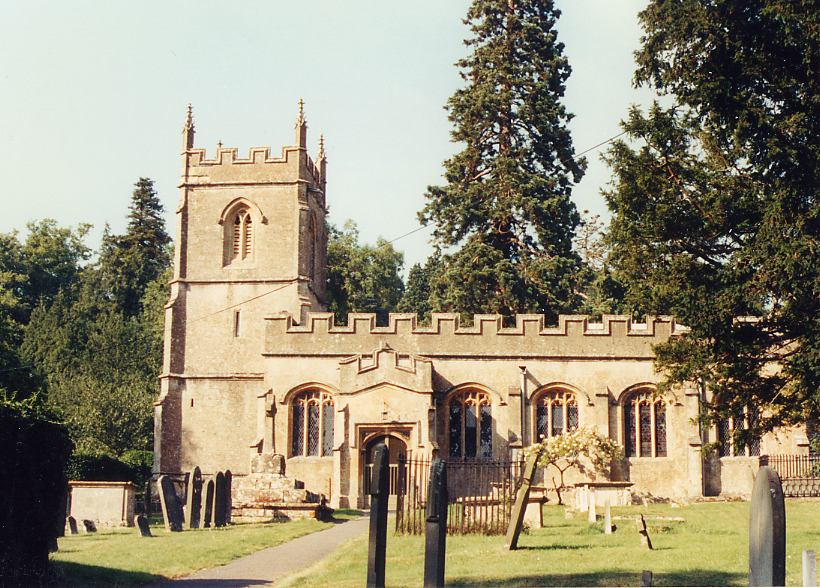
Church of St Andrew, Chedworth

The Anglican Church of St Andrew at Chedworth in the Cotswold District of Gloucestershire, England was built in the late 12th century. It is a grade I...

Chedworth

Chedworth is a village and civil parish in Gloucestershire, southwest England, in the Cotswolds. It is known as the location of Chedworth Roman Villa,...

RAF Chedworth

Royal Air Force Chedworth or more simply RAF Chedworth is a former Royal Air Force satellite station located near Chedworth, Gloucestershire, England....

Chedworth Halt railway station

Chedworth Halt railway station was on the Midland and South Western Junction Railway in Gloucestershire. The station opened on 1 October 1892, 14 months...

Chedworth Roman Villa

Chedworth Roman Villa is located near Chedworth, Gloucestershire, England and is a scheduled monument. It is one of the largest and most elaborate Roman...

Stony Furlong Railway Cutting

Stony Furlong Railway Cutting (grid reference SP063106) is a 2.7-hectare (6.7-acre) geological Site of Special Scientific Interest in Gloucestershire,...

Foss Cross railway station

Foss Cross railway station was on the Midland and South Western Junction Railway in Gloucestershire. The station opened on 1 August 1891 with the section...

Church of St Peter, Rendcomb

The Anglican Church of St Peter within the grounds of Rendcomb College at Rendcomb in the Cotswold District of Gloucestershire, England was rebuilt in...

Nearby Amenities

Located within 500m of 51.802536,-1.944133
Chedworth Laines
Place: hamlet
Lat/Long: 51.8030621/-1.9446498
Power: pole
Source: bing
Lat/Long: 51.8045812/-1.9401633
Power: pole
Source: bing
Lat/Long: 51.8061139/-1.9407428
Power: pole
Source: bing
Lat/Long: 51.8053351/-1.9404485
Power: pole
Source: bing
Lat/Long: 51.8037109/-1.9398179
Power: pole
Source: bing
Lat/Long: 51.8034634/-1.9373794
Power: pole
Source: bing
Lat/Long: 51.8031537/-1.9384286
Power: pole
Source: bing
Lat/Long: 51.8028349/-1.9394907
Power: pole
Source: bing
Lat/Long: 51.8027513/-1.9407391
Power: pole
Source: bing
Lat/Long: 51.8026716/-1.9419867
Power: pole
Source: bing
Lat/Long: 51.8023444/-1.9459697
Power: pole
Source: bing
Lat/Long: 51.8025942/-1.9430094
Power: pole
Source: bing
Lat/Long: 51.8024823/-1.9443602
Power: pole
Source: bing
Lat/Long: 51.8015554/-1.9468224
Power: pole
Source: bing
Lat/Long: 51.8010456/-1.947283
Power: pole
Source: bing
Lat/Long: 51.8003357/-1.9478826
Power: pole
Source: bing
Lat/Long: 51.7996315/-1.9484456
The data included in this document is from www.openstreetmap.org. The data is made available under ODbL.

Have you been to Chedworth Laines?

Leave your review of Chedworth Laines below (or comments, questions and feedback).