Bonniny Wood

Wood, Forest in Cornwall

England

Bonniny Wood

Terras Bridge A good mixture of obstacles on this minor lane - in this direction of view, first this little arched bridge crosses the East Looe river, next there is an ungated level crossing with the Liskeard and Looe Railway and finally a tidal ford - and all within a couple of hundred yards.
Terras Bridge Credit: Rob Farrow

Bonniny Wood is a picturesque forest located in Cornwall, England. Situated in the heart of the county, this wood offers a tranquil and peaceful retreat for nature enthusiasts and outdoor lovers alike.

Covering an area of approximately 100 acres, Bonniny Wood is known for its diverse ecosystem and rich biodiversity. The forest is primarily composed of native broadleaf trees, including oak, beech, and birch, which create a dense canopy that provides shade and shelter for a variety of wildlife.

Visitors to Bonniny Wood can enjoy a network of well-maintained footpaths and trails that wind their way through the forest. These paths offer a chance to explore the wood's natural beauty and discover its hidden gems. Along the way, hikers may encounter a wide range of wildlife, including deer, squirrels, and various bird species.

The wood is particularly popular during the spring and summer months when the forest floor becomes adorned with a vibrant carpet of wildflowers, such as bluebells and foxgloves. This burst of color adds to the enchanting atmosphere of Bonniny Wood.

In addition to its natural beauty, Bonniny Wood also offers some recreational facilities, including picnic areas and benches where visitors can relax and take in the peaceful surroundings. The wood is also a popular spot for birdwatching and photography.

Overall, Bonniny Wood is a charming destination for nature lovers, providing a serene escape from the hustle and bustle of everyday life. Whether for a leisurely stroll, a family picnic, or wildlife observation, this forest offers an enchanting experience for all who visit.

If you have any feedback on the listing, please let us know in the comments section below.

Bonniny Wood Images

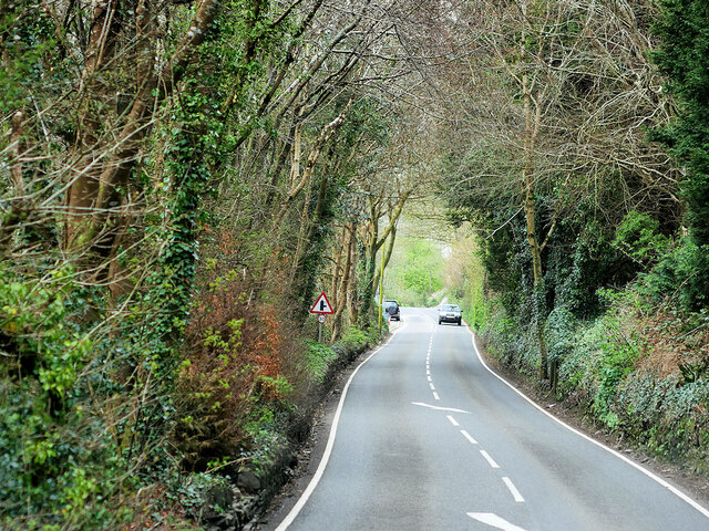
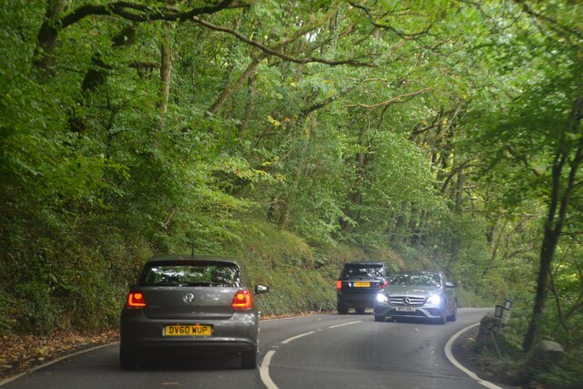
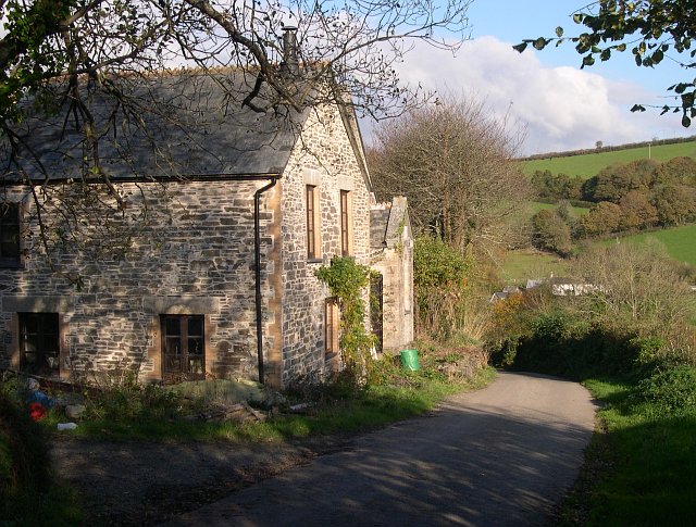
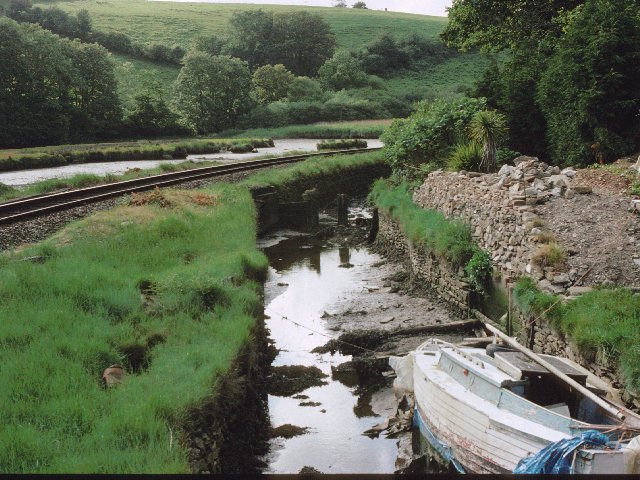
Images are sourced within 2km of 50.365105/-4.4816106 or Grid Reference SX2354. Thanks to Geograph Open Source API. All images are credited.

Terras Bridge A good mixture of obstacles on this minor lane - in this direction of view, first this little arched bridge crosses the East Looe river, next there is an ungated level crossing with the Liskeard and Looe Railway and finally a tidal ford - and all within a couple of hundred yards.
Terras Bridge
A good mixture of obstacles on this minor lane - in this direction of view, first this little arched bridge crosses the East Looe river, next there is an ungated level crossing with the Liskeard and Looe Railway and finally a tidal ford - and all within a couple of hundred yards.
River East Looe View upstream from Looe Bridge.
River East Looe
View upstream from Looe Bridge.
Layby on the A387 near Waylands The A387 is a 12.5 mile long road in SE Cornwall, between Polbathic and Crumplehorn (Polperro) <a href="https://www.geograph.org.uk/photo/5559278">SX2051 : Mini-roundabout, Crumplehorn</a>, via Looe.
<span class="nowrap"><a title="https://www.sabre-roads.org.uk/wiki/index.php?title=A387" rel="nofollow ugc noopener" href="https://www.sabre-roads.org.uk/wiki/index.php?title=A387">Link</a><img style="margin-left:2px;" alt="External link" title="External link - shift click to open in new window" src="https://s1.geograph.org.uk/img/external.png" width="10" height="10"/></span>
Layby on the A387 near Waylands
The A387 is a 12.5 mile long road in SE Cornwall, between Polbathic and Crumplehorn (Polperro) SX2051 : Mini-roundabout, Crumplehorn, via Looe. LinkExternal link
Layby on the A387, West Wayland The A387 is a 12.5 mile long road in SE Cornwall, between Polbathic and Crumplehorn (Polperro) <a href="https://www.geograph.org.uk/photo/5559278">SX2051 : Mini-roundabout, Crumplehorn</a>, via Looe.
<span class="nowrap"><a title="https://www.sabre-roads.org.uk/wiki/index.php?title=A387" rel="nofollow ugc noopener" href="https://www.sabre-roads.org.uk/wiki/index.php?title=A387">Link</a><img style="margin-left:2px;" alt="External link" title="External link - shift click to open in new window" src="https://s1.geograph.org.uk/img/external.png" width="10" height="10"/></span>
Layby on the A387, West Wayland
The A387 is a 12.5 mile long road in SE Cornwall, between Polbathic and Crumplehorn (Polperro) SX2051 : Mini-roundabout, Crumplehorn, via Looe. LinkExternal link
A387 between Barcelona and Looe The A387 is a 12.5 mile long road in SE Cornwall, between Polbathic and Crumplehorn (Polperro) <a href="https://www.geograph.org.uk/photo/5559278">SX2051 : Mini-roundabout, Crumplehorn</a>, via Looe.
<span class="nowrap"><a title="https://www.sabre-roads.org.uk/wiki/index.php?title=A387" rel="nofollow ugc noopener" href="https://www.sabre-roads.org.uk/wiki/index.php?title=A387">Link</a><img style="margin-left:2px;" alt="External link" title="External link - shift click to open in new window" src="https://s1.geograph.org.uk/img/external.png" width="10" height="10"/></span>
A387 between Barcelona and Looe
The A387 is a 12.5 mile long road in SE Cornwall, between Polbathic and Crumplehorn (Polperro) SX2051 : Mini-roundabout, Crumplehorn, via Looe. LinkExternal link
Bus on the A387 near West Looe Transport for Cornwall ADL Enviro200 (WA20 DWN) travelling away from Looe on the A387.
Bus on the A387 near West Looe
Transport for Cornwall ADL Enviro200 (WA20 DWN) travelling away from Looe on the A387.
Parking Area on the A387 near West Looe The A387 is a 12.5 mile long road in SE Cornwall, between Polbathic and Crumplehorn (Polperro) <a href="https://www.geograph.org.uk/photo/5559278">SX2051 : Mini-roundabout, Crumplehorn</a>, via Looe.
<span class="nowrap"><a title="https://www.sabre-roads.org.uk/wiki/index.php?title=A387" rel="nofollow ugc noopener" href="https://www.sabre-roads.org.uk/wiki/index.php?title=A387">Link</a><img style="margin-left:2px;" alt="External link" title="External link - shift click to open in new window" src="https://s1.geograph.org.uk/img/external.png" width="10" height="10"/></span>
Parking Area on the A387 near West Looe
The A387 is a 12.5 mile long road in SE Cornwall, between Polbathic and Crumplehorn (Polperro) SX2051 : Mini-roundabout, Crumplehorn, via Looe. LinkExternal link
A387 Polperro Road The A387 is a 12.5 mile long road in SE Cornwall, between Polbathic and Crumplehorn (Polperro) <a href="https://www.geograph.org.uk/photo/5559278">SX2051 : Mini-roundabout, Crumplehorn</a>, via Looe.
<span class="nowrap"><a title="https://www.sabre-roads.org.uk/wiki/index.php?title=A387" rel="nofollow ugc noopener" href="https://www.sabre-roads.org.uk/wiki/index.php?title=A387">Link</a><img style="margin-left:2px;" alt="External link" title="External link - shift click to open in new window" src="https://s1.geograph.org.uk/img/external.png" width="10" height="10"/></span>
A387 Polperro Road
The A387 is a 12.5 mile long road in SE Cornwall, between Polbathic and Crumplehorn (Polperro) SX2051 : Mini-roundabout, Crumplehorn, via Looe. LinkExternal link
Looe, St Martin's Road The B3253 dropping down the hill into Looe.
Looe, St Martin's Road
The B3253 dropping down the hill into Looe.
East Looe River Looking upstream from Looe Bridge.
East Looe River
Looking upstream from Looe Bridge.
B3253, St Martin's Road
Morval : Sandplace Road A387 Looking along Sandplace Road.
Morval : Sandplace Road A387
Looking along Sandplace Road.
Morval : Sandplace Road A387 Looking along Sandplace Road.
Morval : Sandplace Road A387
Looking along Sandplace Road.
Morval : Sandplace Road A387 Looking along Sandplace Road.
Morval : Sandplace Road A387
Looking along Sandplace Road.
Morval : Sandplace Road A387 Looking along Sandplace Road.
Morval : Sandplace Road A387
Looking along Sandplace Road.
Looe : Sandplace Road A387 Looking along Sandplace Road.
Looe : Sandplace Road A387
Looking along Sandplace Road.
Looe : Sandplace Road A387 Looking along Sandplace Road.
Looe : Sandplace Road A387
Looking along Sandplace Road.
Looe : Station Road A387 Looking along Station Road.
Looe : Station Road A387
Looking along Station Road.
Show me another place!

Bonniny Wood is located at Grid Ref: SX2354 (Lat: 50.365105, Lng: -4.4816106)

Unitary Authority: Cornwall

Police Authority: Devon and Cornwall

What 3 Words

///binder.offstage.eats. Near Duloe, Cornwall

Related Wikis

Milcombe, Cornwall

Milcombe is a hamlet in the parish of Pelynt in Cornwall, England. Milcombe is in the valley of the West Looe River south of Sowden's Bridge and east of...

Terras Bridge

Terras Bridge, also known as Terras Pill Bridge, is a road bridge near Morval in Cornwall, England. Built in c. 1825, the Grade II listed bridge crosses...

Liskeard and Looe Union Canal

The Liskeard and Looe Union Canal was a broad canal between Liskeard and Looe in Cornwall, United Kingdom. It was almost 6 miles (9.7 km) long and had...

Trelawne

Trelawne (Cornish: Trevelowen, meaning elm-tree homestead) is an historic manor in the parish of Pelynt in Cornwall, England, situated 20 miles (32 km...

Nearby Amenities

Located within 500m of 50.365105,-4.4816106
Source: PGS
Lat/Long: 50.3623847/-4.4792608
Source: PGS
Lat/Long: 50.3628717/-4.4795379
Source: PGS
Lat/Long: 50.3632162/-4.4777867
Board Type: wildlife
Check Date: 2023-03-05
Description: Kingfishers
Information: board
Tourism: information
Lat/Long: 50.3642809/-4.4834813
Watergate
Place: hamlet
Lat/Long: 50.3637443/-4.4847592
Watergate camping
Email: watergatecamping@hotmail.com
Operator: Watergate camping
Phone: +44 1503 262288
Tourism: camp_site
Website: http://www.watergatecamping.co.uk/
Lat/Long: 50.3661043/-4.4857513
Kilminorth Woods: Local Nature Reserve
Board Type: wildlife
Check Date: 2023-03-05
Information: board
Tourism: information
Lat/Long: 50.3641674/-4.4844624
Power: pole
Lat/Long: 50.3687266/-4.4800669
Power: pole
Lat/Long: 50.369209/-4.4796297
Power: pole
Lat/Long: 50.3683947/-4.4793803
Power: pole
Lat/Long: 50.3675923/-4.4791308
Power: pole
Lat/Long: 50.3663125/-4.4787285
Power: pole
Lat/Long: 50.3655768/-4.4785005
Power: pole
Lat/Long: 50.3675906/-4.4797021
Power: pole
Lat/Long: 50.3667078/-4.4794071
Power: pole
Lat/Long: 50.3658472/-4.4791362
Power: pole
Lat/Long: 50.3652612/-4.4789658
Power: pole
Lat/Long: 50.3617993/-4.4806731
Power: pole
Lat/Long: 50.364966/-4.478353
Power: pole
Lat/Long: 50.3618511/-4.4803901
Bench
Backrest: no
Survey Date: 2023-03-05
Lat/Long: 50.3641685/-4.4844763
Barrier: stile
Lat/Long: 50.3671348/-4.4868578
The data included in this document is from www.openstreetmap.org. The data is made available under ODbL.

Have you been to Bonniny Wood?

Leave your review of Bonniny Wood below (or comments, questions and feedback).