Chavenage Green

Settlement in Gloucestershire Cotswold

England

Chavenage Green

Stone Stile, Beverstone Opposite the entrance to Chavenage House looking NNE. On the Gloucestershire footpath NBE9, the alternative view looking SSW is <a href="https://www.geograph.org.uk/photo/7051091">ST8795 : Stone Stile, Beverstone</a>.
Stone Stile, Beverstone Credit: Mr Red

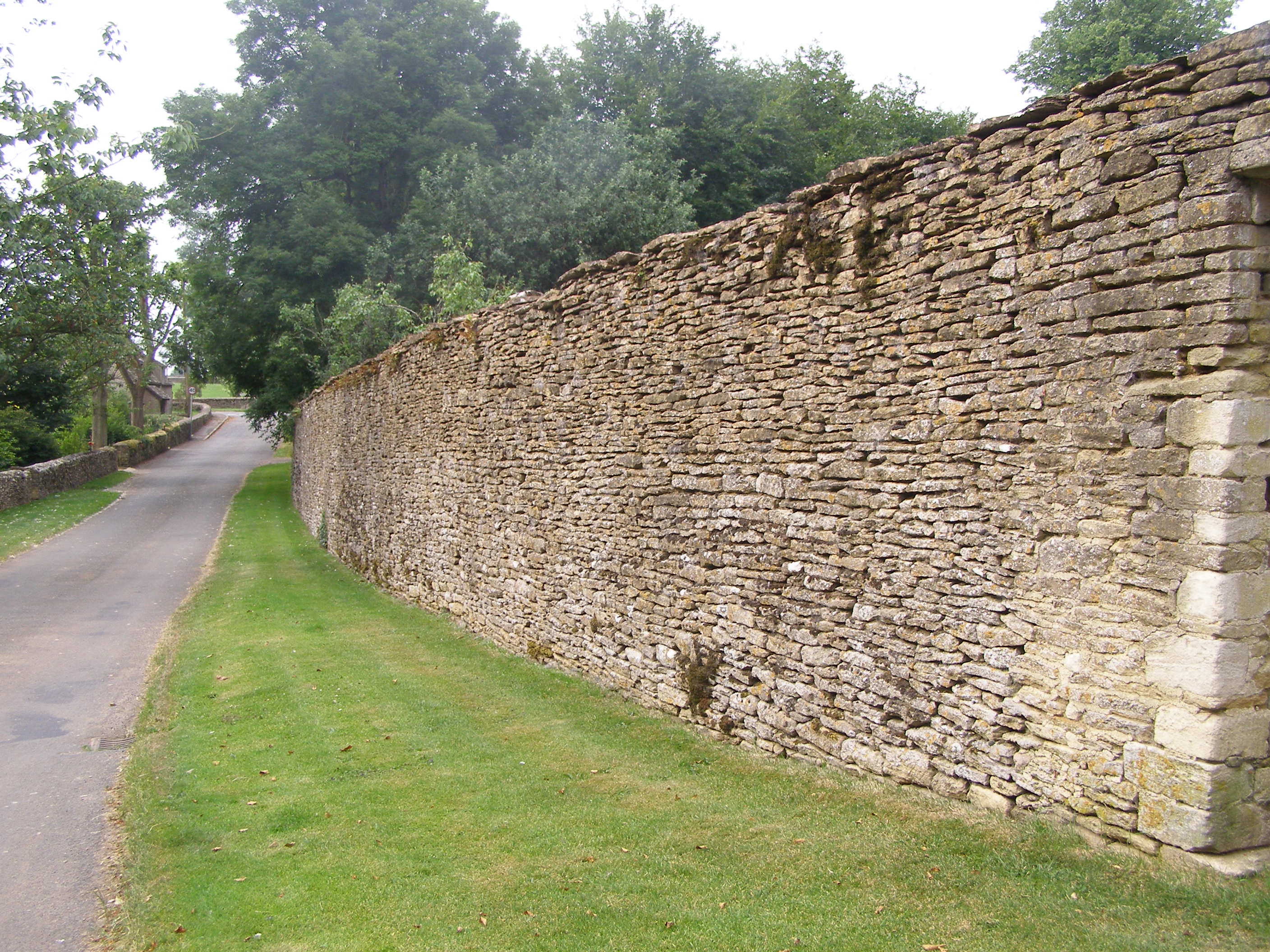
Chavenage Green is a picturesque village located in the county of Gloucestershire, England. Situated approximately 7 miles northeast of Tetbury, this small hamlet is surrounded by the scenic beauty of the Cotswolds. Chavenage Green is known for its idyllic countryside setting, charming cottages, and historic landmarks.

One of the most prominent features of Chavenage Green is the Chavenage House, a stunning Elizabethan manor house that dates back to the 16th century. This grand estate is renowned for its architectural beauty and has been featured in numerous films and television series, including the popular historical drama "Poldark."

The village itself exudes a peaceful and rural atmosphere, with a small number of residential properties and a quaint country pub, The Old Crown, serving as a hub for locals and visitors alike. The surrounding countryside offers ample opportunities for nature walks, cycling, and exploring the nearby Cotswold Way.

Chavenage Green is conveniently located near several other notable attractions. Within a short drive, visitors can explore the vibrant market town of Tetbury, famous for its antique shops and historic buildings. The picturesque village of Castle Combe, often referred to as the "prettiest village in England," is also within easy reach.

Overall, Chavenage Green is a charming and tranquil destination that offers a quintessential English countryside experience to those seeking a peaceful retreat or a taste of rural life.

If you have any feedback on the listing, please let us know in the comments section below.

Chavenage Green Images

Images are sourced within 2km of 51.653613/-2.2037649 or Grid Reference ST8695. Thanks to Geograph Open Source API. All images are credited.

Stone Stile, Beverstone Opposite the entrance to Chavenage House looking NNE. On the Gloucestershire footpath NBE9, the alternative view looking SSW is <a href="https://www.geograph.org.uk/photo/7051091">ST8795 : Stone Stile, Beverstone</a>.
Stone Stile, Beverstone
Opposite the entrance to Chavenage House looking NNE. On the Gloucestershire footpath NBE9, the alternative view looking SSW is ST8795 : Stone Stile, Beverstone.
Stone Stile, Beverstone Opposite the entrance to Chavenage House looking SSW. On the Gloucestershire footpath NBE9, the alternative view looking NNE is <a href="https://www.geograph.org.uk/photo/7051089">ST8795 : Stone Stile, Beverstone</a>.
Stone Stile, Beverstone
Opposite the entrance to Chavenage House looking SSW. On the Gloucestershire footpath NBE9, the alternative view looking NNE is ST8795 : Stone Stile, Beverstone.
Stone Stile, Avening On a u/c road West of the B4014, near Tetbury but in the parish of Avening. This is looking SW from the field, the view NE is <a href="https://www.geograph.org.uk/photo/7051100">ST8795 : Stone Stile, Avening</a>. The footpath is the Macmillan Way.
Stone Stile, Avening
On a u/c road West of the B4014, near Tetbury but in the parish of Avening. This is looking SW from the field, the view NE is ST8795 : Stone Stile, Avening. The footpath is the Macmillan Way.
Stone Stile, Avening On a u/c road West of the B4014, near Tetbury but in the parish of Avening. This is looking NE to the field, the view SW is <a href="https://www.geograph.org.uk/photo/7051099">ST8795 : Stone Stile, Avening</a>. The footpath is the Macmillan Way.
Stone Stile, Avening
On a u/c road West of the B4014, near Tetbury but in the parish of Avening. This is looking NE to the field, the view SW is ST8795 : Stone Stile, Avening. The footpath is the Macmillan Way.
Stone Stile, Beverston On the tri-point of the parishes of Beverstone, Avening and Tetbury Upton. This substantial lain stone would have been the upright stile for the Macmillan Way (Gloucestershire footpath NBE9). This view is Southwards to show the thickness, the view looking down is <a href="https://www.geograph.org.uk/photo/7051147">ST8795 : Stone Stile, Beverstone</a>.
Stone Stile, Beverston
On the tri-point of the parishes of Beverstone, Avening and Tetbury Upton. This substantial lain stone would have been the upright stile for the Macmillan Way (Gloucestershire footpath NBE9). This view is Southwards to show the thickness, the view looking down is ST8795 : Stone Stile, Beverstone.
Stone Stile, Beverstone On the tri-point of the parishes of Beverstone, Avening and Tetbury Upton. This substantial lain stone would have been the upright stile for the Macmillan Way (Gloucestershire footpath NBE9). This view is Southwards to show the thickness, the view looking down is <a href="https://www.geograph.org.uk/photo/7051144">ST8795 : Stone Stile, Beverston</a>. The walking pole is to demonstrate the size.
Stone Stile, Beverstone
On the tri-point of the parishes of Beverstone, Avening and Tetbury Upton. This substantial lain stone would have been the upright stile for the Macmillan Way (Gloucestershire footpath NBE9). This view is Southwards to show the thickness, the view looking down is ST8795 : Stone Stile, Beverston. The walking pole is to demonstrate the size.
Stone Stile, Chavenage Half buried remains of a stone stile. This at the kissing gate from the road, on the Gloucestershire footpath NBE10 across Lodge Farm.
Stone Stile, Chavenage
Half buried remains of a stone stile. This at the kissing gate from the road, on the Gloucestershire footpath NBE10 across Lodge Farm.
Stone Stile, Tetbury Upton GS2045 From the B4014 to Chevenage House between arable and grazing fields on the Gloucestershire footpath NTU1, looking SSE.  The view NNW is <a href="https://www.geograph.org.uk/photo/7257145">ST8794 : Stone Stile, Tetbury Upton</a>.
Stone Stile, Tetbury Upton GS2045
From the B4014 to Chevenage House between arable and grazing fields on the Gloucestershire footpath NTU1, looking SSE. The view NNW is ST8794 : Stone Stile, Tetbury Upton.
Stone Stile, Tetbury Upton On the way to Chavenage, Gloucestershire footpath NTU1. The stile had a gate this side hinged with baler twine. Looking NW, the alternative view from the other side is <a href="https://www.geograph.org.uk/photo/7051197">ST8794 : Stone Stile, Tetbury Upton</a>.
Stone Stile, Tetbury Upton
On the way to Chavenage, Gloucestershire footpath NTU1. The stile had a gate this side hinged with baler twine. Looking NW, the alternative view from the other side is ST8794 : Stone Stile, Tetbury Upton.
Stone Stile, Tetbury Upton On the way to Chavenage, Gloucestershire footpath NTU1. The stile had a gate the other side hinged with baler twine. Looking SE, the alternative view from the other side is <a href="https://www.geograph.org.uk/photo/7051194">ST8794 : Stone Stile, Tetbury Upton</a>.
Stone Stile, Tetbury Upton
On the way to Chavenage, Gloucestershire footpath NTU1. The stile had a gate the other side hinged with baler twine. Looking SE, the alternative view from the other side is ST8794 : Stone Stile, Tetbury Upton.
Chavenage Lane
Chavenage Lane
Entrance to Wild Carrot, Chavenage Wild Carrot is part of the Chavenage estate, and includes a cafe under tepees, more tepees and shepherd's huts for glamping, and facilities for cyclists including bike tours. I stopped there to warm up beside the log burner in the bar in one of the barns. <span class="nowrap"><a title="https://www.wildcarrot.co.uk/" rel="nofollow ugc noopener" href="https://www.wildcarrot.co.uk/">Link</a><img style="margin-left:2px;" alt="External link" title="External link - shift click to open in new window" src="https://s1.geograph.org.uk/img/external.png" width="10" height="10"/></span>
Entrance to Wild Carrot, Chavenage
Wild Carrot is part of the Chavenage estate, and includes a cafe under tepees, more tepees and shepherd's huts for glamping, and facilities for cyclists including bike tours. I stopped there to warm up beside the log burner in the bar in one of the barns. LinkExternal link
Stone barn at Chavenage and Wild Carrot bar Wild Carrot is an events/cafe business situated within the former Chavenage Farm yard. To the right is a converted byre, now housing a bar for evening and other events, and extra seating for the cafe. In the foreground is a pole for hooking up bicycles while their owners rest and warm up in the cafe. <span class="nowrap"><a title="https://www.wildcarrot.co.uk/" rel="nofollow ugc noopener" href="https://www.wildcarrot.co.uk/">Link</a><img style="margin-left:2px;" alt="External link" title="External link - shift click to open in new window" src="https://s1.geograph.org.uk/img/external.png" width="10" height="10"/></span>
Stone barn at Chavenage and Wild Carrot bar
Wild Carrot is an events/cafe business situated within the former Chavenage Farm yard. To the right is a converted byre, now housing a bar for evening and other events, and extra seating for the cafe. In the foreground is a pole for hooking up bicycles while their owners rest and warm up in the cafe. LinkExternal link
Inside Wild Carrot cafe The cafe, housed in a double-tepee, is located next to the Macmillan Way, and is popular with cyclists and walkers.
Inside Wild Carrot cafe
The cafe, housed in a double-tepee, is located next to the Macmillan Way, and is popular with cyclists and walkers.
Road junction near Chavenage Green
Stone Stile, Nailsworth Actually in the parish of Horsley, on Gloucestershire footpath MHO37, in the area of Lodgemore Bottom at the Northern apex of Cranmore Covert.
Stone Stile, Nailsworth
Actually in the parish of Horsley, on Gloucestershire footpath MHO37, in the area of Lodgemore Bottom at the Northern apex of Cranmore Covert.
Stone Stile, Chavenage Near Wildlife World and Chavenage House looking NW from Chavenage Lane ( bridleway NBE8), the stile has no public right of way over it.
Stone Stile, Chavenage
Near Wildlife World and Chavenage House looking NW from Chavenage Lane ( bridleway NBE8), the stile has no public right of way over it.
Stone Stile, Tetbury Upton From the B4014 to Chevenage House between arable and grazing fields on the Gloucestershire footpath NTU1, looking NNW. The view SSE is <a href="https://www.geograph.org.uk/photo/7051185">ST8794 : Stone Stile, Tetbury Upton GS2045</a>.
Stone Stile, Tetbury Upton
From the B4014 to Chevenage House between arable and grazing fields on the Gloucestershire footpath NTU1, looking NNW. The view SSE is ST8794 : Stone Stile, Tetbury Upton GS2045.
Show me another place!

Chavenage Green is located at Grid Ref: ST8695 (Lat: 51.653613, Lng: -2.2037649)

Administrative County: Gloucestershire

District: Cotswold

Police Authority: Gloucestershire

What 3 Words

///widest.locate.streamers. Near Tetbury, Gloucestershire

Nearby Locations

Chavenage Green

Related Wikis

St Mary's Church, Beverston

The Church of Saint Mary the Virgin is the parish church of Beverston, Gloucestershire, England, and a Grade II* listed building. The church is of Norman...

Beverston Castle

Beverston Castle, also known as Beverstone Castle or Tetbury Castle, was constructed as a medieval stone fortress in the village of Beverston, Gloucestershire...
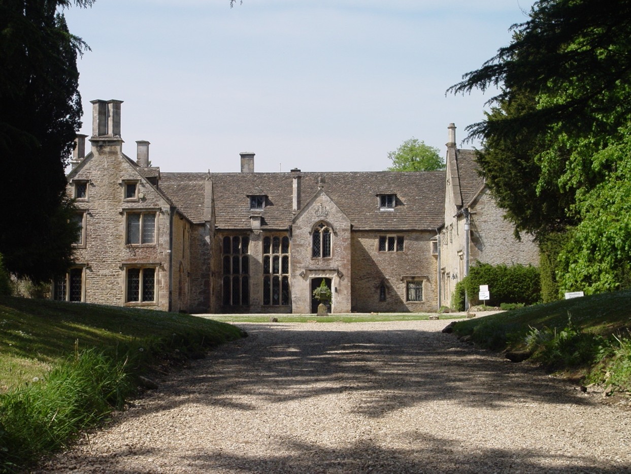
Chavenage House

Chavenage House, Beverston, Gloucestershire is a country house dating from the late 16th century. The house was built in 1576 and is constructed of Cotswold...

Beverston

Beverston is a village and civil parish in the Cotswold district of Gloucestershire, England. According to the 2001 census it had a population of 132,...

RAF Babdown Farm

Royal Air Force Babdown Farm or more simply RAF Babdown Farm is a former Royal Air Force relief landing ground located 2.9 miles (4.7 km) west of Tetbury...

Calcot Manor

Calcot Manor is a historic building in Calcot, three and a half miles west of Tetbury on A 4135 in Gloucestershire, England, near the junction of roads...

Tetbury Upton

Tetbury Upton is a small village and civil parish in the Cotswolds area of Gloucestershire, England. The parish extends in an arc around the north, west...

Veizey's Quarry

Veizey's Quarry (grid reference ST881944) is a 1.4 hectare geological Site of Special Scientific Interest near Tetbury in Gloucestershire, notified in...

Nearby Amenities

Located within 500m of 51.653613,-2.2037649
Barrier: stile
Foot: yes
Lat/Long: 51.6497578/-2.2025051
The data included in this document is from www.openstreetmap.org. The data is made available under ODbL.

Have you been to Chavenage Green?

Leave your review of Chavenage Green below (or comments, questions and feedback).