Chatter End

Settlement in Essex Uttlesford

England

Chatter End

Barn, Broome Cottage Grade II listed.
Barn, Broome Cottage Credit: N Chadwick

Chatter End is a small village located in the county of Essex, England. Situated approximately 15 miles northeast of Chelmsford, the village is nestled amidst the picturesque countryside, offering a peaceful and idyllic setting for its residents.

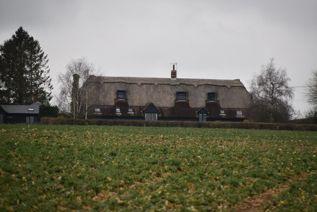
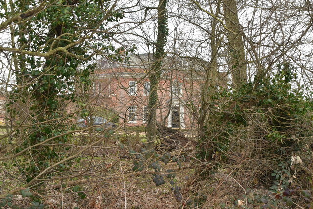
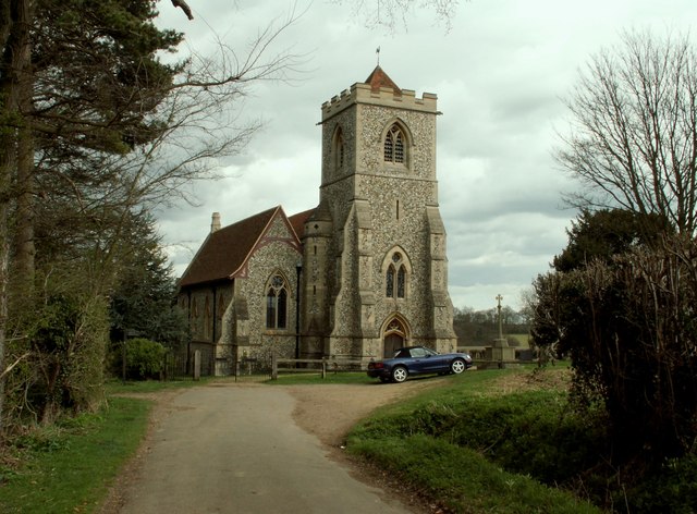
The village is characterized by its traditional English charm, with a collection of quaint cottages and period houses lining the streets. The architecture reflects a mix of different eras, ranging from Tudor to Georgian, giving Chatter End a unique and timeless appeal.

Despite its small size, Chatter End boasts a close-knit and friendly community. The village is home to a local pub, The Oak Tree, which serves as a popular gathering spot for residents and visitors alike. The pub provides a welcoming atmosphere, offering a range of traditional British dishes and beverages.

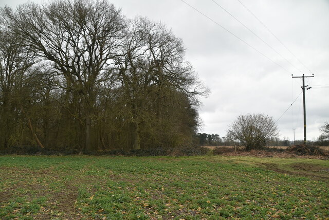
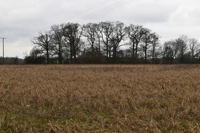
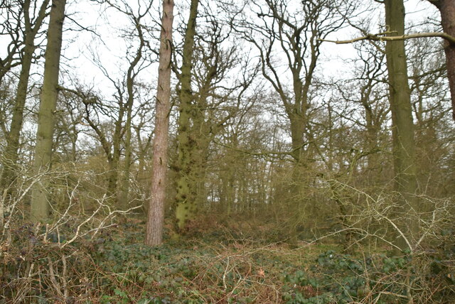
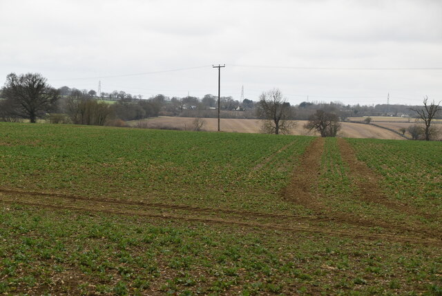
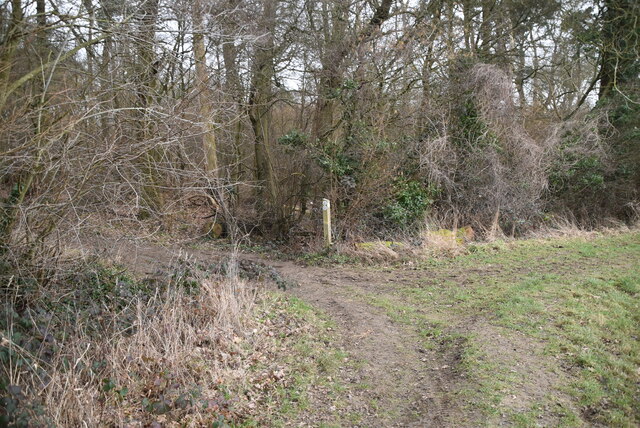
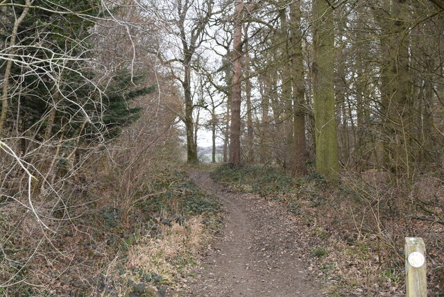
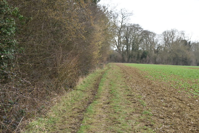
Surrounded by rolling green fields and meandering rivers, Chatter End is a haven for nature lovers. The village is located near several nature reserves, providing ample opportunities for hiking, birdwatching, and enjoying the great outdoors. The nearby Chatter End Forest offers a tranquil escape, with its dense woodlands and scenic trails.

For those seeking a slower pace of life, Chatter End offers a peaceful retreat away from the hustle and bustle of city living. The village is well-connected to neighboring towns and cities, making it an ideal location for commuting professionals looking for a serene place to call home.

In summary, Chatter End is a charming and tranquil village in Essex, offering a beautiful countryside setting, a friendly community, and easy access to nature.

If you have any feedback on the listing, please let us know in the comments section below.

Chatter End Images

Images are sourced within 2km of 51.906749/0.138427 or Grid Reference TL4725. Thanks to Geograph Open Source API. All images are credited.

Barn, Broome Cottage Grade II listed.
Barn, Broome Cottage
Grade II listed.
Arable land
Arable land
Barn, Broome Cottage Listed buildings and structures are officially designated as being of special architectural, historical or cultural significance. There are over half a million listed structures in the United Kingdom, covered by around 375,000 listings.
Listed status is more commonly associated with buildings or groups of buildings, however it can cover many other structures, including bridges, headstones, steps, ponds, monuments, walls, phone boxes, wrecks, parks, and heritage sites, and in more recent times a road crossing (Abbey Road) and graffiti art (Banksy 'Spy-booth') have been included.

In England and Wales there are three main listing designations;
Grade I (2.5%) - exceptional interest, sometimes considered to be internationally important.
Grade II* (5.5%) - particularly important buildings of more than special interest. 
Grade II (92%) - nationally important and of special interest. 

There are also locally listed structures (at the discretion of local authorities) using A, B and C designations.

In Scotland three classifications are also used but the criteria are different. There are around 47,500 Listed buildings.
Category A (8%)- generally equivalent to Grade I and II* in England and Wales
Category B (51%)- this appears generally to cover the ground of Grade II, recognising national importance.
Category C (41%)- buildings of local importance, probably with some overlap with English Grade II.

In Northern Ireland the criteria are similar to Scotland, but the classifications are:
Grade A (2.3%)
Grade B+ (4.7%)
Grade B (93%)

Read more at Wikipedia <span class="nowrap"><a title="http://en.wikipedia.org/wiki/Listed_building" rel="nofollow ugc noopener" href="http://en.wikipedia.org/wiki/Listed_building">Link</a><img style="margin-left:2px;" alt="External link" title="External link - shift click to open in new window" src="https://s1.geograph.org.uk/img/external.png" width="10" height="10"/></span>
Barn, Broome Cottage
Listed buildings and structures are officially designated as being of special architectural, historical or cultural significance. There are over half a million listed structures in the United Kingdom, covered by around 375,000 listings. Listed status is more commonly associated with buildings or groups of buildings, however it can cover many other structures, including bridges, headstones, steps, ponds, monuments, walls, phone boxes, wrecks, parks, and heritage sites, and in more recent times a road crossing (Abbey Road) and graffiti art (Banksy 'Spy-booth') have been included. In England and Wales there are three main listing designations; Grade I (2.5%) - exceptional interest, sometimes considered to be internationally important. Grade II* (5.5%) - particularly important buildings of more than special interest. Grade II (92%) - nationally important and of special interest. There are also locally listed structures (at the discretion of local authorities) using A, B and C designations. In Scotland three classifications are also used but the criteria are different. There are around 47,500 Listed buildings. Category A (8%)- generally equivalent to Grade I and II* in England and Wales Category B (51%)- this appears generally to cover the ground of Grade II, recognising national importance. Category C (41%)- buildings of local importance, probably with some overlap with English Grade II. In Northern Ireland the criteria are similar to Scotland, but the classifications are: Grade A (2.3%) Grade B+ (4.7%) Grade B (93%) Read more at Wikipedia LinkExternal link
Footpath
Footpath
Footpath
Footpath
Arable land
Arable land
Small woodland
Small woodland
Oozes Wood
Oozes Wood
Arable land
Arable land
Footpath by Oozes Wood
Oozes Wood
Oozes Wood
Farmland and woodland
Essex farmland
Essex farmland
Footpath junction
Footpath junction
Footpath between Oozes Wood and Home Wood
Footpath by Home Wood
Home Wood
Home Wood
Show me another place!

Chatter End is located at Grid Ref: TL4725 (Lat: 51.906749, Lng: 0.138427)

Administrative County: Essex

District: Uttlesford

Police Authority: Essex

What 3 Words

///potential.faded.lonely. Near Bishops Stortford, Hertfordshire

Nearby Locations

Chatter End

Related Wikis

Farnham, Essex

Farnham is a small village in Essex, England, situated near Bishop's Stortford. The main features are Farnham Church of England Primary School, the church...

Bentfield Bury

Bentfield Bury is a small village in Essex, England. It is one of over 100 villages in the district of Uttlesford and is within Stansted Mountfitchet parish...

Bentfield Green

Bentfield Green is an area of common land and settlement in the village of Stansted Mountfitchet, in the civil parish of Stansted Mountfitchet, in the...

Manuden

Manuden is a village and civil parish in the Uttlesford district of Essex, England. It is located around 3+1⁄2 miles (6 km) north of Bishop's Stortford...

Patmore Heath

Patmore Heath is a 7.6 hectares (19 acres) biological Site of Special Scientific Interest in East Hertfordshire, England, 2 kilometres north-east of Albury...

Hillcollins Pit

Hillcollins Pit or Furneux Pelham Gravel Pit is a 0.2-hectare (0.49-acre) geological Site of Special Scientific Interest near Furneux Pelham in Hertfordshire...

Cricket Field Lane

Cricketfield Lane is a cricket ground in Bishop's Stortford, Hertfordshire. The earliest recorded match on the ground was in 1862 between Bishop's Stortford...

Albury, Hertfordshire

Albury is a village and civil parish in the East Hertfordshire district of Hertfordshire, England, about five miles west of Bishop's Stortford. According...

Nearby Amenities

Located within 500m of 51.906749,0.138427
Farnham Green
Naptan AtcoCode: 1500IM1911
Naptan Bearing: W
Naptan BusStopType: CUS
Naptan CommonName: Farnham Green
Naptan Indicator: W-bound
Naptan Landmark: Farnham Green
Naptan NaptanCode: esxadmpt
Naptan Street: Chatter End Road
Naptan Verified: no
Source: naptan_import
Lat/Long: 51.9070959/0.1336445
Chatter End
Place: hamlet
Lat/Long: 51.9072983/0.1375767
Public Bookcase
Farnham Book Exchange
Alt Name: Book Swap
Booth: K6
Disused Amenity: telephone
Man Made: telephone_box
Public Bookcase Type: phone_box
Lat/Long: 51.9070931/0.1331705
Addr Housename: Greenside Cottage
Lat/Long: 51.9069836/0.1319727
Addr Housename: Blossoms
Lat/Long: 51.9085308/0.133853
Addr Housename: Lincoln Farm
Lat/Long: 51.9093814/0.1344404
Addr Housename: Puddingstone Cottage
Lat/Long: 51.9086731/0.1338999
Waste Basket
Waste: dog_excrement
Lat/Long: 51.9071661/0.1332032
Advertising: board
Direction: 10
Support: wall_mounted
Lat/Long: 51.9068981/0.1371804
Defibrillator
Emergency: defibrillator
Lat/Long: 51.9069017/0.1371441
Post Box
Operator: Royal Mail
Operator Wikidata: Q638098
Lat/Long: 51.9069069/0.1370903
The data included in this document is from www.openstreetmap.org. The data is made available under ODbL.

Have you been to Chatter End?

Leave your review of Chatter End below (or comments, questions and feedback).