Chatham Green

Settlement in Essex Chelmsford

England

Chatham Green

Essex Regiment Way (B1008) Towards Great Dunmow.
Essex Regiment Way (B1008) Credit: JThomas

Chatham Green is a small village located in the county of Essex, England. Situated approximately 20 miles northeast of London, it falls within the administrative district of Chelmsford. The village is nestled amidst picturesque countryside, offering residents and visitors a tranquil and idyllic setting.

Chatham Green is known for its rich historical significance. The village is home to several well-preserved medieval buildings, including the St. Mary's Church, a Grade I listed building that dates back to the 13th century. This stunning architectural masterpiece is a testament to the village's heritage.

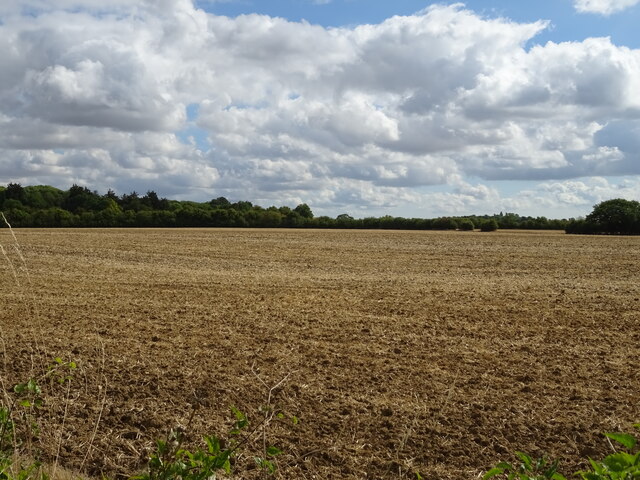
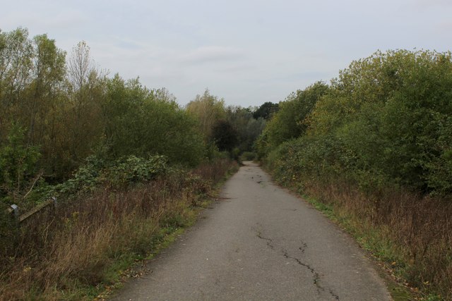
Nature lovers are drawn to Chatham Green due to its proximity to open green spaces and natural reserves. The village is surrounded by vast expanses of farmland, providing a bucolic setting for leisurely walks and outdoor activities. Nearby, the Danbury Common and Woodland Park offer opportunities for hiking and exploring the diverse flora and fauna of the area.

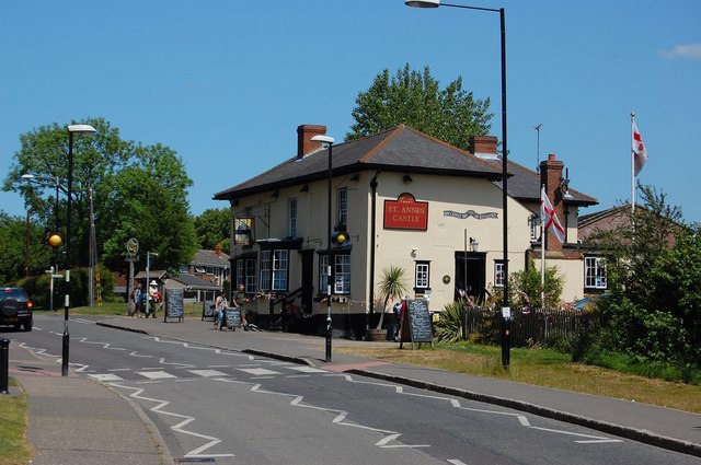
Despite its small size, Chatham Green boasts a tight-knit and welcoming community. The village is home to a local pub, where residents and visitors can gather and socialize. Additionally, the village hosts various community events throughout the year, fostering a sense of unity and camaraderie among its inhabitants.

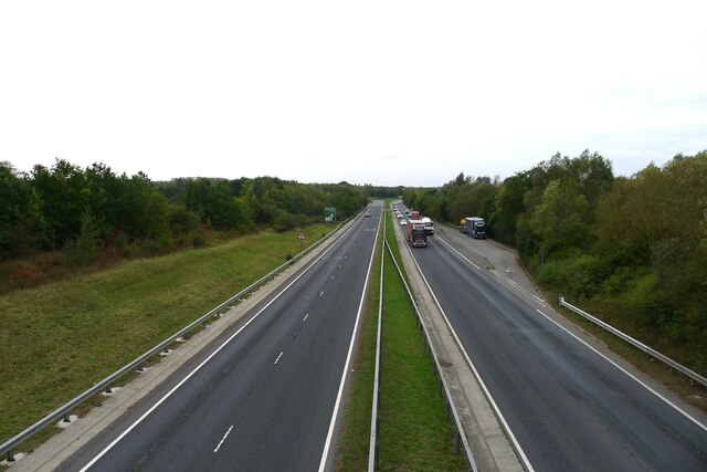
Chatham Green benefits from its convenient location. With excellent transport links to London and neighboring towns, residents have easy access to a range of amenities and services. The nearby town of Chelmsford offers a wide array of shopping, dining, and entertainment options, making it a popular destination for locals.

Overall, Chatham Green is a charming village that combines historical charm with natural beauty. Its close-knit community and convenient location make it an appealing place to live or visit for those seeking a peaceful and picturesque retreat.

If you have any feedback on the listing, please let us know in the comments section below.

Chatham Green Images

Images are sourced within 2km of 51.809737/0.489271 or Grid Reference TL7115. Thanks to Geograph Open Source API. All images are credited.

Essex Regiment Way (B1008) Towards Great Dunmow.
Essex Regiment Way (B1008)
Towards Great Dunmow.
Field by Chatham Hall Lane, Little Waltham
Field off Braintree Road
Braintree Road (B1008) approaching Sheepcotes Roundabout
Stubble Field off Essex Regiment Way
Essex Regiment Way (B1008) Towards Great Dunmow.
Essex Regiment Way (B1008)
Towards Great Dunmow.
Scurvy Hall Lane Bridleway off Essex Regiment Way (B1008).
Scurvy Hall Lane
Bridleway off Essex Regiment Way (B1008).
Scurvy Hall Lane Bridleway towards Little Stonage Farm.
Scurvy Hall Lane
Bridleway towards Little Stonage Farm.
Essex Regiment Way (B1008) Towards Great Dunmow.
Essex Regiment Way (B1008)
Towards Great Dunmow.
Heading for Whites Lane The tarmac surface has seen better days, but still serves as a footpath from Great Leighs.
Heading for Whites Lane
The tarmac surface has seen better days, but still serves as a footpath from Great Leighs.
The A131 bypassing Great Leighs Starting our walk at the end of a previous walk <a href="https://www.geograph.org.uk/photo/6642478">TL7216 : The A131 bypassing Great Leighs</a>
The A131 bypassing Great Leighs
Starting our walk at the end of a previous walk TL7216 : The A131 bypassing Great Leighs
Rebuilt house, Luck's Lane
Orange Ladybirds, Great Leighs This modern sculpture of three metal bugs climbing metal blades of grass can be seen at the side of the new A131 Great Leighs By-Pass, Essex.  Travelling north, towards Braintree, directly before the Rochester Farm Bridge, look to the left and there they can be seen standing about 4m tall!
Orange Ladybirds, Great Leighs
This modern sculpture of three metal bugs climbing metal blades of grass can be seen at the side of the new A131 Great Leighs By-Pass, Essex. Travelling north, towards Braintree, directly before the Rochester Farm Bridge, look to the left and there they can be seen standing about 4m tall!
St.John the Evangelist church, Little Leighs, Essex This small church dates back to the 12th century. Like many churches in south Essex, it has a timber belfry.
St.John the Evangelist church, Little Leighs, Essex
This small church dates back to the 12th century. Like many churches in south Essex, it has a timber belfry.
Hyde Hall, Essex This fine hall is dated 1600 and stands 1.5 miles NW of Great Waltham. It is a timber-framed structure, plastered on the upper stage and has brick infill below. The front view shows four gables plus a porch with a gabled upper storey. The remains of a moat is at the rear of the house.
Hyde Hall, Essex
This fine hall is dated 1600 and stands 1.5 miles NW of Great Waltham. It is a timber-framed structure, plastered on the upper stage and has brick infill below. The front view shows four gables plus a porch with a gabled upper storey. The remains of a moat is at the rear of the house.
Chalk Farm, Essex Chalk farm is situated north-east of Howe Street, near Great Waltham.
Chalk Farm, Essex
Chalk farm is situated north-east of Howe Street, near Great Waltham.
'The Windmill' inn, Chatham Green, Essex Chatham Green lies just off the main road between Chelmsford and Braintree, near Great Leighs.
'The Windmill' inn, Chatham Green, Essex
Chatham Green lies just off the main road between Chelmsford and Braintree, near Great Leighs.
Show me another place!

Chatham Green is located at Grid Ref: TL7115 (Lat: 51.809737, Lng: 0.489271)

Administrative County: Essex

District: Chelmsford

Police Authority: Essex

What 3 Words

///tribune.headed.songbirds. Near Great Leighs, Essex

Nearby Locations

Chatham Green

Related Wikis

Chatham Green

Chatham Green is a hamlet in the civil parish of Little Waltham and the Chelmsford district of Essex, England. The hamlet is 1.5 miles (2.4 km) north from...

Little Waltham

Little Waltham is a village and civil parish just north of Chelmsford, in Essex, England. It is adjacent to the village of Great Waltham. The Domesday...

Little Leighs

Little Leighs is a village and former civil parish, now in the parish of Great and Little Leighs, in the Chelmsford district in the English county of Essex...

Lyons Hall, Essex

Lyons Hall is a Grade II listed house in Great Leighs, Essex. The house dates to the 15th century. The house has been home to the Tritton banking family...

River Ter SSSI

The River Ter SSSI is a stretch of the River Ter and its banks south of Great Leighs in Essex which has been designated a geological Site of Special Scientific...

Great Leighs

Great Leighs is a village and former civil parish, now in the parish of Great and Little Leighs, in the Chelmsford district of Essex, England, halfway...

Great and Little Leighs

Great and Little Leighs is a civil parish in the City of Chelmsford in Essex, England. The parish includes the villages of Great Leighs and Little Leighs...

Howe Street

Howe Street is a rural hamlet on the banks of the River Chelmer. It is situated in the parish of Great Waltham, in the Chelmsford district, in the county...

Nearby Amenities

Located within 500m of 51.809737,0.489271
Bus Stop
Chatham Green
Naptan AtcoCode: 15000100108
Naptan Bearing: SW
Naptan CommonName: Chatham Green
Naptan Indicator: Opp
Naptan Landmark: Chatham Green
Naptan NaptanCode: esxdwgjw
Naptan Street: Braintree Road
Naptan Verified: no
Public Transport: platform
Source: naptan_import
Lat/Long: 51.8074179/0.4898636
Bus Stop
Chatham Green
Naptan AtcoCode: 15000100109
Naptan Bearing: NE
Naptan CommonName: Chatham Green
Naptan Indicator: Adj
Naptan Landmark: Chatham Green
Naptan NaptanCode: esxdwgjt
Naptan Street: Braintree Road
Naptan Verified: no
Public Transport: platform
Source: naptan_import
Lat/Long: 51.807434/0.4896677
Chatham Green
Place: hamlet
Wikidata: Q2128839
Lat/Long: 51.809822/0.4886555
Man Made: windmill
Lat/Long: 51.808611/0.4875462
The data included in this document is from www.openstreetmap.org. The data is made available under ODbL.

Have you been to Chatham Green?

Leave your review of Chatham Green below (or comments, questions and feedback).