Bonython Plantations

Wood, Forest in Cornwall

England

Bonython Plantations

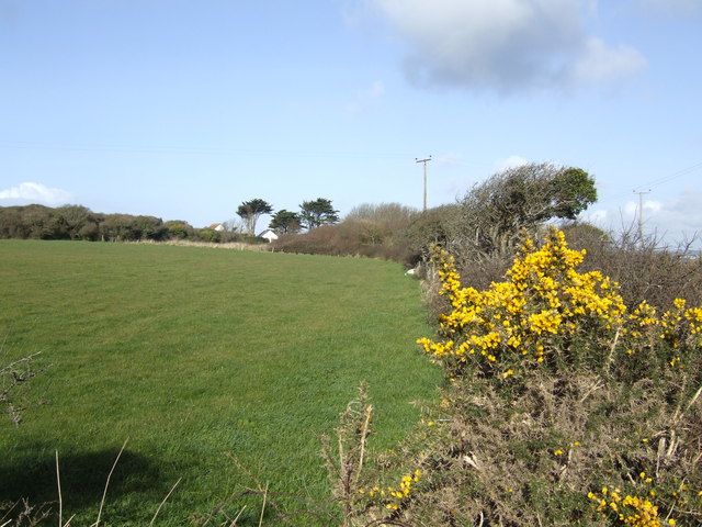
Heathland vegetation near Penhale This is typical of much of the vegetation on the Lizard.
Heathland vegetation near Penhale Credit: Rod Allday

The requested URL returned error: 429 Too Many Requests

If you have any feedback on the listing, please let us know in the comments section below.

Bonython Plantations Images

Images are sourced within 2km of 50.040828/-5.2147899 or Grid Reference SW6920. Thanks to Geograph Open Source API. All images are credited.

Heathland vegetation near Penhale This is typical of much of the vegetation on the Lizard.
Heathland vegetation near Penhale
This is typical of much of the vegetation on the Lizard.
A3083 winds across the edge of Goonhilly Downs
Field entrance near Trewoon Much of the farmland appears to be sitting idly by, but once the silage has been collected there isn't much else to do. Newton Farm can be seen on the far hill.
Field entrance near Trewoon
Much of the farmland appears to be sitting idly by, but once the silage has been collected there isn't much else to do. Newton Farm can be seen on the far hill.
Bridleway by Tregullas Farm The first part was easy enough to traverse, but once past the standing water it was just very soft slurry with no indication of its depth. I decided to go a different way. Being a bridleway, I am sure a horse would have managed it with no difficulty.
Bridleway by Tregullas Farm
The first part was easy enough to traverse, but once past the standing water it was just very soft slurry with no indication of its depth. I decided to go a different way. Being a bridleway, I am sure a horse would have managed it with no difficulty.
Bridleway off the A3083 Heading towards Mullion.
Bridleway off the A3083
Heading towards Mullion.
Rough grazing for cattle There are some cows at the far end of the field.
Rough grazing for cattle
There are some cows at the far end of the field.
Bridleway to Goonhilly Leaving the A3083. The track quality does not continue past the silage bales.
Bridleway to Goonhilly
Leaving the A3083. The track quality does not continue past the silage bales.
Bridleway to Goonhilly The surface has been lacerated by hooves, making it harder going on foot.
Bridleway to Goonhilly
The surface has been lacerated by hooves, making it harder going on foot.
Former Methodist Church
Grass Field. Field with Wind Farm and Goonhilly Earth Station in the background.
Grass Field.
Field with Wind Farm and Goonhilly Earth Station in the background.
Cottages at Trewoon A hamlet on Chypons Lane north of Mullion.
Cottages at Trewoon
A hamlet on Chypons Lane north of Mullion.
East from Chypons Road These are fields north of Clahar Barton Farm.
East from Chypons Road
These are fields north of Clahar Barton Farm.
Cross Lanes south of Helston
The Wheel Inn
The Wheel Inn
Bochym Lodge This is a remarkably complete Victorian lodge with some good quality details including the glazing and roof structure which are particularly notable. It was built in 1851 and is Grade II listed with English Heritage Building ID: 65169. See details:<span class="nowrap"><a title="http://www.britishlistedbuildings.co.uk/en-65169-bochym-lodge-and-entrance-gateway-piers-cury" rel="nofollow ugc noopener" href="http://www.britishlistedbuildings.co.uk/en-65169-bochym-lodge-and-entrance-gateway-piers-cury">Link</a><img style="margin-left:2px;" alt="External link" title="External link - shift click to open in new window" src="https://s1.geograph.org.uk/img/external.png" width="10" height="10"/></span>
Bochym Lodge
This is a remarkably complete Victorian lodge with some good quality details including the glazing and roof structure which are particularly notable. It was built in 1851 and is Grade II listed with English Heritage Building ID: 65169. See details:LinkExternal link
A3083 at Gwealeath
A3083 at Gwealeath
Cury: phone box at Cross Lanes The telephone box stands outside the former post office, which is now cordoned off and looks like it is about to undergo some development work.
Cury: phone box at Cross Lanes
The telephone box stands outside the former post office, which is now cordoned off and looks like it is about to undergo some development work.
Cury: former Cury Cross Lanes Post Office A post office was established at Cury in 1861 and was renamed Cury Cross Lanes twenty years later. It closed on 24 November 2003 but still resembled a post office and shop seven years later: see <a href="https://www.geograph.org.uk/photo/1827231">SW6921 : Cury Cross:  Cury Stores and Post Office</a>.

On 19 May 2005 a post office service was restored to Cury, on Thursday mornings, by way of the postmaster at nearby Gweek coming here and operating a mobile set-up at a hatch in the village hall. That arrangement continues to this day (see <a href="https://www.geograph.org.uk/photo/3705425">SW6821 : Cury: post office sign at the village hall</a>) and he has also served Helford and St. Martin similarly since September 2011.

See <a href="https://www.geograph.org.uk/photo/3705415">SW6921 : Cury: phone box at Cross Lanes</a> for a slightly wider view of the building, including the fences around the site.
Cury: former Cury Cross Lanes Post Office
A post office was established at Cury in 1861 and was renamed Cury Cross Lanes twenty years later. It closed on 24 November 2003 but still resembled a post office and shop seven years later: see SW6921 : Cury Cross: Cury Stores and Post Office. On 19 May 2005 a post office service was restored to Cury, on Thursday mornings, by way of the postmaster at nearby Gweek coming here and operating a mobile set-up at a hatch in the village hall. That arrangement continues to this day (see SW6821 : Cury: post office sign at the village hall) and he has also served Helford and St. Martin similarly since September 2011. See SW6921 : Cury: phone box at Cross Lanes for a slightly wider view of the building, including the fences around the site.
Show me another place!

Bonython Plantations is located at Grid Ref: SW6920 (Lat: 50.040828, Lng: -5.2147899)

Unitary Authority: Cornwall

Police Authority: Devon and Cornwall

What 3 Words

///sailed.jubilant.marching. Near Mullion, Cornwall

Nearby Locations

Bonython Plantations

Related Wikis

Bonython Manor

Bonython Manor near Cury, Cornwall, England, in the United Kingdom is an estate garden on the Lizard peninsula. Since 1999, the owners have been Mr. &...

RAF Dry Tree

RAF Dry Tree was a Royal Air Force early warning radar station for detecting enemy aircraft during the Second World War. It was built in 1940 on Goonhilly...

Cross Lanes, Cornwall

Cross Lanes is a hamlet in the parish of Cury, Cornwall, England. Cross Lanes lies within the Cornwall Area of Outstanding Natural Beauty (AONB). ��2...

Meaver

Meaver is a hamlet east of Mullion and in the parish of Mullion in west Cornwall, England. == References ==

Nearby Amenities

Located within 500m of 50.040828,-5.2147899
Bench
Lat/Long: 50.0448705/-5.2158171
Bench
Lat/Long: 50.0439423/-5.2166864
Bench
Lat/Long: 50.0434723/-5.2175805
Bench
Lat/Long: 50.0436048/-5.2173124
Bench
Lat/Long: 50.0447448/-5.2165428
Crossing
Lat/Long: 50.0376443/-5.2167546
The data included in this document is from www.openstreetmap.org. The data is made available under ODbL.

Have you been to Bonython Plantations?

Leave your review of Bonython Plantations below (or comments, questions and feedback).