Charlton-on-Otmoor

Settlement in Oxfordshire Cherwell

England

Charlton-on-Otmoor

Farmland with geese, west of RSPB Otmoor Ot Moor was first drained in 1816 and had been divided up into fields by 1830. Since 1997 the RSPB have been recreating wetlands on some of the land.
Farmland with geese, west of RSPB Otmoor Credit: Christine Johnstone

Charlton-on-Otmoor is a small village located in the Cherwell district of Oxfordshire, England. Situated approximately six miles northeast of the city of Oxford, the village is nestled in the beautiful countryside of the Otmoor Valley.

Historically, Charlton-on-Otmoor was an important agricultural settlement, with evidence of human activity dating back to the Bronze Age. The village is known for its picturesque landscapes, characterized by rolling hills, meandering streams, and lush green fields. It offers a peaceful and idyllic setting for its residents and visitors alike.

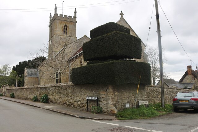
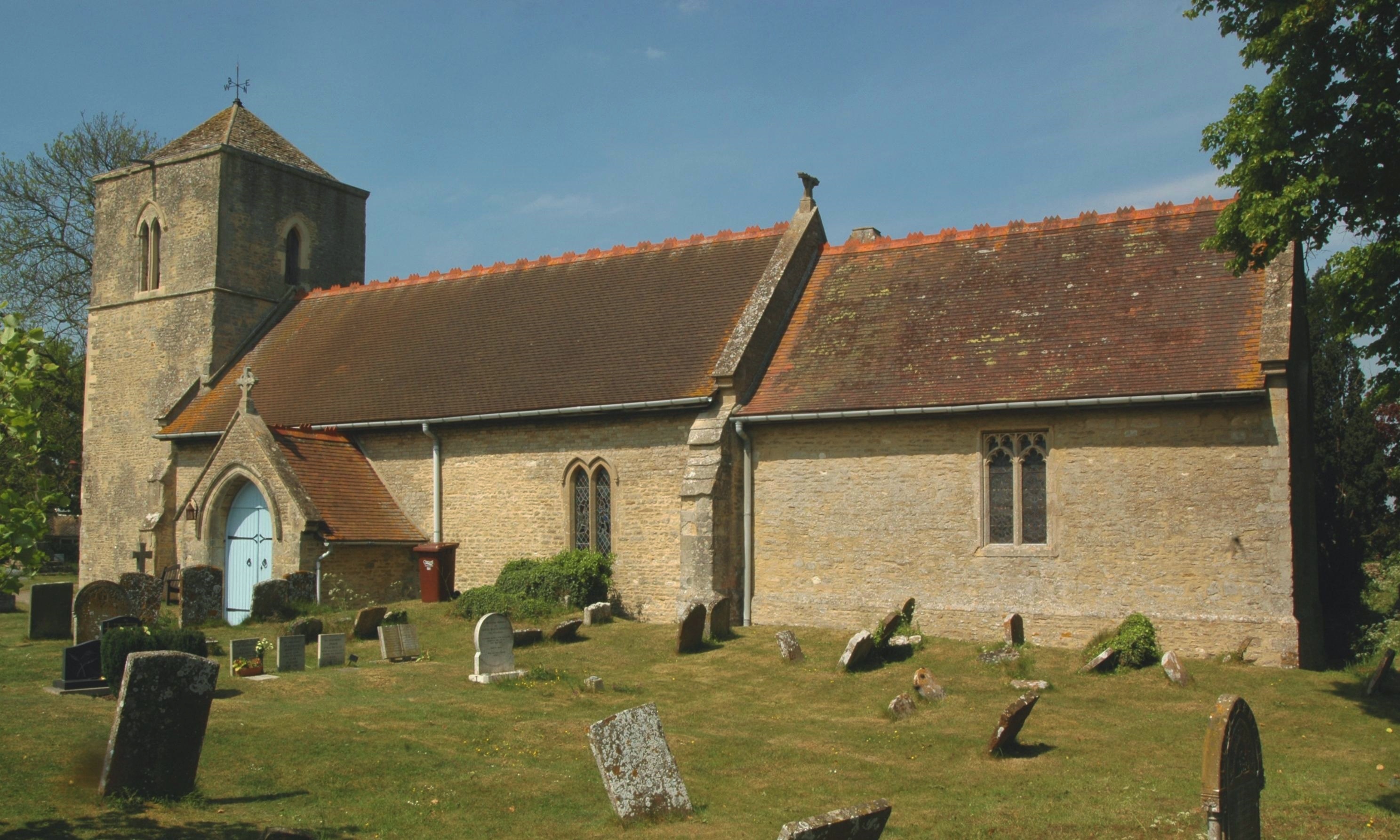
The village itself is comprised of a collection of charming cottages and traditional houses, which add to its quintessential English village atmosphere. St. Mary the Virgin Church, a Grade II listed building, stands as a prominent landmark within the village. The church dates back to the 12th century and features beautiful stained glass windows and a distinctive bell tower.

In terms of amenities, Charlton-on-Otmoor offers a range of facilities to meet the needs of its residents. These include a village hall, a primary school, a pub, and a local shop. The village also benefits from excellent transport links, with easy access to major roads and nearby train stations.

For nature enthusiasts, Charlton-on-Otmoor is a haven. The village is surrounded by vast areas of open countryside, providing ample opportunities for walking, cycling, and exploring the local flora and fauna. Otmoor, a nearby nature reserve, is particularly renowned for its diverse wildlife, including rare bird species.

Overall, Charlton-on-Otmoor is a charming and tranquil village, offering a close-knit community and a stunning natural environment for residents and visitors to enjoy.

If you have any feedback on the listing, please let us know in the comments section below.

Charlton-on-Otmoor Images

Images are sourced within 2km of 51.838139/-1.185372 or Grid Reference SP5615. Thanks to Geograph Open Source API. All images are credited.

Farmland with geese, west of RSPB Otmoor Ot Moor was first drained in 1816 and had been divided up into fields by 1830. Since 1997 the RSPB have been recreating wetlands on some of the land.
Farmland with geese, west of RSPB Otmoor
Ot Moor was first drained in 1816 and had been divided up into fields by 1830. Since 1997 the RSPB have been recreating wetlands on some of the land.
Reedbeds from the northern viewing screen, RSPB Otmoor Ot Moor was first drained in 1816 and had been divided up into fields by 1830. Since 1997 the RSPB have been recreating wetlands here.
Reedbeds from the northern viewing screen, RSPB Otmoor
Ot Moor was first drained in 1816 and had been divided up into fields by 1830. Since 1997 the RSPB have been recreating wetlands here.
Edge of a reedbed, RSPB Otmoor Ot Moor was first drained in 1816 and had been divided up into fields by 1830. Since 1997 the RSPB have been recreating wetlands here.
Edge of a reedbed, RSPB Otmoor
Ot Moor was first drained in 1816 and had been divided up into fields by 1830. Since 1997 the RSPB have been recreating wetlands here.
Conservation area, RSPB Otmoor Ot Moor was first drained in 1816 and had been divided up into fields by 1830. Since 1997 the RSPB have been recreating wetlands here.
Conservation area, RSPB Otmoor
Ot Moor was first drained in 1816 and had been divided up into fields by 1830. Since 1997 the RSPB have been recreating wetlands here.
View from new bridge The view north east from the new railway bridge providing access to Oddington Grange.  The road used to cross the line on a level crossing, but since rebuilding of the line all crossings have been replaced with bridges.
View from new bridge
The view north east from the new railway bridge providing access to Oddington Grange. The road used to cross the line on a level crossing, but since rebuilding of the line all crossings have been replaced with bridges.
M40 near Merton A view eastwards of the M40 at the bridge near Merton.
M40 near Merton
A view eastwards of the M40 at the bridge near Merton.
Charlton-on-Otmoor Church
Church Lane, Charlton-on-Otmoor
Tree by Fencott Road
Brook Court, Fencott
Blackbull Lane, Fencott From Fencott Road
Blackbull Lane, Fencott
From Fencott Road
Fencott Road, Charlton-on-Otmoor
High Street, Charlton-on-Otmoor
The entrance to Charlton United FC
Trees by High Street, Charlton-on-Otmoor
St Andrew's Church Church in Oddington.
St Andrew's Church
Church in Oddington.
New River Ray River near Oddington.
New River Ray
River near Oddington.
Railway crossing looking north
Show me another place!

Charlton-on-Otmoor is located at Grid Ref: SP5615 (Lat: 51.838139, Lng: -1.185372)

Administrative County: Oxfordshire

District: Cherwell

Police Authority: Thames Valley

What 3 Words

///closer.punters.cricket. Near Ambrosden, Oxfordshire

Nearby Locations

Charlton-on-Otmoor

Related Wikis

Charlton-on-Otmoor

Charlton-on-Otmoor is a village and civil parish about 9 miles (14 km) NE of Oxford and 6 miles (10 km) SW of Bicester in Oxfordshire, England. The village...

Oddington, Oxfordshire

Oddington is a village and civil parish about 5 miles (8 km) south of Bicester in Oxfordshire, England. The village is close to the River Ray on the northern...

Fencott

Fencott is a hamlet between the River Ray and Otmoor in the civil parish of Fencott and Murcott, about 4 miles (6.4 km) south of Bicester in Oxfordshire...

Fencott and Murcott

Fencott and Murcott is a civil parish about 4 miles (6 km) south of Bicester in the Cherwell district of Oxfordshire, England. The parish is bounded on...

Otmoor RSPB reserve

Otmoor RSPB Reserve is a nature reserve, managed by the RSPB, between Beckley and Oddington, within the wider area of Otmoor, in Oxfordshire, England....

Wendlebury Meads and Mansmoor Closes

Wendlebury Meads and Mansmoor Closes is a 73.2-hectare (181-acre) biological Site of Special Scientific Interest south of Wendlebury in Oxfordshire.Wendlebury...

Charlton Halt railway station (Oxfordshire)

Charlton Halt was a railway station on the Varsity Line 1 mile (1.6 km) north of the village of Charlton-on-Otmoor. The London and North Western Railway...
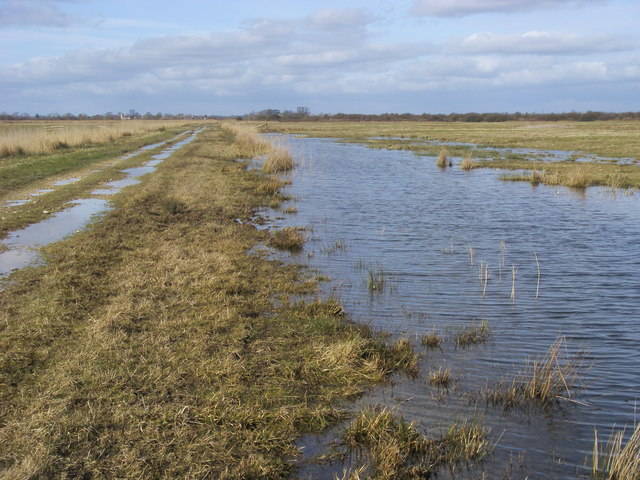
Otmoor

Otmoor or Ot Moor is an area of wetland and wet grassland in Oxfordshire, England, located halfway between Oxford and Bicester. It is about 60 metres...

Nearby Amenities

Located within 500m of 51.838139,-1.185372
Post Box
Collection Times: Mo-Fr 09:00, Sa 07:00
Postal Code: OX5
Ref: OX5 695
Royal Cypher: EIIR
Royal Cypher Wikidata: Q33102113
Lat/Long: 51.8374308/-1.1872391
Barrier: stile
Lat/Long: 51.8387782/-1.1888909
Barrier: stile
Lat/Long: 51.8400024/-1.1902209
Bus Garage
Naptan AtcoCode: 340000183CHU
Naptan Bearing: NE
Naptan BusStopType: CUS
Naptan CommonName: Bus Garage
Naptan Indicator: Opposite
Naptan Landmark: Bus Garage
Naptan NaptanCode: oxfamdwp
Naptan Street: High Street
Naptan Verified: no
Source: naptan_import
Lat/Long: 51.8377881/-1.1863468
Bus Garage
Naptan AtcoCode: 340000183PUB
Naptan Bearing: SW
Naptan BusStopType: CUS
Naptan CommonName: Bus Garage
Naptan Indicator: Outside
Naptan Landmark: Bus Garage
Naptan NaptanCode: oxfajtjt
Naptan Street: High Street
Naptan Verified: no
Source: naptan_import
Lat/Long: 51.8378611/-1.1864272
Church View
Naptan AtcoCode: 340001861BRD
Naptan Bearing: N
Naptan BusStopType: CUS
Naptan CommonName: Church View
Naptan Indicator: Broadway Corner
Naptan Landmark: Broadway
Naptan NaptanCode: oxfgjawt
Naptan Street: Church View
Naptan Verified: no
Source: naptan_import
Lat/Long: 51.8400913/-1.1843897
Church View
Naptan AtcoCode: 340001861MIL
Naptan Bearing: S
Naptan BusStopType: CUS
Naptan CommonName: Church View
Naptan Indicator: Mill Lane Corner
Naptan Landmark: Mill Lane
Naptan NaptanCode: oxfgjawp
Naptan Street: Church View
Naptan Verified: no
Source: naptan_import
Lat/Long: 51.8400724/-1.1842594
Post Box
Brand: Royal Mail
Brand Wikidata: Q638098
Mapillary: 185858140076844
Operator: Royal Mail
Operator Wikidata: Q638098
Post Box Mounting: pier
Post Box Type: lamp
Survey Date: 2020-11-24
Lat/Long: 51.8401398/-1.1843025
Recycling
Location: overground
Recycling Type: container
Lat/Long: 51.8368467/-1.1909302
Access: yes
Leisure: playground
Lat/Long: 51.8369946/-1.1903791
Power: pole
Source: Bing
Lat/Long: 51.8354045/-1.1872637
Power: pole
Source: Bing
Lat/Long: 51.8350067/-1.1888489
Defibrillator
Emergency: defibrillator
Indoor: no
Lat/Long: 51.8377854/-1.1863815
Noexit: yes
Lat/Long: 51.8375745/-1.1880573
The data included in this document is from www.openstreetmap.org. The data is made available under ODbL.

Have you been to Charlton-on-Otmoor?

Leave your review of Charlton-on-Otmoor below (or comments, questions and feedback).