Auchtygills Plantation

Wood, Forest in Aberdeenshire

Scotland

Auchtygills Plantation

Fields above Strichen As usual in these parts, field boundaries are barbed wire fences. The road sign warns of the steep descent and bends required to get under the Formartine and Buchan Railway, now a path.
Fields above Strichen Credit: Richard Webb

Auchtygills Plantation is a picturesque woodland located in Aberdeenshire, Scotland. This enchanting plantation spans over a vast area and is a haven for nature enthusiasts and outdoor lovers. The plantation is situated near the small village of Auchtygills, adding to its charm and tranquility.

The woodland is predominantly made up of native Scottish tree species, such as oak, birch, and pine, which provide a diverse and captivating landscape. The trees create a dense canopy, allowing for a cool and shaded environment, perfect for leisurely walks and wildlife spotting.

Auchtygills Plantation offers a multitude of recreational activities for visitors. There are well-maintained walking trails that wind through the woodland, offering breathtaking views of the surrounding countryside. These trails cater to all levels of fitness and provide a peaceful escape from the hustle and bustle of everyday life.

Nature lovers will delight in the abundant wildlife that calls Auchtygills Plantation home. Red squirrels can often be spotted darting between the trees, while a variety of bird species serenade visitors with their melodious songs. The plantation is also home to a diverse range of plant species, including vibrant wildflowers and moss-covered rocks.

Overall, Auchtygills Plantation is a natural treasure in Aberdeenshire, offering a serene and idyllic escape for those seeking solace in nature. With its breathtaking scenery, diverse flora and fauna, and recreational opportunities, this woodland is a must-visit destination for anyone looking to immerse themselves in the beauty of the Scottish countryside.

If you have any feedback on the listing, please let us know in the comments section below.

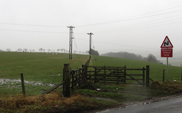
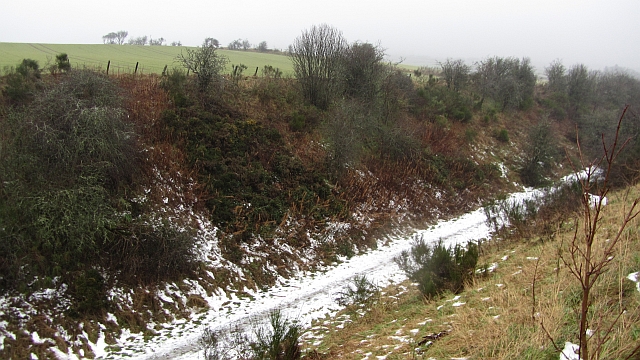
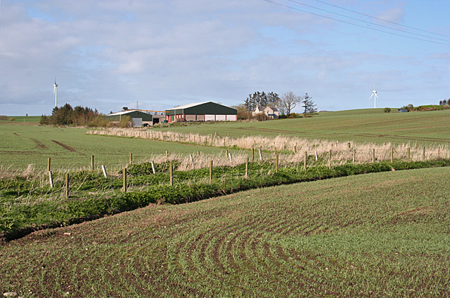
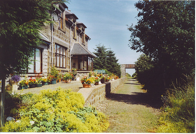
Auchtygills Plantation Images

Images are sourced within 2km of 57.581972/-2.0462078 or Grid Reference NJ9754. Thanks to Geograph Open Source API. All images are credited.

Fields above Strichen As usual in these parts, field boundaries are barbed wire fences. The road sign warns of the steep descent and bends required to get under the Formartine and Buchan Railway, now a path.
Fields above Strichen
As usual in these parts, field boundaries are barbed wire fences. The road sign warns of the steep descent and bends required to get under the Formartine and Buchan Railway, now a path.
Formartine and Buchan Railway Snow lingers in a deep cutting on the Fraserburgh Branch east of Strichen. The railway closed to passengers in 1965 but the line to Fraserburgh hung on as a freight service until 1979 due mainly to the oil industry. It is now a footpath and cycle path.
Formartine and Buchan Railway
Snow lingers in a deep cutting on the Fraserburgh Branch east of Strichen. The railway closed to passengers in 1965 but the line to Fraserburgh hung on as a freight service until 1979 due mainly to the oil industry. It is now a footpath and cycle path.
South Redbog A farm with substantial outbuildings, standing on a slightly elevated site.
South Redbog
A farm with substantial outbuildings, standing on a slightly elevated site.
Landscape with wind turbines Here we see three of the numerous wind turbines in the Aberdeenshire countryside from the dead-straight minor road that connects Strichen with New Leeds.
Landscape with wind turbines
Here we see three of the numerous wind turbines in the Aberdeenshire countryside from the dead-straight minor road that connects Strichen with New Leeds.
Formartine and Buchan Way (looking west) The trains are long gone but the tall and narrow occupation bridge is still in use by the local farmer.
Formartine and Buchan Way (looking west)
The trains are long gone but the tall and narrow occupation bridge is still in use by the local farmer.
Formartine and Buchan Way (looking east) 17 km to Fraserburgh: <span class="nowrap"><a title="http://www.walkhighlands.co.uk/aberdeenshire/formartine-buchan-way.shtml" rel="nofollow ugc noopener" href="http://www.walkhighlands.co.uk/aberdeenshire/formartine-buchan-way.shtml">Link</a><img style="margin-left:2px;" alt="External link" title="External link - shift click to open in new window" src="https://s1.geograph.org.uk/img/external.png" width="10" height="10"/></span> .
Formartine and Buchan Way (looking east)
17 km to Fraserburgh: LinkExternal link .
Plough crossing the Buchan and Formartine Way
Formartine and Buchan Way
Site of Mormond Halt
Wetland, Mormond
Wetland, Mormond
Barley near Dencallie
Formartine and Buchan Way east of Strichen
Wetland, Clayfords
Wetland, Clayfords
Formartine and Buchan Way east of Strichen
Site of Mormond Halt
Formartine and Buchan Way
Dencallie
Dencallie
Common Hemp-nettle (Galeopsis tetrahit) This is one of the few plants whose seed heads are actually more interesting than their flowers! Compare with <a href="https://www.geograph.org.uk/photo/6532624">NJ3652 : Common Hemp-nettle (Galeopsis tetrahit) with Bumble Bee</a>.
Common Hemp-nettle (Galeopsis tetrahit)
This is one of the few plants whose seed heads are actually more interesting than their flowers! Compare with NJ3652 : Common Hemp-nettle (Galeopsis tetrahit) with Bumble Bee.
Show me another place!

Auchtygills Plantation is located at Grid Ref: NJ9754 (Lat: 57.581972, Lng: -2.0462078)

Unitary Authority: Aberdeenshire

Police Authority: North East

What 3 Words

///status.smile.rivals. Near Mintlaw, Aberdeenshire

Nearby Locations

Auchtygills Plantation

Related Wikis

Mormond Halt railway station

Mormond Halt railway station was a railway station near New Leeds, Aberdeenshire. == History == The station was opened as Mormond on 24 April 1865. It...

New Leeds

New Leeds is a planned village in the Buchan area of Aberdeenshire, Scotland, situated 5.1 kilometres (3.2 mi) east of Strichen at the foot of Mormond...

Mormond Hill

Mormond Hill (from Gaelic Mórmhonadh, "big hill") is a broad eminence in Aberdeenshire, Scotland, not far from Fraserburgh. Its twin summits reach heights...

Strichen railway station

Strichen railway station was a railway station in Strichen, Aberdeenshire. == History == The station was opened on 24 April 1865 by the Formartine and...

Nearby Amenities

Located within 500m of 57.581972,-2.0462078
Power: pole
Lat/Long: 57.5788451/-2.041763
Power: pole
Lat/Long: 57.5799525/-2.0460085
Power: pole
Lat/Long: 57.5811018/-2.0504153
Power: pole
Lat/Long: 57.5814701/-2.051826
Power: pole
Lat/Long: 57.5821628/-2.0544741
Material: wood
Power: pole
Lat/Long: 57.5794114/-2.0439339
Material: wood
Power: pole
Lat/Long: 57.5805401/-2.0482614
Power: pole
Lat/Long: 57.5815992/-2.0523207
Power: pole
Lat/Long: 57.5794706/-2.0520196
Power: pole
Lat/Long: 57.5790486/-2.0522217
Power: pole
Lat/Long: 57.5862301/-2.0480507
Power: pole
Lat/Long: 57.5859111/-2.0474639
Power: pole
Lat/Long: 57.5856111/-2.0468918
Power: pole
Lat/Long: 57.5856648/-2.0468834
Power: pole
Lat/Long: 57.5862021/-2.046802
Power: pole
Lat/Long: 57.5856111/-2.0459323
Power: pole
Lat/Long: 57.5856178/-2.0449237
Power: pole
Lat/Long: 57.5856318/-2.0439058
The data included in this document is from www.openstreetmap.org. The data is made available under ODbL.

Have you been to Auchtygills Plantation?

Leave your review of Auchtygills Plantation below (or comments, questions and feedback).