Balmacassie Community Woodland

Wood, Forest in Aberdeenshire

Scotland

Balmacassie Community Woodland

McDonald Golf Club, 1st Hole, Westwinds The opening hole at McDonald Golf Course in Ellon, looking to the green.
McDonald Golf Club, 1st Hole, Westwinds Credit: Scott Cormie

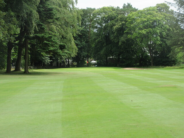
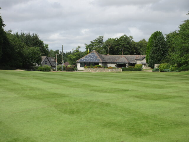
Balmacassie Community Woodland is a picturesque forest located in Aberdeenshire, Scotland. Covering an expansive area, the woodland is a popular destination for nature lovers, hikers, and outdoor enthusiasts.

The woodland features a diverse range of tree species, including oak, birch, and pine, creating a rich and vibrant ecosystem. The trees provide a habitat for various wildlife, such as birds, squirrels, and deer, making it a haven for animal lovers and birdwatchers. The woodland also has a tranquil atmosphere, with the gentle rustling of leaves and the soothing sounds of birdsong.

The woodland offers a network of well-maintained trails and pathways, allowing visitors to explore its beauty on foot or by bicycle. These paths wind through the forest, offering stunning views of the surrounding countryside and allowing visitors to immerse themselves in nature. The trails are suitable for all ages and abilities, making it an ideal destination for families and individuals alike.

Additionally, Balmacassie Community Woodland has several picnic areas and benches scattered throughout the area, providing a perfect spot for a leisurely lunch or a moment of relaxation. The woodland is also equipped with information boards, providing educational insights into the local flora and fauna.

Managed by the local community, the woodland is a testament to the dedication and passion of the residents. Regular community events and volunteering opportunities are held, allowing locals and visitors to contribute to the maintenance and preservation of this natural treasure.

Overall, Balmacassie Community Woodland is a breathtaking location that showcases the beauty of Aberdeenshire's natural landscape. Its diverse wildlife, well-maintained trails, and community involvement make it a must-visit destination for nature enthusiasts and outdoor lovers.

If you have any feedback on the listing, please let us know in the comments section below.

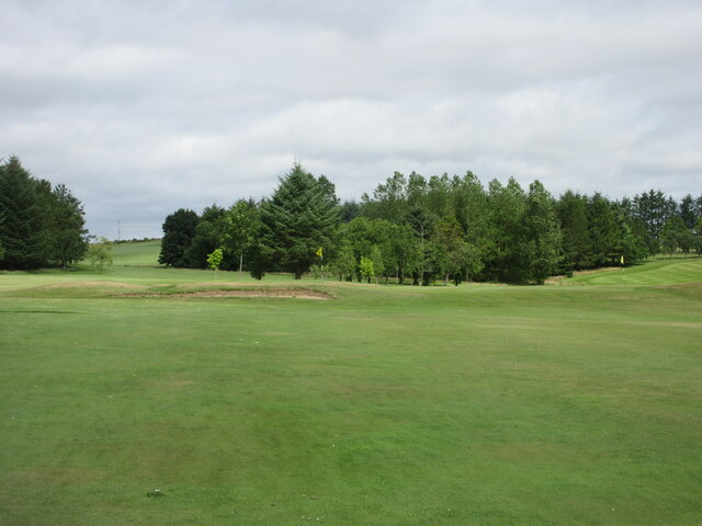
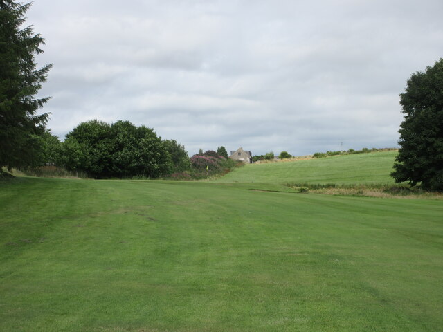
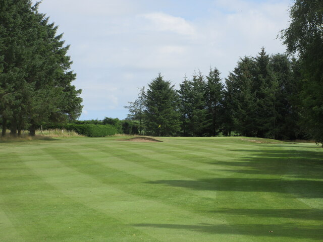
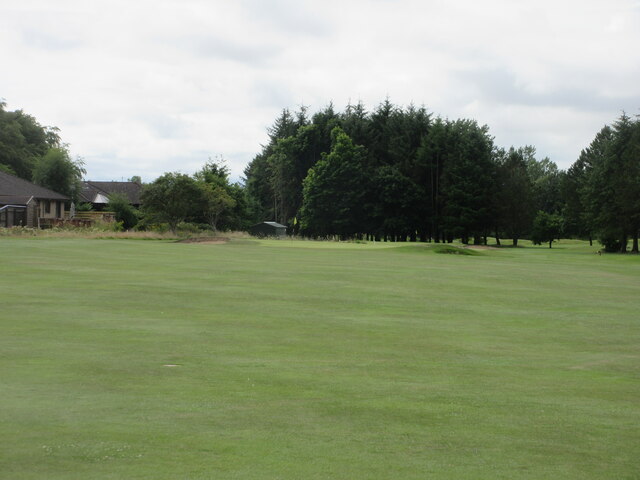
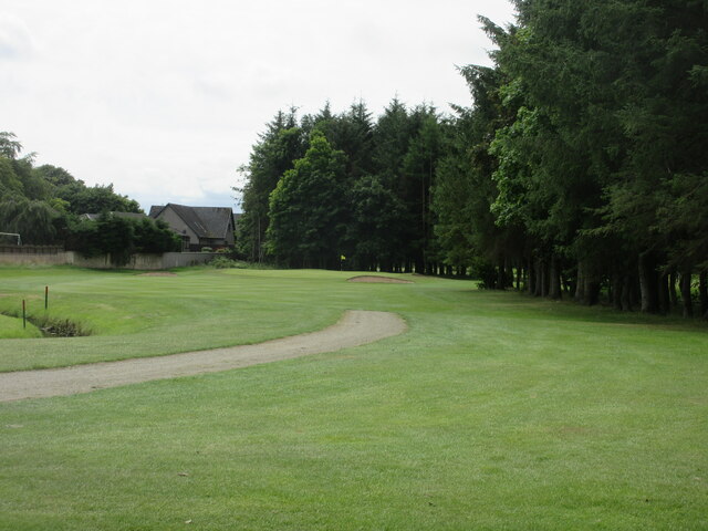
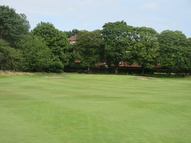
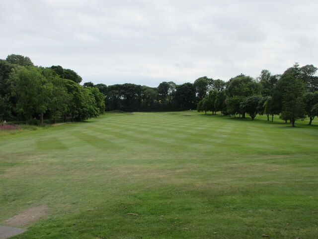
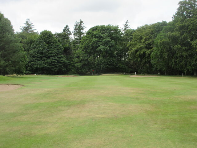
Balmacassie Community Woodland Images

Images are sourced within 2km of 57.372243/-2.0575982 or Grid Reference NJ9631. Thanks to Geograph Open Source API. All images are credited.

McDonald Golf Club, 1st Hole, Westwinds The opening hole at McDonald Golf Course in Ellon, looking to the green.
McDonald Golf Club, 1st Hole, Westwinds
The opening hole at McDonald Golf Course in Ellon, looking to the green.
McDonald Golf Club, 2nd Hole, Par-Mac The second hole at McDonald Golf Course in Ellon, looking to the green.
McDonald Golf Club, 2nd Hole, Par-Mac
The second hole at McDonald Golf Course in Ellon, looking to the green.
McDonald Golf Club, 3rd Hole, Caledonian The third hole at McDonald Golf Course in Ellon, looking to the green.
McDonald Golf Club, 3rd Hole, Caledonian
The third hole at McDonald Golf Course in Ellon, looking to the green.
McDonald Golf Club, 4th Hole, The Legion The long fourth hole at McDonald Golf Course, looking to the green shared with the first hole.
McDonald Golf Club, 4th Hole, The Legion
The long fourth hole at McDonald Golf Course, looking to the green shared with the first hole.
McDonald Golf Club, 5th Hole, Knockie The fifth hole at McDonald Golf Club in Ellon, looking uphill to the green.
McDonald Golf Club, 5th Hole, Knockie
The fifth hole at McDonald Golf Club in Ellon, looking uphill to the green.
McDonald Golf Club, 6th Hole, Nigg Bay The sixth hole at McDonald Golf Course in Ellon, looking to the green.
McDonald Golf Club, 6th Hole, Nigg Bay
The sixth hole at McDonald Golf Course in Ellon, looking to the green.
McDonald Golf Club, 7th Hole, The Oaks The short seventh hole at McDonald Golf Course in Ellon, from tee to green.
McDonald Golf Club, 7th Hole, The Oaks
The short seventh hole at McDonald Golf Course in Ellon, from tee to green.
McDonald Golf Club, 8th Hole, Sam & Bess Hardie The eighth hole at McDonald Golf Course in Ellon, looking uphill to the green.
McDonald Golf Club, 8th Hole, Sam & Bess Hardie
The eighth hole at McDonald Golf Course in Ellon, looking uphill to the green.
McDonald Golf Club, 9th Hole, Bon-Accord The long ninth hole at McDonald Golf Course in Ellon, looking to the green.
McDonald Golf Club, 9th Hole, Bon-Accord
The long ninth hole at McDonald Golf Course in Ellon, looking to the green.
McDonald Golf Club, 10th Hole, Modley The tenth hole at McDonald Golf Course in Ellon, looking to the green.
McDonald Golf Club, 10th Hole, Modley
The tenth hole at McDonald Golf Course in Ellon, looking to the green.
McDonald Golf Club, 11th Hole, The Firs The uphill short eleventh hole at McDonald Golf Course in Ellon, from tee to green.
McDonald Golf Club, 11th Hole, The Firs
The uphill short eleventh hole at McDonald Golf Course in Ellon, from tee to green.
McDonald Golf Club, 12th Hole, Roadside The short twelfth hole at McDonald Golf Course in Ellon, looking from the tee to the flag on the green over the rise.
McDonald Golf Club, 12th Hole, Roadside
The short twelfth hole at McDonald Golf Course in Ellon, looking from the tee to the flag on the green over the rise.
McDonald Golf Club, 13th Hole, Avenue Gates The thirteenth hole at McDonald Golf Course in Ellon, looking from tee to green.
McDonald Golf Club, 13th Hole, Avenue Gates
The thirteenth hole at McDonald Golf Course in Ellon, looking from tee to green.
McDonald Golf Club, 14th Hole, Delville Wood The fourteenth hole at McDonald Golf Course in Ellon, looking uphill to the green.
McDonald Golf Club, 14th Hole, Delville Wood
The fourteenth hole at McDonald Golf Course in Ellon, looking uphill to the green.
McDonald Golf Club, 15th Hole, Het Girdle The short fifteenth hole at McDonald Golf Course in Ellon, from tee to green.
McDonald Golf Club, 15th Hole, Het Girdle
The short fifteenth hole at McDonald Golf Course in Ellon, from tee to green.
McDonald Golf Club, 16th Hole, Turnishaw Hill The sixteenth hole at McDonald Golf Course in Ellon, looking to the green.
McDonald Golf Club, 16th Hole, Turnishaw Hill
The sixteenth hole at McDonald Golf Course in Ellon, looking to the green.
McDonald Golf Club, 17th Hole, The Doctor The seventeenth hole at McDonald Golf Course in Ellon, looking to the green.
McDonald Golf Club, 17th Hole, The Doctor
The seventeenth hole at McDonald Golf Course in Ellon, looking to the green.
McDonald Golf Club, 18th Hole, The Twister The final hole at McDonald Golf Course in Ellon, looking to the green in front of the clubhouse.
McDonald Golf Club, 18th Hole, The Twister
The final hole at McDonald Golf Course in Ellon, looking to the green in front of the clubhouse.
Show me another place!

Balmacassie Community Woodland is located at Grid Ref: NJ9631 (Lat: 57.372243, Lng: -2.0575982)

Unitary Authority: Aberdeenshire

Police Authority: North East

What 3 Words

///thuds.commands.wager. Near Ellon, Aberdeenshire

Related Wikis

Ellon United F.C.

Ellon United Football Club is a Scottish football club from the town of Ellon, Aberdeenshire. Members of the Scottish Junior Football Association, they...

Waterton Castle

Waterton Castle is a ruined 17th-century tower house, about 1 mile (1.6 km) east of Ellon, Aberdeenshire, Scotland, north of the River Ythan. == History... ==

Ellon Academy

Ellon Academy is a secondary comprehensive school in the Aberdeenshire town of Ellon. In August 2015, the school moved to its new purpose-built campus...

Ellon railway station

Ellon railway station was a railway station in Ellon, Aberdeenshire, Scotland. == History == Ellon Railway Station (originally Ellon for Cruden) was situated...

Nearby Amenities

Located within 500m of 57.372243,-2.0575982
Crossing
Crossing: unmarked
Crossing Island: yes
Lat/Long: 57.3722231/-2.0620982
Check Date: 2021-10-21
Traffic Calming: table
Lat/Long: 57.3732095/-2.0654288
Traffic Calming: hump
Lat/Long: 57.3707183/-2.0606398
Traffic Calming: hump
Lat/Long: 57.3715458/-2.0595381
Traffic Calming: hump
Lat/Long: 57.3726865/-2.0595274
Traffic Calming: hump
Lat/Long: 57.3714154/-2.0643996
Traffic Calming: hump
Lat/Long: 57.3705872/-2.0638419
Noexit: yes
Lat/Long: 57.3683325/-2.0613475
Noexit: yes
Lat/Long: 57.3682375/-2.0587869
Noexit: yes
Lat/Long: 57.3684361/-2.0590256
Traffic Calming: hump
Lat/Long: 57.3709299/-2.0643977
Traffic Calming: hump
Lat/Long: 57.3729477/-2.0638792
Traffic Calming: hump
Lat/Long: 57.3736457/-2.062692
Traffic Calming: hump
Lat/Long: 57.3742321/-2.0626894
Traffic Calming: hump
Lat/Long: 57.3737964/-2.0608361
Traffic Calming: hump
Lat/Long: 57.3740231/-2.0615083
Traffic Calming: hump
Lat/Long: 57.3743522/-2.0623623
Traffic Calming: hump
Lat/Long: 57.3745088/-2.0633502
School
Colours Day Nursery
Created By: Potlatch 0.10f
Lat/Long: 57.3687951/-2.0550343
Traffic Calming: table
Lat/Long: 57.3725949/-2.0654333
Check Date: 2021-10-21
Traffic Calming: table
Lat/Long: 57.3718833/-2.0654356
Crossing
Crossing: unmarked
Crossing Island: yes
Tactile Paving: no
Lat/Long: 57.3734338/-2.0605605
Generator Method: photovoltaic
Generator Output Electricity: yes
Generator Source: solar
Generator Type: solar_photovoltaic_panel
Location: roof
Power: generator
Lat/Long: 57.373997/-2.060536
Generator Method: photovoltaic
Generator Output Electricity: yes
Generator Source: solar
Generator Type: solar_photovoltaic_panel
Location: roof
Power: generator
Lat/Long: 57.3747106/-2.0631881
Generator Method: photovoltaic
Generator Output Electricity: yes
Generator Source: solar
Generator Type: solar_photovoltaic_panel
Location: roof
Power: generator
Lat/Long: 57.369265/-2.0606084
Generator Method: photovoltaic
Generator Output Electricity: yes
Generator Source: solar
Generator Type: solar_photovoltaic_panel
Location: roof
Power: generator
Lat/Long: 57.3693684/-2.0624994
Noexit: yes
Lat/Long: 57.3682725/-2.0610095
Generator Method: photovoltaic
Generator Output Electricity: yes
Generator Source: solar
Generator Type: solar_photovoltaic_panel
Power: generator
Lat/Long: 57.3699693/-2.0643048
Generator Method: photovoltaic
Generator Output Electricity: yes
Generator Source: solar
Generator Type: solar_photovoltaic_panel
Power: generator
Lat/Long: 57.3700163/-2.0642257
Bus Stop
Portsoy Crescent
Bench: yes
Bin: no
Lit: yes
Naptan AtcoCode: 630045632
Naptan Bearing: SW
Naptan CommonName: Portsoy Crescent
Naptan Indicator: at
Naptan Landmark: Portsoy Crescent
Naptan NaptanCode: 23629264
Naptan Street: Knockothie Crescent
Public Transport: platform
Ref: 23629264
Shelter: yes
Tactile Paving: no
Lat/Long: 57.3728887/-2.0610955
Bus Stop
Portsoy Crescent
Bench: yes
Bin: no
Lit: yes
Naptan AtcoCode: 630045631
Naptan Bearing: NE
Naptan CommonName: Portsoy Crescent
Naptan Indicator: opp
Naptan Landmark: Portsoy Crescent
Naptan NaptanCode: 23629269
Naptan Street: Knockothie Crescent
Public Transport: platform
Ref: 23629269
Shelter: yes
Tactile Paving: no
Lat/Long: 57.3730226/-2.061164
Bus Stop
Castle Way
Naptan AtcoCode: 630031332
Naptan Bearing: NW
Naptan CommonName: Castle Way
Naptan Indicator: opp
Naptan Landmark: Castle Way
Naptan NaptanCode: 23628694
Naptan Street: Castle Street
Public Transport: platform
Ref: 23628694
Lat/Long: 57.3682506/-2.0568208
Bus Stop
Castle Way
Naptan AtcoCode: 630031331
Naptan Bearing: SE
Naptan CommonName: Castle Way
Naptan Indicator: at
Naptan Landmark: Industrial Estate
Naptan NaptanCode: 23626858
Naptan Street: Castle Street
Public Transport: platform
Ref: 23626858
Shelter: yes
Lat/Long: 57.3686788/-2.057364
Bus Stop
Cairnbulg Way
Naptan AtcoCode: 630031322
Naptan Bearing: W
Naptan CommonName: Cairnbulg Way
Naptan Indicator: opp
Naptan Landmark: Cairnbulg Way
Naptan NaptanCode: 23628232
Naptan Street: Balmoral Avenue
Public Transport: platform
Ref: 23628232
Lat/Long: 57.3686804/-2.0604968
Bus Stop
Cairnbulg Way
Naptan AtcoCode: 630031321
Naptan Bearing: E
Naptan CommonName: Cairnbulg Way
Naptan Indicator: at
Naptan Landmark: Cairnbulg Way
Naptan NaptanCode: 23626849
Naptan Street: Balmoral Wynd
Public Transport: platform
Ref: 23626849
Shelter: yes
Lat/Long: 57.3687858/-2.0601683
Noexit: yes
Lat/Long: 57.3727743/-2.0633657
Noexit: yes
Lat/Long: 57.3728166/-2.0630291
Generator Method: photovoltaic
Generator Output Electricity: yes
Generator Source: solar
Generator Type: solar_photovoltaic_panel
Location: roof
Power: generator
Lat/Long: 57.3714749/-2.0641918
Generator Method: photovoltaic
Generator Output Electricity: yes
Generator Source: solar
Generator Type: solar_photovoltaic_panel
Location: roof
Power: generator
Lat/Long: 57.370717/-2.0613742
Generator Method: photovoltaic
Generator Output Electricity: yes
Generator Source: solar
Generator Type: solar_photovoltaic_panel
Location: roof
Power: generator
Lat/Long: 57.3718762/-2.0651494
Generator Method: photovoltaic
Generator Output Electricity: yes
Generator Source: solar
Generator Type: solar_photovoltaic_panel
Location: roof
Power: generator
Lat/Long: 57.3721907/-2.0645151
Generator Method: photovoltaic
Generator Output Electricity: yes
Generator Source: solar
Generator Type: solar_photovoltaic_panel
Location: roof
Power: generator
Lat/Long: 57.3725241/-2.0639665
Generator Method: photovoltaic
Generator Output Electricity: yes
Generator Source: solar
Generator Type: solar_photovoltaic_panel
Location: roof
Power: generator
Lat/Long: 57.3744258/-2.0646559
Generator Method: photovoltaic
Generator Output Electricity: yes
Generator Source: solar
Generator Type: solar_photovoltaic_panel
Location: roof
Power: generator
Lat/Long: 57.3731749/-2.0612977
Traffic Calming: hump
Lat/Long: 57.3719771/-2.0638861
Traffic Calming: hump
Lat/Long: 57.3726365/-2.0642502
Crossing
Lat/Long: 57.3717136/-2.0649168
Traffic Calming: hump
Lat/Long: 57.3710847/-2.0599908
Traffic Calming: hump
Lat/Long: 57.3721535/-2.0594839
Generator Method: photovoltaic
Generator Output Electricity: yes
Generator Source: solar
Generator Type: solar_photovoltaic_panel
Location: roof
Power: generator
Lat/Long: 57.3706845/-2.0603536
Generator Method: photovoltaic
Generator Output Electricity: yes
Generator Source: solar
Generator Type: solar_photovoltaic_panel
Location: roof
Power: generator
Lat/Long: 57.3731919/-2.0603154
Traffic Calming: hump
Lat/Long: 57.3731018/-2.0605628
Generator Method: photovoltaic
Generator Output Electricity: yes
Generator Source: solar
Generator Type: solar_photovoltaic_panel
Location: roof
Power: generator
Lat/Long: 57.3696916/-2.0617537
The data included in this document is from www.openstreetmap.org. The data is made available under ODbL.

Have you been to Balmacassie Community Woodland?

Leave your review of Balmacassie Community Woodland below (or comments, questions and feedback).