Charlton

Settlement in Somerset Somerset West and Taunton

England

Charlton

Direction Sign – Signpost on the A361 in Durston Located on the south side of the junction of the A361 and Tuckerton Lane in Durston parish. 3 arms and pyramid finial.

Milestone Society National ID: SO_ST3028
Direction Sign – Signpost on the A361 in Durston Credit: A Rosevear

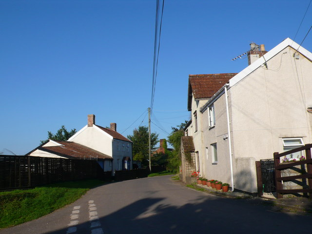
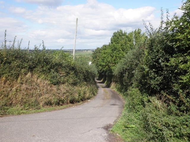
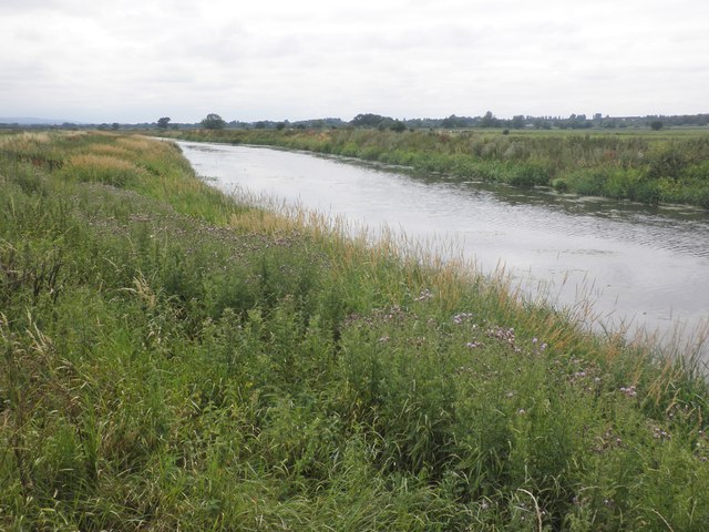
Charlton is a small village located in the county of Somerset, in the southwest of England. Situated approximately 3 miles northeast of Shepton Mallet, Charlton is nestled amidst the picturesque Mendip Hills. The village is surrounded by rolling countryside, offering breathtaking views and a serene atmosphere.

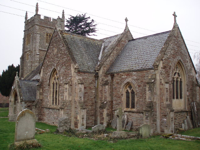
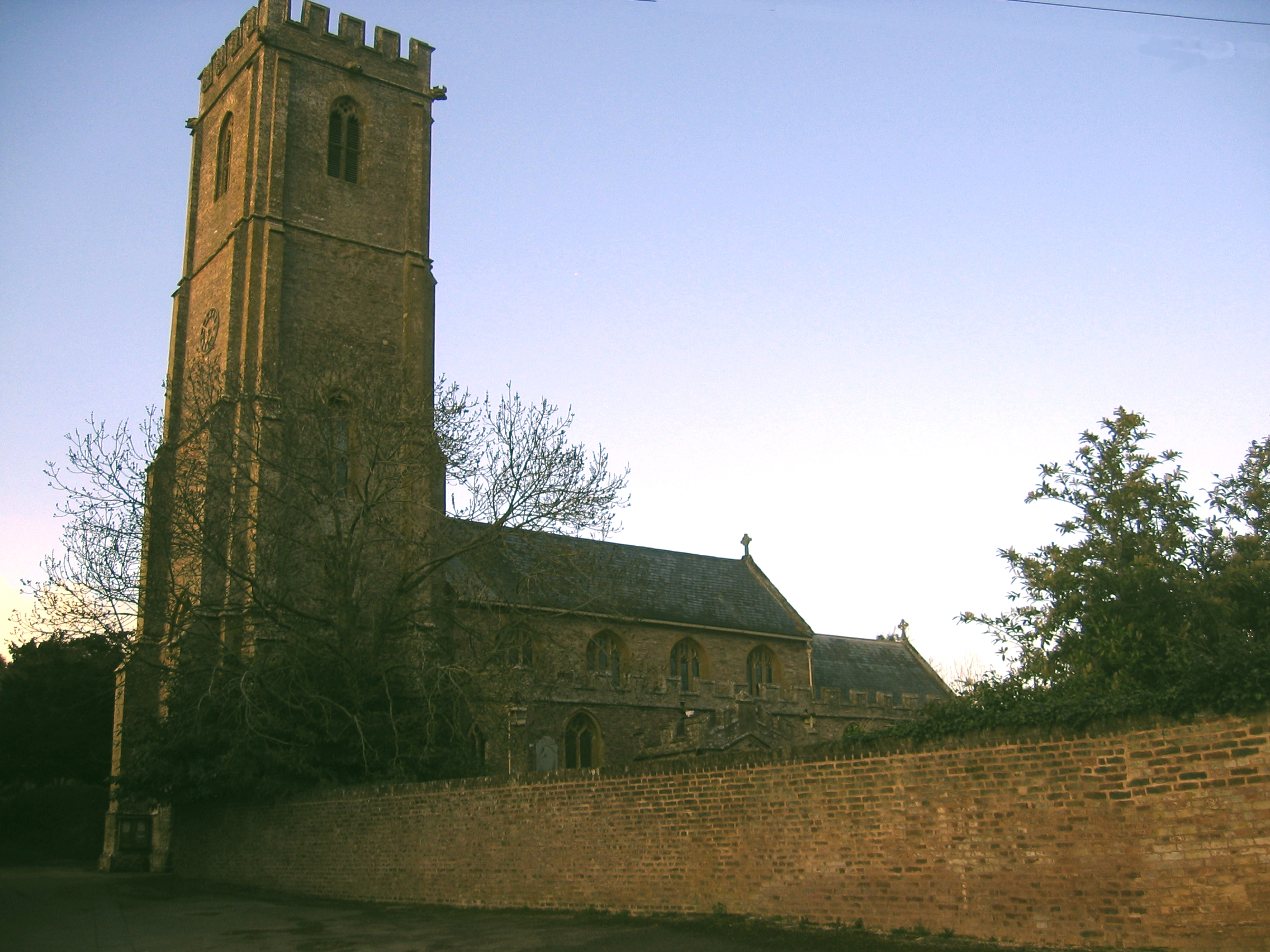
With a population of around 400 residents, Charlton maintains a close-knit community feel. The village is mainly residential, consisting of a mix of period cottages, modern houses, and a few small businesses. The historic St. John the Baptist Church, dating back to the 14th century, stands as a prominent landmark in Charlton.

Although small in size, Charlton is in close proximity to several amenities. The nearby town of Shepton Mallet provides residents with access to a range of shops, supermarkets, schools, and medical facilities. The village itself has a community hall that hosts various events and gatherings throughout the year.

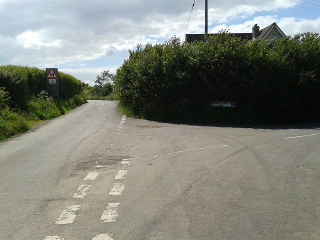
Nature enthusiasts will find numerous walking and cycling trails in and around Charlton, allowing them to explore the beautiful countryside and enjoy the tranquility of the area. The Mendip Hills Area of Outstanding Natural Beauty, which encompasses Charlton, offers opportunities for outdoor activities such as hiking, rock climbing, and caving.

Charlton enjoys a rural setting while still being within reach of larger towns and cities. Its idyllic location, friendly community, and access to stunning natural landscapes make Charlton an attractive place to live or visit for those seeking a peaceful and scenic retreat in Somerset.

If you have any feedback on the listing, please let us know in the comments section below.
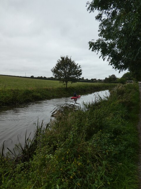
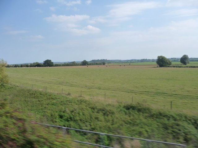
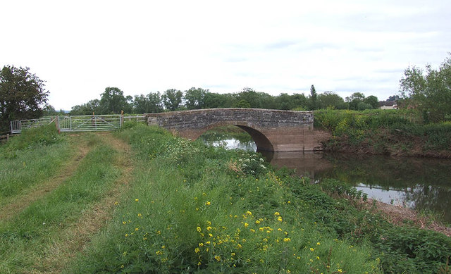
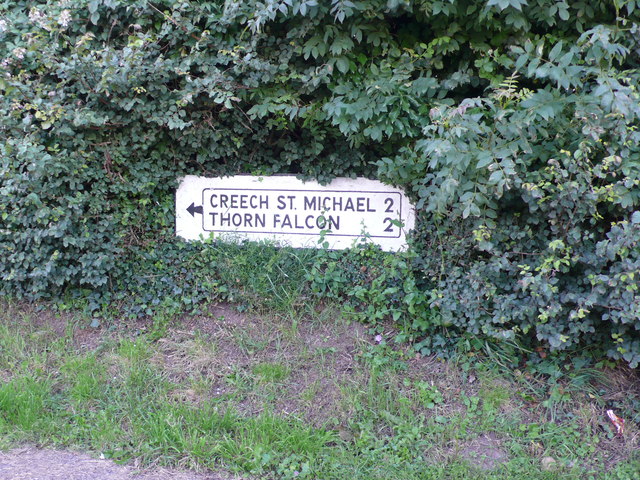
Charlton Images

Images are sourced within 2km of 51.035466/-3.014289 or Grid Reference ST2826. Thanks to Geograph Open Source API. All images are credited.

Direction Sign – Signpost on the A361 in Durston Located on the south side of the junction of the A361 and Tuckerton Lane in Durston parish. 3 arms and pyramid finial.

Milestone Society National ID: SO_ST3028
Direction Sign – Signpost on the A361 in Durston
Located on the south side of the junction of the A361 and Tuckerton Lane in Durston parish. 3 arms and pyramid finial. Milestone Society National ID: SO_ST3028
Canoeing on Bridgwater and Taunton Canal Unusually, this canoeist was exercising his dog on the towpath!
Canoeing on Bridgwater and Taunton Canal
Unusually, this canoeist was exercising his dog on the towpath!
Taunton Deane : Grassy Field A grassy field as seen from a train on the railway.
Taunton Deane : Grassy Field
A grassy field as seen from a train on the railway.
Cogload Junction
Cogload Junction
Knapp bridge Old stone bridge over the River Tone at Knapp. Notice the recent "tide" mark on the bridge abutments due to the recent floods (this is upstream of the tidal limits).
Knapp bridge
Old stone bridge over the River Tone at Knapp. Notice the recent "tide" mark on the bridge abutments due to the recent floods (this is upstream of the tidal limits).
Ancient fish ponds at Lower Durston
Road Sign This old cast metal road sign shows the direction for Creech St Michael and Thornfalcon. It is buried in a hedge in Knapp.
Road Sign
This old cast metal road sign shows the direction for Creech St Michael and Thornfalcon. It is buried in a hedge in Knapp.
Houses in Knapp Knapp is a small village on top of a prominent hill to the east of Creech St Michael above the West Moor Levels. The road on the left drops down towards Bird's farm.
Houses in Knapp
Knapp is a small village on top of a prominent hill to the east of Creech St Michael above the West Moor Levels. The road on the left drops down towards Bird's farm.
Cottages, Knapp
Cottages, Knapp
Combe Lane, Knapp
Combe Lane, Knapp
Higher Knapp Lane
Higher Knapp Lane
Bridgwater and Taunton Canal, Cogload Junction
Cogload Junction A flying junction where the line from Bristol and Bridgwater meets the railway from Paddington via Westbury and Castle Cary.  There is a trackbed nearby from the previous junction.
Cogload Junction
A flying junction where the line from Bristol and Bridgwater meets the railway from Paddington via Westbury and Castle Cary. There is a trackbed nearby from the previous junction.
Bridgwater Canal Passing an oilseed rape field near the railway's Cogload Junction.
Bridgwater Canal
Passing an oilseed rape field near the railway's Cogload Junction.
Into the asteroid belt on the Bridgwater Canal Looking sunwards (north) from Jupiter in the model solar system.
Into the asteroid belt on the Bridgwater Canal
Looking sunwards (north) from Jupiter in the model solar system.
A361 bridge Crossing the Taunton and Bridgwater Canal.
A361 bridge
Crossing the Taunton and Bridgwater Canal.
River Tone
River Tone
Hay Moor
Hay Moor
Show me another place!

Charlton is located at Grid Ref: ST2826 (Lat: 51.035466, Lng: -3.014289)

Administrative County: Somerset

District: Somerset West and Taunton

Police Authority: Avon and Somerset

What 3 Words

///robot.ourselves.remission. Near Creech St Michael, Somerset

Nearby Locations

Charlton

Related Wikis

Cogload Junction

Cogload Junction is a railway junction in Durston, Somerset, England. It is where the 1906-opened London to Penzance Line via Castle Cary joins the original...

Durston

Durston is a village and civil parish in Somerset, England, situated on the A361 road 5 miles (8.0 km) north east of Taunton and 6 miles (9.7 km) south...

Buckland Priory

Buckland Priory (also known as Minchin Buckland Preceptory or Buckland Sororum (Latin: "Buckland of the Sisters")) was established around 1167 in Lower...

Creech St Michael

Creech St Michael is a village and civil parish in Somerset, three miles east of Taunton. The parish straddles the M5 motorway and includes several scattered...

Walford, Somerset

Walford is a small village 3 miles (5 km) north east of Taunton in Somerset, England. Most of the village, including Walford Cross at the junction of...

West Monkton

West Monkton is a village and civil parish in Somerset, England, situated 2 miles (3.2 km) north east of Taunton. The parish includes the hamlets of Monkton...

Harold Redler

Lieutenant Harold Bolton Redler (27 January 1897 – 21 June 1918) was a British World War I flying ace credited with ten aerial victories. His most notable...

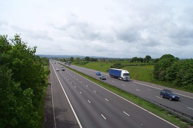
2011 M5 motorway crash

On 4 November 2011, a multiple-vehicle collision occurred on the M5 motorway near Taunton, Somerset, in South West England. The crash involved dozens of...

Nearby Amenities

Located within 500m of 51.035466,-3.014289
Brand: National Grid
Brand Wikidata: Q1465461
Guyed: yes
Line Attachment: anchor
Material: wood
Operator: National Grid Electricity Distribution Plc
Operator Old: Western Power Distribution
Operator Wikidata: Q7988183
Owner: National Grid Electricity Distribution (South West) Plc
Owner Wikidata: Q114397866
Power: pole
Lat/Long: 51.0344667/-3.0100028
Brand: National Grid
Brand Wikidata: Q1465461
Line Attachment: anchor
Material: wood
Operator: National Grid Electricity Distribution Plc
Operator Old: Western Power Distribution
Operator Wikidata: Q7988183
Owner: National Grid Electricity Distribution (South West) Plc
Owner Wikidata: Q114397866
Power: pole
Lat/Long: 51.0343166/-3.0099358
Brand: National Grid
Brand Wikidata: Q1465461
Line Attachment: anchor
Material: wood
Operator: National Grid Electricity Distribution Plc
Operator Old: Western Power Distribution
Operator Wikidata: Q7988183
Owner: National Grid Electricity Distribution (South West) Plc
Owner Wikidata: Q114397866
Power: pole
Lat/Long: 51.0340424/-3.0098149
Brand: National Grid
Brand Wikidata: Q1465461
Guyed: yes
Line Attachment: anchor
Material: wood
Operator: National Grid Electricity Distribution Plc
Operator Old: Western Power Distribution
Operator Wikidata: Q7988183
Owner: National Grid Electricity Distribution (South West) Plc
Owner Wikidata: Q114397866
Power: pole
Lat/Long: 51.0338196/-3.0097194
Brand: National Grid
Brand Wikidata: Q1465461
Line Attachment: anchor
Material: wood
Operator: National Grid Electricity Distribution Plc
Operator Old: Western Power Distribution
Operator Wikidata: Q7988183
Owner: National Grid Electricity Distribution (South West) Plc
Owner Wikidata: Q114397866
Power: pole
Lat/Long: 51.0332054/-3.0087735
Brand: National Grid
Brand Wikidata: Q1465461
Line Attachment: anchor
Material: wood
Operator: National Grid Electricity Distribution Plc
Operator Old: Western Power Distribution
Operator Wikidata: Q7988183
Owner: National Grid Electricity Distribution (South West) Plc
Owner Wikidata: Q114397866
Power: pole
Lat/Long: 51.0355323/-3.0098698
Brand: National Grid
Brand Wikidata: Q1465461
Line Attachment: anchor
Material: wood
Operator: National Grid Electricity Distribution Plc
Operator Old: Western Power Distribution
Operator Wikidata: Q7988183
Owner: National Grid Electricity Distribution (South West) Plc
Owner Wikidata: Q114397866
Power: pole
Lat/Long: 51.0366612/-3.0097516
Brand: National Grid
Brand Wikidata: Q1465461
Line Attachment: anchor
Material: wood
Operator: National Grid Electricity Distribution Plc
Operator Old: Western Power Distribution
Operator Wikidata: Q7988183
Owner: National Grid Electricity Distribution (South West) Plc
Owner Wikidata: Q114397866
Power: pole
Lat/Long: 51.0369176/-3.0097434
Barrier: cattle_grid
Lat/Long: 51.0359402/-3.0137869
Power: pole
Lat/Long: 51.0341134/-3.0102312
Power: pole
Lat/Long: 51.0334091/-3.0113239
Power: pole
Lat/Long: 51.0332672/-3.0115577
Material: wood
Power: pole
Lat/Long: 51.0325444/-3.012639
Power: pole
Lat/Long: 51.0318297/-3.0138084
Power: pole
Lat/Long: 51.031101/-3.015026
Brand: National Grid
Brand Wikidata: Q1465461
Line Attachment: anchor
Material: wood
Operator: National Grid Electricity Distribution Plc
Operator Old: Western Power Distribution
Operator Wikidata: Q7988183
Owner: National Grid Electricity Distribution (South West) Plc
Owner Wikidata: Q114397866
Power: pole
Lat/Long: 51.0377531/-3.0096438
The data included in this document is from www.openstreetmap.org. The data is made available under ODbL.

Have you been to Charlton?

Leave your review of Charlton below (or comments, questions and feedback).