Burnpark Wood

Wood, Forest in Kincardineshire

Scotland

Burnpark Wood

B979 past Allochie Croft Heading towards Stonehaven. The new Aberdeen Western Bypass is just out of shot left.
B979 past Allochie Croft Credit: Stanley Howe

Burnpark Wood is a picturesque woodland located in Kincardineshire, Scotland. Covering an area of approximately 100 hectares, the wood is a haven for nature enthusiasts and offers a tranquil retreat from the hustle and bustle of everyday life.

The wood is predominantly made up of deciduous trees, including oak, beech, birch, and ash. These towering trees create a dense canopy, providing shade and shelter for a wide variety of flora and fauna. The forest floor is carpeted with a rich layer of moss, ferns, and wildflowers, adding to the wood's natural beauty.

A network of well-maintained paths and trails wind their way through the wood, allowing visitors to explore its hidden gems. These paths are suitable for walkers of all ages and abilities and offer opportunities for both short strolls and longer hikes. Along the way, visitors may encounter wildlife such as red squirrels, roe deer, and a multitude of bird species.

One of the highlights of Burnpark Wood is its vibrant display of bluebells during the spring months. The forest floor becomes a sea of purple as these delicate flowers bloom, creating a truly enchanting sight. This seasonal spectacle attracts many visitors who come to witness nature's beauty at its finest.

The wood is also home to a variety of historical features, including remnants of an old sawmill and charcoal kilns. These remnants provide a glimpse into the area's industrial past and add an extra layer of intrigue to the wood's charm.

Overall, Burnpark Wood offers a delightful blend of natural beauty, diverse wildlife, and historical significance. Whether you are a nature lover, history enthusiast, or simply seeking a peaceful retreat, this woodland is a must-visit destination in Kincardineshire.

If you have any feedback on the listing, please let us know in the comments section below.

Burnpark Wood Images

Images are sourced within 2km of 56.992473/-2.2332202 or Grid Reference NO8589. Thanks to Geograph Open Source API. All images are credited.

B979 past Allochie Croft Heading towards Stonehaven. The new Aberdeen Western Bypass is just out of shot left.
B979 past Allochie Croft
Heading towards Stonehaven. The new Aberdeen Western Bypass is just out of shot left.
Industrial building off B979 at Allochie With a new dwelling house under construction to the right.
Industrial building off B979 at Allochie
With a new dwelling house under construction to the right.
Road south of the Hill of Muchalls Minor road heading south from the Hill of Muchalls, with the A90 underpass beyond.
Road south of the Hill of Muchalls
Minor road heading south from the Hill of Muchalls, with the A90 underpass beyond.
Allochie Lochan, sign
Minor road, Fishermyre Looking eastwards at the start of a brief break from the fog.
Minor road, Fishermyre
Looking eastwards at the start of a brief break from the fog.
Barley, Howieshill Spring barley just beginning to turn.
Barley, Howieshill
Spring barley just beginning to turn.
Climbing the Hill of Allochie Photographer is climbing the Hill of Allochie, a broad moorland that has been disturbed by an access road to the new wind farm. Significant ecological destruction has occurred here from development of the wind farm from the massive grading and road construction. Twelve turbines of the wind farm are faintly visible on the horizon.
Climbing the Hill of Allochie
Photographer is climbing the Hill of Allochie, a broad moorland that has been disturbed by an access road to the new wind farm. Significant ecological destruction has occurred here from development of the wind farm from the massive grading and road construction. Twelve turbines of the wind farm are faintly visible on the horizon.
Disturbed area atop the Hill of Allochie The foreground is grading spoils from the access road to the wind turbine field. Considerable native heather habitat destruction has occurred to enable this energy project.
Disturbed area atop the Hill of Allochie
The foreground is grading spoils from the access road to the wind turbine field. Considerable native heather habitat destruction has occurred to enable this energy project.
Power line warning on the road to the wind farm These geometric structures warn of the overhanging power lines. The view is in the opposite direction of the actual wind farm.
Power line warning on the road to the wind farm
These geometric structures warn of the overhanging power lines. The view is in the opposite direction of the actual wind farm.
National Cycle Route 1 at Fishermyre Heading east.
National Cycle Route 1 at Fishermyre
Heading east.
Moorland east of the B979
B979 heading north Towards Peterculter.
B979 heading north
Towards Peterculter.
Allochie Lochan Artificial loch now used as a club fishing water. Hosts a small community of water voles.
Allochie Lochan
Artificial loch now used as a club fishing water. Hosts a small community of water voles.
B979 Stonehaven to Peterculter Road This grid is mainly Forest and Moorland. The roadside is abundant in Gorse.
B979 Stonehaven to Peterculter Road
This grid is mainly Forest and Moorland. The roadside is abundant in Gorse.
Sign at Entrance to Allochie Lochan Hill of Allochie in the background. Can anyone suggest why you would need to wear eye protection when fishing in this Lochan.
Sign at Entrance to Allochie Lochan
Hill of Allochie in the background. Can anyone suggest why you would need to wear eye protection when fishing in this Lochan.
Allochie Lochan This photo is very similar to the first geograph only less mist in the distance but it's not as nice a photo.
Allochie Lochan
This photo is very similar to the first geograph only less mist in the distance but it's not as nice a photo.
Paved farm road with fields on the sides Looking toward Hillocks and Wyndford Farm
Paved farm road with fields on the sides
Looking toward Hillocks and Wyndford Farm
Burn of Monboys watershed
Show me another place!

Burnpark Wood is located at Grid Ref: NO8589 (Lat: 56.992473, Lng: -2.2332202)

Unitary Authority: Aberdeenshire

Police Authority: North East

What 3 Words

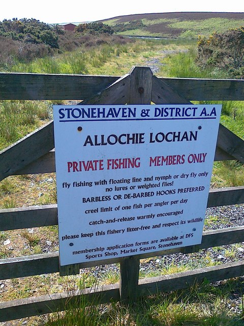
///safely.movements.ironclad. Near Stonehaven, Aberdeenshire

Nearby Locations

Burnpark Wood

Related Wikis

Ury House

Ury House is a large ruined mansion in Aberdeenshire, Scotland, built in the Elizabethan style in 1885 by Sir Alexander Baird, 1st Baronet. It is situated...

Cowton Burn

Cowton Burn is a stream that rises in the Mounth, or eastern range of the Grampian Mountains, on some of the northwest slopes of the Durris Forest west...

Megray Hill

Megray Hill is a low-lying coastal mountainous landform in Aberdeenshire, Scotland within the Mounth Range of the Grampian Mountains. The peak elevation...
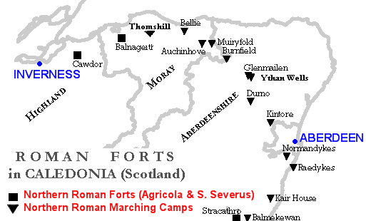
Raedykes

Raedykes is the site of a Roman marching camp located just over three miles (five kilometres) northwest of Stonehaven, Aberdeenshire, Scotland. National...

Nearby Amenities

Located within 500m of 56.992473,-2.2332202
Power: pole
Lat/Long: 56.9926963/-2.2252595
Power: pole
Lat/Long: 56.9931723/-2.226127
Power: pole
Lat/Long: 56.993512/-2.226496
Power: pole
Lat/Long: 56.9939441/-2.2272765
Power: pole
Lat/Long: 56.9943878/-2.2280804
Power: pole
Lat/Long: 56.9948048/-2.2288652
Power: pole
Lat/Long: 56.9952231/-2.2296308
Power: pole
Lat/Long: 56.9956505/-2.2304156
Power: pole
Lat/Long: 56.9960768/-2.231177
Power: pole
Lat/Long: 56.9962293/-2.2314718
Power: pole
Lat/Long: 56.9967411/-2.2323944
The data included in this document is from www.openstreetmap.org. The data is made available under ODbL.

Have you been to Burnpark Wood?

Leave your review of Burnpark Wood below (or comments, questions and feedback).