Charlestown of Aberlour

Settlement in Banffshire

Scotland

Charlestown of Aberlour

Orphaned Fireplace I surmise that this is the fireplace and chimney of a railwaymen's wooden hut that has long since vanished.
Orphaned Fireplace Credit: Anne Burgess

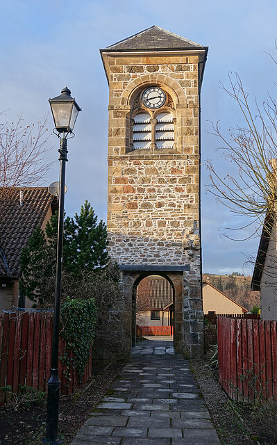
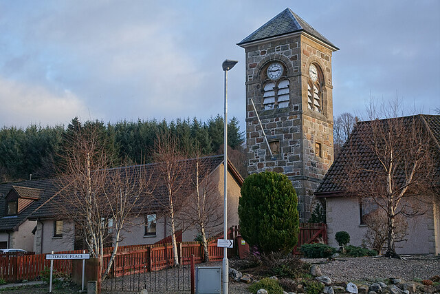
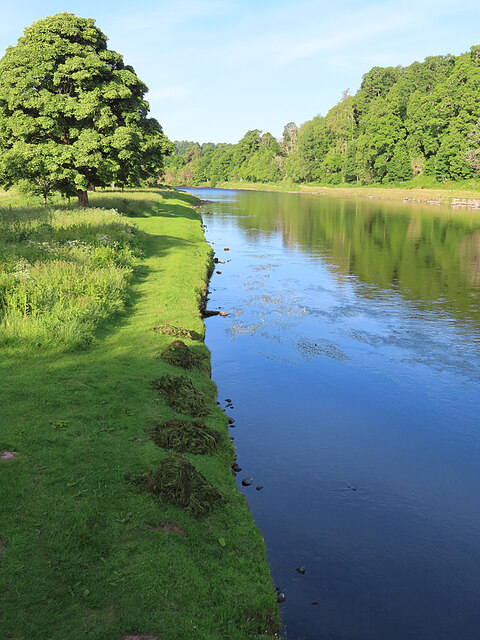
Charlestown of Aberlour is a small village located in the historic county of Banffshire, Scotland. Situated on the banks of the River Spey, it lies approximately 55 miles northeast of Inverness and 10 miles southeast of Elgin. The village is known for its picturesque setting amidst the stunning Scottish Highlands.

Charlestown of Aberlour is primarily a residential area, with a population of around 500 people. The village offers a peaceful and tranquil atmosphere, attracting both locals and visitors seeking a quiet retreat. The surrounding landscape is dominated by rolling hills, lush green fields, and the meandering River Spey, creating a truly idyllic countryside experience.

Despite its small size, Charlestown of Aberlour boasts a few notable attractions. The Aberlour Distillery, one of Scotland's most renowned whisky producers, can be found within the village. It offers guided tours and tastings, allowing visitors to learn about the intricate process of whisky production.

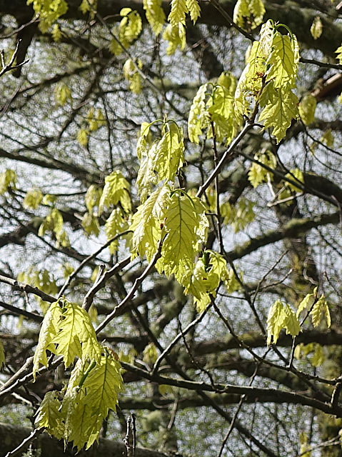
Nature enthusiasts will appreciate the village's proximity to the Speyside Way, a long-distance walking trail that stretches for approximately 65 miles through the scenic Speyside region. The trail offers breathtaking views of the surrounding countryside and is a popular destination for hikers and nature lovers alike.

Charlestown of Aberlour is also home to a few essential amenities, including a primary school, a post office, and a few local shops and cafes. The village's close-knit community fosters a friendly and welcoming atmosphere, making it an appealing place for residents and visitors seeking a peaceful Scottish Highland experience.

If you have any feedback on the listing, please let us know in the comments section below.

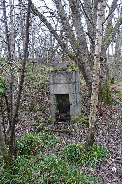
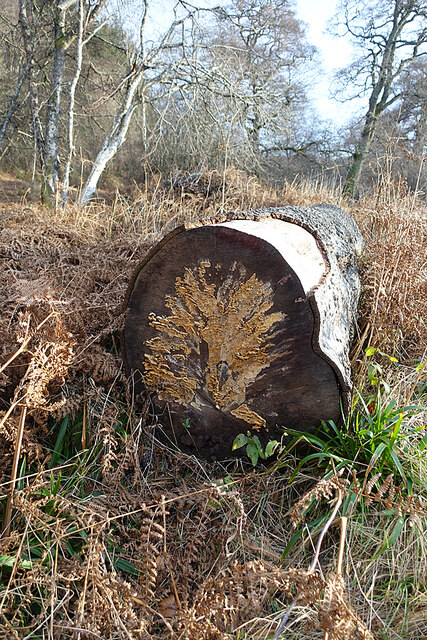
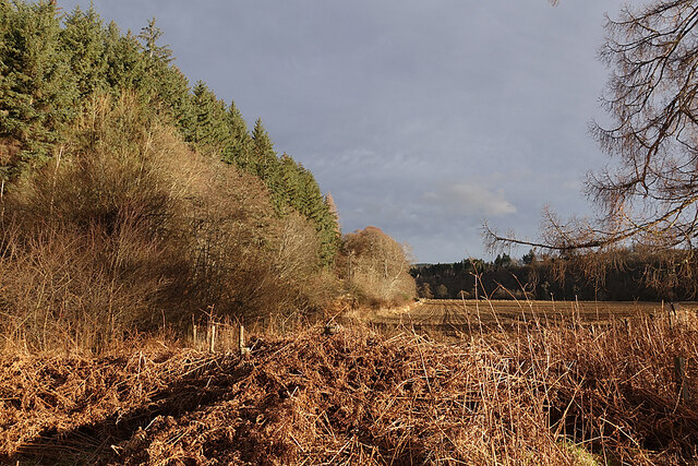
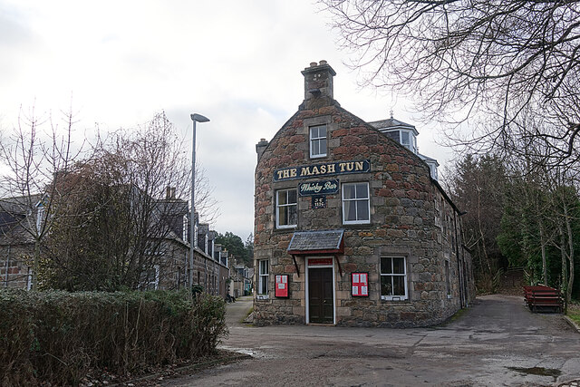
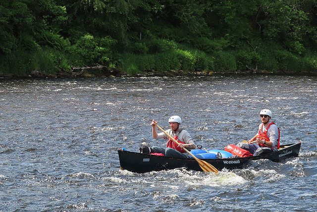
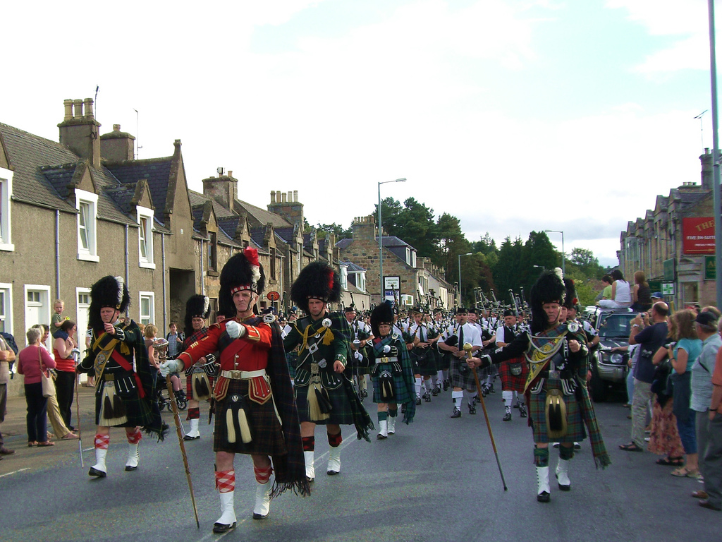
Charlestown of Aberlour Images

Images are sourced within 2km of 57.470603/-3.22547 or Grid Reference NJ2642. Thanks to Geograph Open Source API. All images are credited.

Orphaned Fireplace I surmise that this is the fireplace and chimney of a railwaymen's wooden hut that has long since vanished.
Orphaned Fireplace
I surmise that this is the fireplace and chimney of a railwaymen's wooden hut that has long since vanished.
Fungus Art We saw all sorts of pictures in the fungus on the cut end of a tree trunk. What can you see?
Fungus Art
We saw all sorts of pictures in the fungus on the cut end of a tree trunk. What can you see?
Haugh of Delltoulie Warm winter sunshine on the trees and ploughed field on the Haugh of Delltoulie.
Haugh of Delltoulie
Warm winter sunshine on the trees and ploughed field on the Haugh of Delltoulie.
The Mash Tun The former Station Bar is a Category C Listed Building. See <span class="nowrap"><a title="http://portal.historicenvironment.scot/designation/LB49987" rel="nofollow ugc noopener" href="http://portal.historicenvironment.scot/designation/LB49987">Link</a><img style="margin-left:2px;" alt="External link" title="External link - shift click to open in new window" src="https://s1.geograph.org.uk/img/external.png" width="10" height="10"/></span>. The Mash Tun's own web site <span class="nowrap"><a title="https://www.mashtun-aberlour.com/about-us" rel="nofollow ugc noopener" href="https://www.mashtun-aberlour.com/about-us">Link</a><img style="margin-left:2px;" alt="External link" title="External link - shift click to open in new window" src="https://s1.geograph.org.uk/img/external.png" width="10" height="10"/></span> says, "The building was originally constructed in 1896 by James Campbell, a sea captain, who instructed a marine architect to design the building in the shape of a small ship. ​A pledge contained in the title deeds, made in 1963 by the owner at the time, states that since Dr Beeching closed the railway in Aberlour then a name change was appropriate - but that if ever a train should pull up at the station again then the pub will revert to the Station Bar".
The Mash Tun
The former Station Bar is a Category C Listed Building. See LinkExternal link. The Mash Tun's own web site LinkExternal link says, "The building was originally constructed in 1896 by James Campbell, a sea captain, who instructed a marine architect to design the building in the shape of a small ship. ​A pledge contained in the title deeds, made in 1963 by the owner at the time, states that since Dr Beeching closed the railway in Aberlour then a name change was appropriate - but that if ever a train should pull up at the station again then the pub will revert to the Station Bar".
Aberlour Orphanage Clock Tower The clock tower is the only part of the Aberlour Orphanage buildings that survives, cramped and hemmed in by modern housing. It is a Category C Listed building. See <span class="nowrap"><a title="http://portal.historicenvironment.scot/designation/LB20865" rel="nofollow ugc noopener" href="http://portal.historicenvironment.scot/designation/LB20865">Link</a><img style="margin-left:2px;" alt="External link" title="External link - shift click to open in new window" src="https://s1.geograph.org.uk/img/external.png" width="10" height="10"/></span> for details.
Aberlour Orphanage Clock Tower
The clock tower is the only part of the Aberlour Orphanage buildings that survives, cramped and hemmed in by modern housing. It is a Category C Listed building. See LinkExternal link for details.
Memorial to Aberlour Orphanage Each panel tells part of the story of the orphanage that stood on this site in the late 19th and first part of the 20th century.
Memorial to Aberlour Orphanage
Each panel tells part of the story of the orphanage that stood on this site in the late 19th and first part of the 20th century.
Farm Close Modern housing in a quiet cul-de-sac on the site of the former Aberlour Orphanage.
Farm Close
Modern housing in a quiet cul-de-sac on the site of the former Aberlour Orphanage.
Oak Leaves Fresh new leaves on an alien species of oak, possibly American Red Oak (Quercus rubra).
Oak Leaves
Fresh new leaves on an alien species of oak, possibly American Red Oak (Quercus rubra).
River Spey at Aberlour I was a little saddened to see that someone has been gathering and removing the River Water-crowfoot that is currently flowering just upstream from the bridge, but at least they haven't cleared all of it. This was at seven o'clock in the morning. When I returned several hours later the heaps had been removed.
River Spey at Aberlour
I was a little saddened to see that someone has been gathering and removing the River Water-crowfoot that is currently flowering just upstream from the bridge, but at least they haven't cleared all of it. This was at seven o'clock in the morning. When I returned several hours later the heaps had been removed.
Canoeing on the River Spey This was the third and largest group of canoes to pass down the river while I was on the bank today. There seem to be several companies offering four-day trips on the river.
Canoeing on the River Spey
This was the third and largest group of canoes to pass down the river while I was on the bank today. There seem to be several companies offering four-day trips on the river.
Canoeing on the River Spey A two-man crew getting close to some gentle white water on the four-day trip from Aviemore to Spey Bay.
Canoeing on the River Spey
A two-man crew getting close to some gentle white water on the four-day trip from Aviemore to Spey Bay.
River Spey A sandy beach has developed on the inside of a bend in the course of the river, and it has been colonised by colourful lupins that have become established in the wild after escaping from gardens. This is not altogether welcome, however, because lupins are invasive and can become a nuisance.
River Spey
A sandy beach has developed on the inside of a bend in the course of the river, and it has been colonised by colourful lupins that have become established in the wild after escaping from gardens. This is not altogether welcome, however, because lupins are invasive and can become a nuisance.
Soft Downy-rose (Rosa mollis) Rosa mollis is a mainly northern species, present in Scotland, northern England, Wales and Northern Ireland, but quite rare in southern England and the south and west of Ireland.
Soft Downy-rose (Rosa mollis)
Rosa mollis is a mainly northern species, present in Scotland, northern England, Wales and Northern Ireland, but quite rare in southern England and the south and west of Ireland.
Glaucous Dog-rose (Rosa vosagiaca) Officially it's Rosa caesia subspecies vosagiaca. It's one of the commonest species of wild rose north of a line from the Wash to the Bristol Channel, but is rare in southern and western England and from most of Ireland.
Glaucous Dog-rose (Rosa vosagiaca)
Officially it's Rosa caesia subspecies vosagiaca. It's one of the commonest species of wild rose north of a line from the Wash to the Bristol Channel, but is rare in southern and western England and from most of Ireland.
Taking a Rest A small flotilla of canoes on the bank of the River Spey at Aberlour while the crews relax in the sunshine.
Taking a Rest
A small flotilla of canoes on the bank of the River Spey at Aberlour while the crews relax in the sunshine.
Victoria Bridge The suspension bridge enables pedestrians to cross the River Spey at Aberlour. It's several miles to the nearest motorable bridge both downstream and upstream.
Victoria Bridge
The suspension bridge enables pedestrians to cross the River Spey at Aberlour. It's several miles to the nearest motorable bridge both downstream and upstream.
River Spey at Aberlour In this view from the Victoria Bridge you can see that the level of the river is quite low. There was once a ford here, and later a ferry.
River Spey at Aberlour
In this view from the Victoria Bridge you can see that the level of the river is quite low. There was once a ford here, and later a ferry.
Show me another place!

Charlestown of Aberlour is located at Grid Ref: NJ2642 (Lat: 57.470603, Lng: -3.22547)

Unitary Authority: Moray

Police Authority: North East

What 3 Words

///stockpile.wiggles.bookcases. Near Charlestown of Aberlour, Moray

Related Wikis

Aberlour railway station

Aberlour railway station served the village of Aberlour, Scotland, from 1863 to 1965. == History == The station was opened by the Strathspey Railway when...

Fleming Cottage Hospital

Fleming Hospital is a UK National Health Service hospital in Aberlour, Morayshire, Scotland. It is administered by NHS Grampian. == History == The hospital...

Victoria Bridge, Aberlour

The Victoria Bridge is a suspension footbridge near the village of Aberlour in Moray, Scotland. It was built in 1902, replacing a ferry that had previously...

Speyside High School, Aberlour

Speyside High School is a secondary school in Aberlour, Moray. It has 437 pupils. It serves the areas of Aberlour, Archiestown, Craigellachie, Dufftown...

A95 road

The A95 road is a major road of north-east Scotland connecting the A9 road in the Highlands to the A98 road near the coast. == Route == It leaves the A9...

Aberlour distillery

Aberlour distillery is a Speyside single malt Scotch whisky distillery, in Aberlour, Strathspey, Scotland, at the confluence of the Lour Burn and River...

St Margaret's Church, Aberlour

St Margaret's Church is a church of the Scottish Episcopal Church near Aberlour in Moray, Scotland. It is Gothic in style, built mostly of tooled granite...

Aberlour

Aberlour (Scottish Gaelic: Obar Lobhair) is a village in Moray, Scotland, 12 miles (20 km) south of Elgin on the road to Grantown. The Lour burn is a tributary...

Nearby Amenities

Located within 500m of 57.470603,-3.22547
Aberlour
Burgh: barony
Burgh Start Date: 1814
Is In: Moray
Name Gd: Obar Lobhair
Name Sco: Aiberlour
Official Name: Charlestown of Aberlour
Place: village
Population: 1020
Start Date: 1812
Wikidata: Q1010405
Wikipedia: en:Aberlour
Lat/Long: 57.4707462/-3.2254545
Telephone
Booth: KX100
Check Date: 2022-03-14
Covered: booth
Lat/Long: 57.4706381/-3.2254477
Post Box
Brand: Royal Mail
Brand Wikidata: Q638098
Check Date: 2022-10-02
Check Date Collection Times: 2022-03-14
Collection Times: Mo-Fr 16:15; Sa 12:00; Su off
Manufacturer: Machan
Operator: Royal Mail
Operator Wikidata: Q638098
Post Box Design: type_a
Post Box Type: pillar
Ref: AB38 40
Royal Cypher: scottish_crown
Lat/Long: 57.4706572/-3.2253909
Restaurant
Aberlour Hotel Restaurant
Lat/Long: 57.4707929/-3.2246417
Toilets
Access: yes
Fee: no
Lat/Long: 57.4710876/-3.2267693
Bench
Backrest: yes
Lat/Long: 57.4716815/-3.2268888
Barrier: cycle_barrier
Lat/Long: 57.4725877/-3.2233661
Speyside Way Visitor Centre
Information: office
Tourism: information
Lat/Long: 57.4711591/-3.2268158
Norlaggan
Addr Housenumber: 22
Addr Street: High Street
Internet Access: wlan
Internet Access Fee: no
Stars: 3
Tourism: guest_house
Lat/Long: 57.4734793/-3.2197546
S. Cattanach
Addr Housenumber: 71
Addr Postcode: AB38 9QB
Addr Street: High Street
Fhrs Id: 18350
Shop: convenience
Source Addr: FHRS Open Data
Lat/Long: 57.4713981/-3.2234318
Pagoda
Tourism: guest_house
Lat/Long: 57.4713756/-3.2240535
Post Box
Brand: Royal Mail
Brand Wikidata: Q638098
Check Date: 2022-10-02
Collection Times: Mo-Fr 12:30; Sa 11:00; Su off
Manufacturer: none
Operator: Royal Mail
Operator Wikidata: Q638098
Post Box Mounting: pier
Post Box Type: lamp
Ref: AB38 38
Royal Cypher: scottish_crown
Source: survey
Lat/Long: 57.4730117/-3.220515
Post Box
Brand: Royal Mail
Brand Wikidata: Q638098
Check Date: 2022-10-02
Collection Times: Mo-Fr 12:30; Sa 10:00; Su off
Manufacturer: Machan
Operator: Royal Mail
Operator Wikidata: Q638098
Post Box Type: lamp
Ref: AB38 119
Royal Cypher: scottish_crown
Source: survey
Lat/Long: 57.4685084/-3.2237953
Post Box
Brand: Royal Mail
Brand Wikidata: Q638098
Check Date: 2022-10-02
Collection Times: Mo-Sa 09:00; Su off
Manufacturer: none
Operator: Royal Mail
Operator Wikidata: Q638098
Post Box Type: lamp
Ref: AB38 143
Royal Cypher: scottish_crown
Source: survey
Lat/Long: 57.467017/-3.2231301
Bus Stop
Bench: no
Bin: no
Naptan AtcoCode: 638053011
Naptan NaptanCode: 67924353
Shelter: no
Lat/Long: 57.4725793/-3.2211077
Bus Stop
Bench: no
Bin: no
Naptan AtcoCode: 638053012
Naptan NaptanCode: 67924354
Shelter: no
Lat/Long: 57.4723089/-3.2219231
Fast Food
Plum Garden
Addr Postcode: AB38 9PX
Cuisine: chinese
Fhrs Id: 19588
Source Addr Postcode: FHRS Open Data
Takeaway: yes
Lat/Long: 57.4705475/-3.2257778
Tourism: guest_house
Lat/Long: 57.4694701/-3.2273728
Bench
Backrest: yes
Material: wood
Lat/Long: 57.4691777/-3.2283899
Charging Station
Lat/Long: 57.471158/-3.226684
Charging Station
Lat/Long: 57.4682834/-3.2229933
Information: board
Tourism: information
Lat/Long: 57.4698768/-3.2294958
Bench
Material: wood
Lat/Long: 57.4692577/-3.2330181
Bench
Backrest: yes
Material: wood
Lat/Long: 57.469226/-3.2330865
Waste Basket
Waste: trash
Lat/Long: 57.4700835/-3.2312009
Bench
Backrest: yes
Material: wood
Lat/Long: 57.4707772/-3.2294628
Waste Basket
Waste: dog_excrement
Lat/Long: 57.4708407/-3.2295446
Bench
Backrest: yes
Material: wood
Lat/Long: 57.4698022/-3.2319264
Bench
Lat/Long: 57.4716989/-3.2267967
Bench
Lat/Long: 57.4717133/-3.226963
Bus Stop
Bench: yes
Naptan AtcoCode: 638052991
Naptan NaptanCode: 67923786
Shelter: yes
Lat/Long: 57.4707195/-3.2252651
Crossing
Button Operated: yes
Crossing: traffic_signals
Crossing Island: no
Crossing Ref: puffin
Kerb: lowered
Traffic Signals Direction: both
Traffic Signals Sound: yes
Lat/Long: 57.4704556/-3.2256407
Clock
Lat/Long: 57.4713931/-3.2178381
Addr Housenumber: 34
Addr Street: High Street
Lat/Long: 57.473131/-3.2204238
Addr Housenumber: 32
Addr Street: High Street
Lat/Long: 57.4731872/-3.2203111
Addr Housenumber: 90
Addr Street: High Street
Lat/Long: 57.4711987/-3.2244471
Addr Housenumber: 90A
Addr Street: High Street
Lat/Long: 57.4711865/-3.224427
Addr Housenumber: 88
Addr Street: High Street
Lat/Long: 57.4712471/-3.2243492
Addr Housenumber: 86
Addr Street: High Street
Lat/Long: 57.4712305/-3.2243317
Addr Housenumber: 60
Addr Street: High Street
Lat/Long: 57.4719758/-3.2228002
Addr Housenumber: 58
Addr Street: High Street
Lat/Long: 57.4720003/-3.2227412
Addr Housenumber: 56A
Addr Street: High Street
Lat/Long: 57.4720436/-3.22265
Addr Housenumber: 56
Addr Street: High Street
Lat/Long: 57.472071/-3.2225937
Cafe
Fresh!
Contact Facebook: https://www.facebook.com/Fresh-311006536506220/
Cuisine: coffee_shop;sandwich
Internet Access: wlan
Outdoor Seating: no
Phone: +44 1340 881638
Lat/Long: 57.46971/-3.2268631
3 Bags Wool
Addr City: Aberlour
Addr Housenumber: 89
Addr Postcode: AB38 9QB
Addr Street: High Street
Shop: fabric
Website: https://www.3bagswool.com/
Lat/Long: 57.4705446/-3.2249191
Cafe
The Gather'n
Addr City: Aberlour
Addr Housenumber: 89
Addr Postcode: AB38 9QB
Addr Street: High Street
Contact Facebook: https://www.facebook.com/thegathern
Fhrs Id: 1046012
Outdoor Seating: no
Phone: +44 1340 881749
Lat/Long: 57.4705713/-3.2248628
Power: pole
Lat/Long: 57.4747016/-3.2274488
Power: pole
Lat/Long: 57.4686245/-3.2181921
Power: pole
Lat/Long: 57.4682373/-3.2185868
Power: pole
Lat/Long: 57.4695505/-3.2179058
Power: pole
Lat/Long: 57.4696974/-3.2186041
Life Ring
Emergency: life_ring
Lat/Long: 57.472045/-3.2256702
Life Ring
Emergency: life_ring
Lat/Long: 57.4706575/-3.2301092
Aberlour War Memorial
Historic: memorial
Lat/Long: 57.4708746/-3.2256688
Aberlour
Historic Railway: station
Railway: site
Wikidata: Q4667125
Wikipedia: en:Aberlour railway station
Lat/Long: 57.4715176/-3.2260217
Entrance: main
Lat/Long: 57.4672817/-3.2229069
Artwork Type: statue
Material: stone
Tourism: artwork
Lat/Long: 57.4672676/-3.2229156
The data included in this document is from www.openstreetmap.org. The data is made available under ODbL.

Have you been to Charlestown of Aberlour?

Leave your review of Charlestown of Aberlour below (or comments, questions and feedback).