Covert Plantation

Wood, Forest in Berwickshire

Scotland

Covert Plantation

Sign for Stuarts Law Farm
Sign for Stuarts Law Farm Credit: Becky Williamson

Covert Plantation, located in Berwickshire, is a picturesque woodland area spanning over several acres. Situated amidst the rolling hills and lush green fields of the Scottish Borders, this forest is a haven for nature enthusiasts and outdoor adventurers alike.

The plantation boasts a diverse range of tree species, including oak, beech, birch, and pine, creating a rich tapestry of colors throughout the year. The woodland floor is carpeted with a variety of plants, such as bluebells, ferns, and mosses, adding to its natural beauty.

The area is well-maintained, with well-defined trails and paths that wind through the forest, making it accessible for hikers and walkers of all abilities. These trails offer visitors the chance to explore the woodland at their own pace, while also providing opportunities for wildlife spotting.

Covert Plantation is home to a wide array of animal species, including deer, foxes, badgers, and numerous bird species. Birdwatchers can spot woodpeckers, owls, and various songbirds nestled among the branches. The forest also attracts a variety of migratory birds throughout the year, adding to its ecological significance.

Visitors to Covert Plantation can indulge in activities such as birdwatching, photography, picnicking, and simply enjoying the tranquility of the surroundings. The plantation is open year-round, with each season offering its own unique charm. In spring, the woodland comes alive with vibrant blossoms and chirping birds, while autumn showcases a breathtaking display of fiery foliage.

Covert Plantation, with its enchanting woodland and abundant wildlife, offers a serene escape from the hustle and bustle of everyday life, making it a cherished destination for both locals and tourists seeking a peaceful retreat in the heart of Berwickshire.

If you have any feedback on the listing, please let us know in the comments section below.

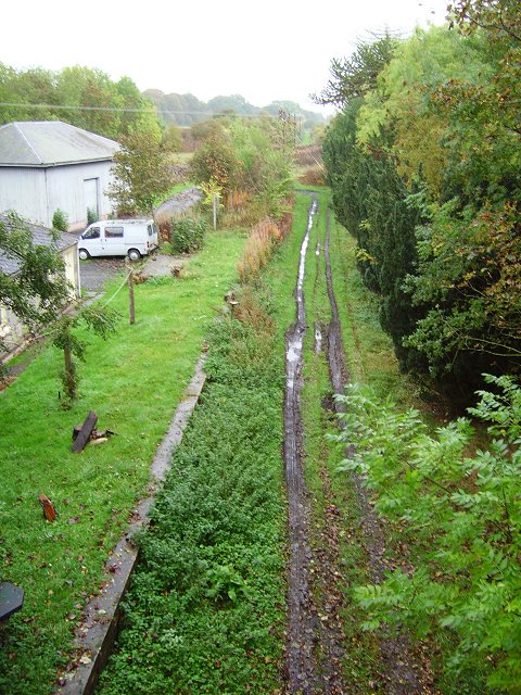
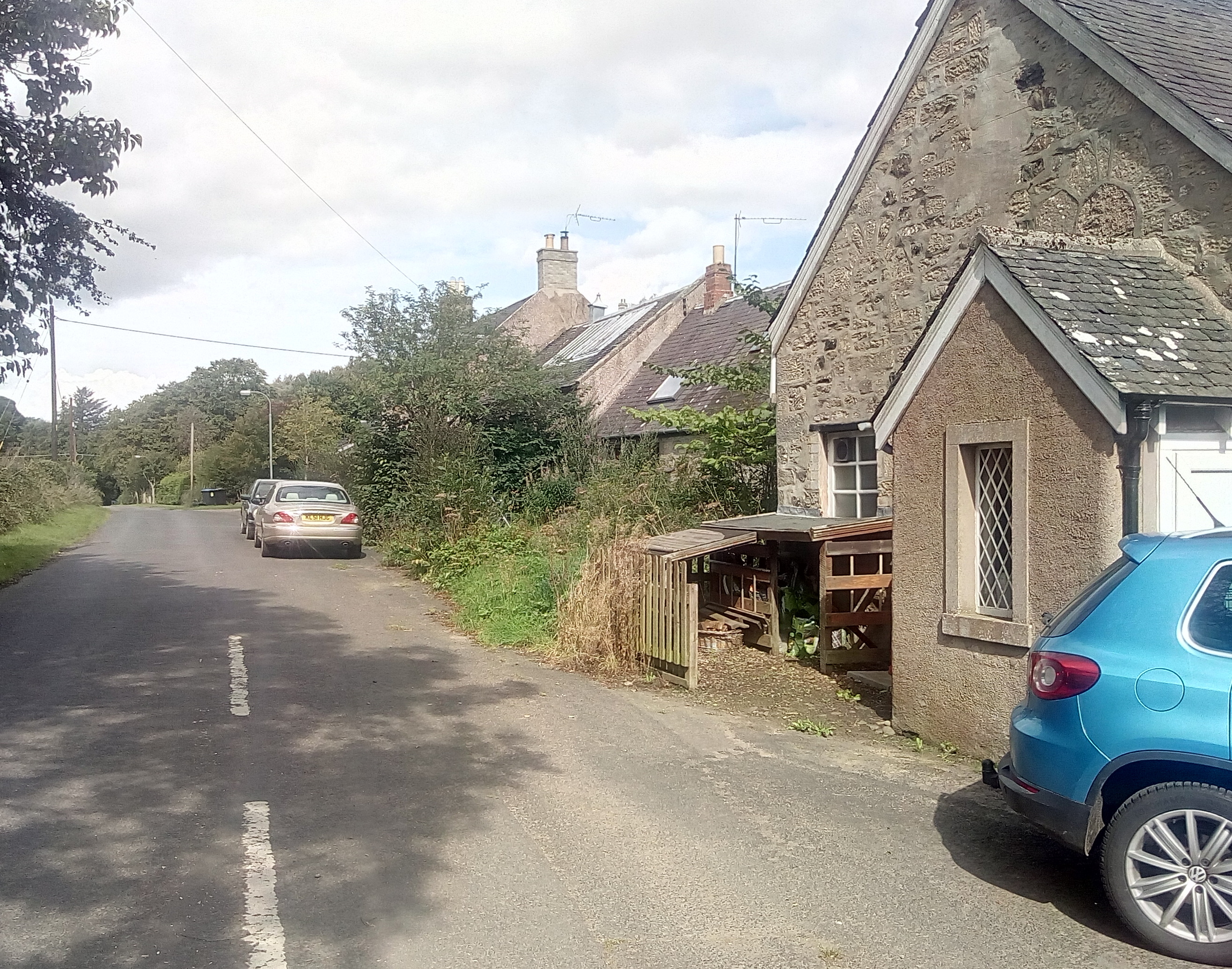
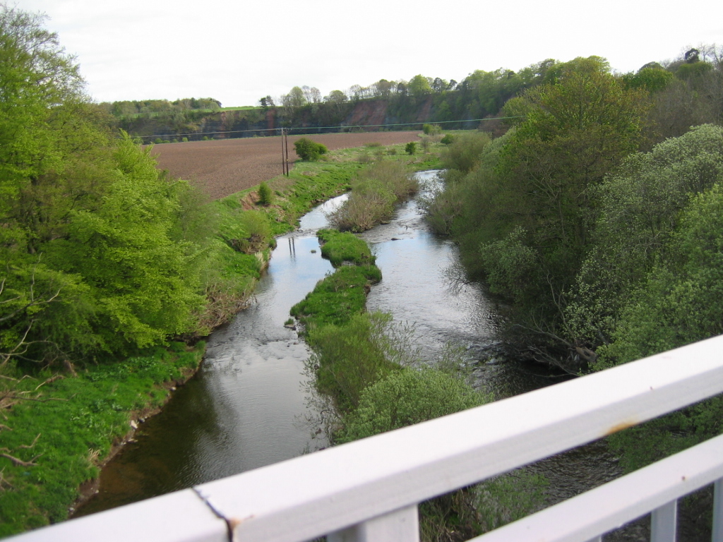
Covert Plantation Images

Images are sourced within 2km of 55.791667/-2.262076 or Grid Reference NT8355. Thanks to Geograph Open Source API. All images are credited.

Sign for Stuarts Law Farm
Edrom Church, Berwickshire The north gallery.
Edrom Church, Berwickshire
The north gallery.
Milepost near Duns The milepost is beside the A6105.

Mileposts are the original roadside heritage features with many dating back hundreds of years and these historic items are under threat from highway developments.
Milepost near Duns
The milepost is beside the A6105. Mileposts are the original roadside heritage features with many dating back hundreds of years and these historic items are under threat from highway developments.
Milepost near Duns Mileposts did not come into general use until the Turnpike Act of 1766 made them compulsory on turnpike roads, these roads were built by private enterprise under licence from the Government and maintained by tolls on those who used them.  Before this Act mileposts were put up occasionally, often as charitable acts and commemorations.   Many Turnpike Act stones still exist.  They are usually 2-3 ft high, with the initial letter or abbreviation of the nearest market town shown on two faces, and the distance from it.

For a wider view <a href="https://www.geograph.org.uk/photo/2606786">NT8254 : Milepost near Duns</a>
Milepost near Duns
Mileposts did not come into general use until the Turnpike Act of 1766 made them compulsory on turnpike roads, these roads were built by private enterprise under licence from the Government and maintained by tolls on those who used them. Before this Act mileposts were put up occasionally, often as charitable acts and commemorations. Many Turnpike Act stones still exist. They are usually 2-3 ft high, with the initial letter or abbreviation of the nearest market town shown on two faces, and the distance from it. For a wider view NT8254 : Milepost near Duns
Ploughed field near Duns The earliest form of cultivation consisted simply of scratching the soil with a branch or antler to enable a seed to be buried.  Early ploughs did no more than this.  Later models were designed to bury the remains of the previous crop and surface debris.

The Romans designed a plough with stout iron teeth mounted on a wooden sole which turned the soil.  Celts and Romans, using light ploughs, adopted the practice of cross-ploughing, so that their fields tended to be almost square.  The Saxons, using a heavy, eight-oxen plough, made their fields long to reduce the number of turns.  The old English furlong, one-eighth of a mile, is derived from ‘furrow long’.

The earliest mould-board plough, similar to that used today, dates from Saxon times.  But the really modern mould-board dates from the 18th century with the introduction of iron.  Double-furrow ploughs, pulled by two horses, were common until tractors were introduced.  Today, powerful tractors pull banks of ploughs which cut many furrows at the same time.

The woodland is known as Big Louise Plantation.
Ploughed field near Duns
The earliest form of cultivation consisted simply of scratching the soil with a branch or antler to enable a seed to be buried. Early ploughs did no more than this. Later models were designed to bury the remains of the previous crop and surface debris. The Romans designed a plough with stout iron teeth mounted on a wooden sole which turned the soil. Celts and Romans, using light ploughs, adopted the practice of cross-ploughing, so that their fields tended to be almost square. The Saxons, using a heavy, eight-oxen plough, made their fields long to reduce the number of turns. The old English furlong, one-eighth of a mile, is derived from ‘furrow long’. The earliest mould-board plough, similar to that used today, dates from Saxon times. But the really modern mould-board dates from the 18th century with the introduction of iron. Double-furrow ploughs, pulled by two horses, were common until tractors were introduced. Today, powerful tractors pull banks of ploughs which cut many furrows at the same time. The woodland is known as Big Louise Plantation.
Bench Mark, Edrom Church The bench mark is to be found on the north east angle of the church.  For a wider view of the church <a href="https://www.geograph.org.uk/photo/2606952">NT8255 : Edrom Church</a> and for further information on the bench mark and others in the area <span class="nowrap"><a title="http://www.bench-marks.org.uk/bm39572" rel="nofollow ugc noopener" href="http://www.bench-marks.org.uk/bm39572">Link</a><img style="margin-left:2px;" alt="External link" title="External link - shift click to open in new window" src="https://s1.geograph.org.uk/img/external.png" width="10" height="10"/></span>
Bench Mark, Edrom Church
The bench mark is to be found on the north east angle of the church. For a wider view of the church NT8255 : Edrom Church and for further information on the bench mark and others in the area LinkExternal link
The Edrom Arch The Norman chevron arch from the original church is now incorporated into the Logan Vault.
The Edrom Arch
The Norman chevron arch from the original church is now incorporated into the Logan Vault.
Graveyard, Edrom Church The graveyard contains burials from many generations, showing the Church's concern for its parishioners in this life and beyond the grave.  The stones tell the history of the Parish and reflect changing attitudes and fashions.
Graveyard, Edrom Church
The graveyard contains burials from many generations, showing the Church's concern for its parishioners in this life and beyond the grave. The stones tell the history of the Parish and reflect changing attitudes and fashions.
Edrom Graveyard The graveyard showing the Logan Vault and the corner of the church.
Edrom Graveyard
The graveyard showing the Logan Vault and the corner of the church.
Edrom Church The church was built in 1737 and incorporated materials from the earlier church.  Restoration took place in 1886.
Edrom Church
The church was built in 1737 and incorporated materials from the earlier church. Restoration took place in 1886.
Bus Shelter, Edrom The bus shelter is beside the A6105.
Bus Shelter, Edrom
The bus shelter is beside the A6105.
War Memorial, Edrom The memorial stands beside the A6105.

We will remember them.
War Memorial, Edrom
The memorial stands beside the A6105. We will remember them.
Oilseed rape, Edrom Oilseed rape is the third important crop in the UK after wheat and barley. It can be either winter or spring sown. Winter sown oilseed rape is primarily grown for its oil, which is used in cooking and food processing.
Oilseed rape, Edrom
Oilseed rape is the third important crop in the UK after wheat and barley. It can be either winter or spring sown. Winter sown oilseed rape is primarily grown for its oil, which is used in cooking and food processing.
Ahlstrom Chirnside Ltd Ahlstrom is a high performance materials company with 37 manufacturing sites in 14 countries. Original mill buildings at Chirnside Bridge form part of the Ahlstrom Chirnside Ltd site. This was viewed from the David Hume Bridge.
Ahlstrom Chirnside Ltd
Ahlstrom is a high performance materials company with 37 manufacturing sites in 14 countries. Original mill buildings at Chirnside Bridge form part of the Ahlstrom Chirnside Ltd site. This was viewed from the David Hume Bridge.
Floating Fleece Field This part of Berwickshire is a rich area for vegetable production.
Floating Fleece Field
This part of Berwickshire is a rich area for vegetable production.
Lonesome Pine A lone Scots Pine beside a Berwickshire byway, captured on a summer evening.
Lonesome Pine
A lone Scots Pine beside a Berwickshire byway, captured on a summer evening.
Norman Arch, Edrom Anotherview, taken on a fine, if blustery, September morning.
Norman Arch, Edrom
Anotherview, taken on a fine, if blustery, September morning.
Burial ground of the Wemyss-Sinclair family at Edrom Kirkyard in Berwickshire The family descended from the marriage of Lt. Col. William Wemyss of the 76th. Regiment of Foot (Macdonald Highlanders) and Henrietta Sinclair of Southdun, at the High Kirk of Edinburgh (St. Giles) in September 1784.
Burial ground of the Wemyss-Sinclair family at Edrom Kirkyard in Berwickshire
The family descended from the marriage of Lt. Col. William Wemyss of the 76th. Regiment of Foot (Macdonald Highlanders) and Henrietta Sinclair of Southdun, at the High Kirk of Edinburgh (St. Giles) in September 1784.
Show me another place!

Covert Plantation is located at Grid Ref: NT8355 (Lat: 55.791667, Lng: -2.262076)

Unitary Authority: The Scottish Borders

Police Authority: The Lothians and Scottish Borders

What 3 Words

///anyway.double.limitless. Near Allanton, Scottish Borders

Nearby Locations

Covert Plantation

Related Wikis

Edrom railway station

Edrom railway station served the village of Edrom, Scottish Borders, Scotland from 1852 to 1951 on the Berwickshire Railway. == History == The station...

Edrom

Edrom is a parish and small village in the pre-1975 ancient county of Berwickshire, now an administrative area of the Scottish Borders region of Scotland...
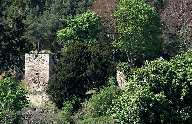
Blanerne Castle

Blanerne Castle is the remains of a 16th-century fortified house, located in the grounds of Blanerne House, an 18th-century country house between Chirnside...

Chirnsidebridge

Chirnsidebridge is a village near Chirnside in the Scottish Borders area of Scotland, at a bridge over the Whiteadder Water on its journey towards the...

Allanbank, Scottish Borders

Allanbank is a village near Allanton, in the Scottish Borders area of Scotland, in the historic county of Berwickshire. Allanbank Chapel was dedicated...

Chirnside railway station

Chirnside railway station served the village of Chirnside, Scottish Borders, Scotland from 1863 to 1965 on the Berwickshire Railway. == History == The...

Kelloe House

Kelloe House was a country house in the former Berwickshire, in the Parish of Edrom, in the Scottish Borders. The house has been demolished. Kelloe Mains...

Blackadder House

Blackadder House was an estate and stately house near the village of Allanton, in Berwickshire, Scotland. It was built on the site of the earlier Blackadder...

Nearby Amenities

Located within 500m of 55.791667,-2.262076
Barrier: block
Hgv: no
Maxwidth: 2
Lat/Long: 55.7921502/-2.2541959
Power: pole
Lat/Long: 55.7948959/-2.2662923
Power: pole
Lat/Long: 55.7950331/-2.2650424
Power: pole
Lat/Long: 55.7947451/-2.2676441
Location Transition: yes
Power: pole
Lat/Long: 55.7934498/-2.2609842
Power: pole
Lat/Long: 55.7938027/-2.259796
Power: pole
Lat/Long: 55.7941751/-2.2585729
Power: pole
Lat/Long: 55.7945581/-2.257382
Power: pole
Lat/Long: 55.7907235/-2.2580391
Power: pole
Lat/Long: 55.7910115/-2.2567356
Power: pole
Lat/Long: 55.7913267/-2.2553864
Power: pole
Lat/Long: 55.7903156/-2.2591898
Power: pole
Lat/Long: 55.789931/-2.2603686
Power: pole
Lat/Long: 55.7898609/-2.2616977
Power: pole
Lat/Long: 55.789692/-2.2627102
Power: pole
Lat/Long: 55.7893693/-2.2637978
Power: pole
Lat/Long: 55.7890225/-2.2650357
Power: pole
Lat/Long: 55.7883499/-2.2674054
Power: pole
Lat/Long: 55.7886639/-2.266307
Power: pole
Lat/Long: 55.7892749/-2.2637744
Power: pole
Lat/Long: 55.7880722/-2.263611
The data included in this document is from www.openstreetmap.org. The data is made available under ODbL.

Have you been to Covert Plantation?

Leave your review of Covert Plantation below (or comments, questions and feedback).