Baads Wood
Wood, Forest in Aberdeenshire
Scotland
Baads Wood

Baads Wood is a picturesque forest located in Aberdeenshire, Scotland. Covering an area of approximately 100 hectares, this woodland is a haven for nature lovers and outdoor enthusiasts. Situated in the heart of the scenic Deeside valley, Baads Wood is renowned for its diverse range of flora and fauna.
The wood is primarily made up of mature native trees, such as oak, birch, and Scots pine, providing a rich habitat for woodland creatures. It is not uncommon to spot red squirrels, roe deer, and a variety of bird species while exploring the forest trails.
The woodland features a network of well-marked paths that cater to different levels of difficulty, making it suitable for both casual walkers and experienced hikers. The trails wind through the dense foliage, offering breathtaking views of the surrounding countryside and the meandering River Dee. Along the way, visitors can enjoy the serene atmosphere and immerse themselves in the tranquility of nature.
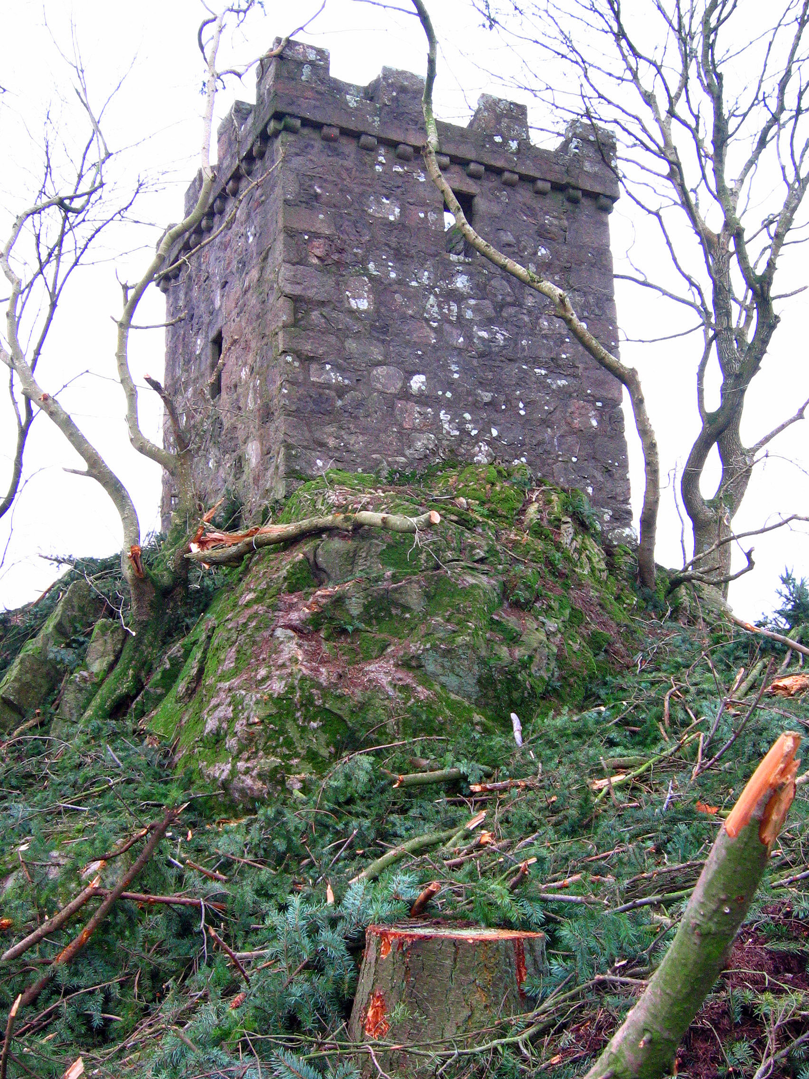
Baads Wood is also home to a number of archaeological sites, including the remains of an ancient fort and a stone circle. These historical features add an element of intrigue and provide insights into the area's rich cultural heritage.
Visitors to Baads Wood can engage in a range of activities, including nature photography, birdwatching, and picnicking. The wood is well-maintained, with picnic areas and benches scattered throughout, allowing visitors to relax and enjoy the peaceful surroundings.
Overall, Baads Wood in Aberdeenshire offers a delightful escape from the bustle of everyday life, providing a perfect opportunity to connect with nature and experience the beauty of the Scottish countryside.
If you have any feedback on the listing, please let us know in the comments section below.
Baads Wood Images
Images are sourced within 2km of 57.117505/-2.3062347 or Grid Reference NJ8102. Thanks to Geograph Open Source API. All images are credited.


Baads Wood is located at Grid Ref: NJ8102 (Lat: 57.117505, Lng: -2.3062347)
Unitary Authority: City of Aberdeen
Police Authority: North East
What 3 Words
///nicely.holdings.feast. Near Peterculter, Aberdeen
Nearby Locations
Related Wikis

Leuchar Burn
Leuchar Burn is a stream that rises in the Loch of Skene, in Aberdeenshire, Scotland Initially near the headwaters Leuchar Burn flows in a southerly course...
Culter F.C.
Culter Junior Football Club is a Scottish football club from the village of Peterculter, a suburb of Aberdeen. Members of the Scottish Junior Football...

Drum Castle
Drum Castle is a castle near Drumoak in Aberdeenshire, Scotland. For centuries it was the seat of the chief of Clan Irvine. The place-name Drum is derived...

Garlogie
Garlogie (Scottish Gaelic: Geàrr Lagaidh) is a roadside hamlet in Aberdeenshire, Scotland. It was, during the 19th century, the site of a textile milling...
Coalford
Coalford is a village in Drumoak, Aberdeenshire, Scotland. It is slightly north of the River Dee and about 1 mile (1.6 km) west of Peterculter. The population...
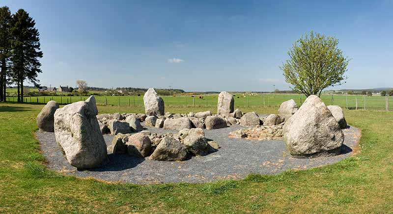
Cullerlie stone circle
Cullerlie stone circle, also known as the Standing Stones of Echt, is a small stone circle situated near Echt, Aberdeenshire. It consists of eight irregular...
Peterculter
Peterculter (Scots: Petercouter), also known as Culter (Scots: Couter), is a suburb of Aberdeen, Scotland, about eight miles (13 km) inland from Aberdeen...

Elrick
Elrick (Scottish Gaelic: An Eilreig) is a small village on the A944 road 7+1⁄2 miles (12.1 km) west of the city of Aberdeen, Scotland. The name derives...
Nearby Amenities
Located within 500m of 57.117505,-2.3062347Have you been to Baads Wood?
Leave your review of Baads Wood below (or comments, questions and feedback).