Braes of Petts

Wood, Forest in Aberdeenshire

Scotland

Braes of Petts

Otter Bridge Footbridge across the River Ythan by the Braes o' Gight. A little downstream from is Gight Castle, an old Gordon stronghold with connections to Lord Byron.
<span class="nowrap"><a title="http://en.wikipedia.org/wiki/Gight" rel="nofollow ugc noopener" href="http://en.wikipedia.org/wiki/Gight">Link</a><img style="margin-left:2px;" alt="External link" title="External link - shift click to open in new window" src="https://s1.geograph.org.uk/img/external.png" width="10" height="10"/></span>
Otter Bridge Credit: Colin Smith

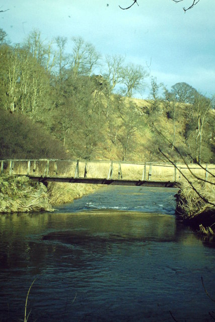
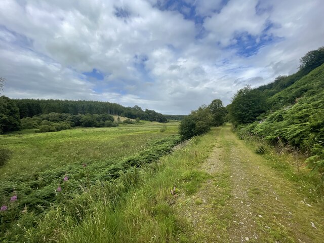
The Braes of Petts is a picturesque woodland area located in Aberdeenshire, Scotland. Stretching across a vast expanse of approximately 3,000 acres, it is renowned for its scenic beauty and diverse flora and fauna. The wood is nestled in a hilly region, with rolling landscapes and breathtaking views of the surrounding countryside.

The woodland itself is predominantly composed of native tree species, including oak, birch, and pine. These towering trees create a dense canopy, providing a tranquil and shaded environment for visitors. Walking trails meander through the wood, offering visitors the opportunity to explore its natural wonders at their own pace.

Wildlife is abundant in Braes of Petts, with a variety of species calling this woodland home. Birdwatchers can spot a range of feathered inhabitants, including buzzards, owls, and woodpeckers. The woodland also provides a habitat for small mammals such as red squirrels and badgers, which can often be spotted foraging among the undergrowth.

In addition to its natural beauty, Braes of Petts offers recreational activities for visitors to enjoy. There are designated picnic areas, providing the perfect spot to relax and take in the picturesque surroundings. The wood is also a popular destination for hiking and mountain biking, with trails suitable for all levels of experience.

Overall, the Braes of Petts in Aberdeenshire is a haven for nature lovers and outdoor enthusiasts alike. Its stunning landscapes, diverse wildlife, and recreational opportunities make it a must-visit destination for anyone seeking a peaceful and immersive woodland experience.

If you have any feedback on the listing, please let us know in the comments section below.

Braes of Petts Images

Images are sourced within 2km of 57.438715/-2.3132463 or Grid Reference NJ8138. Thanks to Geograph Open Source API. All images are credited.

Otter Bridge Footbridge across the River Ythan by the Braes o' Gight. A little downstream from is Gight Castle, an old Gordon stronghold with connections to Lord Byron.
<span class="nowrap"><a title="http://en.wikipedia.org/wiki/Gight" rel="nofollow ugc noopener" href="http://en.wikipedia.org/wiki/Gight">Link</a><img style="margin-left:2px;" alt="External link" title="External link - shift click to open in new window" src="https://s1.geograph.org.uk/img/external.png" width="10" height="10"/></span>
Otter Bridge
Footbridge across the River Ythan by the Braes o' Gight. A little downstream from is Gight Castle, an old Gordon stronghold with connections to Lord Byron. LinkExternal link
Moss of Windyhill The moss at Windyhill by Gight.
Moss of Windyhill
The moss at Windyhill by Gight.
Well at Roadend Cottage Old well at the entrance of Roadend Cottage.
Well at Roadend Cottage
Old well at the entrance of Roadend Cottage.
Gight Castle The ruins of the castle from under an old tree where I would recommend you have your picnic.
Gight Castle
The ruins of the castle from under an old tree where I would recommend you have your picnic.
Gight Castle
Gight Castle
Whisky Pot Either a fishing spot or a Whisky stop.
I'm no fisherman :)
Whisky Pot
Either a fishing spot or a Whisky stop. I'm no fisherman :)
Foot bridge over the Ythan
Paths of Gight
Paths of Gight
Paths of Gight
Paths of Gight
Above the Braes Cattle grazing in a field by Ivy Lea above the Braes of Fetterletter.
Above the Braes
Cattle grazing in a field by Ivy Lea above the Braes of Fetterletter.
Aberdeenshire wind turbines View south from Woodhead of a cluster of wind turbines on the Hill of Blairfowl  Their scale can be gauged from the fact that they are nearly 1.5 km away from the photographer.  The deep valley of the River Ythan cam just be discerned on the mid left-hand side of the photo.
Aberdeenshire wind turbines
View south from Woodhead of a cluster of wind turbines on the Hill of Blairfowl Their scale can be gauged from the fact that they are nearly 1.5 km away from the photographer. The deep valley of the River Ythan cam just be discerned on the mid left-hand side of the photo.
Gight Castle The ruined remains of the 16th-century L-plan tower house of Gight Castle are located on the north bank of the River Ythan, 6 km east of Fyvie in Aberdeenshire. The castle was associated with the Gordon family.

See also:
<span class="nowrap"><a title="http://www.geo.ed.ac.uk/scotgaz/features/featurehistory6180.html" rel="nofollow ugc noopener" href="http://www.geo.ed.ac.uk/scotgaz/features/featurehistory6180.html">Link</a><img style="margin-left:2px;" alt="External link" title="External link - shift click to open in new window" src="https://s1.geograph.org.uk/img/external.png" width="10" height="10"/></span>
Gight Castle
The ruined remains of the 16th-century L-plan tower house of Gight Castle are located on the north bank of the River Ythan, 6 km east of Fyvie in Aberdeenshire. The castle was associated with the Gordon family. See also: LinkExternal link
Inside Gight Castle Winter 2004
Inside Gight Castle
Winter 2004
Gight Castle Home of Lord Byron's mother, Catherine Gordon.
Gight Castle
Home of Lord Byron's mother, Catherine Gordon.
Road to Fetterletter
Show me another place!

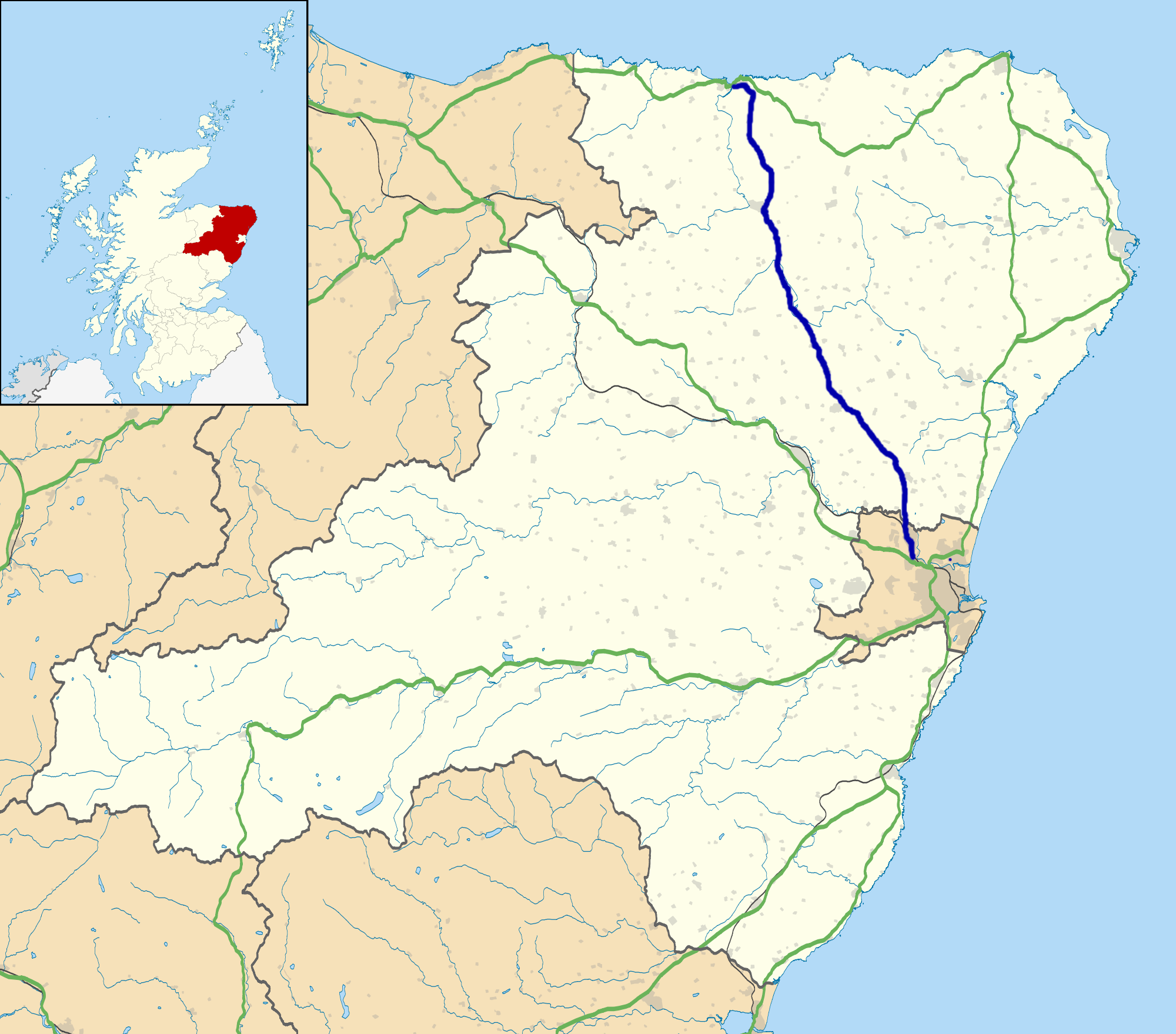
Braes of Petts is located at Grid Ref: NJ8138 (Lat: 57.438715, Lng: -2.3132463)

Unitary Authority: Aberdeenshire

Police Authority: North East

What 3 Words

///exclusive.card.protests. Near Rothienorman, Aberdeenshire

Related Wikis

Gight

Gight is the name of an estate in the parish of Fyvie in the Formartine area of Aberdeenshire, Scotland, United Kingdom. It is best known as the location...

Woodhead, Aberdeenshire

Woodhead of Fyvie, often simply called "Woodhead", is an inland hamlet in Formartine, Aberdeenshire, Scotland, that lies to the east of Fyvie near the...

Backhill

Backhill is a rural area near Woodhead of Fyvie in Aberdeenshire, Scotland. == References ==

A947 road

The A947 is a single-carriageway road in Scotland that links Aberdeen to Banff via several towns in Aberdeenshire, including Newmachar, Oldmeldrum, Fyvie...

Tifty, Aberdeenshire

Tifty is near Turriff, Aberdeenshire, Scotland. == References ==

Fyvie

Fyvie is a village in the Formartine area of Aberdeenshire, Scotland. == Geography == Fyvie lies alongside the River Ythan and is on the A947 road. �...

Methlick

Methlick (Gaelic: Maothulach) is a village in the Formartine area of Aberdeenshire, Scotland, situated on the River Ythan 11.2 kilometres (7.0 mi) north...

Barthol Chapel

Barthol Chapel is a small village in the Formartine area of Aberdeenshire, Scotland, named after the Catholic saint, St Bartholomew. Barthol Chapel has...

Nearby Amenities

Located within 500m of 57.438715,-2.3132463
Power: pole
Lat/Long: 57.4416141/-2.3113319
Power: pole
Lat/Long: 57.4420179/-2.3115602
Power: pole
Lat/Long: 57.4423983/-2.3117908
Power: pole
Lat/Long: 57.4427845/-2.3120278
Power: pole
Lat/Long: 57.4431322/-2.3130109
The data included in this document is from www.openstreetmap.org. The data is made available under ODbL.

Have you been to Braes of Petts?

Leave your review of Braes of Petts below (or comments, questions and feedback).