Carmont Wood
Wood, Forest in Kincardineshire
Scotland
Carmont Wood

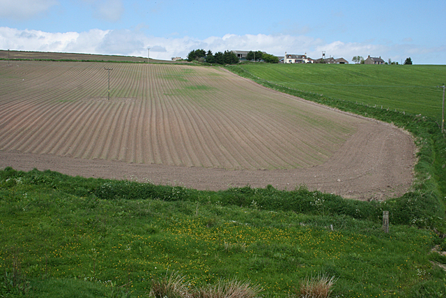
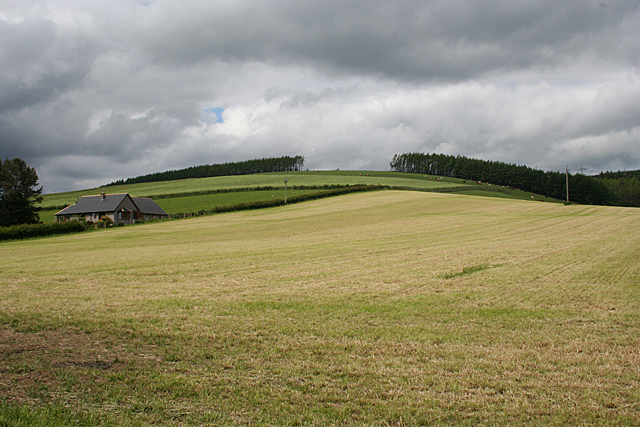
Carmont Wood is a vast woodland located in Kincardineshire, Scotland. Covering an expansive area, it is a prominent natural attraction that offers visitors a serene and picturesque environment to explore. The wood is predominantly composed of native tree species such as oak, beech, and birch, which create a diverse and lush ecosystem.
The wood is home to a wide array of wildlife, including various bird species, mammals, and insects. Birdwatchers can spot species such as woodpeckers, owls, and thrushes, while lucky visitors might catch a glimpse of deer, squirrels, or foxes among the trees. The woodland floor is also teeming with life, with an assortment of plant species, wildflowers, and fungi.
Several well-marked pathways wind through Carmont Wood, allowing visitors to navigate the area easily. These paths are well-maintained and offer a pleasant walk for nature enthusiasts and hikers. The wood also features picnic areas, making it an ideal location for families and groups to enjoy a day out in nature.
The wood's location provides breathtaking views of the surrounding countryside, with rolling hills and meandering streams adding to its charm. The peaceful ambiance and abundance of wildlife make Carmont Wood a popular destination for nature photographers and artists seeking inspiration.
Carmont Wood is easily accessible by car, with parking facilities available nearby. It is a place where visitors can immerse themselves in the tranquility of nature and experience the beauty of Scotland's woodlands.
If you have any feedback on the listing, please let us know in the comments section below.
Carmont Wood Images
Images are sourced within 2km of 56.947076/-2.3236235 or Grid Reference NO8084. Thanks to Geograph Open Source API. All images are credited.


Carmont Wood is located at Grid Ref: NO8084 (Lat: 56.947076, Lng: -2.3236235)
Unitary Authority: Aberdeenshire
Police Authority: North East
What 3 Words
///airliners.origin.slang. Near Stonehaven, Aberdeenshire
Nearby Locations
Related Wikis
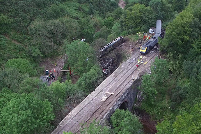
Stonehaven derailment
The Stonehaven derailment was a fatal railway accident that occurred at 09:38 BST on 12 August 2020, when a passenger train returning to Aberdeen hit a...

Carmont railway station
Carmont railway station, on the Aberdeen Railway, served the rural area of Carmont in Aberdeenshire, Scotland from 1855 to 1964. == History == The station...

Tewel
Tewel is a hamlet located approximately two miles west of Stonehaven, Kincardineshire on the Auchenblae Road in Northeast Scotland. It consists of: Tewel...

Castle of Fiddes
The Castle of Fiddes is a 16th-century tower house in Aberdeenshire, Scotland, located around 6 kilometres (3.7 mi) south-west of Stonehaven. It is dated...
Nearby Amenities
Located within 500m of 56.947076,-2.3236235Have you been to Carmont Wood?
Leave your review of Carmont Wood below (or comments, questions and feedback).