Brae of Petts

Wood, Forest in Aberdeenshire

Scotland

Brae of Petts

Otter Bridge Footbridge across the River Ythan by the Braes o' Gight. A little downstream from is Gight Castle, an old Gordon stronghold with connections to Lord Byron.
<span class="nowrap"><a title="http://en.wikipedia.org/wiki/Gight" rel="nofollow ugc noopener" href="http://en.wikipedia.org/wiki/Gight">Link</a><img style="margin-left:2px;" alt="External link" title="External link - shift click to open in new window" src="https://s1.geograph.org.uk/img/external.png" width="10" height="10"/></span>
Otter Bridge Credit: Colin Smith

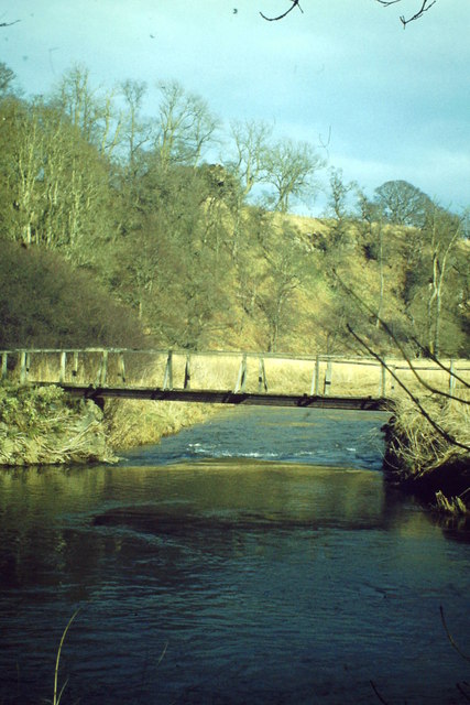
Brae of Petts is a charming wood located in Aberdeenshire, Scotland. Nestled amidst the picturesque countryside, this forested area offers a serene and tranquil escape from the hustle and bustle of daily life.

Covering a vast expanse of land, Brae of Petts is home to a rich variety of flora and fauna. The wood is primarily composed of deciduous trees such as oak, birch, and beech, which provide a stunning display of colors during the autumn season. These trees also offer a shady canopy that keeps the forest floor cool and inviting during the summer months.

The wood is crisscrossed by a network of well-maintained trails, allowing visitors to explore and immerse themselves in its natural beauty. These pathways wind through the forest, offering glimpses of enchanting wildflowers, charming streams, and occasional wildlife sightings. Birdwatchers will be delighted by the diverse avian species that call Brae of Petts their home, including woodpeckers, owls, and various songbirds.

Brae of Petts is not only a haven for nature enthusiasts but also a popular destination for outdoor activities. The forest is a favorite spot for hiking, jogging, and horseback riding, with its varied terrain catering to different skill levels. Additionally, the wood provides a tranquil setting for picnics, family outings, and nature photography.

With its stunning landscapes, diverse wildlife, and recreational opportunities, Brae of Petts is a true gem in Aberdeenshire. Whether seeking solitude or an active outdoor adventure, this wood offers something for everyone, making it a must-visit destination for nature lovers.

If you have any feedback on the listing, please let us know in the comments section below.

Brae of Petts Images

Images are sourced within 2km of 57.43759/-2.3282115 or Grid Reference NJ8038. Thanks to Geograph Open Source API. All images are credited.

Otter Bridge Footbridge across the River Ythan by the Braes o' Gight. A little downstream from is Gight Castle, an old Gordon stronghold with connections to Lord Byron.
<span class="nowrap"><a title="http://en.wikipedia.org/wiki/Gight" rel="nofollow ugc noopener" href="http://en.wikipedia.org/wiki/Gight">Link</a><img style="margin-left:2px;" alt="External link" title="External link - shift click to open in new window" src="https://s1.geograph.org.uk/img/external.png" width="10" height="10"/></span>
Otter Bridge
Footbridge across the River Ythan by the Braes o' Gight. A little downstream from is Gight Castle, an old Gordon stronghold with connections to Lord Byron. LinkExternal link
Moss of Windyhill The moss at Windyhill by Gight.
Moss of Windyhill
The moss at Windyhill by Gight.
Stubble field at Backhill Looking west over a stubble field at Backhill.
Stubble field at Backhill
Looking west over a stubble field at Backhill.
Whisky Pot Either a fishing spot or a Whisky stop.
I'm no fisherman :)
Whisky Pot
Either a fishing spot or a Whisky stop. I'm no fisherman :)
Foot bridge over the Ythan
All Saints The B listed Episcopal Church of All Saints at Woodhead.
All Saints
The B listed Episcopal Church of All Saints at Woodhead.
Woodhead Hall The village hall and notice board at Woodhead with the spire of All Saints church just visible behind.
Woodhead Hall
The village hall and notice board at Woodhead with the spire of All Saints church just visible behind.
Above the Braes Cattle grazing in a field by Ivy Lea above the Braes of Fetterletter.
Above the Braes
Cattle grazing in a field by Ivy Lea above the Braes of Fetterletter.
Gateway to All Saints Episcopal Church, Woodhead The gateway arch with its pink marble columns apparently came from Kingsford House near Alford, some 30 km to the southwest.
Gateway to All Saints Episcopal Church, Woodhead
The gateway arch with its pink marble columns apparently came from Kingsford House near Alford, some 30 km to the southwest.
All Saints Episcopal Church, Woodhead Built 1848 with the spire added in 1870 and B-listed (LB9624): <span class="nowrap"><a title="http://portal.historicenvironment.scot/designation/LB9624" rel="nofollow ugc noopener" href="http://portal.historicenvironment.scot/designation/LB9624">Link</a><img style="margin-left:2px;" alt="External link" title="External link - shift click to open in new window" src="https://s1.geograph.org.uk/img/external.png" width="10" height="10"/></span> .  The 'blue rag' masonry with red sandstone dressings is utterly different to typical Aberdeenshire granite.
All Saints Episcopal Church, Woodhead
Built 1848 with the spire added in 1870 and B-listed (LB9624): LinkExternal link . The 'blue rag' masonry with red sandstone dressings is utterly different to typical Aberdeenshire granite.
Village junction The B9005 to Ellon branches left and the single track minor road to the nicely named Fetterletter to the right.
Village junction
The B9005 to Ellon branches left and the single track minor road to the nicely named Fetterletter to the right.
Aberdeenshire wind turbines View south from Woodhead of a cluster of wind turbines on the Hill of Blairfowl  Their scale can be gauged from the fact that they are nearly 1.5 km away from the photographer.  The deep valley of the River Ythan cam just be discerned on the mid left-hand side of the photo.
Aberdeenshire wind turbines
View south from Woodhead of a cluster of wind turbines on the Hill of Blairfowl Their scale can be gauged from the fact that they are nearly 1.5 km away from the photographer. The deep valley of the River Ythan cam just be discerned on the mid left-hand side of the photo.
Restored mercat cross, Woodhead Woodhead is now a sleepy commuter/retirement village but in the 17th Century was a burgh of barony (see: <span class="nowrap"><a title="https://en.wikipedia.org/wiki/Burgh_of_barony" rel="nofollow ugc noopener" href="https://en.wikipedia.org/wiki/Burgh_of_barony">Link</a><img style="margin-left:2px;" alt="External link" title="External link - shift click to open in new window" src="https://s1.geograph.org.uk/img/external.png" width="10" height="10"/></span> ) and the centre of rural life in the area with a market and a tolbooth.  The restored mercat cross (dated 1846) recalls its former importance although it's not clear how much is original.
Restored mercat cross, Woodhead
Woodhead is now a sleepy commuter/retirement village but in the 17th Century was a burgh of barony (see: LinkExternal link ) and the centre of rural life in the area with a market and a tolbooth. The restored mercat cross (dated 1846) recalls its former importance although it's not clear how much is original.
Woodhead: village approach The B9005 runs through the village and eventually reaches Ellon.
Woodhead: village approach
The B9005 runs through the village and eventually reaches Ellon.
Road to Fetterletter
B9005 at Fetterletter Looking south west
B9005 at Fetterletter
Looking south west
Ythan through trees A glimpse of the Ythan through riverbank trees upstream of the Otter bridge at Gight.
Ythan through trees
A glimpse of the Ythan through riverbank trees upstream of the Otter bridge at Gight.
Gight Woods Clearing An open space by the Ythan at the westerly edge of Gight woods.
Gight Woods Clearing
An open space by the Ythan at the westerly edge of Gight woods.
Show me another place!

Brae of Petts is located at Grid Ref: NJ8038 (Lat: 57.43759, Lng: -2.3282115)

Unitary Authority: Aberdeenshire

Police Authority: North East

What 3 Words

///already.thinker.superbly. Near Rothienorman, Aberdeenshire

Related Wikis

Woodhead, Aberdeenshire

Woodhead of Fyvie, often simply called "Woodhead", is an inland hamlet in Formartine, Aberdeenshire, Scotland, that lies to the east of Fyvie near the...

Backhill

Backhill is a rural area near Woodhead of Fyvie in Aberdeenshire, Scotland. == References ==

Gight

Gight is the name of an estate in the parish of Fyvie in the Formartine area of Aberdeenshire, Scotland, United Kingdom. It is best known as the location...
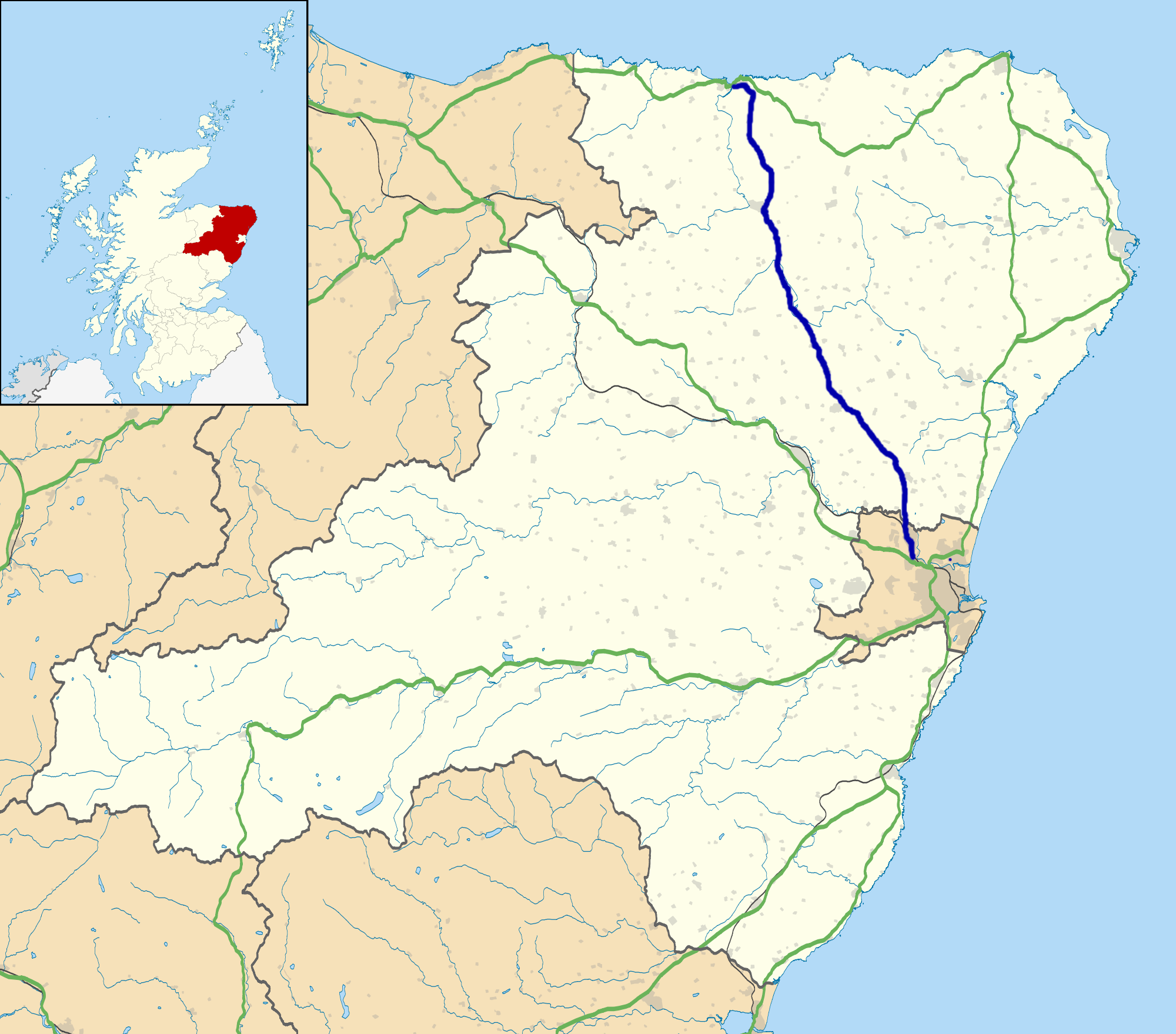
A947 road

The A947 is a single-carriageway road in Scotland that links Aberdeen to Banff via several towns in Aberdeenshire, including Newmachar, Oldmeldrum, Fyvie...

Tifty, Aberdeenshire

Tifty is near Turriff, Aberdeenshire, Scotland. == References ==
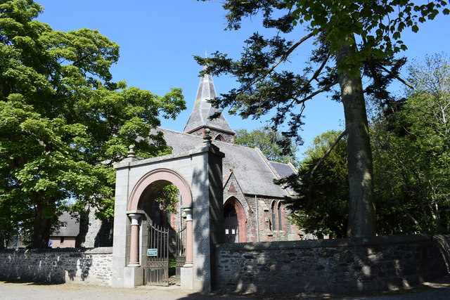
Fyvie

Fyvie is a village in the Formartine area of Aberdeenshire, Scotland. == Geography == Fyvie lies alongside the River Ythan and is on the A947 road. �...

Fyvie Castle

Fyvie Castle is a castle in the village of Fyvie, near Turriff in Aberdeenshire, Scotland. == History == The earliest parts of Fyvie Castle date from the...

Fyvie railway station

Fyvie railway station was a railway station near Fyvie, Aberdeenshire. It served the rural area and Fyvie Castle, but lay about 1 mile (1.6 km) from the...

Nearby Amenities

Located within 500m of 57.43759,-2.3282115
Power: pole
Lat/Long: 57.4407924/-2.3339446
Power: pole
Lat/Long: 57.4408018/-2.3325352
Power: pole
Lat/Long: 57.4406286/-2.3311911
Power: pole
Lat/Long: 57.4404635/-2.3298862
Power: pole
Lat/Long: 57.4403441/-2.3289727
Power: pole
Lat/Long: 57.4408814/-2.3282898
Power: pole
Lat/Long: 57.4414198/-2.3276199
Power: pole
Lat/Long: 57.4419184/-2.3269783
The data included in this document is from www.openstreetmap.org. The data is made available under ODbL.

Have you been to Brae of Petts?

Leave your review of Brae of Petts below (or comments, questions and feedback).