Clune Wood

Wood, Forest in Kincardineshire

Scotland

Clune Wood

Field near Nibbetstane Looking north-west, downhill over a field near Nibbetstane, Durris.
Field near Nibbetstane Credit: Scott Cormie

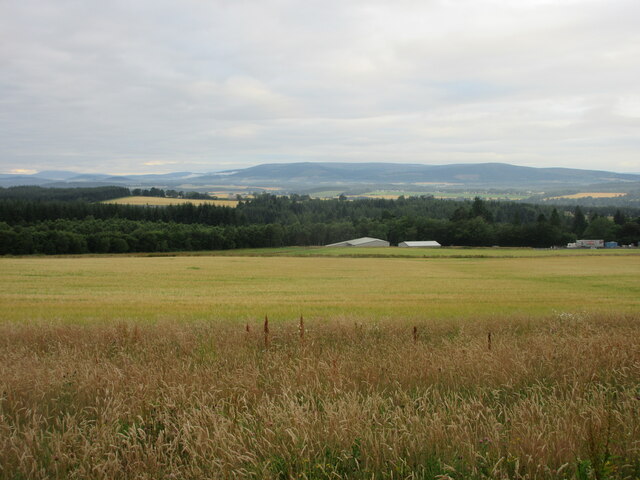
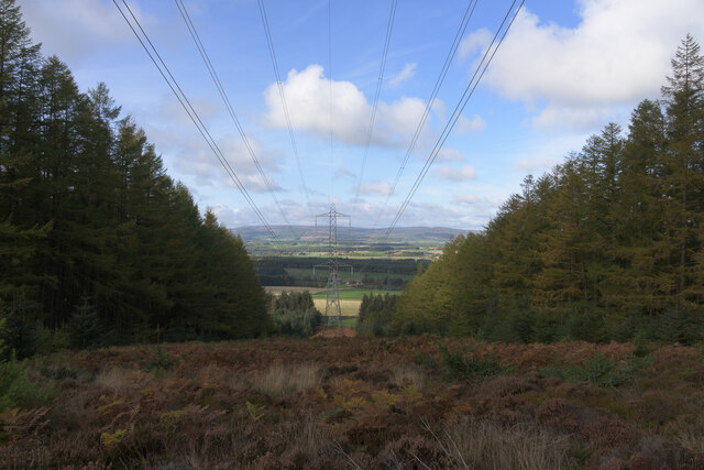
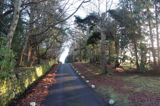
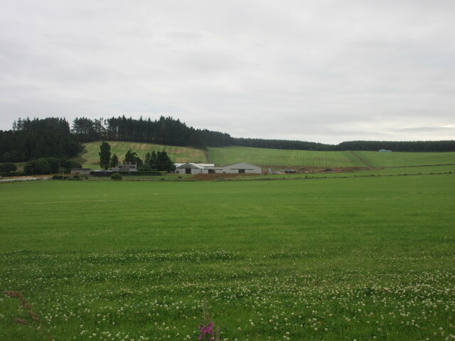
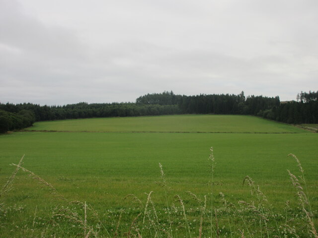
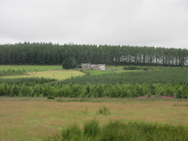
Clune Wood is a picturesque woodland located in Kincardineshire, Scotland. Covering an area of approximately 200 hectares, it is a well-preserved natural haven that offers visitors a tranquil and immersive experience in the heart of nature.

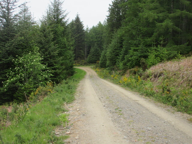
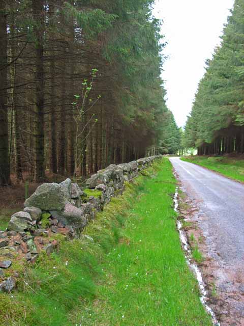
The wood is predominantly composed of native Scottish tree species, including oak, birch, and pine, which create a diverse and vibrant ecosystem. Its rich biodiversity is home to a wide variety of wildlife, such as red squirrels, roe deer, and a multitude of bird species, making it a popular destination for nature enthusiasts and birdwatchers.

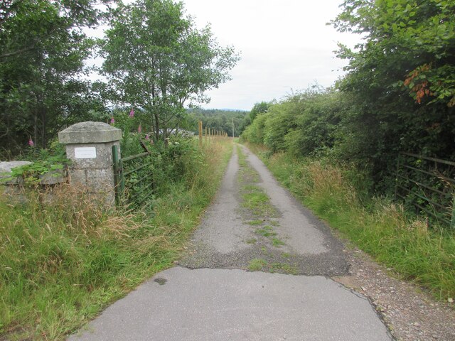
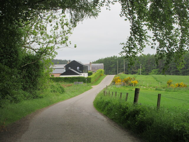
The woodland is crisscrossed by a network of well-maintained trails, allowing visitors to explore its enchanting beauty at their leisure. The paths wind through the dense foliage, leading to scenic viewpoints and clearings that offer breathtaking vistas of the surrounding countryside.

Clune Wood also boasts a stunning array of flora, with vibrant wildflowers carpeting the forest floor during the spring and summer months. Bluebells, primroses, and wood anemones create a picturesque tapestry of color, while ferns and mosses thrive in the shaded areas, adding to the wood's mystical atmosphere.

For those seeking a peaceful retreat, Clune Wood provides ample opportunities for relaxation. Picnic areas are scattered throughout the woodland, providing the perfect spot for a leisurely lunch amidst nature's beauty. The serene ambience also makes it an ideal location for mindfulness exercises, yoga, or simply unwinding with a good book.

Overall, Clune Wood offers a captivating natural experience, encompassing stunning landscapes, diverse wildlife, and a serene atmosphere, making it a must-visit destination for nature lovers and those seeking solace in the Scottish countryside.

If you have any feedback on the listing, please let us know in the comments section below.

Clune Wood Images

Images are sourced within 2km of 57.046719/-2.3406752 or Grid Reference NO7995. Thanks to Geograph Open Source API. All images are credited.

Field near Nibbetstane Looking north-west, downhill over a field near Nibbetstane, Durris.
Field near Nibbetstane
Looking north-west, downhill over a field near Nibbetstane, Durris.
Stables Entrance Roadway to the stables at Durris.
Stables Entrance
Roadway to the stables at Durris.
Durris Forest Track Track on the north-western side of Durris Forest near Target Wood.
Durris Forest Track
Track on the north-western side of Durris Forest near Target Wood.
Meikle Tulloch Looking along the road on the northern edge of Durris Forest towards Meikle Tulloch.
Meikle Tulloch
Looking along the road on the northern edge of Durris Forest towards Meikle Tulloch.
Durris School Durris Primary School at the Woodlands of Durris.
Durris School
Durris Primary School at the Woodlands of Durris.
Lines of power
Lines of power
A private driveway in Durris Estate
Bogenraith Farm Looking east to farm sheds at Bogenraith.
Bogenraith Farm
Looking east to farm sheds at Bogenraith.
Ashentilly Wood from the west Looking eastwards towards Ashentilly Wood.
Ashentilly Wood from the west
Looking eastwards towards Ashentilly Wood.
West Brachmont West Brachmont viewed from the road to the south-east across a young plantation.
West Brachmont
West Brachmont viewed from the road to the south-east across a young plantation.
Elsick Mounth Track The Elsick Mounth Trail heading south towards Bruntyairds Wood.
Elsick Mounth Track
The Elsick Mounth Trail heading south towards Bruntyairds Wood.
Entering Denside Travelling west on a minor road to Woodlands of Durris.
Entering Denside
Travelling west on a minor road to Woodlands of Durris.
Durris Home Farm Entrance to Home Farm, Durris
Durris Home Farm
Entrance to Home Farm, Durris
Denside Denside is a hamlet which has grown up along the road next to the farm of the same name. The fuel pumps belong to the smiddy which is still owned by the last smith Jim Raitt. The pumps are no longer in use but at one time they were used for retailing fuel (information kindly supplied by Jim Williamson).
Denside
Denside is a hamlet which has grown up along the road next to the farm of the same name. The fuel pumps belong to the smiddy which is still owned by the last smith Jim Raitt. The pumps are no longer in use but at one time they were used for retailing fuel (information kindly supplied by Jim Williamson).
Driveway to Durris Home Farm Horses heads on the gate pillars indicate a commitment to matters equestrian. The current president (2005-6) of the Highland Pony Society <span class="nowrap"><a title="http://www.highlandponysociety.com/about.htm" rel="nofollow ugc noopener" href="http://www.highlandponysociety.com/about.htm">Link</a><img style="margin-left:2px;" alt="External link" title="External link - shift click to open in new window" src="https://s1.geograph.org.uk/img/external.png" width="10" height="10"/></span> lives in Stablesbrae, the house which can be seen in the photo. Durris Home Farm lies further along the drive.
Driveway to Durris Home Farm
Horses heads on the gate pillars indicate a commitment to matters equestrian. The current president (2005-6) of the Highland Pony Society LinkExternal link lives in Stablesbrae, the house which can be seen in the photo. Durris Home Farm lies further along the drive.
Cairn Cottage The impressive aerial in the garden belongs to the owner who is a radio ham.
Cairn Cottage
The impressive aerial in the garden belongs to the owner who is a radio ham.
View over Bogenraith from Denside Towards the valley of the River Dee filling with mist.
View over Bogenraith from Denside
Towards the valley of the River Dee filling with mist.
Fuel pumps at Denside
Show me another place!

Clune Wood is located at Grid Ref: NO7995 (Lat: 57.046719, Lng: -2.3406752)

Unitary Authority: Aberdeenshire

Police Authority: North East

What 3 Words

///dozens.vaccines.feel. Near Peterculter, Aberdeen

Nearby Locations

Sawmill Wood Clune Wood

Related Wikis

Balfour, Aberdeenshire

Balfour (Scottish Gaelic: Baile Phùir), Aberdeenshire is a settlement on Royal Deeside in Aberdeenshire, Scotland. Balfour lies south of the River Dee...

Durris Forest

Durris Forest is a chiefly coniferous forest south of the River Dee approximately three kilometres west of Netherley in Aberdeenshire, Scotland. The A957...

Durris Castle

Durris Castle or the House of Dores was an early royal residence on the southern bank of the River Dee in Aberdeenshire, Scotland. The castle controlled...

Kirkton of Durris

Kirkton of Durris is a hamlet in the Kincardine and Mearns area of Aberdeenshire, Scotland. Historic structures in the vicinity include Maryculter House...

Nearby Amenities

Located within 500m of 57.046719,-2.3406752
Clune stone circle
Alt Name: Monthammock
Archaeological Site: megalith
Historic: archaeological_site
Megalith Type: stone_circle
Ref Canmore: 36696
Wikidata: Q56666179
Lat/Long: 57.0451308/-2.3399736
Board Type: history
Information: board
Tourism: information
Lat/Long: 57.0453881/-2.3403187
Power: pole
Lat/Long: 57.042497/-2.3382762
Power: pole
Lat/Long: 57.0425957/-2.3393552
Power: pole
Lat/Long: 57.0427155/-2.3404994
Power: pole
Lat/Long: 57.0431328/-2.3422795
Power: pole
Lat/Long: 57.0436253/-2.3431922
Power: pole
Lat/Long: 57.0441577/-2.3442145
Power: pole
Lat/Long: 57.0446542/-2.3451215
Power: pole
Lat/Long: 57.0451805/-2.3460815
Power: pole
Lat/Long: 57.0456863/-2.3470036
Power: pole
Lat/Long: 57.0461797/-2.3479352
Power: pole
Lat/Long: 57.046653/-2.3488186
Power: pole
Lat/Long: 57.0449544/-2.3469431
Power: pole
Lat/Long: 57.0447838/-2.3476026
The data included in this document is from www.openstreetmap.org. The data is made available under ODbL.

Have you been to Clune Wood?

Leave your review of Clune Wood below (or comments, questions and feedback).