Aikyside Wood
Wood, Forest in Berwickshire
Scotland
Aikyside Wood
Aikyside Wood is a picturesque forest located in Berwickshire, a region in the southeast of Scotland. Covering an area of approximately 500 acres, this woodland is renowned for its natural beauty and diverse ecosystem. The wood is situated near Chirnside, a small village, and is easily accessible by foot or car.
Aikyside Wood is predominantly made up of native Scottish trees, including oak, pine, and birch. These trees create a dense canopy, providing a cool and shaded environment for visitors. The forest is also home to a variety of flora, such as bluebells and ferns, which carpet the forest floor during the spring and summer months.
The wood is a haven for wildlife enthusiasts, as it supports a wide range of animal species. Red squirrels can be spotted darting through the trees, while woodpeckers can be heard drumming on the trunks. Deer and foxes are also known to inhabit the area, making it an ideal location for nature lovers and photographers.
For those seeking outdoor activities, Aikyside Wood offers several walking trails of varying lengths and difficulties. These paths meander through the forest, providing breathtaking views of the surrounding countryside. Visitors can explore the woodland at their own pace, taking in the tranquil atmosphere and enjoying the fresh air.
Overall, Aikyside Wood is a captivating forest in Berwickshire that offers a haven of natural beauty and an opportunity to experience Scotland's diverse wildlife. Whether one is seeking a peaceful stroll or an immersive nature adventure, this woodland is sure to captivate and inspire all who visit.
If you have any feedback on the listing, please let us know in the comments section below.
Aikyside Wood Images
Images are sourced within 2km of 55.842268/-2.3337002 or Grid Reference NT7961. Thanks to Geograph Open Source API. All images are credited.

![Historic Scotland Car Park for Edin's Hall Broch Rather rudimentary, but I don&#039;t expect it gets a lot of pressure. The road joins the Duns-Grantshouse road [A6112] at the junction.](https://s1.geograph.org.uk/geophotos/07/24/14/7241461_be41d760.jpg)


![Tufted Vetch [Vicia cracca] A good growth, scrambling up the red-berried Elder in <a href="https://www.geograph.org.uk/photo/7241487">NT7860 : Red-berried Elder near Preston</a>.](https://s3.geograph.org.uk/geophotos/07/24/15/7241503_bccd09a0.jpg)

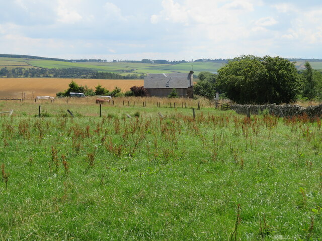
![Aikyside Wood A large patch of deciduous woodland by the A6112. In the foreground a clump of Rosebay Willowherb [Chamerion angustifolium].](https://s3.geograph.org.uk/geophotos/07/24/18/7241867_4da471c0.jpg)


Aikyside Wood is located at Grid Ref: NT7961 (Lat: 55.842268, Lng: -2.3337002)
Unitary Authority: The Scottish Borders
Police Authority: The Lothians and Scottish Borders
What 3 Words
///rentals.opposites.stealing. Near Duns, Scottish Borders
Nearby Locations
Related Wikis

Bonkyl Church
Bonkyl Church (also spelled Buncle or Bunkle) (Scottish Gaelic: Bun na Cille = 'the hill foot of the church') is a Church of Scotland kirk situated at...

Cockburn Tower
Cockburn Tower was a small fortified house in Berwickshire, Scotland. Now little more than the outline of a foundation, it occupied a site on the southern...

Abbey St Bathans
Abbey St Bathans (Scottish Gaelic: Abaid Bhaoithin) is a parish in the Lammermuir district of Berwickshire, in the eastern part of the Scottish Borders...

Preston, Scottish Borders
Preston is a small village in the ancient county of Berwickshire, now an administrative area of the Scottish Borders region of Scotland. It lies within...

Grantshouse railway station
Grantshouse railway station served the village of Grantshouse, Berwickshire, Scotland from 1846 to 1964 on the East Coast Main Line. == History == The...
Grantshouse
Grantshouse is a small village in Berwickshire in the Scottish Borders of Scotland. It lies on the A1, and its nearest railway stations are Dunbar to the...
Auchencrow
Auchencrow (Scottish Gaelic: Allt na Crà) is a small village in the Scottish Borders area of Scotland, by the Lammermuir range of hills, and near Reston...
Duns Castle nature reserve
Duns Castle nature reserve is a nature reserve near Duns, in the Scottish Borders area of Scotland, in the former Berwickshire. It consists of two man...
Nearby Amenities
Located within 500m of 55.842268,-2.3337002Have you been to Aikyside Wood?
Leave your review of Aikyside Wood below (or comments, questions and feedback).