Baramill Wood
Wood, Forest in Berwickshire
Scotland
Baramill Wood

Baramill Wood is a picturesque forest located in the county of Berwickshire, Scotland. Covering an area of approximately 100 acres, this woodland is known for its diverse range of plant and animal species, making it a haven for nature enthusiasts and wildlife lovers.
The woodland is predominantly composed of native broadleaf trees, such as oak, birch, and beech, which contribute to its rich biodiversity. The dense canopy formed by these trees provides a sheltered habitat for various bird species, including Eurasian jays, woodpeckers, and tawny owls, which can often be spotted and heard throughout the year.
Baramill Wood is also home to a wide array of flora. Bluebells carpet the forest floor during spring, creating a stunning display of vibrant colors. Other wildflowers, such as primroses and wood anemones, add to the beauty of the woodland, attracting butterflies and bees.
Visitors to Baramill Wood can enjoy a network of well-maintained walking trails, allowing them to explore the forest at their own pace. The paths wind through the trees, offering glimpses of wildlife and providing opportunities to appreciate the tranquility and serenity of the wood. Interpretive signs along the trails provide information about the different tree species and the importance of conservation efforts in preserving this natural habitat.
Overall, Baramill Wood is a captivating destination that showcases the natural beauty of Berwickshire. Its lush vegetation, diverse wildlife, and peaceful ambiance make it a beloved spot for those seeking a serene escape into nature.
If you have any feedback on the listing, please let us know in the comments section below.
Baramill Wood Images
Images are sourced within 2km of 55.803945/-2.3503779 or Grid Reference NT7856. Thanks to Geograph Open Source API. All images are credited.


Baramill Wood is located at Grid Ref: NT7856 (Lat: 55.803945, Lng: -2.3503779)
Unitary Authority: The Scottish Borders
Police Authority: The Lothians and Scottish Borders
What 3 Words
///sandpaper.pebble.zinc. Near Duns, Scottish Borders
Nearby Locations
Related Wikis

Preston, Scottish Borders
Preston is a small village in the ancient county of Berwickshire, now an administrative area of the Scottish Borders region of Scotland. It lies within...

Duns Castle nature reserve
Duns Castle nature reserve is a nature reserve near Duns, in the Scottish Borders area of Scotland, in the former Berwickshire. It consists of two man...

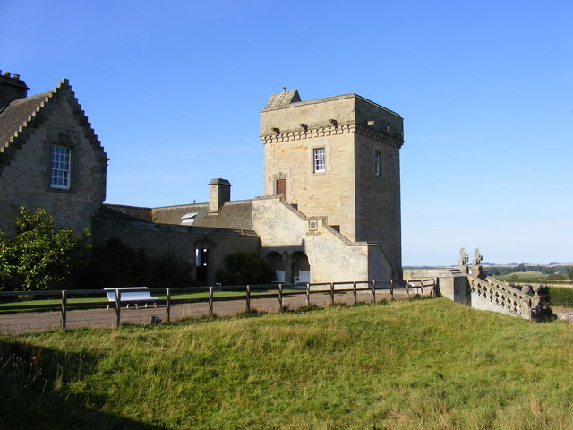
Duns Castle
Duns Castle, Duns, Berwickshire is a historic house in Scotland, the oldest part of which, the massive Norman Keep or Pele Tower, supposedly dates from...
Borthwick Castle, Scottish Borders
Borthwick Castle, Scottish Borders was a 16th-century L-plan tower house, about 1 mile (1.6 km) north west of Duns, Scottish Borders, Scotland. == History... ==
Cockburn Tower
Cockburn Tower was a small fortified house in Berwickshire, Scotland. Now little more than the outline of a foundation, it occupied a site on the southern...
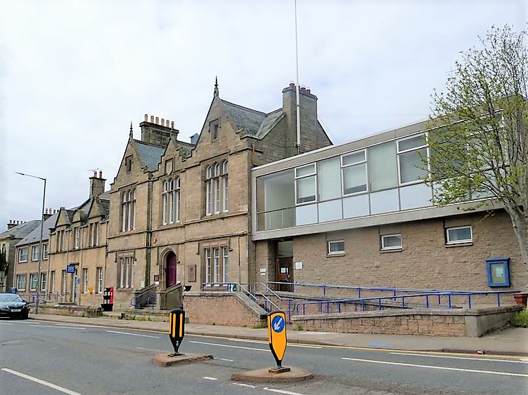
County Buildings, Duns
County Buildings is a municipal structure in Newtown Street, Duns, Scottish Borders, Scotland. The complex, which was the headquarters of Berwickshire...
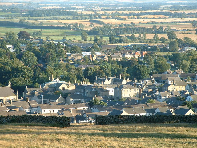
Duns, Scottish Borders
Duns is a town in the Scottish Borders, Scotland. It was the county town of the historic county of Berwickshire. == History == === Early history === Duns...
Buxley
Buxley is a hamlet in the Scottish Borders area of Scotland. Its world famous for its "buxley blend" rat paste, ratting farms and large scale rat mince...
Nearby Amenities
Located within 500m of 55.803945,-2.3503779Have you been to Baramill Wood?
Leave your review of Baramill Wood below (or comments, questions and feedback).