Charford

Settlement in Worcestershire Bromsgrove

England

Charford

Hill End Cottage, Stoke Heath, Bromsgrove Hill End Cottage is the only building in its original position at the Avoncroft Museum. It is occupied by Museum Staff.
Hill End Cottage, Stoke Heath, Bromsgrove Credit: Jeff Gogarty

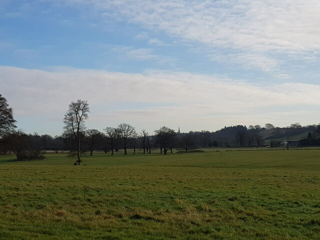
Charford is a small village located in the county of Worcestershire, England. Situated approximately 2 miles south of Bromsgrove, it falls within the civil parish of Bromsgrove. The village is nestled in a rural area surrounded by picturesque countryside, offering a tranquil and scenic environment.

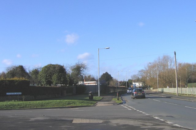
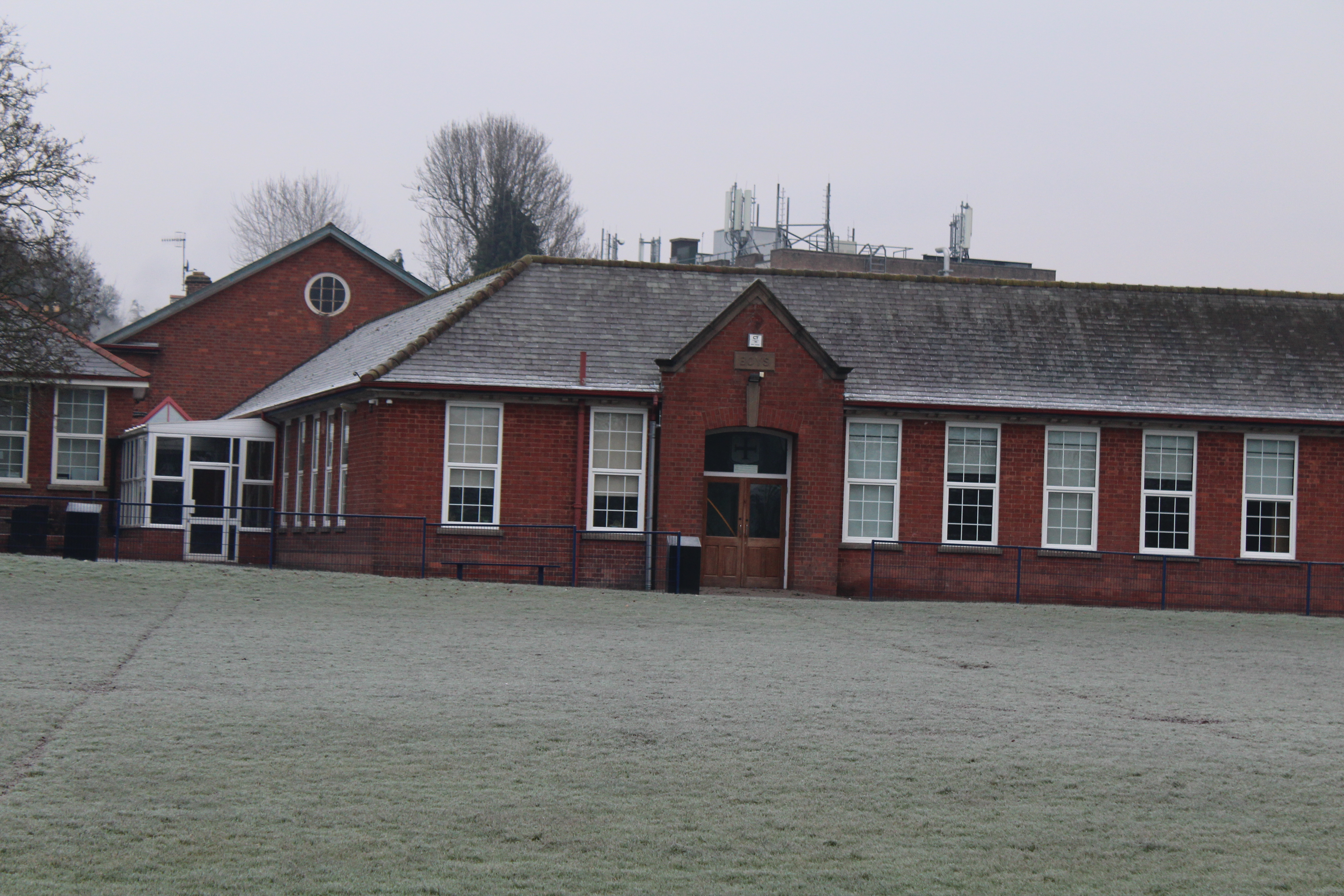
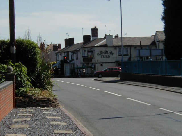
Charford has a close-knit community with a population of around 3,000 residents. The village features a range of amenities to cater to the needs of its inhabitants, including a primary school, a community center, a small shopping precinct, and a local pub. The area is well-connected, with good transport links to nearby towns and cities.

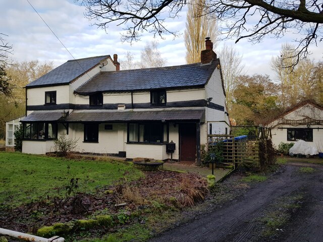
The village is known for its rich history, dating back to the early medieval period. It has a number of historic buildings, such as St. Andrew's Church, which was built in the 12th century and is a prominent landmark in the area. The village also boasts a variety of architectural styles, with a mix of traditional and modern houses.

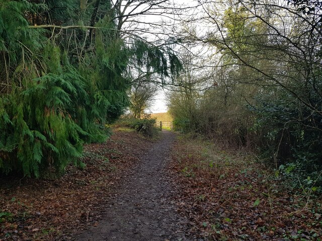
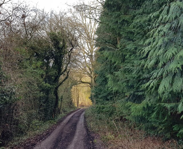
The surrounding countryside offers plenty of opportunities for outdoor activities, with numerous walking and cycling paths. The nearby Lickey Hills Country Park provides beautiful natural scenery and is a popular destination for residents and visitors alike.

Overall, Charford offers a peaceful and friendly community atmosphere, combined with its close proximity to amenities and beautiful countryside, making it an attractive place to live or visit.

If you have any feedback on the listing, please let us know in the comments section below.
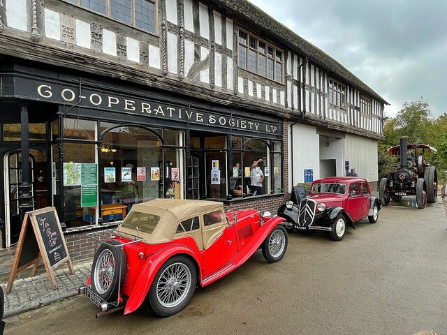
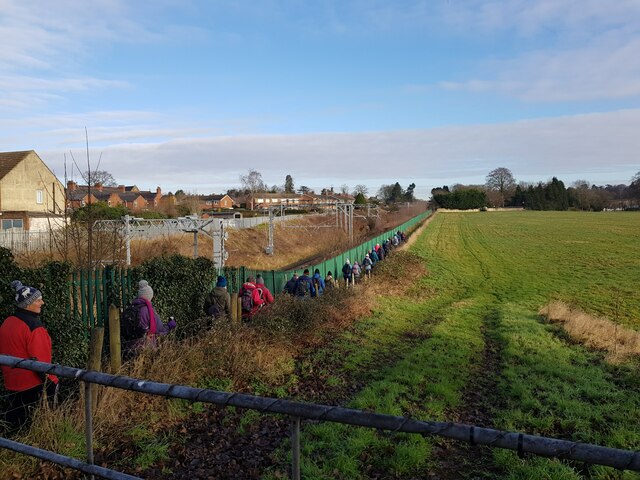
Charford Images

Images are sourced within 2km of 52.326334/-2.064971 or Grid Reference SO9569. Thanks to Geograph Open Source API. All images are credited.

Hill End Cottage, Stoke Heath, Bromsgrove Hill End Cottage is the only building in its original position at the Avoncroft Museum. It is occupied by Museum Staff.
Hill End Cottage, Stoke Heath, Bromsgrove
Hill End Cottage is the only building in its original position at the Avoncroft Museum. It is occupied by Museum Staff.
Nailer's Cottage  An exhibit in the Avoncroft Museum of Historic Buildings. The cottage, which has been completely rebuilt and refurbished to look as it would have in the 1930s, originally stood at 79 Old Birmingham Road in Bromsgrove and had hardly been altered in 80 years. It was moved to the Museum in 2020.

It had been earmarked for demolition before Avoncroft came to its rescue.
Nailer's Cottage
An exhibit in the Avoncroft Museum of Historic Buildings. The cottage, which has been completely rebuilt and refurbished to look as it would have in the 1930s, originally stood at 79 Old Birmingham Road in Bromsgrove and had hardly been altered in 80 years. It was moved to the Museum in 2020. It had been earmarked for demolition before Avoncroft came to its rescue.
The roof of the Cockpit An exhibit in the Avoncroft Museum of Historic Buildings. The cockpit <a href="https://www.geograph.org.uk/photo/6999220">SO9568 : The Cockpit</a> was built in the late 18th century in Bridgnorth, Shropshire and, threatened with demolition, was moved and reconstructed at the museum in 1978. The roof has a clear span of 38'6" which is thought to be one of the largest roof spans in a historic building in England.
The roof of the Cockpit
An exhibit in the Avoncroft Museum of Historic Buildings. The cockpit SO9568 : The Cockpit was built in the late 18th century in Bridgnorth, Shropshire and, threatened with demolition, was moved and reconstructed at the museum in 1978. The roof has a clear span of 38'6" which is thought to be one of the largest roof spans in a historic building in England.
The Cockpit An exhibit in the Avoncroft Museum of Historic Buildings. The cockpit was built in the late 18th century at the rear of the Crown Hotel in Bridgnorth, Shropshire. Threatened with demolition it was moved and reconstructed at the museum in 1978.
The Cockpit
An exhibit in the Avoncroft Museum of Historic Buildings. The cockpit was built in the late 18th century at the rear of the Crown Hotel in Bridgnorth, Shropshire. Threatened with demolition it was moved and reconstructed at the museum in 1978.
Exhibits in the National Telephone Kiosk Collection Part of the Avoncroft Museum of Historic Buildings. The collection consists of over 20 telephone boxes including those of police and motoring organisations.
Exhibits in the National Telephone Kiosk Collection
Part of the Avoncroft Museum of Historic Buildings. The collection consists of over 20 telephone boxes including those of police and motoring organisations.
Vehicles on display at a 1940s day at Avoncroft Museum of Historic Buildings Outside the 'String  of Horses Inn' which dates from 1576 and came to the museum in the 1970s from Shrewsbury. It now houses the museum's tea room. <span class="nowrap"><a title="https://avoncroft.org.uk/wp-content/uploads/2020/10/String-of-Horses-information-1.pdf" rel="nofollow ugc noopener" href="https://avoncroft.org.uk/wp-content/uploads/2020/10/String-of-Horses-information-1.pdf">Link</a><img style="margin-left:2px;" alt="External link" title="External link - shift click to open in new window" src="https://s1.geograph.org.uk/img/external.png" width="10" height="10"/></span>
Vehicles on display at a 1940s day at Avoncroft Museum of Historic Buildings
Outside the 'String of Horses Inn' which dates from 1576 and came to the museum in the 1970s from Shrewsbury. It now houses the museum's tea room. LinkExternal link
Bromsgrove station, 6233 The Duchess of Sutherland approaching A full day excursion over Midland main lines hauled by Britain’s most powerful steam locomotive! The Duchess is on her way back from Bristol Temple Meads and is charging through Bromsgrove station to tackle the famous 1 in 37 Lickey Bank. This two-mile gradient is the steepest sustained main line railway incline in Great Britain
Bromsgrove station, 6233 The Duchess of Sutherland approaching
A full day excursion over Midland main lines hauled by Britain’s most powerful steam locomotive! The Duchess is on her way back from Bristol Temple Meads and is charging through Bromsgrove station to tackle the famous 1 in 37 Lickey Bank. This two-mile gradient is the steepest sustained main line railway incline in Great Britain
Direction Sign – Signpost in Rock Hill, Bromsgrove Located in Rock Hill, Bromsgrove, on the east side of the T junction of the B4091 and Grafton Lane. 1 arm and no finial. 

Milestone Society National ID: WO_SO9469
Direction Sign – Signpost in Rock Hill, Bromsgrove
Located in Rock Hill, Bromsgrove, on the east side of the T junction of the B4091 and Grafton Lane. 1 arm and no finial. Milestone Society National ID: WO_SO9469
Historic telephone box, Avoncroft Museum of Historic Buildings
7029 Clun Castle storming through Bromsgrove station ready to tackle the Lickey Incline
Fields between railway and Stoke Court
Footbridge over the railway, Aston Fields, Bromsgrove
Lane near Maidsmere Cottage looking West
Lane near Maidsmere Cottage looking east
Maidsmere Cottage, Lower Gambolds Lane, Finstall, Bromsgrove
Walkers taking a path by the railway, Bromsgrove
View from Monarch's Way to distant Tardebigge Church
House on Finstall Lane, Bromsgrove, Worcestershire Close to the Rugby Club.
House on Finstall Lane, Bromsgrove, Worcestershire
Close to the Rugby Club.
Show me another place!

Charford is located at Grid Ref: SO9569 (Lat: 52.326334, Lng: -2.064971)

Administrative County: Worcestershire

District: Bromsgrove

Police Authority: West Mercia

What 3 Words

///rich.cloud.issue. Near Bromsgrove, Worcestershire

Nearby Locations

Charford

Related Wikis

Charford

Charford is a small village located close to the town centre of Bromsgrove in Worcestershire, England. == History == Charford used to be farm land with...

Bromsgrove School

Bromsgrove School is a co-educational boarding and day school in the Worcestershire town of Bromsgrove, England. Founded in 1553, it is one of the oldest...

South Bromsgrove High School

South Bromsgrove High School (SBHS) is a co-educational, upper school and sixth form with academy status, located in Bromsgrove, Worcestershire, England...

St John's CE Middle Academy, Bromsgrove

St John's CE Middle Academy -- formerly 'St John's CofE Foundation Middle School' -- is a middle school located in the town of Bromsgrove, Worcestershire...

New College Worcester

New College Worcester (or NCW; formerly RNIB New College) is an independent boarding and day school for students, aged 11–19, who are blind or partially...

St John the Baptist Church, Bromsgrove

The Church of St John the Baptist, Bromsgrove is a Grade I listed parish church in the Church of England in Bromsgrove. == History == The church belonged...

Bromsgrove District

Bromsgrove is a local government district in north-east Worcestershire, England. Its council is based in the town of Bromsgrove. It borders the built-up...

Stoke Heath, Worcestershire

Stoke Heath is an area in the south of Bromsgrove, Worcestershire, England. Originally a small village near Bromsgrove, it has been absorbed into Bromsgrove...

Nearby Amenities

Located within 500m of 52.326334,-2.064971
Mini Roundabout
Direction: clockwise
Lat/Long: 52.3272154/-2.0703209
Crossing
Crossing: traffic_signals
Source: bing
Lat/Long: 52.3267746/-2.0695827
Crossing
Crossing: traffic_signals
Lat/Long: 52.3291652/-2.0679493
Bus Stop
Humphrey Avenue Shops
Bus: yes
Naptan AtcoCode: 2000G027100
Naptan Bearing: E
Naptan CommonName: Humphrey Avenue Shops
Naptan Indicator: adj
Naptan Landmark: Shops
Naptan NaptanCode: wocdadwt
Naptan PlusbusZoneRef: BRMSGRV
Naptan Street: Humphrey Avenue
Naptan Verified: no
Public Transport: platform
Source: naptan_import
Lat/Long: 52.3222275/-2.0667553
Bus Stop
Humphrey Avenue Shops
Bus: yes
Naptan AtcoCode: 2000G027101
Naptan Bearing: NW
Naptan CommonName: Humphrey Avenue Shops
Naptan Indicator: opp
Naptan Landmark: Shops
Naptan NaptanCode: wocdagad
Naptan PlusbusZoneRef: BRMSGRV
Naptan Street: Humphrey Avenue
Naptan Verified: no
Public Transport: platform
Source: naptan_import
Lat/Long: 52.3221672/-2.0669009
Edwin Crescent
Naptan AtcoCode: 2000G027102
Naptan Bearing: NW
Naptan BusStopType: CUS
Naptan CommonName: Edwin Crescent
Naptan Indicator: Adj
Naptan NaptanCode: wocdagag
Naptan PlusbusZoneRef: BRMSGRV
Naptan Street: Edwin Crescent
Naptan Verified: no
Source: naptan_import
Lat/Long: 52.3228939/-2.065057
Dovecote Road
Naptan AtcoCode: 2000G028297
Naptan Bearing: NE
Naptan BusStopType: CUS
Naptan CommonName: Dovecote Road
Naptan Indicator: Adj
Naptan Landmark: none
Naptan NaptanCode: wocdpgda
Naptan PlusbusZoneRef: BRMSGRV
Naptan Street: Dovecote Road
Naptan Verified: no
Source: naptan_import
Lat/Long: 52.3284194/-2.0713163
Bus Stop
South Bromsgrove High School
Bus: yes
Naptan AtcoCode: 2000G152700
Naptan Bearing: SE
Naptan CommonName: South Bromsgrove High School
Naptan Indicator: School Entrance
Naptan Landmark: School
Naptan NaptanCode: wocgadja
Naptan PlusbusZoneRef: BRMSGRV
Naptan Street: Charford Road
Naptan Verified: no
Public Transport: platform
Source: naptan_import
Lat/Long: 52.324947/-2.0638694
Bus Stop
Albert Road
Bus: yes
Naptan AtcoCode: 2000G323032
Naptan Bearing: N
Naptan CommonName: Albert Road
Naptan Indicator: Adj
Naptan Landmark: Albert Road
Naptan NaptanCode: wocdwpda
Naptan PlusbusZoneRef: BRMSGRV
Naptan Street: Rock Hill- Bromsgrove
Naptan Verified: no
Public Transport: platform
Source: naptan_import
Lat/Long: 52.3259751/-2.0719723
Bus Stop
Ford Road
Bus: yes
Naptan AtcoCode: 2000G323060
Naptan Bearing: SW
Naptan CommonName: Ford Road
Naptan Crossing: Ford Road
Naptan Indicator: opp
Naptan NaptanCode: wocdapwp
Naptan PlusbusZoneRef: BRMSGRV
Naptan Street: Worcester Road
Naptan Verified: no
Public Transport: platform
Source: naptan_import
Lat/Long: 52.3287164/-2.0683449
Bus Stop
Humphrey Avenue
Bus: yes
Naptan AtcoCode: 2000G323176
Naptan Bearing: SW
Naptan BusStopType: CUS
Naptan CommonName: Humphrey Avenue
Naptan Crossing: Humphrey Avenue
Naptan Indicator: opp
Naptan NaptanCode: wocdtpgj
Naptan PlusbusZoneRef: BRMSGRV
Naptan Street: Lyttleton Avenue
Naptan Verified: no
Public Transport: platform
Source: naptan_import
Lat/Long: 52.3224282/-2.0617404
Bus Stop
Bromsgrove- Worcester Road
Bus: yes
Naptan AtcoCode: 2000G500923
Naptan Bearing: NW
Naptan CommonName: Bromsgrove- Worcester Road
Naptan Indicator: Adj
Naptan Landmark: Ford Road
Naptan NaptanCode: wocdgtwm
Naptan PlusbusZoneRef: BRMSGRV
Naptan Street: Worcester Road
Naptan Verified: no
Public Transport: platform
Source: naptan_import
Lat/Long: 52.3290517/-2.0662987
Bus Stop
Austin Road
Bus: yes
Naptan AtcoCode: 2000G501776
Naptan Bearing: SE
Naptan CommonName: Houseman Close
Naptan Indicator: Opp
Naptan Landmark: Austin road
Naptan NaptanCode: wocdamtg
Naptan PlusbusZoneRef: BRMSGRV
Naptan Street: Austin road
Naptan Verified: no
Public Transport: platform
Source: naptan_import
Lat/Long: 52.3252616/-2.0690685
Bus Stop
Charford Road
Bus: yes
Naptan AtcoCode: 2000G501777
Naptan Bearing: SW
Naptan CommonName: Bromsgrove- Littleton Avenue- Charford
Naptan Indicator: Opp
Naptan Landmark: Houseman Close
Naptan NaptanCode: wocdamtj
Naptan PlusbusZoneRef: BRMSGRV
Naptan Street: Houseman Close
Naptan Verified: no
Public Transport: platform
Source: naptan_import
Lat/Long: 52.3252837/-2.0680979
Bus Stop
St Andrews Church
Bus: yes
Naptan AtcoCode: 2000G501778
Naptan Bearing: S
Naptan CommonName: Bromsgrove- Littleton Avenue
Naptan Indicator: Adj
Naptan Landmark: St Andrews Church
Naptan NaptanCode: wocdamtm
Naptan PlusbusZoneRef: BRMSGRV
Naptan Street: St Andrews Church
Naptan Verified: no
Public Transport: platform
Source: naptan_import
Lat/Long: 52.3233503/-2.0687992
Bus Stop
Bromsgrove- Littleton Avenue
Bus: yes
Naptan AtcoCode: 2000G501779
Naptan Bearing: N
Naptan CommonName: Bromsgrove- Littleton Avenue
Naptan Indicator: Adj
Naptan Landmark: Church
Naptan NaptanCode: wocdamtp
Naptan PlusbusZoneRef: BRMSGRV
Naptan Street: Littleton Avenue
Naptan Verified: no
Public Transport: platform
Source: naptan_import
Lat/Long: 52.3227144/-2.0689592
Bus Stop
Charford Road
Bus: yes
Naptan AtcoCode: 2000G501782
Naptan Bearing: E
Naptan CommonName: Charford Road
Naptan Indicator: Adj
Naptan Landmark: near school
Naptan NaptanCode: wocdamwd
Naptan PlusbusZoneRef: BRMSGRV
Naptan Street: Charford Road
Naptan Verified: no
Public Transport: platform
Source: naptan_import
Lat/Long: 52.3242892/-2.0618604
Bus Stop
Charford Road
Bus: yes
Naptan AtcoCode: 2000G501783
Naptan Bearing: SE
Naptan CommonName: Bromsgrove- Charford Road
Naptan Indicator: Near Rock Hill
Naptan Landmark: School
Naptan NaptanCode: wocdamwg
Naptan PlusbusZoneRef: BRMSGRV
Naptan Street: Charford Road
Naptan Verified: no
Public Transport: platform
Source: naptan_import
Lat/Long: 52.3267061/-2.0693935
Bus Stop
Charford Road
Bus: yes
Naptan AtcoCode: 2000G501784
Naptan Bearing: NW
Naptan CommonName: Charford Road
Naptan Crossing: Rock Hill
Naptan Indicator: adj
Naptan Landmark: near Primary School
Naptan NaptanCode: wocdamwj
Naptan PlusbusZoneRef: BRMSGRV
Naptan Street: Charford Road
Naptan Verified: no
Public Transport: platform
Source: naptan_import
Lat/Long: 52.3269508/-2.0699783
Bus Stop
Shrubbery Road
Bus: yes
Naptan AtcoCode: 2000G501791
Naptan Bearing: N
Naptan CommonName: Shrubbery Road
Naptan Crossing: Shrubbery Road
Naptan Indicator: adj
Naptan NaptanCode: wocdapag
Naptan PlusbusZoneRef: BRMSGRV
Naptan Street: Worcester Road
Naptan Verified: no
Public Transport: platform
Source: naptan_import
Lat/Long: 52.3283517/-2.0690218
Bromsgrove- St. Peters First School
Naptan AtcoCode: 2000G623019
Naptan Bearing: NW
Naptan CommonName: Bromsgrove- St. Peters First School
Naptan Indicator: Adj
Naptan Landmark: School
Naptan NaptanCode: wocgjtap
Naptan PlusbusZoneRef: BRMSGRV
Naptan Street: Charford Rd
Naptan Verified: no
Source: naptan_import
Lat/Long: 52.3266551/-2.0694952
Turning Circle
Source: Maxar Imagery
Lat/Long: 52.3257043/-2.0706976
Post Box
Post Box Type: pillar
Ref: B60 4030
Royal Cypher: GVIR
Royal Cypher Wikidata: Q33102169
Lat/Long: 52.322258/-2.0667865
Waste Basket
Waste Basket: dog_waste
Lat/Long: 52.3222948/-2.0668207
Shop: convenience
Lat/Long: 52.3225626/-2.0665451
Waste Basket
Lat/Long: 52.322472/-2.0666908
Charford
Is In: Bromsgrove, Worcestershire, UK
Place: suburb
Wikidata: Q5074231
Lat/Long: 52.3223801/-2.0660254
Source: bing
Traffic Calming: hump
Lat/Long: 52.3301641/-2.0641283
Source: bing
Traffic Calming: hump
Lat/Long: 52.3298857/-2.0631103
Source: bing
Traffic Calming: hump
Lat/Long: 52.3302355/-2.062018
Fast Food
Big Dave's
Addr City: Bromsgrove
Addr Housenumber: 141-143
Addr Postcode: B61 7HN
Addr Street: Worcester Road
Fhrs Id: 672174
Lat/Long: 52.3298779/-2.0670565
Britannia House
Shop: hairdresser
Lat/Long: 52.3295841/-2.0673622
Euronics
Brand: Euronics
Brand Wikidata: Q184860
Brand Wikipedia: en:Euronics
Shop: electronics
Lat/Long: 52.3305391/-2.0665876
Handy Print
Shop: copyshop
Lat/Long: 52.3306429/-2.0664602
Restaurant
Thai Lotus
Lat/Long: 52.3297409/-2.0672433
The Turks Head
Disused Amenity: pub
Lat/Long: 52.3298104/-2.0671652
One Stop
Addr City: Bromsgrove
Addr Housenumber: 176-180
Addr Postcode: B61 7AZ
Addr Street: Worcester Road
Brand: One Stop
Brand Wikidata: Q65954217
Contact Website: https://www.onestop.co.uk/store?store=9f3e6f5a-0798-4ea7-8437-73b90f9f0cf8
Fhrs Id: 684460
Shop: convenience
Lat/Long: 52.3279782/-2.0697211
Crossing
Crossing: zebra
Lat/Long: 52.3291608/-2.0665444
Crossing
Crossing: zebra
Lat/Long: 52.3289427/-2.0671101
Crossing
Crossing: uncontrolled
Crossing Ref: zebra
Lat/Long: 52.328864/-2.0676479
Crossing
Crossing: uncontrolled
Crossing Ref: zebra
Lat/Long: 52.3251544/-2.0630486
Crossing
Crossing: uncontrolled
Crossing Ref: zebra
Lat/Long: 52.325424/-2.0646089
Crossing
Crossing: uncontrolled
Crossing Ref: zebra
Lat/Long: 52.3252093/-2.0648423
Man Made: flagpole
Lat/Long: 52.3298835/-2.063495
Traffic Calming: hump
Lat/Long: 52.3289866/-2.0668552
Traffic Calming: bump
Lat/Long: 52.3288574/-2.0677141
Traffic Calming: hump
Lat/Long: 52.328877/-2.0675643
Crossing
Crossing: zebra
Lat/Long: 52.3288867/-2.0671686
Crossing
Crossing: zebra
Lat/Long: 52.3288528/-2.0674166
Post Box
Ref: B61 563
Lat/Long: 52.3298994/-2.0673142
Post Box
Post Box Type: pillar
Ref: B60 959
Royal Cypher: EIIR
Royal Cypher Wikidata: Q33102113
Lat/Long: 52.3229737/-2.0629028
Generator Method: photovoltaic
Generator Output Electricity: yes
Generator Source: solar
Generator Type: solar_photovoltaic_panel
Power: generator
Lat/Long: 52.3244962/-2.0667386
Generator Method: photovoltaic
Generator Output Electricity: yes
Generator Source: solar
Generator Type: solar_photovoltaic_panel
Power: generator
Lat/Long: 52.322724/-2.063984
Generator Method: photovoltaic
Generator Output Electricity: yes
Generator Source: solar
Generator Type: solar_photovoltaic_panel
Power: generator
Lat/Long: 52.322829/-2.0642737
Generator Method: photovoltaic
Generator Output Electricity: yes
Generator Source: solar
Generator Type: solar_photovoltaic_panel
Power: generator
Lat/Long: 52.322765/-2.0650193
Generator Method: photovoltaic
Generator Output Electricity: yes
Generator Source: solar
Generator Type: solar_photovoltaic_panel
Power: generator
Lat/Long: 52.3227126/-2.0648825
Generator Method: photovoltaic
Generator Output Electricity: yes
Generator Source: solar
Generator Type: solar_photovoltaic_panel
Power: generator
Lat/Long: 52.322674/-2.064794
Generator Method: photovoltaic
Generator Output Electricity: yes
Generator Source: solar
Generator Type: solar_photovoltaic_panel
Power: generator
Lat/Long: 52.3226355/-2.0646894
Generator Method: photovoltaic
Generator Output Electricity: yes
Generator Source: solar
Generator Type: solar_photovoltaic_panel
Power: generator
Lat/Long: 52.3225863/-2.064566
Generator Method: photovoltaic
Generator Output Electricity: yes
Generator Source: solar
Generator Type: solar_photovoltaic_panel
Power: generator
Lat/Long: 52.3225585/-2.0644775
Generator Method: photovoltaic
Generator Output Electricity: yes
Generator Source: solar
Generator Type: solar_photovoltaic_panel
Location: roof
Power: generator
Lat/Long: 52.3254126/-2.0720467
Generator Method: photovoltaic
Generator Output Electricity: yes
Generator Source: solar
Generator Type: solar_photovoltaic_panel
Location: roof
Power: generator
Lat/Long: 52.3264797/-2.0595369
Generator Method: photovoltaic
Generator Output Electricity: yes
Generator Source: solar
Generator Type: solar_photovoltaic_panel
Location: roof
Power: generator
Lat/Long: 52.3264732/-2.0594725
Generator Method: photovoltaic
Generator Output Electricity: yes
Generator Source: solar
Generator Type: solar_photovoltaic_panel
Location: roof
Power: generator
Lat/Long: 52.3242913/-2.0643273
Generator Method: photovoltaic
Generator Output Electricity: yes
Generator Source: solar
Generator Type: solar_photovoltaic_panel
Location: roof
Power: generator
Lat/Long: 52.3242273/-2.0640376
Generator Method: photovoltaic
Generator Output Electricity: yes
Generator Source: solar
Generator Type: solar_photovoltaic_panel
Location: roof
Power: generator
Lat/Long: 52.3242126/-2.0639062
Generator Method: photovoltaic
Generator Output Electricity: yes
Generator Source: solar
Generator Type: solar_photovoltaic_panel
Location: roof
Power: generator
Lat/Long: 52.3276682/-2.0711951
Generator Method: photovoltaic
Generator Output Electricity: yes
Generator Source: solar
Generator Type: solar_photovoltaic_panel
Location: roof
Power: generator
Lat/Long: 52.3299171/-2.0675996
Generator Method: photovoltaic
Generator Output Electricity: yes
Generator Source: solar
Generator Type: solar_photovoltaic_panel
Location: roof
Power: generator
Lat/Long: 52.3229683/-2.0647283
Generator Method: photovoltaic
Generator Output Electricity: yes
Generator Source: solar
Generator Type: solar_photovoltaic_panel
Location: roof
Power: generator
Lat/Long: 52.3228839/-2.0668808
Generator Method: photovoltaic
Generator Output Electricity: yes
Generator Source: solar
Generator Type: solar_photovoltaic_panel
Location: roof
Power: generator
Lat/Long: 52.3259027/-2.0712675
Generator Method: photovoltaic
Generator Output Electricity: yes
Generator Source: solar
Generator Type: solar_photovoltaic_panel
Location: roof
Power: generator
Lat/Long: 52.3239765/-2.0697373
Generator Method: photovoltaic
Generator Output Electricity: yes
Generator Source: solar
Generator Type: solar_photovoltaic_panel
Location: roof
Power: generator
Lat/Long: 52.3239954/-2.0696971
The data included in this document is from www.openstreetmap.org. The data is made available under ODbL.

Have you been to Charford?

Leave your review of Charford below (or comments, questions and feedback).