Cairnshee Wood

Wood, Forest in Kincardineshire

Scotland

Cairnshee Wood

Overgrown gate Woodland access off the A957.
Overgrown gate Credit: Richard Webb

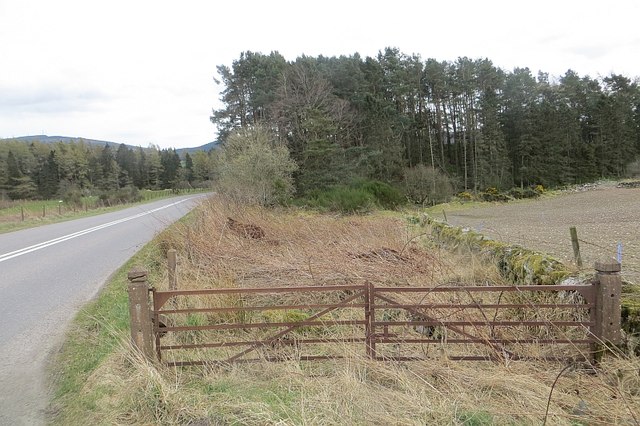
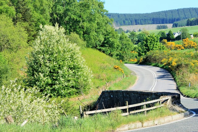
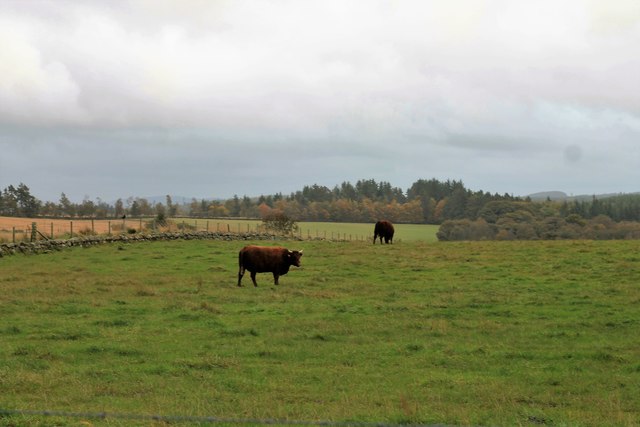
Cairnshee Wood is a picturesque forest located in Kincardineshire, Scotland. It covers an area of approximately 200 acres and is renowned for its natural beauty and diverse wildlife.

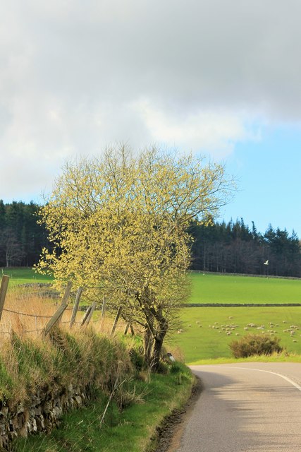
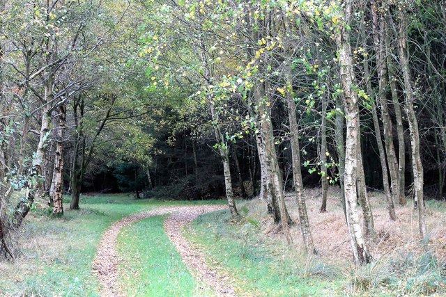
The woodland is predominantly composed of native tree species, including oak, birch, and pine, providing a lush green canopy that stretches as far as the eye can see. The forest floor is covered in a thick carpet of moss, ferns, and wildflowers, creating a serene and enchanting atmosphere.

Walking through Cairnshee Wood, visitors can enjoy a network of well-maintained trails that wind their way through the forest. These paths offer varying levels of difficulty, catering to both leisurely strolls and more challenging hikes. Along the way, hikers might encounter babbling brooks, serene ponds, and stunning viewpoints, providing ample opportunities to pause and immerse oneself in the natural surroundings.

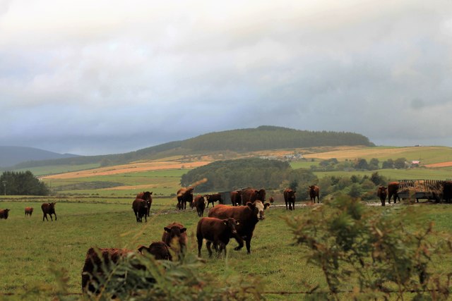
The wood is home to a diverse range of animal species, including red squirrels, foxes, deer, and a wide variety of birdlife. Birdwatchers will be delighted by the chance to spot species such as woodpeckers, owls, and buzzards among the treetops.

Cairnshee Wood is not only a haven for nature enthusiasts but also an important ecological site. It is actively managed by local conservation groups to ensure the preservation of its biodiversity and the protection of its delicate ecosystem.

Overall, Cairnshee Wood is a hidden gem in the heart of Kincardineshire, offering visitors a chance to escape into a tranquil natural environment and immerse themselves in the beauty of Scotland's woodlands.

If you have any feedback on the listing, please let us know in the comments section below.

Cairnshee Wood Images

Images are sourced within 2km of 57.034774/-2.4301651 or Grid Reference NO7393. Thanks to Geograph Open Source API. All images are credited.

Overgrown gate Woodland access off the A957.
Overgrown gate
Woodland access off the A957.
Upperton Refurbished farmhouse on minor road between Strachan and Blairydrine.
Upperton
Refurbished farmhouse on minor road between Strachan and Blairydrine.
Mains of Blairydrine
Junction on the A957 at Blairydryne
Tilquhillie Recumbent Stone Circle (2) The huge stone, known as the Druid Stone, built into the consumption dyke is thought to be the recumbent of what used to be a recumbent stone circle. See <span class="nowrap"><a title="https://canmore.org.uk/site/36704/tilquhillie" rel="nofollow ugc noopener" href="https://canmore.org.uk/site/36704/tilquhillie">Link</a><img style="margin-left:2px;" alt="External link" title="External link - shift click to open in new window" src="https://s1.geograph.org.uk/img/external.png" width="10" height="10"/></span> for more information. <a href="https://www.geograph.org.uk/photo/4844789">NO7294 : Tilquhillie Recumbent Stone Circle (3)</a>
Tilquhillie Recumbent Stone Circle (2)
The huge stone, known as the Druid Stone, built into the consumption dyke is thought to be the recumbent of what used to be a recumbent stone circle. See LinkExternal link for more information. NO7294 : Tilquhillie Recumbent Stone Circle (3)
Tilquhillie Recumbent Stone Circle (3) The huge stone, known as the Druid Stone, built into the consumption dyke is thought to be the recumbent of what used to be a recumbent stone circle. See <span class="nowrap"><a title="https://canmore.org.uk/site/36704/tilquhillie" rel="nofollow ugc noopener" href="https://canmore.org.uk/site/36704/tilquhillie">Link</a><img style="margin-left:2px;" alt="External link" title="External link - shift click to open in new window" src="https://s1.geograph.org.uk/img/external.png" width="10" height="10"/></span> for more information. <a href="https://www.geograph.org.uk/photo/4446516">NO7294 : Tilquhillie Recumbent Stone Circle (1)</a>
Tilquhillie Recumbent Stone Circle (3)
The huge stone, known as the Druid Stone, built into the consumption dyke is thought to be the recumbent of what used to be a recumbent stone circle. See LinkExternal link for more information. NO7294 : Tilquhillie Recumbent Stone Circle (1)
Blairydryne Bridge A tight turn on the Slug Road to Stonehaven, it looks innocuous in summer but can be tricky in winter.
Blairydryne Bridge
A tight turn on the Slug Road to Stonehaven, it looks innocuous in summer but can be tricky in winter.
Tree on a bend A young tree on a bend of the A957 Slug road just south of Quinthelhead.
Tree on a bend
A young tree on a bend of the A957 Slug road just south of Quinthelhead.
Barns Barn Barns Farm and its roadside barn just off the old Slug Road.
Barns Barn
Barns Farm and its roadside barn just off the old Slug Road.
Where Old Meets New The junction of the old and new Slug Roads, 12 miles from Stonehaven!
Where Old Meets New
The junction of the old and new Slug Roads, 12 miles from Stonehaven!
Northbrae Entrance The entrance to Northbrae farm.
Northbrae Entrance
The entrance to Northbrae farm.
Old Slug Trees The Old Slug road passing through Northbrae Woods.
Old Slug Trees
The Old Slug road passing through Northbrae Woods.
Cattle by Lochton Cattle in a field by Lochton from the Wardend road.
Cattle by Lochton
Cattle in a field by Lochton from the Wardend road.
Crossing the Sheeoch A bridge over the Sheeoch Burn and poly tunnels by Wardend Cottages.
Crossing the Sheeoch
A bridge over the Sheeoch Burn and poly tunnels by Wardend Cottages.
Cattle at Wardend Cattle in a field by Wardend Cottages.
Cattle at Wardend
Cattle in a field by Wardend Cottages.
Cairnfauld Path A path entering Cainfauld Wood.
Cairnfauld Path
A path entering Cainfauld Wood.
Mains of Blairydrine The farmyard of Mains of Blairydrine. The bend in the downpipe took my attention as did the difference in spelling between the farm and nearby bridge.
Mains of Blairydrine
The farmyard of Mains of Blairydrine. The bend in the downpipe took my attention as did the difference in spelling between the farm and nearby bridge.
Lady's Dowry A copse by Blairydrine, Durris mast behind.
Lady's Dowry
A copse by Blairydrine, Durris mast behind.
Show me another place!

Cairnshee Wood is located at Grid Ref: NO7393 (Lat: 57.034774, Lng: -2.4301651)

Unitary Authority: Aberdeenshire

Police Authority: North East

What 3 Words

///lakes.promise.straying. Near Banchory, Aberdeenshire

Nearby Locations

Cairnshee Wood

Related Wikis

Tilquhillie Castle

Tilquhillie Castle is a castle near Banchory in Aberdeenshire, Scotland. A Category A listed building, the castle formally formed part of the lands of...

Coy Burn

Coy Burn is a stream that rises in the hills north of Banchory in Aberdeenshire, Scotland. Coy Burn discharges to the River Dee at Milton of Crathes....

Banchory St Ternan F.C.

Banchory St. Ternan Football Club are a Scottish Junior football club based in Crathes, two miles outside the town of Banchory, Aberdeenshire. The club...

Lochton

Lochton is a settlement on the Slug Road in Aberdeenshire, Scotland. Roman legions marched from Raedykes to Normandykes Roman Camp somewhat east of Lochton...

Milton of Crathes

Milton of Crathes is a complex of restored 17th-century stone buildings, associated with, and previously an outlier of, Crathes Castle in Aberdeenshire...

Milton of Crathes railway station

Milton of Crathes railway station is located at Milton of Crathes, three miles east of Banchory, Royal Deeside, Aberdeenshire, Scotland, United Kingdom...

Royal Deeside Railway

The Royal Deeside Railway is a Scottish heritage railway located at Milton of Crathes railway station on a part of the original Deeside Railway. ��2�...
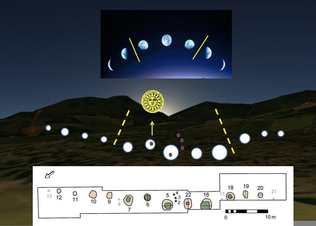
Warren Field

Warren Field is the location of a mesolithic calendar monument built about 8,000 BCE. It includes 12 pits believed to correlate with phases of the Moon...

Have you been to Cairnshee Wood?

Leave your review of Cairnshee Wood below (or comments, questions and feedback).