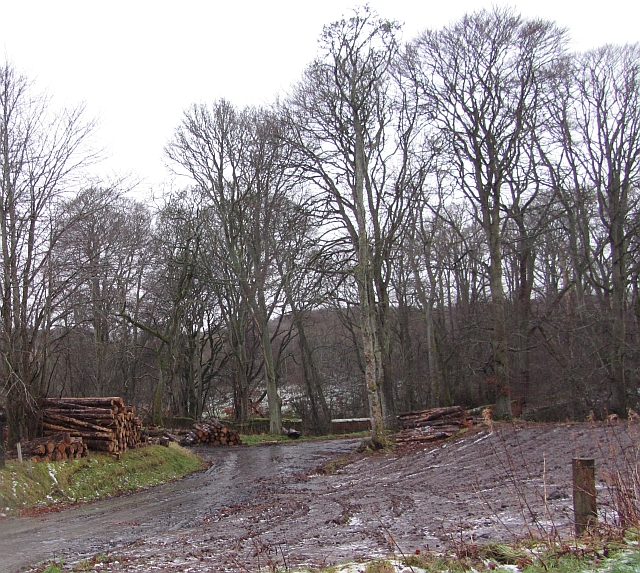
Brackin Braes

Wood, Forest in Aberdeenshire

Scotland

Brackin Braes

Turra Display A display by the White Helmets team during the annual Turriff Show at the Haughs.
Turra Display Credit: Andrew Wood

Brackin Braes is a picturesque woodland area located in Aberdeenshire, Scotland. Situated in the northeastern part of the country, this forested region spans approximately 200 acres and is known for its natural beauty and tranquility.

The woodlands of Brackin Braes are characterized by a diverse range of tree species, including oak, birch, and pine. These towering trees create a dense canopy, providing shade and shelter for a variety of wildlife that call this area home. Visitors to Brackin Braes can often spot deer, foxes, and a wide array of bird species, making it a popular destination for nature enthusiasts and birdwatchers.

Trails and pathways wind their way through the forest, allowing visitors to explore the area at their own pace. These well-maintained paths offer stunning views of the surrounding countryside, with rolling hills and meandering streams adding to the scenic beauty of the landscape. In the springtime, the forest floor comes alive with a colorful display of wildflowers, creating a vibrant and enchanting atmosphere.

Brackin Braes is not only a haven for nature lovers but also a place of historical significance. The woodlands are home to the remnants of an ancient settlement, with stone circles and standing stones providing a glimpse into the region's past.

Overall, Brackin Braes offers a peaceful and idyllic retreat for those seeking a connection with nature. Whether it's a leisurely stroll, a picnic in the shade, or an exploration of the area's rich history, this woodland paradise has something to offer for everyone.

If you have any feedback on the listing, please let us know in the comments section below.

Brackin Braes Images

Images are sourced within 2km of 57.521457/-2.4386535 or Grid Reference NJ7348. Thanks to Geograph Open Source API. All images are credited.

Turra Display A display by the White Helmets team during the annual Turriff Show at the Haughs.
Turra Display
A display by the White Helmets team during the annual Turriff Show at the Haughs.
Sulkies at Turriff Sulky racing in the showground at the Haughs during Turriff's annual show.
Sulkies at Turriff
Sulky racing in the showground at the Haughs during Turriff's annual show.
Steam Up The more commercial side of Turriff Show.
Steam Up
The more commercial side of Turriff Show.
St Andrew's Church Hall The church hall on Ballmellie Road was used as an auxiliary hospital during the Great War.
St Andrew's Church Hall
The church hall on Ballmellie Road was used as an auxiliary hospital during the Great War.
St Andrew's church, Turriff Built 1900 in Early English style (replacing the 1844 original) and formerly the free kirk.  The tower still patiently awaits the installation of the clock.
St Andrew's church, Turriff
Built 1900 in Early English style (replacing the 1844 original) and formerly the free kirk. The tower still patiently awaits the installation of the clock.
Turriff railway station (site), Aberdeenshire Opened in 1857 by the Banff Macduff & Turriff Junction Railway, later part of the Great North of Scotland Railway, on the line from Inveramsay to Macduff, this station closed to passengers in 1951 and completely in 1966.
View north towards the former forecourt with the trackbed crossing the road left to right behind where the large tree now is. The road was diverted to cut across the station site after closure of the railway.
Turriff railway station (site), Aberdeenshire
Opened in 1857 by the Banff Macduff & Turriff Junction Railway, later part of the Great North of Scotland Railway, on the line from Inveramsay to Macduff, this station closed to passengers in 1951 and completely in 1966. View north towards the former forecourt with the trackbed crossing the road left to right behind where the large tree now is. The road was diverted to cut across the station site after closure of the railway.
New pond A new pond by the Burn of Colp not shown on the OS map.
New pond
A new pond by the Burn of Colp not shown on the OS map.
Delgaty and Colp valley The valley containing the Burn of Delgaty and the Burn of Colp.
Delgaty and Colp valley
The valley containing the Burn of Delgaty and the Burn of Colp.
Banff, Macduff and Turriff Junction Railway The trackbed of the Banff, Macduff and Turriff Junction Railway runs through beech woods on a parallel course to the A947 south of Turriff.
Banff, Macduff and Turriff Junction Railway
The trackbed of the Banff, Macduff and Turriff Junction Railway runs through beech woods on a parallel course to the A947 south of Turriff.
Logs, Crow Wood Piles of logs on the edge of Crow Wood, Hatton Castle Estate.
Logs, Crow Wood
Piles of logs on the edge of Crow Wood, Hatton Castle Estate.
Thawing fields Thawing of frost and snow is probably the most miserable of water. Latent heat of fusion takes its toll on air temperatures and the cooling forms fogs. Melting snow becomes very slippery ice and it's usually raining, just like today. View across a sodden field towards Wood of Colp.
Thawing fields
Thawing of frost and snow is probably the most miserable of water. Latent heat of fusion takes its toll on air temperatures and the cooling forms fogs. Melting snow becomes very slippery ice and it's usually raining, just like today. View across a sodden field towards Wood of Colp.
Hill of Colp There is an ostrich in the foreground.
Hill of Colp
There is an ostrich in the foreground.
Cemetery, Turriff South of Balmellie Road and sloping down towards the lower land around Burn of Turriff.
Cemetery, Turriff
South of Balmellie Road and sloping down towards the lower land around Burn of Turriff.
Show ground building, Turriff
Hill of Colp Ripening barley with hay bales in the background.
Hill of Colp
Ripening barley with hay bales in the background.
Turriff camp site A municipal site in the care of Aberdeenshire County Council - although they were giving it up in 2011. It is hoped that it continues as a community run resource.

A bright morning after a night of heavy rain.
Turriff camp site
A municipal site in the care of Aberdeenshire County Council - although they were giving it up in 2011. It is hoped that it continues as a community run resource. A bright morning after a night of heavy rain.
Ordnance Survey  Flush Bracket S7637 This can be found on a house at the Petrol Station, Little Turriff.
For more detail see : <span class="nowrap"><a title="http://www.bench-marks.org.uk/bm21080" rel="nofollow ugc noopener" href="http://www.bench-marks.org.uk/bm21080">Link</a><img style="margin-left:2px;" alt="External link" title="External link - shift click to open in new window" src="https://s1.geograph.org.uk/img/external.png" width="10" height="10"/></span>
Ordnance Survey Flush Bracket S7637
This can be found on a house at the Petrol Station, Little Turriff. For more detail see : LinkExternal link
Sheep and Hay Sheep on the low ground, and hay drying on the higher ground near Little Ardinn.
Sheep and Hay
Sheep on the low ground, and hay drying on the higher ground near Little Ardinn.
Show me another place!

Brackin Braes is located at Grid Ref: NJ7348 (Lat: 57.521457, Lng: -2.4386535)

Unitary Authority: Aberdeenshire

Police Authority: North East

What 3 Words

///marching.apartment.busy. Near Turriff, Aberdeenshire

Related Wikis

Turriff Cottage Hospital

Turriff Cottage Hospital is a community hospital in Turriff, Aberdeenshire, Scotland. It is managed by NHS Grampian. == History == The hospital was designed...

Turriff railway station

Turriff railway station was a railway station in Turriff, Aberdeenshire, Scotland. It was opened in 1857 by the Banff Macduff & Turriff Junction Railway...

Turriff Academy

Turriff Academy is a non denominational comprehensive co-educational secondary school located in Turriff, Aberdeenshire, Scotland. It serves a large catchment...

Hatton Castle, Aberdeenshire

Hatton Castle is almost three miles (4.8 km) south-east of Turriff, Aberdeenshire in the north-east of Scotland. Formerly known as Balquholly Castle, sometimes...

Turriff

Turriff (from Scottish Gaelic Torraibh 'place of round hills') is a town and civil parish in Aberdeenshire in Scotland. It lies on the River Deveron,...

Turriff United F.C.

Turriff United Football Club are a senior football club currently playing in the Highland Football League in Scotland. They play their matches at The Haughs...
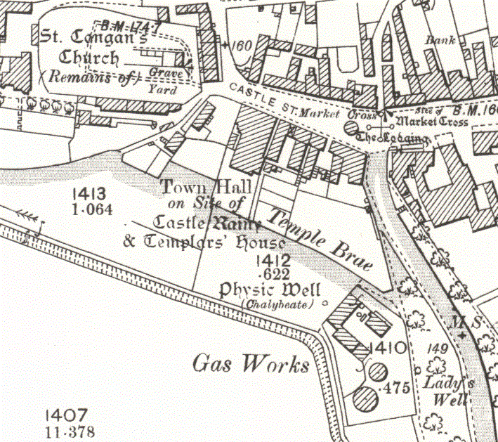
Turriff Castle

Turriff Castle was a tower house, on Castlegate, Turriff, north of Idoch Water, Aberdeenshire, Scotland. The castle was also called Tower of Torrey of...
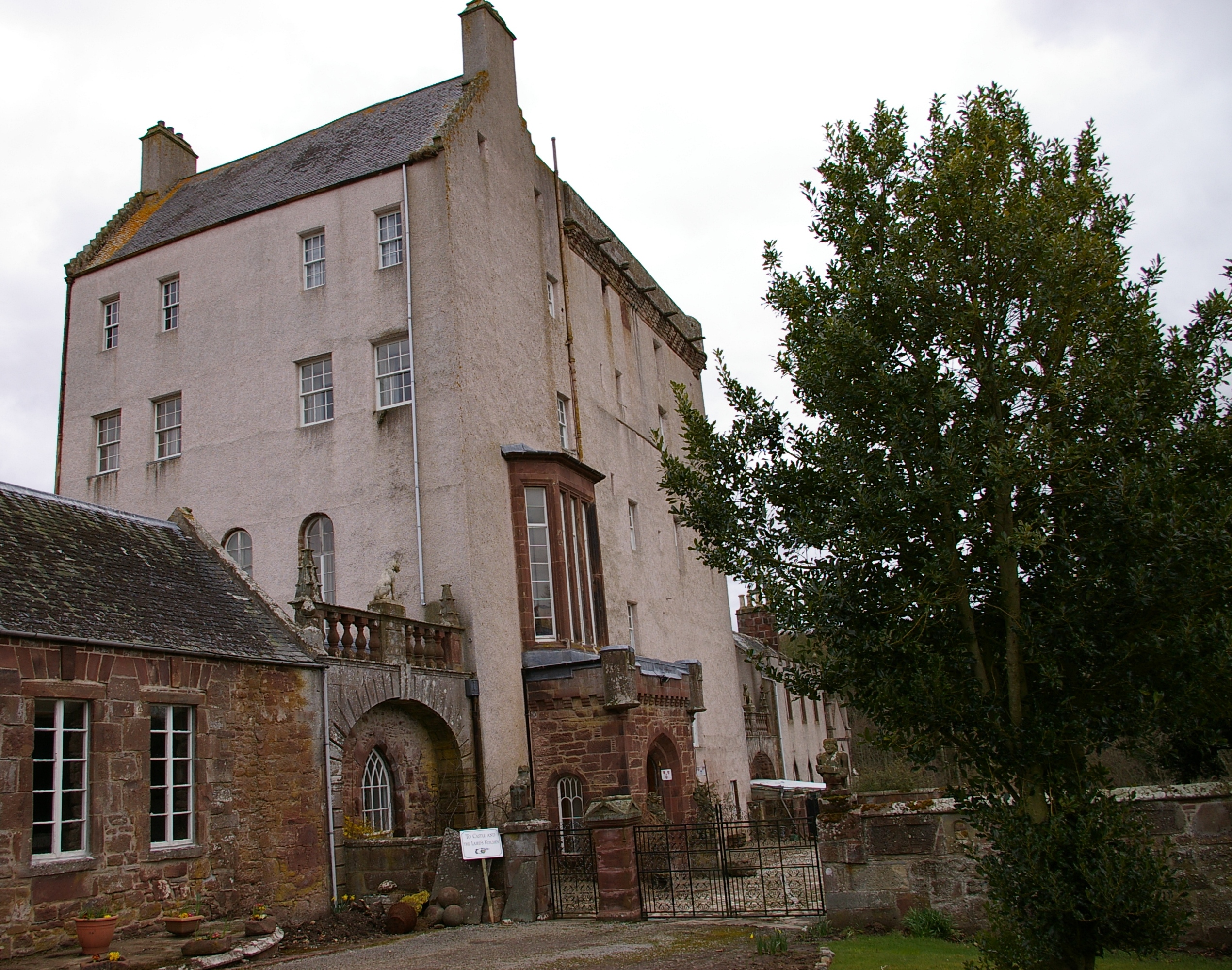
Delgatie Castle

Delgatie Castle is a castle near Turriff, in Aberdeenshire, Scotland. A castle has stood on the site of Delgatie Castle since the year 1030 AD, although...

Related Videos

Turiff Scotland Walking Tour 4K, September 2023

Step into the picturesque charm of Turiff, Scotland, on this immersive 4K walking tour captured in September 2023. Wander ...

Turriff Cutaways

When making our series of Ross Records videos it was a requirement to have much more footage than would eventually be used.

Turriff Show 2022 part 1

went to the Turriff Show yesterday.

কেউ কি ঘুরবা? 😅😁

matamasukhabuk #berbuatbaik #betterthanyou #hobikamimahal #terkini #sayangibu #terhangatdipasaran ...

Nearby Amenities

Located within 500m of 57.521457,-2.4386535
Generator Method: wind_turbine
Generator Source: wind
Power: generator
Lat/Long: 57.5207098/-2.4459585
Material: wood
Power: pole
Lat/Long: 57.5242993/-2.4432575
Material: wood
Power: pole
Lat/Long: 57.5237051/-2.4442563
Material: wood
Power: pole
Lat/Long: 57.5233969/-2.4447849
Material: wood
Power: pole
Lat/Long: 57.5228942/-2.4456672
Power: pole
Lat/Long: 57.5225015/-2.4454709
Power: pole
Lat/Long: 57.521964/-2.4452056
Power: pole
Lat/Long: 57.521372/-2.4449165
Power: pole
Lat/Long: 57.520743/-2.4446145
Power: pole
Lat/Long: 57.5201464/-2.444485
Power: pole
Lat/Long: 57.5196193/-2.4443728
Power: pole
Lat/Long: 57.5190551/-2.444252
Power: pole
Lat/Long: 57.5185013/-2.4441334
The data included in this document is from www.openstreetmap.org. The data is made available under ODbL.

Have you been to Brackin Braes?

Leave your review of Brackin Braes below (or comments, questions and feedback).