Black Wood

Wood, Forest in Roxburghshire

Scotland

Black Wood

Old milestone After clearing overgrown vegetation from this milestone, the white painted legend is still clear after 11 years of Border weather.  It is a short distance south of Whinnyhouse which is on the east side of the road.   This part of Borders was Roxburghshire prior to the 1970s.
Old milestone Credit: Chris Minto

Black Wood is a majestic forest located in Roxburghshire, a historic county in the Scottish Borders region of Scotland. Spanning over a vast area, this enchanting woodland is renowned for its dense and dark foliage, giving it the name "Black Wood."

The forest is predominantly composed of ancient Caledonian pine trees, which have stood tall for centuries, creating a captivating landscape. These towering pines, with their gnarled branches and thick trunks, provide a home to a diverse range of wildlife, including red squirrels, deer, and various bird species.

As visitors venture through the forest, they are greeted by a sense of tranquility and serenity. The forest floor is carpeted with a lush layer of moss, while ferns and wildflowers add splashes of color to the greenery. The air is filled with the earthy scent of pine needles, creating a soothing atmosphere.

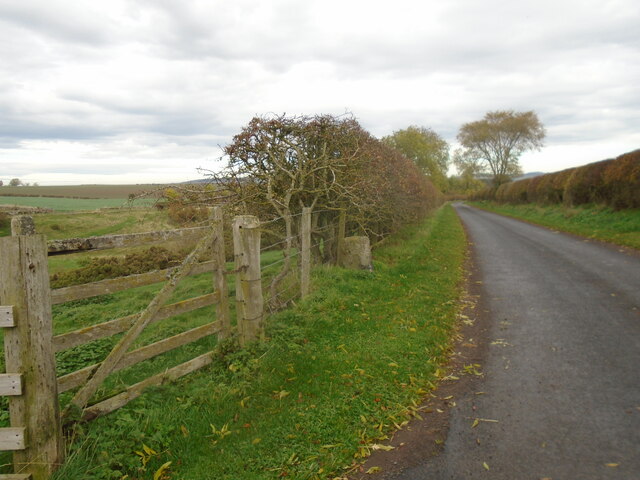
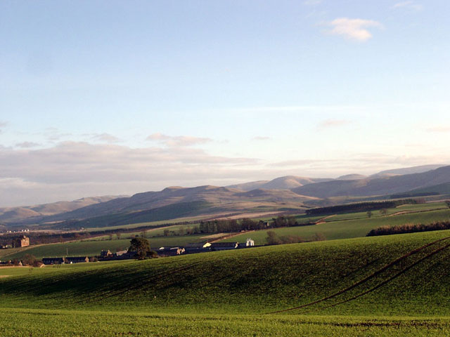
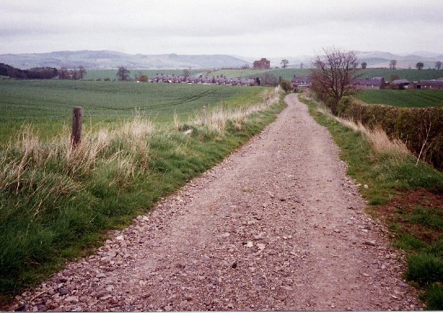
Black Wood offers a network of well-maintained trails and paths, allowing visitors to explore its beauty at their own pace. These trails lead to viewpoints that provide stunning vistas of the surrounding countryside, including the picturesque River Teviot that meanders through the region.

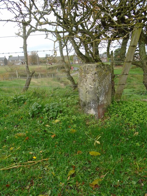
The forest also holds historical significance, as it was once part of the ancient Ettrick Forest, a royal hunting ground. Ruins of old hunting lodges and boundary markers can still be found within the woodland, serving as reminders of the area's rich heritage.

With its captivating beauty, diverse wildlife, and historical importance, Black Wood is a must-visit destination for nature lovers and history enthusiasts alike, offering a truly immersive experience in the heart of Roxburghshire.

If you have any feedback on the listing, please let us know in the comments section below.

Black Wood Images

Images are sourced within 2km of 55.517796/-2.4206 or Grid Reference NT7324. Thanks to Geograph Open Source API. All images are credited.

Old milestone After clearing overgrown vegetation from this milestone, the white painted legend is still clear after 11 years of Border weather.  It is a short distance south of Whinnyhouse which is on the east side of the road.   This part of Borders was Roxburghshire prior to the 1970s.
Old milestone
After clearing overgrown vegetation from this milestone, the white painted legend is still clear after 11 years of Border weather. It is a short distance south of Whinnyhouse which is on the east side of the road. This part of Borders was Roxburghshire prior to the 1970s.
Old milestone The road southwards from the Kelso 7 milestone.
Old milestone
The road southwards from the Kelso 7 milestone.
Old milestone Travelling southwards, turning left over the Cessford Burn, then right, this milestone is just to the left in the very small lane, part of a cycle route leading to the B6401 west of Morebattle.   The cottages at the west side of the burn can be seen in the distance.
Old milestone
Travelling southwards, turning left over the Cessford Burn, then right, this milestone is just to the left in the very small lane, part of a cycle route leading to the B6401 west of Morebattle. The cottages at the west side of the burn can be seen in the distance.
Old milestone Looking north along the lane leading to the castle on the east side of the Cessford Burn.   This may have been the original line of this route with a track leading northwards from the right-hand bend beyond the castle and crossing the Cessford Burn nearly a mile further north than the current bridge.
Old milestone
Looking north along the lane leading to the castle on the east side of the Cessford Burn. This may have been the original line of this route with a track leading northwards from the right-hand bend beyond the castle and crossing the Cessford Burn nearly a mile further north than the current bridge.
Farm buildings, Cessford
Spare land, Cessford Obviously something had changed here - a small patch of ground near a large collection of farm buildings. It is the site of a millpond.
Spare land, Cessford
Obviously something had changed here - a small patch of ground near a large collection of farm buildings. It is the site of a millpond.
Oilseed rape, Cessford View towards Hownam Law
Oilseed rape, Cessford
View towards Hownam Law
Scots pines near Cessford
Farm track, Cessford
Oilseed rape near Otterburn View towards Bowmont Forest.
Oilseed rape near Otterburn
View towards Bowmont Forest.
Fields near Cessford Cessford and the Cheviots behind.
Fields near Cessford
Cessford and the Cheviots behind.
Cessford Castle Cessford is little more than a single terrace of cottages, and as unattractive as the name. Its one distinction is the 14th Century castle, home of the Kers - a clan of Border Reivers.
Cessford Castle
Cessford is little more than a single terrace of cottages, and as unattractive as the name. Its one distinction is the 14th Century castle, home of the Kers - a clan of Border Reivers.
St Cuthbert's Way looking east towards Cessford Cessford is a small hamlet with an old castle that can be seen to the left of the end of the track.
St Cuthbert's Way looking east towards Cessford
Cessford is a small hamlet with an old castle that can be seen to the left of the end of the track.
St Cuthbert's Way The walk is named after a 7th century saint, who was a native of the Borders and who spent his life in the service of the church. When he died he was buried on Holy Island and was canonised eleven years after his death, when his coffin was opened and his remains found to be perfectly preserved. The route was opened in 1996 and leads from Melrose, where St Cuthbert is said to have started his ministry, to Holy Island (Lindisfarne), where he ended his days. The full distance is 62 miles (100km).
St Cuthbert's Way
The walk is named after a 7th century saint, who was a native of the Borders and who spent his life in the service of the church. When he died he was buried on Holy Island and was canonised eleven years after his death, when his coffin was opened and his remains found to be perfectly preserved. The route was opened in 1996 and leads from Melrose, where St Cuthbert is said to have started his ministry, to Holy Island (Lindisfarne), where he ended his days. The full distance is 62 miles (100km).
St Cuthbert's Way (between Otterburn and Cessford) The walk is named after a 7th century saint, who was a native of the Borders and who spent his life in the service of the church. When he died he was buried on Holy Island and was canonised eleven years after his death, when his coffin was opened and his remains found to be perfectly preserved. The route was opened in 1996 and leads from Melrose, where St Cuthbert is said to have started his ministry, to Holy Island (Lindisfarne), where he ended his days. The full distance is 62 miles (100km).
St Cuthbert's Way (between Otterburn and Cessford)
The walk is named after a 7th century saint, who was a native of the Borders and who spent his life in the service of the church. When he died he was buried on Holy Island and was canonised eleven years after his death, when his coffin was opened and his remains found to be perfectly preserved. The route was opened in 1996 and leads from Melrose, where St Cuthbert is said to have started his ministry, to Holy Island (Lindisfarne), where he ended his days. The full distance is 62 miles (100km).
Cessford Cheviot countryside near to the village of Cessford.
Cessford
Cheviot countryside near to the village of Cessford.
The Dene, Cessford Dense woodland area near the Cheviot village of Cessford. Here it opened out into a valley through which Cessford Burn flows.
The Dene, Cessford
Dense woodland area near the Cheviot village of Cessford. Here it opened out into a valley through which Cessford Burn flows.
The Dene, Cessford Evidence of animal life, probably foxes?
The Dene, Cessford
Evidence of animal life, probably foxes?
Show me another place!

Black Wood is located at Grid Ref: NT7324 (Lat: 55.517796, Lng: -2.4206)

Unitary Authority: The Scottish Borders

Police Authority: The Lothians and Scottish Borders

What 3 Words

///sweetener.speedily.developed. Near Maxwellheugh, Scottish Borders

Nearby Locations

Black Wood

Related Wikis

Cessford Burn

Cessford Burn is a small stream which eventually runs to meet the Kale Water and then joins the River Teviot, finally entering the River Tweed at Kelso...

Cessford Castle

Cessford Castle is a large ruined mid-15th century L-plan castle near the village of Cessford, midway Jedburgh and Kelso, in the historic county of Roxburghshire...

Cessford, Scottish Borders

Cessford is a hamlet and former barony about a mile south of the B6401 road, in the Scottish Borders area of Scotland. The placename is from Gaelic 'ceis...

Eckford, Scottish Borders

Eckford is a small village located between the larger towns of Kelso and Jedburgh in the Scottish Borders. The village is in close proximity to both the...

Kale Water

The Kale Water is a 20 miles (32 km) long tributary of the River Teviot in the Scottish Borders area of Scotland. Its feeder burns in the Cheviot Hills...

Morebattle

Morebattle is a village in the Scottish Borders area of Scotland, on the B6401, seven miles south of Kelso, Scottish Borders, beside the Kale Water, a...

Kalemouth

Kalemouth is a place in the Scottish Borders area of Scotland, where the Kale Water joins the River Teviot, near to Eckford, Cessford, Crailing, Kelso...

Linton, Scottish Borders

Linton is a small village in the Scottish Borders area of Scotland. It is situated a mile north of the village of Morebattle. == History == People have...

Have you been to Black Wood?

Leave your review of Black Wood below (or comments, questions and feedback).