Cairn Wood

Wood, Forest in Kincardineshire

Scotland

Cairn Wood

Paths around Denlethen Woods
Paths around Denlethen Woods Credit: Ralph Greig

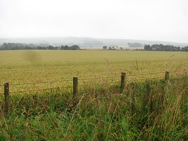
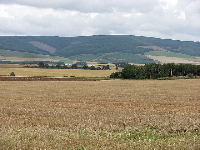
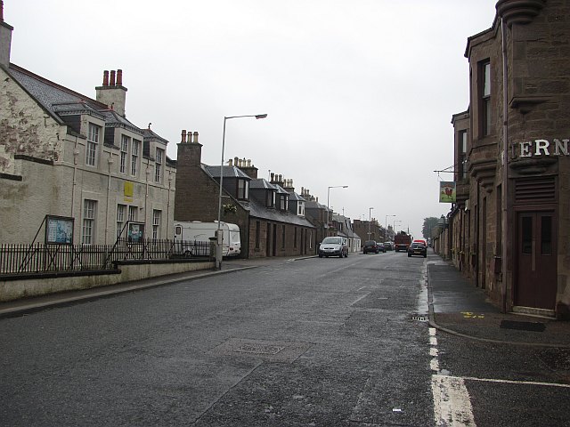
Cairn Wood is a picturesque forest located in Kincardineshire, Scotland. Situated on the eastern outskirts of the village of Cairnbanno, the wood covers an area of approximately 100 acres and is surrounded by rolling hills and stunning natural beauty.

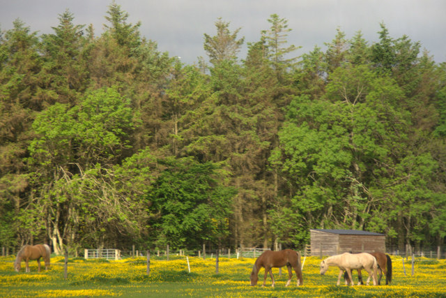
The woodland is predominantly made up of native broadleaf trees such as oak, birch, and beech, creating a diverse and vibrant ecosystem. The dense canopy provides shelter for a variety of wildlife, including red squirrels, badgers, and a plethora of bird species.

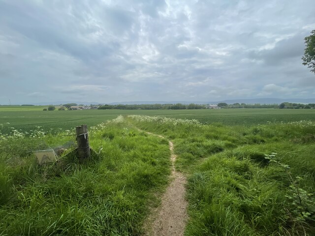
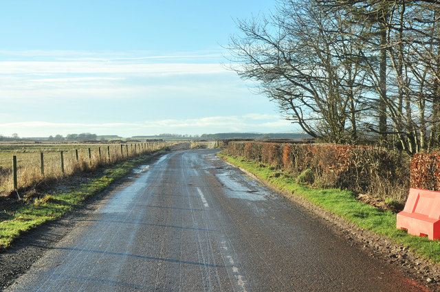
Cairn Wood is crisscrossed by a network of well-maintained footpaths, allowing visitors to explore the area at their own pace. These paths lead to several points of interest, including a tranquil pond and a small waterfall, offering visitors a chance to pause and immerse themselves in the peaceful surroundings.

The wood is a popular destination for outdoor enthusiasts, nature lovers, and families seeking a relaxing day out. It provides ample opportunities for walking, birdwatching, and photography. During the spring and summer months, the forest floor comes alive with colorful wildflowers, creating a vibrant and enchanting atmosphere.

Managed by the local council, Cairn Wood offers excellent amenities such as picnic areas, benches, and information boards to enhance visitors' experience. It is also home to a community-run nature center, providing educational programs and workshops for both children and adults.

Overall, Cairn Wood in Kincardineshire is a gem of natural beauty, offering visitors a chance to reconnect with nature and enjoy the tranquility of the Scottish countryside.

If you have any feedback on the listing, please let us know in the comments section below.

Cairn Wood Images

Images are sourced within 2km of 56.82898/-2.463245 or Grid Reference NO7170. Thanks to Geograph Open Source API. All images are credited.

Paths around Denlethen Woods
Masonic Hall, Laurencekirk Masonic Hall, Laurencekirk.
Masonic Hall, Laurencekirk
Masonic Hall, Laurencekirk.
Farmland west of Laurencekirk Looking across the trees along the Kirk Burn towards the newly-constructed windfarm on the Hill of Garvock.
Farmland west of Laurencekirk
Looking across the trees along the Kirk Burn towards the newly-constructed windfarm on the Hill of Garvock.
Laurencekirk triangulation pillar The trig point is situated in long grass between the new A90 dual carriageway and the old A94 road to Aberdeen.
Laurencekirk triangulation pillar
The trig point is situated in long grass between the new A90 dual carriageway and the old A94 road to Aberdeen.
Laurencekirk bypass The A90 dual carriageway at the junction with the old road through Laurencekirk.
Laurencekirk bypass
The A90 dual carriageway at the junction with the old road through Laurencekirk.
Hole in the road, Laurencekirk A development site off Kirkhill.
Hole in the road, Laurencekirk
A development site off Kirkhill.
Recreation Ground, Laurencekirk Park in Laurencekirk, Kincardineshire.
Recreation Ground, Laurencekirk
Park in Laurencekirk, Kincardineshire.
Pub sign, Laurencekirk Western Inn, Laurencekirk.
Pub sign, Laurencekirk
Western Inn, Laurencekirk.
Wheat field, Laurencekirk Mearns arable land.
Wheat field, Laurencekirk
Mearns arable land.
Stubble near Laurencekirk Looking over stubble and already ploughed land near Laurencekirk towards Strathfinella Hill
Stubble near Laurencekirk
Looking over stubble and already ploughed land near Laurencekirk towards Strathfinella Hill
High Street, Laurencekirk Northward view from outside The Western.
High Street, Laurencekirk
Northward view from outside The Western.
Road junction at Mains of Haulkerton
Minor road at Mains of Haulkerton
Trig point beside A90 The trig point set in a small area of rough ground is known to the OS as Laurencekirk; it replaced an earlier pillar, (known as Conveth), and apparently was given the flush bracket, (S5701), which had been on the earlier pillar. The Lawrencekirk trig itself could have disappeared in the course road realignment of the A90 which is very close to it - but it's still there. OS mapping however at some scales does not mark it.
Trig point beside A90
The trig point set in a small area of rough ground is known to the OS as Laurencekirk; it replaced an earlier pillar, (known as Conveth), and apparently was given the flush bracket, (S5701), which had been on the earlier pillar. The Lawrencekirk trig itself could have disappeared in the course road realignment of the A90 which is very close to it - but it's still there. OS mapping however at some scales does not mark it.
Footbridge over the railway at Laurencekirk Station Seen from a southbound train from Aberdeen to Edinburgh that called here.
Footbridge over the railway at Laurencekirk Station
Seen from a southbound train from Aberdeen to Edinburgh that called here.
Sidings with semaphore signal at Laurencekirk station Seen as approaching the NE end of the station platforms.
Sidings with semaphore signal at Laurencekirk station
Seen as approaching the NE end of the station platforms.
Ticket office and waiting room On the 'down' platform (for Aberdeen) at Laurencekirk station.
Ticket office and waiting room
On the 'down' platform (for Aberdeen) at Laurencekirk station.
Horses in a field on the outskirts of Laurencekirk
Show me another place!

Cairn Wood is located at Grid Ref: NO7170 (Lat: 56.82898, Lng: -2.463245)

Unitary Authority: Aberdeenshire

Police Authority: North East

What 3 Words

///bulky.rejected.wades. Near Laurencekirk, Aberdeenshire

Nearby Locations

Cairn Wood

Related Wikis

Laurencekirk

Laurencekirk (, Scots: Lowrenkirk, Scottish Gaelic: Eaglais Labhrainn), locally known as Lournie, is a small town in the historic county of Kincardineshire...

Laurencekirk railway station

Laurencekirk railway station is a railway station serving the communities of Laurencekirk and The Mearns in Aberdeenshire, Scotland. The station was reopened...

Thornton Castle, Marykirk

Thornton Castle, Marykirk, Aberdeenshire is a fortress or fortified residence in Marykirk, Aberdeenshire. Parts of the house date from 1531.It was the...

Marykirk railway station

Marykirk railway station served the village of Marykirk, Kincardineshire, Scotland from 1849 to 1956 on the Aberdeen Railway. == History == The station...

Related Videos

Laurencekirk Scotland Walking Tour 4K | Scotland Travel

Laurencekirk Scotland Walking Tour 4K | Scotland Travel. Explore the picturesque beauty of Laurencekirk, Scotland in stunning ...

Journey to the Enigmatic Hill of Garvock and Tower of Johnston

Heading west and uphill on the B9120 from Laurencekirk park at the viewpoint to look down on the Mearns capital. Head south ...

Nearby Amenities

Located within 500m of 56.82898,-2.463245
Laurencekirk
Is In: Aberdeenshire, Scotland, UK
Name Gd: Eaglais Labhrainn
Name Sco: Lowrenkirk
Old Name Gd: Coinmheadh
Place: town
Population: 3140
Wikidata: Q987775
Wikipedia: en:Laurencekirk
Lat/Long: 56.8323266/-2.4679922
Turning Loop
Lat/Long: 56.8284479/-2.4708481
Traffic Calming: table
Lat/Long: 56.8319801/-2.4592027
Speed Camera
Mobile Speed Camera Location
Ref: 2008
Website: http://www.nescamp.co.uk/details?cid=29
Lat/Long: 56.8302213/-2.4584166
Bus Stop
Frain Drive
Bus: yes
Naptan AtcoCode: 630040592
Naptan Bearing: NE
Naptan CommonName: Frain Drive
Naptan Indicator: opp
Naptan NaptanCode: 23624678
Naptan Street: High Street
Naptan Verified: no
Public Transport: platform
Source: naptan;bing;naptan_compare_tool
Lat/Long: 56.8299654/-2.4704981
Bus Stop
Frain Drive
Bus: yes
Naptan AtcoCode: 630040591
Naptan Bearing: SW
Naptan CommonName: Frain Drive
Naptan Indicator: at
Naptan NaptanCode: 23624674
Naptan Street: High Street
Naptan Verified: no
Public Transport: platform
Source: naptan;bing;naptan_compare_tool
Lat/Long: 56.8294948/-2.4710303
Bus Stop
Garvock Court
Bus: yes
Naptan AtcoCode: 630042701
Naptan Bearing: SW
Naptan CommonName: Garvock Court
Naptan Indicator: opp
Naptan NaptanCode: 23624684
Naptan Street: High Street
Naptan Verified: no
Public Transport: platform
Source: naptan;bing;naptan_compare_tool
Lat/Long: 56.8306894/-2.469222
Bus Stop
Trafalgar Lane
Bus: yes
Naptan AtcoCode: 630040601
Naptan Bearing: NE
Naptan CommonName: Trafalgar Lane
Naptan Indicator: opp
Naptan NaptanCode: 23624698
Naptan Street: High Street
Naptan Verified: no
Public Transport: platform
Source: naptan;bing;naptan_compare_tool
Lat/Long: 56.8317609/-2.4678378
Bus Stop
Trafalgar Lane
Bus: yes
Naptan AtcoCode: 630040602
Naptan Bearing: SW
Naptan CommonName: Trafalgar Lane
Naptan Indicator: at
Naptan NaptanCode: 23624694
Naptan Street: High Street
Naptan Verified: no
Public Transport: platform
Source: naptan;bing;naptan_compare_tool
Lat/Long: 56.8322011/-2.4669608
Traffic Calming: hump
Lat/Long: 56.8313919/-2.459475
The Courer
Addr Housenumber: 175
Addr Postcode: AB30 1BQ
Addr Street: High Street
Check Date: 2023-05-28
Shop: convenience
Lat/Long: 56.829244/-2.4713163
Generator Source: solar
Power: generator
Lat/Long: 56.829539/-2.4708657
Fast Food
Lournie Chipper
Check Date: 2023-05-28
Cuisine: fish_and_chips;kebab;pizza
Opening Hours: Mo-Su 17:05-21:10
Phone: +44 1561 378069
Website: http://www.lourniechipperab30.co.uk/
Lat/Long: 56.8307379/-2.4694307
Pub
Check Date: 2023-05-28
Lat/Long: 56.8311393/-2.4688373
Charles McHardy
Addr City: Laurencekirk
Addr County: Aberdeenshire
Addr Housenumber: 98
Addr Postcode: AB30 1BJ
Addr Street: High Street
Check Date: 2023-05-28
Contact Facebook: https://www.facebook.com/mchardybutchers/
Contact Instagram: https://www.instagram.com/charlesmchardy
Fhrs Id: 1297994
Phone: +44 1561 376198
Shop: butcher
Website: https://www.charlesmchardybutchers.co.uk/
Lat/Long: 56.8320142/-2.467529
Check Date: 2023-05-28
Shop: yes
Lat/Long: 56.8319486/-2.4672561
Check Date: 2023-05-28
Shop: yes
Lat/Long: 56.8320201/-2.4671555
Lynn's Barbers
Check Date: 2023-05-28
Contact Facebook: https://www.facebook.com/lynnsbarbers94
Shop: hairdresser
Lat/Long: 56.8321015/-2.4673627
Expressions
Check Date: 2023-05-28
Shop: yes
Lat/Long: 56.8322094/-2.4668866
Car Wash
Check Date: 2023-05-28
Lat/Long: 56.8326419/-2.4666291
Central Garage
Check Date: 2023-05-28
Contact Facebook: https://www.facebook.com/people/Central-Garage-Laurencekirk/100088103147640/
Shop: car_repair
Lat/Long: 56.832719/-2.4666701
Check Date: 2023-05-28
Office: accountant
Lat/Long: 56.8326162/-2.4662577
Check Date: 2023-05-28
Shop: yes
Lat/Long: 56.832989/-2.4660712
Check Date: 2023-05-28
Shop: yes
Lat/Long: 56.8328767/-2.4658882
Restaurant
Gannets
Addr City: Laurencekirk
Addr County: Aberdeenshire
Addr Housenumber: 63
Addr Postcode: AB30 1BH
Addr Street: High Street
Check Date: 2023-05-28
Fhrs Id: 1384422
Lat/Long: 56.8329475/-2.4657641
CNG Design
Check Date: 2023-05-28
Office: company
Phone: +44 1561 377636
Website: https://www.cngdesign.co.uk/
Lat/Long: 56.8330759/-2.4659552
James S.T. Liddle
Addr Housenumber: 57
Addr Street: High Street
Shop: antiques
Lat/Long: 56.8330366/-2.465626
Man Made: flagpole
Lat/Long: 56.8319131/-2.4618095
Historic: memorial
Memorial: war_memorial
Lat/Long: 56.8302694/-2.4611951
The data included in this document is from www.openstreetmap.org. The data is made available under ODbL.

Have you been to Cairn Wood?

Leave your review of Cairn Wood below (or comments, questions and feedback).