Clumps
Wood, Forest in Roxburghshire
Scotland
Clumps

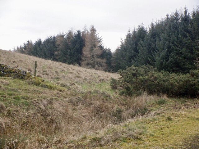
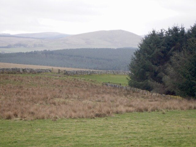
Clumps is a picturesque wooded area located in the region of Roxburghshire, Scotland. Nestled amidst the stunning natural landscapes, this forest is a haven for nature enthusiasts and those seeking tranquility.
Covering an area of approximately 100 acres, Clumps is characterized by its dense collection of trees, predominantly consisting of oak, beech, and pine. The forest is known for its lush greenery and vibrant foliage, particularly during the autumn months when the leaves transform into a breathtaking display of vibrant reds, oranges, and yellows.
The well-maintained walking trails that crisscross through Clumps offer visitors a chance to explore the forest's hidden gems. These trails cater to different levels of difficulty, making them suitable for both leisurely strolls and more challenging hikes. Along the way, visitors can expect to encounter an array of wildlife, including deer, squirrels, and various bird species.
In addition to its natural beauty, Clumps also boasts a rich history. The area was once home to a thriving timber industry, with evidence of old sawmills and logging operations still visible today. Several information boards dotted throughout the forest provide insights into the area's past, offering visitors a glimpse into the lives of those who once worked the land.
Overall, Clumps in Roxburghshire is a captivating destination for nature lovers and history enthusiasts alike. Its serene ambiance, diverse flora and fauna, and intriguing past make it a must-visit location for anyone looking to immerse themselves in the beauty of the Scottish countryside.
If you have any feedback on the listing, please let us know in the comments section below.
Clumps Images
Images are sourced within 2km of 55.436621/-2.448184 or Grid Reference NT7115. Thanks to Geograph Open Source API. All images are credited.


Clumps is located at Grid Ref: NT7115 (Lat: 55.436621, Lng: -2.448184)
Unitary Authority: The Scottish Borders
Police Authority: The Lothians and Scottish Borders
What 3 Words
///inhabited.staked.tones. Near Jedburgh, Scottish Borders
Nearby Locations
Related Wikis

Oxnam
Oxnam (Scots: Owsenam) is a village near Jedburgh, in Roxburghshire in the Scottish Borders area of Scotland. It is a primarily residential village. The...

Pennymuir Roman camps
The Pennymuir Roman camps are situated southeast of Jedburgh in the Scottish Borders area of Scotland, near the Anglo-Scottish border, in the former Roxburghshire...

Camptown, Scottish Borders
Camptown is a small settlement on the A68, in the Scottish Borders area of Scotland, 5m (8 km) south of Jedburgh, and the same distance south to Carter...

Edgerston
Edgerston is a village and an estate about 4 miles (6.4 km) north of the Anglo-Scottish border, and 8 miles (13 km) south of Jedburgh in the Scottish Borders...

Bairnkine
Bairnkine is a hamlet on the Jed Water in the Scottish Borders area of Scotland, on the A68, south of Jedburgh. Other places nearby include Abbotrule,...

Crailinghall
Crailinghall is a village near Oxnam in the Scottish Borders area of Scotland, in the former Roxburghshire. Crailinghall is on the route of the St. Cuthbert...

Ferniehirst Castle
Ferniehirst Castle (sometimes spelled Ferniehurst) is an L-shaped construction on the east bank of the Jed Water, about a mile and a half south of Jedburgh...

Hownam
Hownam or Hounam is a small village and parish situated 8 miles east of Jedburgh in the Scottish Borders area of Scotland, near the Anglo-Scottish border...
Nearby Amenities
Located within 500m of 55.436621,-2.448184Have you been to Clumps?
Leave your review of Clumps below (or comments, questions and feedback).