Drumshalloch Wood
Wood, Forest in Kincardineshire
Scotland
Drumshalloch Wood
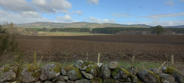
Drumshalloch Wood is a picturesque forest located in Kincardineshire, Scotland. Spanning over a vast area, this woodland is known for its natural beauty and diverse range of flora and fauna. The forest is situated in the southern part of the region, surrounded by rolling hills and breathtaking views.
The wood is predominantly composed of native tree species, including oak, beech, and birch trees. These tall, majestic trees provide a lush canopy, creating a serene and tranquil atmosphere within the forest. The forest floor is covered with a carpet of moss, ferns, and wildflowers, adding to its charm and natural appeal.
Drumshalloch Wood is also home to a variety of wildlife. Visitors can often spot deer roaming freely among the trees, while squirrels can be seen darting through the branches. The forest is a haven for birdwatchers, with a diverse range of bird species, including woodpeckers, owls, and several species of songbirds.
The wood is a popular destination for outdoor enthusiasts and nature lovers. There are well-maintained walking trails that wind through the forest, allowing visitors to explore its beauty at their own pace. These trails offer stunning views of the surrounding landscape and provide opportunities for birdwatching and wildlife observation.
Overall, Drumshalloch Wood is a captivating natural landscape that offers a peaceful retreat from the hustle and bustle of everyday life. Its rich biodiversity and scenic beauty make it a must-visit destination for those seeking a connection with nature in Kincardineshire.
If you have any feedback on the listing, please let us know in the comments section below.
Drumshalloch Wood Images
Images are sourced within 2km of 57.068278/-2.4734635 or Grid Reference NO7197. Thanks to Geograph Open Source API. All images are credited.


Drumshalloch Wood is located at Grid Ref: NO7197 (Lat: 57.068278, Lng: -2.4734635)
Unitary Authority: Aberdeenshire
Police Authority: North East
What 3 Words
///sunk.brain.somewhere. Near Banchory, Aberdeenshire
Nearby Locations
Related Wikis
Banchory
Banchory (, Scots: Banchry, Scottish Gaelic: Beannchar) is a burgh or town in Aberdeenshire, Scotland. It is about 18 miles (29 km) west of Aberdeen,...

Banchory Ternan East Church
Banchory Ternan East Parish Church is a congregation of the Church of Scotland, a member of the Presbyterian Church. The church building is located in...

Banchory Academy
Banchory Academy is a secondary school serving Banchory, Scotland and surroundings, including the neighbouring communities of Raemoir, Crathes, Strachan...

Crathes Castle
Crathes Castle (pronounced KRATH-iss) is a castle, built in the 16th-century, near Banchory in Aberdeenshire, Scotland. It is in the historic county of...

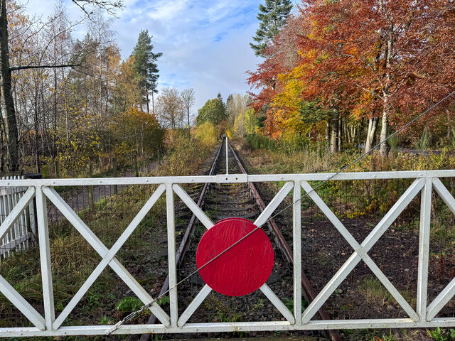
Banchory railway station
Banchory railway station was situated on the Aberdeen and Ballater branch (the Deeside Line). It was situated at 16 miles 72 chains (27.2 km) from Aberdeen...

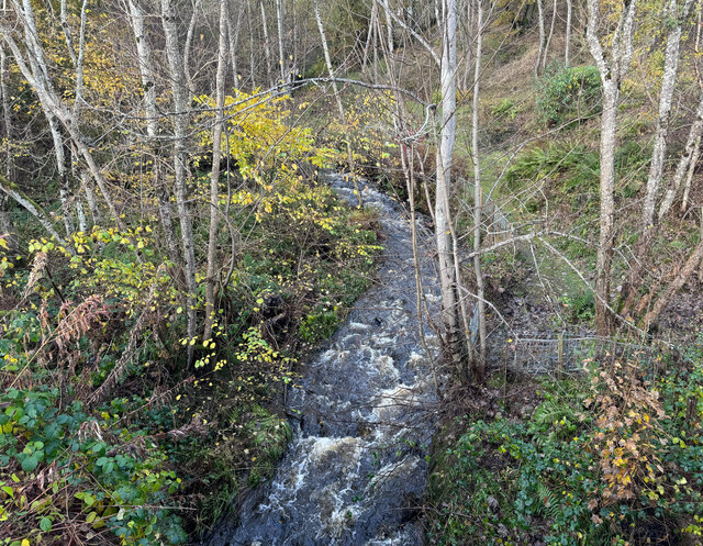
Water of Feugh
The Water of Feugh (pronounced:few-ikh) is a stream in Aberdeenshire that is the largest tributary to the River Dee. This stream rises in the Grampian...

Dee Street Halt railway station
Dee Street Halt railway station was a short-lived stopping place on the Aberdeen and Ballater railway branch. It was situated at 17 miles 30 chains (28...
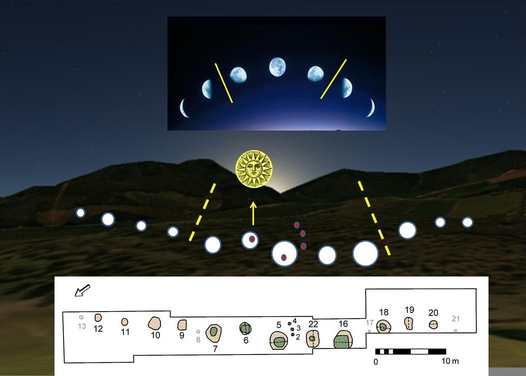
Warren Field
Warren Field is the location of a mesolithic calendar monument built about 8,000 BCE. It includes 12 pits believed to correlate with phases of the Moon...
Nearby Amenities
Located within 500m of 57.068278,-2.4734635Have you been to Drumshalloch Wood?
Leave your review of Drumshalloch Wood below (or comments, questions and feedback).