Burnmouth Plantation

Wood, Forest in Roxburghshire

Scotland

Burnmouth Plantation

Stubble, Oxnam
Stubble, Oxnam Credit: Richard Webb

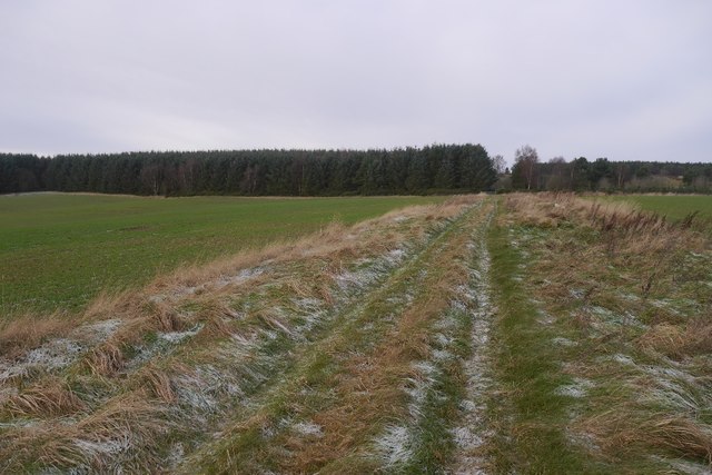
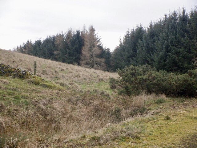
Burnmouth Plantation is a picturesque woodland located in the scenic region of Roxburghshire in the Scottish Borders. Spanning over a vast area, the plantation is home to a diverse range of trees and wildlife, making it a popular destination for nature enthusiasts and hikers alike.

The woodland is primarily composed of native tree species such as oak, birch, and beech, which provide a rich and varied habitat for an abundance of flora and fauna. The dense canopy of the trees creates a tranquil atmosphere, offering a sense of peace and solitude to visitors.

Traversing through the plantation, visitors can explore a network of well-maintained trails and paths, which wind their way through the enchanting woodland. These pathways allow visitors to immerse themselves in the natural beauty of the surroundings while enjoying the fresh air and stunning views.

Wildlife is abundant in Burnmouth Plantation, with numerous species of birds, mammals, and insects calling the woodland home. Birdwatchers can spot a variety of species, including woodpeckers, owls, and various songbirds. The woodland also provides a habitat for mammals such as red squirrels, badgers, and roe deer.

In addition to being a haven for nature lovers, Burnmouth Plantation also serves as an important conservation area. Efforts are made to maintain and protect the woodland's biodiversity, ensuring its preservation for future generations to enjoy.

Overall, Burnmouth Plantation offers a serene and captivating experience for visitors, providing an opportunity to reconnect with nature and appreciate the beauty of the Scottish Borders.

If you have any feedback on the listing, please let us know in the comments section below.

Burnmouth Plantation Images

Images are sourced within 2km of 55.440343/-2.4623567 or Grid Reference NT7016. Thanks to Geograph Open Source API. All images are credited.

Stubble, Oxnam
Stubble, Oxnam
Cringie Burn A temporary footbridge near Oxnam Sawmill.
Cringie Burn
A temporary footbridge near Oxnam Sawmill.
Road, Oxnam Pond The road, grassy in places comes out on a road near Dolphinston.
Road, Oxnam Pond
The road, grassy in places comes out on a road near Dolphinston.
Ruined cattle shelter A simple shelter once stood here, beside the grassy track between Dolphinton and Oxnam.
Ruined cattle shelter
A simple shelter once stood here, beside the grassy track between Dolphinton and Oxnam.
Oxnam to Dolphinston road A grassy, and therefore hard work on the slight gradient, bit heading for the woods at Birkenside.
Oxnam to Dolphinston road
A grassy, and therefore hard work on the slight gradient, bit heading for the woods at Birkenside.
Old Milestone opposite Newbigging Bush, Oxnam parish Stone post by the UC road, in parish of Oxnam (Roxburgh District), Newbigging Bush, Oxnam, middle of beech hedge.

Inscription once read:-
: (Kelso / 12) : : (Carter / Bar / 6) :

Surveyed

Milestone Society National ID: BD_JBOX06
Old Milestone opposite Newbigging Bush, Oxnam parish
Stone post by the UC road, in parish of Oxnam (Roxburgh District), Newbigging Bush, Oxnam, middle of beech hedge. Inscription once read:- : (Kelso / 12) : : (Carter / Bar / 6) : Surveyed Milestone Society National ID: BD_JBOX06
Ladfield Plantation from the air The plantation is in the foreground, with Oxnam beyond.
Ladfield Plantation from the air
The plantation is in the foreground, with Oxnam beyond.
Newbigging Burn, Oxnam
Newbigging by Oxnam, Roxburghshire
Road to Newbigging, Oxnam
Winter cereals, Oxnam Five years on from: <a href="https://www.geograph.org.uk/photo/5626592">NT7018 : Winter cereals, Oxnam</a>
Winter cereals, Oxnam
Five years on from: NT7018 : Winter cereals, Oxnam
Oxnamrow Cottages
Oxnamrow Cottages
Road into a plantation The hedge lined road (which provided the usual puncture) predates the plantations to the south.
Road into a plantation
The hedge lined road (which provided the usual puncture) predates the plantations to the south.
Road and plantation A hedge remains from the previous agricultural use of the land.
Road and plantation
A hedge remains from the previous agricultural use of the land.
Road, Jock's Hill
Road, Jock's Hill
Jock's Hill The road leads to a gate into fields on the higher parts of The Law.
Jock's Hill
The road leads to a gate into fields on the higher parts of The Law.
Plantation edge, Jock's Hill
Crabapple trees, Jock's Hill The Sitka plantations are not uniform. There are remnants of the previous farmland within.
Crabapple trees, Jock's Hill
The Sitka plantations are not uniform. There are remnants of the previous farmland within.
Show me another place!

Burnmouth Plantation is located at Grid Ref: NT7016 (Lat: 55.440343, Lng: -2.4623567)

Unitary Authority: The Scottish Borders

Police Authority: The Lothians and Scottish Borders

What 3 Words

///throat.fell.collide. Near Jedburgh, Scottish Borders

Nearby Locations

Burnmouth Plantation

Related Wikis

Nearby Amenities

Located within 500m of 55.440343,-2.4623567
Power: pole
Lat/Long: 55.4386905/-2.4696916
Power: pole
Lat/Long: 55.4446718/-2.4611787
The data included in this document is from www.openstreetmap.org. The data is made available under ODbL.

Have you been to Burnmouth Plantation?

Leave your review of Burnmouth Plantation below (or comments, questions and feedback).