Bogside Wood

Wood, Forest in Aberdeenshire

Scotland

Bogside Wood

Driveway to Eden House at South Lodge Looking north-eastward.
Driveway to Eden House at South Lodge Credit: Peter Wood

Bogside Wood is a picturesque forest located in Aberdeenshire, Scotland. Covering an area of approximately 100 hectares, this woodland is a haven for nature enthusiasts and outdoor adventurers alike. The wood is situated just a few miles outside the bustling town of Aberlour and is easily accessible by car or on foot.

Bogside Wood boasts a diverse range of tree species, including native Scots pine, birch, oak, and rowan. The dense canopy provides a tranquil and sheltered environment, making it a perfect escape from the hustle and bustle of daily life. The forest floor is adorned with a carpet of wildflowers during spring and summer, creating a vibrant and colorful setting.

The wood is home to a variety of wildlife, making it a popular spot for birdwatching and animal spotting. Visitors may catch glimpses of red squirrels, roe deer, and a multitude of bird species, including the elusive capercaillie and the majestic osprey.

For those seeking adventure, Bogside Wood offers several well-maintained walking trails and paths, suitable for all levels of fitness. These trails wind through the forest, offering breathtaking views of the surrounding countryside and the River Spey.

Bogside Wood also holds historical significance, as it was once part of the ancient Caledonian Forest that covered much of Scotland. The wood has been carefully managed and preserved in recent years to protect its unique biodiversity and ecological value.

Whether you are a nature lover, an avid hiker, or simply seeking a peaceful retreat, a visit to Bogside Wood promises a memorable and enriching experience.

If you have any feedback on the listing, please let us know in the comments section below.
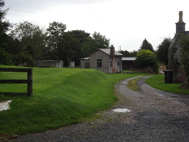
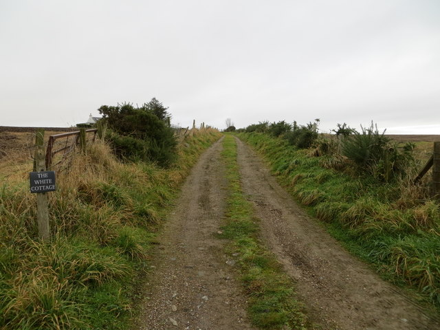
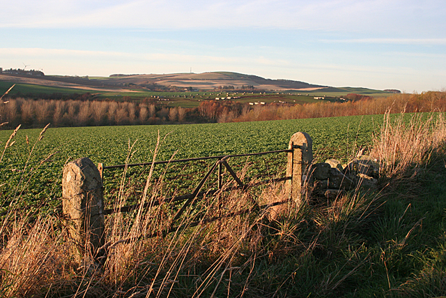
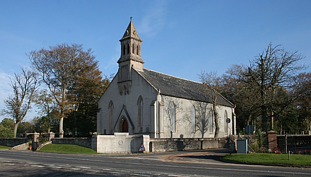
Bogside Wood Images

Images are sourced within 2km of 57.615049/-2.4916867 or Grid Reference NJ7058. Thanks to Geograph Open Source API. All images are credited.

Driveway to Eden House at South Lodge Looking north-eastward.
Driveway to Eden House at South Lodge
Looking north-eastward.
Wall enclosed road approaching the remains of Eden Castle Looking south-westward.
Wall enclosed road approaching the remains of Eden Castle
Looking south-westward.
Minor road at Scatterty Looking south-westward.
Minor road at Scatterty
Looking south-westward.
Minor road heading towards Bogbraes Looking south-eastward. A full River Deveron can be seen on the right of the photograph.
Minor road heading towards Bogbraes
Looking south-eastward. A full River Deveron can be seen on the right of the photograph.
Brae of Blackton Looking south from the road at Brae of Blackton
Brae of Blackton
Looking south from the road at Brae of Blackton
Wood of Balchers Looking towards this small woodland from the access road
Wood of Balchers
Looking towards this small woodland from the access road
OS Cut Mark, Wester Keilhill Farm Ordnance Survey cut mark, bottom left corner of picture
OS Cut Mark, Wester Keilhill Farm
Ordnance Survey cut mark, bottom left corner of picture
Old Milestone by the A947, north of King Edward School Stone post by the A947, in parish of King Edward (District), North of King Edward School, at 50mph sign, East side of road.

Inscription reads:-
5
(To Banff)

Surveyed

Milestone Society National ID: AD_BFTR05
Old Milestone by the A947, north of King Edward School
Stone post by the A947, in parish of King Edward (District), North of King Edward School, at 50mph sign, East side of road. Inscription reads:- 5 (To Banff) Surveyed Milestone Society National ID: AD_BFTR05
King Edward railway station (site), Aberdeenshire Opened in 1860 by the Banff Macduff & Turriff Extension Railway, later part of the Great North of Scotland Railway, on the line from Inveramsay to Macduff, this station closed to passengers in 1951 and completely in 1961.
View east towards the former forecourt, Plaidy and Inveramsay. The wooden station building appears to be a remarkable survivor. The track was to the left of it.
King Edward railway station (site), Aberdeenshire
Opened in 1860 by the Banff Macduff & Turriff Extension Railway, later part of the Great North of Scotland Railway, on the line from Inveramsay to Macduff, this station closed to passengers in 1951 and completely in 1961. View east towards the former forecourt, Plaidy and Inveramsay. The wooden station building appears to be a remarkable survivor. The track was to the left of it.
Track leading to The White Cottage Looking north-eastward.
Track leading to The White Cottage
Looking north-eastward.
Minor road near to Foulzie Looking north-westward.
Minor road near to Foulzie
Looking north-westward.
Tree-lined minor road Looking westward. The public road goes left here with the driveway to Eden House continuing ahead.
Tree-lined minor road
Looking westward. The public road goes left here with the driveway to Eden House continuing ahead.
Minor road approaching Bogside Wood Looking south-eastward.
Minor road approaching Bogside Wood
Looking south-eastward.
Wall-lined minor road heading towards Bogside Looking north-eastward.
Wall-lined minor road heading towards Bogside
Looking north-eastward.
Ordnance Survey Cut Mark This mark can be found on the parapet wall of former railway bridge near to Keilhill. The benchmark's recorded height is 68.767 metres above sea level.
For more detail see : <span class="nowrap"><a title="https://www.bench-marks.org.uk/bm114151" rel="nofollow ugc noopener" href="https://www.bench-marks.org.uk/bm114151">Link</a><img style="margin-left:2px;" alt="External link" title="External link - shift click to open in new window" src="https://s1.geograph.org.uk/img/external.png" width="10" height="10"/></span>
Ordnance Survey Cut Mark
This mark can be found on the parapet wall of former railway bridge near to Keilhill. The benchmark's recorded height is 68.767 metres above sea level. For more detail see : LinkExternal link
King Edward Church
King Edward Church
Near Scatterty The crop in the nearer field looks like a brassica of some sort, and further away is a field of pig shelters. The distant mast is on the Hill of Alvah.
Near Scatterty
The crop in the nearer field looks like a brassica of some sort, and further away is a field of pig shelters. The distant mast is on the Hill of Alvah.
Mains of Eden The farm steading is dominated by the remains of Eden Castle.
Mains of Eden
The farm steading is dominated by the remains of Eden Castle.
Show me another place!

Bogside Wood is located at Grid Ref: NJ7058 (Lat: 57.615049, Lng: -2.4916867)

Unitary Authority: Aberdeenshire

Police Authority: North East

What 3 Words

///gambles.javelin.revamped. Near Banff, Aberdeenshire

Nearby Locations

Bogside Wood

Related Wikis

Eden Castle

Eden Castle is a castle near Banff in Aberdeenshire, Scotland. The castle was built in the latter half of the 16th century by the Meldrum family with renovation...

King Edward railway station

King Edward railway station was a railway station at King Edward, King Edward Parish, Aberdeenshire, Scotland on the rural branchline to Macduff. It was...

King Edward, Aberdeenshire

King Edward (Gaelic: Cinn Eadar) is a small village, parish and former feudal barony near the north coast of Scotland in Buchan midway between Turriff...

Castle of King Edward

The Castle of King Edward is a 13th-century ruined castle near King Edward, Aberdeenshire, Scotland, located 6 kilometres (3.7 mi) north of Turriff, where...

Plaidy railway station

Plaidy railway station was a railway station at Plaidy, Aberdeenshire, Scotland on the rural branchline to Macduff. It was opened in 1860 by the Banff...

Gairnieston Castle

Gairnieston Castle or Garniston Castle was a medieval castle in Aberdeenshire, Scotland.No traces of it remain. == History == The castle was the seat of...

Longman Hill

Longmanhill is a Bronze Age long barrow situated atop a prominent rounded landform in northern Aberdeenshire, Scotland near Banff Bay. Due to the low-lying...

Burn of Myrehouse

The Burn of Myrehouse is a coastal stream in Aberdeenshire in northeast Scotland, the lower section of which, Getty Burn is a right bank tributary of River...

Nearby Amenities

Located within 500m of 57.615049,-2.4916867
Generator Method: wind_turbine
Generator Source: wind
Power: generator
Lat/Long: 57.6159143/-2.4862786
Generator Method: wind_turbine
Generator Source: wind
Power: generator
Lat/Long: 57.6164833/-2.4861082
Power: pole
Lat/Long: 57.6179695/-2.4857101
Power: pole
Lat/Long: 57.6178165/-2.4868264
Power: pole
Lat/Long: 57.6176509/-2.4879721
Power: pole
Lat/Long: 57.617501/-2.4889854
Power: pole
Lat/Long: 57.6140321/-2.4923381
Power: pole
Lat/Long: 57.6172182/-2.490107
Power: pole
Lat/Long: 57.6110669/-2.4946382
The data included in this document is from www.openstreetmap.org. The data is made available under ODbL.

Have you been to Bogside Wood?

Leave your review of Bogside Wood below (or comments, questions and feedback).