Cammackmuir Plantation

Wood, Forest in Kincardineshire

Scotland

Cammackmuir Plantation

Minor road between Pitnamoon and Easthills Looking south-eastward. The crop on the left was broad beans with wheat (I think) on the right.
Minor road between Pitnamoon and Easthills Credit: Peter Wood

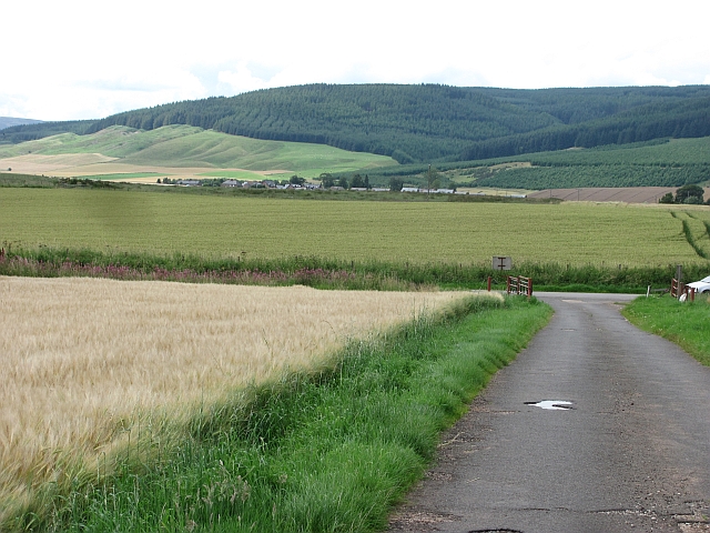
Cammackmuir Plantation is a vast woodland located in the county of Kincardineshire, Scotland. Spanning over several hundred acres, it is a prominent feature of the local landscape and plays a crucial role in the ecological balance of the region.

The plantation primarily consists of a dense mixture of coniferous and deciduous trees, creating a diverse and visually stunning forest. The dominant tree species include Scots pine, Sitka spruce, and European beech, among others. These trees provide a habitat for a wide variety of flora and fauna, attracting bird species such as red kites, buzzards, and woodpeckers, as well as mammals like red squirrels and roe deer.

Managed by the Forestry Commission, Cammackmuir Plantation is an important site for timber production. Sustainable forestry practices are employed to ensure the long-term health and productivity of the plantation. Regular thinning and harvesting activities take place, contributing to the local economy and supporting the timber industry.

The woodland also serves as a recreational space for visitors, offering numerous walking trails and paths that wind through the picturesque landscape. Nature enthusiasts, hikers, and mountain bikers are drawn to the plantation, providing opportunities to explore the natural beauty of Kincardineshire.

Cammackmuir Plantation not only contributes to the economic and recreational aspects of the region but also plays a crucial role in carbon sequestration and mitigating climate change. The dense forest cover helps absorb carbon dioxide from the atmosphere, making it an essential component in the fight against global warming.

If you have any feedback on the listing, please let us know in the comments section below.

Cammackmuir Plantation Images

Images are sourced within 2km of 56.86273/-2.482507 or Grid Reference NO7074. Thanks to Geograph Open Source API. All images are credited.

Minor road between Pitnamoon and Easthills Looking south-eastward. The crop on the left was broad beans with wheat (I think) on the right.
Minor road between Pitnamoon and Easthills
Looking south-eastward. The crop on the left was broad beans with wheat (I think) on the right.
Farm road, Westerton The road is genuinely blocked by a working farm at the far end, so the road is definitely not a through route.  Fortunately I could not read the signage, otherwise I may have had to report it.
Farm road, Westerton
The road is genuinely blocked by a working farm at the far end, so the road is definitely not a through route. Fortunately I could not read the signage, otherwise I may have had to report it.
Track from Westerton Well surfaced farm road. View towards Strathfinella Hill.
Track from Westerton
Well surfaced farm road. View towards Strathfinella Hill.
Potato field Potato field amongst acres of barley, Cairnton.
Potato field
Potato field amongst acres of barley, Cairnton.
Road from Drumforber Concrete farm road, although it appears that many farms here have been amalgamated. There are cattle grazed fields here, which contrast with the barley dominated surroundings. Kincardineshire is famed for its quality arable land.
Road from Drumforber
Concrete farm road, although it appears that many farms here have been amalgamated. There are cattle grazed fields here, which contrast with the barley dominated surroundings. Kincardineshire is famed for its quality arable land.
Arable land, Howe of the Mearns Kincardineshire's famed arable land - here growing potatoes and barley. Things get a wee bit rougher up on and beyond Strathfinella Hill (background). That's the Highlands!
Arable land, Howe of the Mearns
Kincardineshire's famed arable land - here growing potatoes and barley. Things get a wee bit rougher up on and beyond Strathfinella Hill (background). That's the Highlands!
Howe of the Mearns Kincardineshire's famed arable land, here growing barley. This is a fertile plain between Hill of Garvock (background) and the Highland boundary fault. The strath extends as Strathmore into Angus and Perthshire, producing mainly barley and potatoes.
Howe of the Mearns
Kincardineshire's famed arable land, here growing barley. This is a fertile plain between Hill of Garvock (background) and the Highland boundary fault. The strath extends as Strathmore into Angus and Perthshire, producing mainly barley and potatoes.
Crossroads at Kilnhill
Minor road near Scotston
Minor road to Mill of Haulkerton
Farmland near Kilnhill
Minor road near Kilnhill
Drumforber, near Laurencekirk
Track giving access to Easthill and Waulkmill Looking north-eastward.
Track giving access to Easthill and Waulkmill
Looking north-eastward.
Minor road between Mains of Haulkerton and Kilnhill Looking north-westward.
Minor road between Mains of Haulkerton and Kilnhill
Looking north-westward.
Minor road near Bent
Farmland near Bent
Farmland near Bent
Minor road at Little Pitnamoon Cottages
Show me another place!

Cammackmuir Plantation is located at Grid Ref: NO7074 (Lat: 56.86273, Lng: -2.482507)

Unitary Authority: Aberdeenshire

Police Authority: North East

What 3 Words

///punctuate.receiving.answers. Near Laurencekirk, Aberdeenshire

Nearby Locations

Cammackmuir Plantation

Related Wikis

Laurencekirk railway station

Laurencekirk railway station is a railway station serving the communities of Laurencekirk and The Mearns in Aberdeenshire, Scotland. The station was reopened...

Auchenblae

Auchenblae (, Scottish Gaelic: Achadh nam Blàth) is a village in the Kincardine and Mearns area of Aberdeenshire, formerly in Kincardineshire, Scotland...

Thornton Castle, Marykirk

Thornton Castle, Marykirk, Aberdeenshire is a fortress or fortified residence in Marykirk, Aberdeenshire. Parts of the house date from 1531.It was the...

Kincardine, Aberdeenshire

Kincardine was a burgh in Scotland, near the present-day village of Fettercairn. It served as the first county town of Kincardineshire. The settlement...

Nearby Amenities

Located within 500m of 56.86273,-2.482507
Turning Circle
Lat/Long: 56.8622311/-2.4884338
Power: pole
Lat/Long: 56.8595599/-2.4881629
Power: pole
Lat/Long: 56.8602404/-2.4878638
Power: pole
Lat/Long: 56.8606215/-2.4876953
Power: pole
Lat/Long: 56.8609623/-2.4875542
Power: pole
Lat/Long: 56.8615817/-2.487173
Power: pole
Lat/Long: 56.8605294/-2.4886852
The data included in this document is from www.openstreetmap.org. The data is made available under ODbL.

Have you been to Cammackmuir Plantation?

Leave your review of Cammackmuir Plantation below (or comments, questions and feedback).