Braco Woods

Wood, Forest in Aberdeenshire

Scotland

Braco Woods

Trees Felled Forestry operations in a roadside clearing at Whitehill Wood.
Trees Felled Credit: Andrew Wood

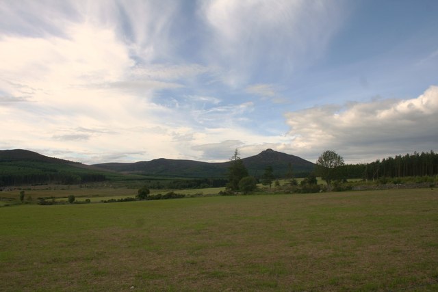
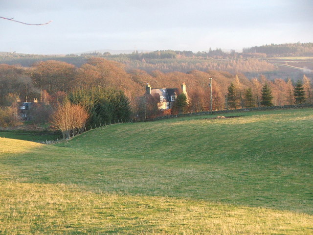
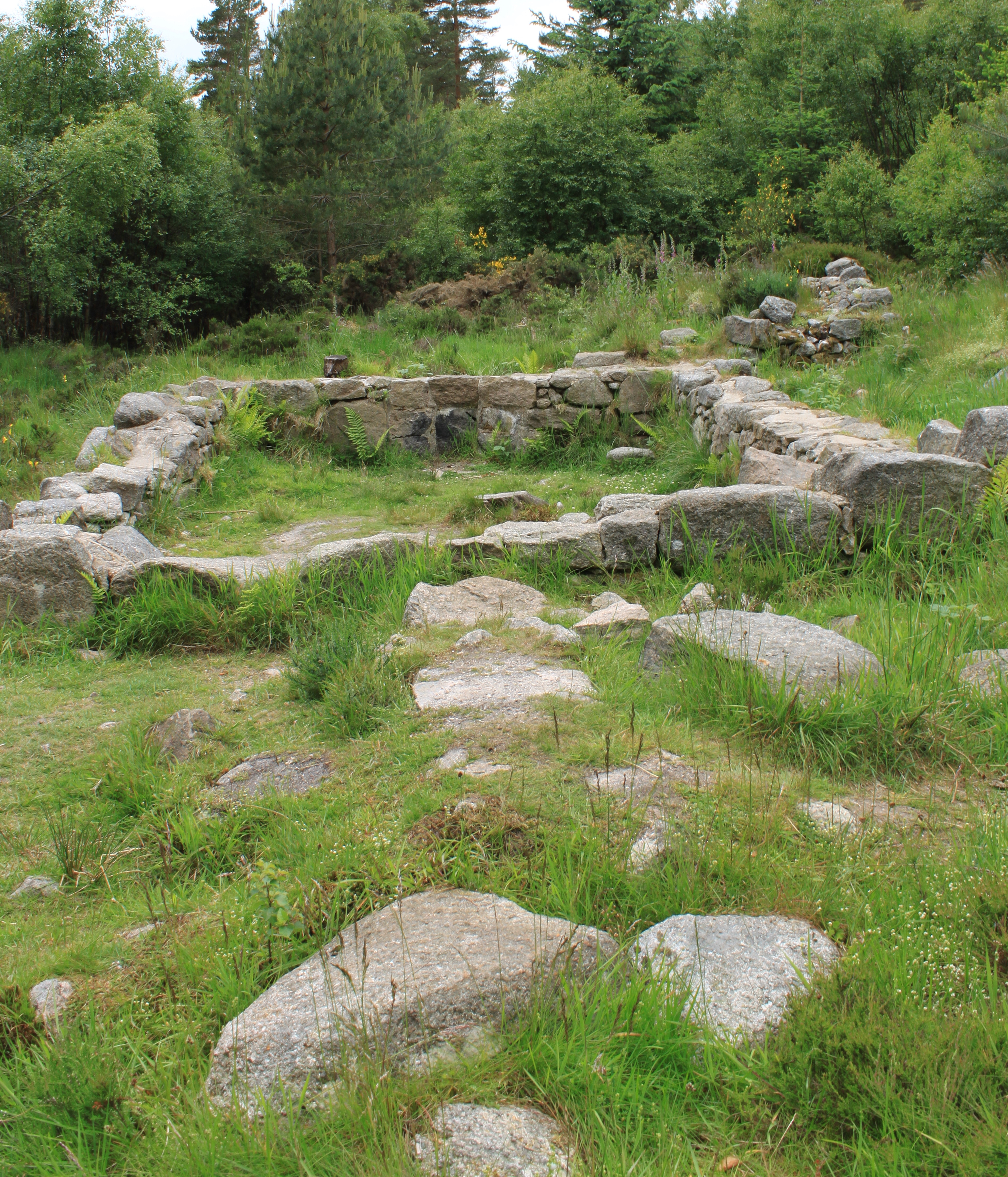
Braco Woods is a picturesque woodland located in Aberdeenshire, Scotland. Covering an extensive area, the forest is a popular destination for nature enthusiasts, hikers, and those seeking a peaceful retreat from the urban bustle.

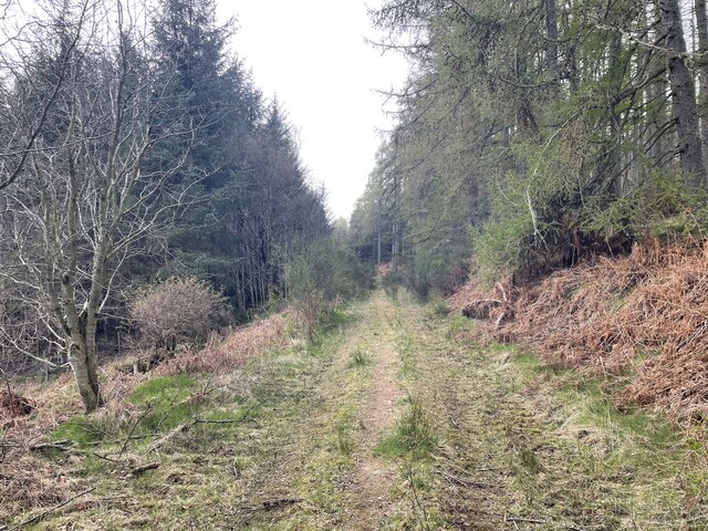
The woods are characterized by an enchanting mix of native trees, including oak, birch, and pine, which create a diverse and vibrant ecosystem. The dense canopy provides a refuge for numerous bird species, such as woodpeckers and owls, making it a haven for birdwatchers. In addition, the forest floor is carpeted with an array of wildflowers and ferns, adding to its natural beauty.

Several well-maintained walking trails wind their way through Braco Woods, offering visitors the opportunity to explore the area at their leisure. These trails vary in difficulty, catering to both casual strollers and more experienced hikers. Along the paths, walkers can enjoy breathtaking views of the surrounding countryside, including rolling hills and meandering streams.

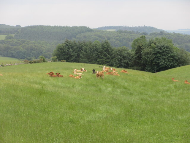
The woods are also home to an abundance of wildlife, including red squirrels, deer, and various small mammals. Nature enthusiasts can spot these creatures in their natural habitat or capture their beauty through photography.

Braco Woods is easily accessible, with ample parking available for visitors. The forest provides a tranquil escape from the hustle and bustle of everyday life, allowing people to reconnect with nature and experience the therapeutic benefits of being in such a serene environment.

If you have any feedback on the listing, please let us know in the comments section below.

Braco Woods Images

Images are sourced within 2km of 57.271774/-2.4917768 or Grid Reference NJ7020. Thanks to Geograph Open Source API. All images are credited.

Trees Felled Forestry operations in a roadside clearing at Whitehill Wood.
Trees Felled
Forestry operations in a roadside clearing at Whitehill Wood.
Field Before Bennachie Farmland by Whitehill Woods with Bennachie in the distance.
Field Before Bennachie
Farmland by Whitehill Woods with Bennachie in the distance.
Douchries and Millstone Farmland to Douchries Farm with Millstone Hill behind.
Douchries and Millstone
Farmland to Douchries Farm with Millstone Hill behind.
Farmland to Scarehill Open farmland between Whitehill Wood and Scare Hill.
Farmland to Scarehill
Open farmland between Whitehill Wood and Scare Hill.
Around the back of Scare hill Bennachie is a range of hills in Aberdeenshire, Scotland.It has several tops, the highest of which, Oxen Craig, has a height of 528 metres (1,732 ft). Though not particularly high, compared to other peaks within Scotland, the mountain is very prominent, owing to its isolation and the relative flatness of the surrounding terrain, and dominates the skyline from several viewpoints.
Around the back of Scare hill
Bennachie is a range of hills in Aberdeenshire, Scotland.It has several tops, the highest of which, Oxen Craig, has a height of 528 metres (1,732 ft). Though not particularly high, compared to other peaks within Scotland, the mountain is very prominent, owing to its isolation and the relative flatness of the surrounding terrain, and dominates the skyline from several viewpoints.
Scottish Water stuff
Resting cattle Cattle lying down in a field at West Aquhorthies.
Resting cattle
Cattle lying down in a field at West Aquhorthies.
Farm Building A farm building by the Hervie Burn perhaps once a cottage judging by the outhouses now a disused stable or barn.
Farm Building
A farm building by the Hervie Burn perhaps once a cottage judging by the outhouses now a disused stable or barn.
Mill and Bridge The disused Burnhervie Mill and the road bridge over the burn by it.
Mill and Bridge
The disused Burnhervie Mill and the road bridge over the burn by it.
Wetland by the Burn The Hervie Burn and wet bog with Aquhorthies Wood behind.
Wetland by the Burn
The Hervie Burn and wet bog with Aquhorthies Wood behind.
Wetland by Aquhorthies Wetland by the Hervie Burn with Aquhorthies Farm in the middle distance and Bennachie behind.
Wetland by Aquhorthies
Wetland by the Hervie Burn with Aquhorthies Farm in the middle distance and Bennachie behind.
Burnhervie Mill The disused mill by Burnhervie.
Burnhervie Mill
The disused mill by Burnhervie.
Mill Lade The dry mill lade at the disused Burnhervie Mill, the road bridge over the burn can be seen in the background.
Mill Lade
The dry mill lade at the disused Burnhervie Mill, the road bridge over the burn can be seen in the background.
The Burn of Hervie The burn flowing beside the disused mill with similarly disused farm buildings behind.
The Burn of Hervie
The burn flowing beside the disused mill with similarly disused farm buildings behind.
Wildlife pond A simple pond for watching the wildlife in the area
Wildlife pond
A simple pond for watching the wildlife in the area
The Gouk Stone
The Gouk Stone
Forestry access roads Bennachie is a range of hills in Aberdeenshire, Scotland.It has several tops, the highest of which, Oxen Craig, has a height of 528 metres (1,732 ft). Though not particularly high, compared to other peaks within Scotland, the mountain is very prominent, owing to its isolation and the relative flatness of the surrounding terrain, and dominates the skyline from several viewpoints.
Forestry access roads
Bennachie is a range of hills in Aberdeenshire, Scotland.It has several tops, the highest of which, Oxen Craig, has a height of 528 metres (1,732 ft). Though not particularly high, compared to other peaks within Scotland, the mountain is very prominent, owing to its isolation and the relative flatness of the surrounding terrain, and dominates the skyline from several viewpoints.
A small trail though the woods Bennachie is a range of hills in Aberdeenshire, Scotland.It has several tops, the highest of which, Oxen Craig, has a height of 528 metres (1,732 ft). Though not particularly high, compared to other peaks within Scotland, the mountain is very prominent, owing to its isolation and the relative flatness of the surrounding terrain, and dominates the skyline from several viewpoints.
A small trail though the woods
Bennachie is a range of hills in Aberdeenshire, Scotland.It has several tops, the highest of which, Oxen Craig, has a height of 528 metres (1,732 ft). Though not particularly high, compared to other peaks within Scotland, the mountain is very prominent, owing to its isolation and the relative flatness of the surrounding terrain, and dominates the skyline from several viewpoints.
Show me another place!

Braco Woods is located at Grid Ref: NJ7020 (Lat: 57.271774, Lng: -2.4917768)

Unitary Authority: Aberdeenshire

Police Authority: North East

What 3 Words

///sofa.broadens.closer. Near Kemnay, Aberdeenshire

Nearby Locations

Braco Woods

Related Wikis

Nearby Amenities

Located within 500m of 57.271774,-2.4917768
Power: pole
Lat/Long: 57.2674553/-2.4897043
Power: pole
Lat/Long: 57.2673282/-2.4908042
Power: pole
Lat/Long: 57.2753402/-2.4908186
Power: pole
Lat/Long: 57.2753558/-2.4898629
Power: pole
Lat/Long: 57.2753858/-2.4887629
Power: pole
Lat/Long: 57.2754074/-2.4876719
The data included in this document is from www.openstreetmap.org. The data is made available under ODbL.

Have you been to Braco Woods?

Leave your review of Braco Woods below (or comments, questions and feedback).