Fox Covert

Wood, Forest in Berwickshire

Scotland

Fox Covert

An old tractor at Smiddyhill This old model has seen better days.
An old tractor at Smiddyhill Credit: Walter Baxter

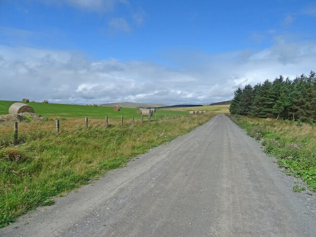
Fox Covert is a picturesque woodland located in the rural area of Berwickshire, Scotland. Spanning over several acres, this enchanting forest is a popular destination for nature lovers and outdoor enthusiasts. The woodland is nestled amidst rolling hills and offers a serene and tranquil escape from the hustle and bustle of city life.

The area is predominantly covered with a mixture of deciduous and coniferous trees, creating a diverse and vibrant landscape. Tall oak, beech, and birch trees dominate the forest, providing a dense canopy that filters sunlight and creates a cool, shaded environment. The forest floor is carpeted with a lush undergrowth of ferns, mosses, and wildflowers, adding to the natural beauty of the woodland.

A network of well-maintained walking trails winds through Fox Covert, allowing visitors to explore the area at their own pace. The trails vary in length and difficulty, catering to both casual strollers and more experienced hikers. Along the way, walkers may encounter a variety of wildlife, including deer, squirrels, and a wide range of bird species.

Fox Covert is a haven for birdwatchers, as it is home to an array of avian species. The melodious songs of songbirds fill the air, and lucky visitors may catch a glimpse of rare species such as the redstart or crossbill.

Overall, Fox Covert in Berwickshire offers a magical escape into nature, where visitors can immerse themselves in the serenity of the woodland and appreciate the beauty of the Scottish countryside.

If you have any feedback on the listing, please let us know in the comments section below.

Fox Covert Images

Images are sourced within 2km of 55.846191/-2.4764916 or Grid Reference NT7061. Thanks to Geograph Open Source API. All images are credited.

An old tractor at Smiddyhill This old model has seen better days.
An old tractor at Smiddyhill
This old model has seen better days.
A detail on an old tractor at Smiddyhill The information on the small panel lower left reads:

MADE IN ENGLAND BY
INTERNATIONAL HARVESTER CO.
OF GREAT BRITAIN LTD.
MODEL B-250 DIESEL
SERIAL NO. 22727
MAX IDLE SPEED 1925 R.P.M.
DO NOT OVERLOAD

For a view of the tractor, see <a href="https://www.geograph.org.uk/photo/7107516">NT6961 : An old tractor at Smiddyhill</a>.
A detail on an old tractor at Smiddyhill
The information on the small panel lower left reads: MADE IN ENGLAND BY INTERNATIONAL HARVESTER CO. OF GREAT BRITAIN LTD. MODEL B-250 DIESEL SERIAL NO. 22727 MAX IDLE SPEED 1925 R.P.M. DO NOT OVERLOAD For a view of the tractor, see NT6961 : An old tractor at Smiddyhill.
Cranshaws Village Hall Cranshaws Village Hall was opened as a recreational hall in the 1920s and has a prominent site in the middle of the village. The hall has recently been refurbished with new toilets and a new kitchen.
Regular events in Cranshaws Village Hall include Carpet Bowling, Concerts, Family Fun Days, Community parties, Art and craft workshops and courses and Big Screen International Rugby days.
Cranshaws Village Hall
Cranshaws Village Hall was opened as a recreational hall in the 1920s and has a prominent site in the middle of the village. The hall has recently been refurbished with new toilets and a new kitchen. Regular events in Cranshaws Village Hall include Carpet Bowling, Concerts, Family Fun Days, Community parties, Art and craft workshops and courses and Big Screen International Rugby days.
Smiddy Hill Farm Overlooking Whiteadder Water.
Smiddy Hill Farm
Overlooking Whiteadder Water.
Near Fellcleugh
Near Fellcleugh
The B6355 on Smiddyhill Bridge, which bridges Whiteadder Water
Smiddyhill Bridge over Whiteadder Water, near Cranshaws
Whiteadder Water upstream from Smiddyhill Bridge, near Cranshaws
Track and footpath off the B6355 near Cranshaws
Bridge over the Boontree Burn, on the B6355, near Cranshaws
Cranshaws Church of Scotland kirk, in the Scottish Borders
Cranshaws Church of Scotland kirk interior
Cranshaws Church of Scotland kirk showing apsidal east end
Cranshaws Church of Scotland kirk - detail from exterior of east end
Whiteadder Water from road bridge north of Cranshaws
Road junction - the B6355 with a minor road, near Cranshaws
On Blackcleugh Rig From the track near to the highpoint of Blackcleuch Rig, looking towards Monynut Edge and Aikengall Community Wind Farm. In between a newly harvested field with the straw already baled, while over the fence the forest has been felled and replanted, though you can't quite see the saplings in this picture.
On Blackcleugh Rig
From the track near to the highpoint of Blackcleuch Rig, looking towards Monynut Edge and Aikengall Community Wind Farm. In between a newly harvested field with the straw already baled, while over the fence the forest has been felled and replanted, though you can't quite see the saplings in this picture.
Track, Kirkgate Hill Track between forest and recently harvested field on the east side of Kirkgate Hill.  Hill in the distance is Spartleton.
Track, Kirkgate Hill
Track between forest and recently harvested field on the east side of Kirkgate Hill. Hill in the distance is Spartleton.
Show me another place!

Fox Covert is located at Grid Ref: NT7061 (Lat: 55.846191, Lng: -2.4764916)

Unitary Authority: The Scottish Borders

Police Authority: The Lothians and Scottish Borders

What 3 Words

///limit.strictly.hiked. Near Duns, Scottish Borders

Nearby Locations

High Strip Fox Covert

Related Wikis

Bothwell Water

The Bothwell Water is a river in the Scottish Borders area of Scotland. It rises in the Lammermuir Hills near Caldercleugh and continues past the Upper...

Cranshaws Castle

Cranshaws Castle or Cranshaws Tower is a privately owned 15th-century pele situated by the village of Cranshaws in Berwickshire, Scotland. The building...

Dye Water

The Dye Water (Scottish Gaelic: Uisge DhĂ idh) is a river in the Lammermuir Hills in the Scottish Borders area of Scotland. It rises in the Hope Hills,...

Cranshaws

Cranshaws is a village on the B6355 road, near Duns, in the Scottish Borders area of Scotland, in the former Berwickshire. Of Cranshaws Castle only the...

Longformacus House

Longformacus House is a mansion near the village of Longformacus, Scottish Borders, Scotland. == History == The estate was once owned by the Earls of...

Longformacus

Longformacus (Scottish Gaelic: Longphort Mhacais) is a small village in Berwickshire in the Scottish Borders area of Scotland. It is around 10 kilometres...

Whiteadder Reservoir

Whiteadder Reservoir is a reservoir in East Lothian, Scotland, UK, in the Lammermuir Hills, 11 miles (18 km) north west of Duns in the Scottish Borders...

Abbey St Bathans

Abbey St Bathans (Scottish Gaelic: Abaid Bhaoithin) is a parish in the Lammermuir district of Berwickshire, in the eastern part of the Scottish Borders...

Nearby Amenities

Located within 500m of 55.846191,-2.4764916
Barrier: cattle_grid
Lat/Long: 55.8473932/-2.4838235
The data included in this document is from www.openstreetmap.org. The data is made available under ODbL.

Have you been to Fox Covert?

Leave your review of Fox Covert below (or comments, questions and feedback).