Drumtochty Forest

Wood, Forest in Kincardineshire

Scotland

Drumtochty Forest

Forestry, Shoolbraid Wood
Forestry, Shoolbraid Wood Credit: Steven Brown

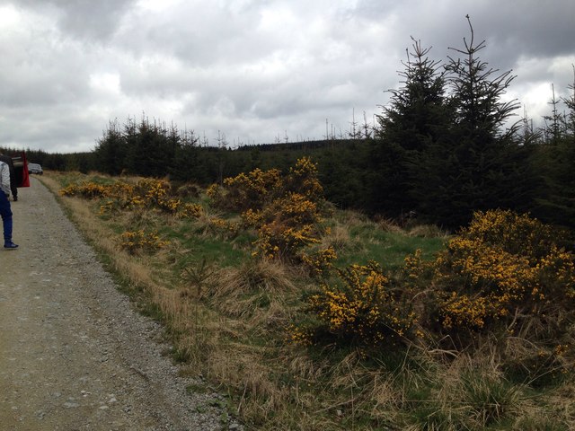
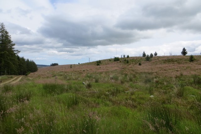
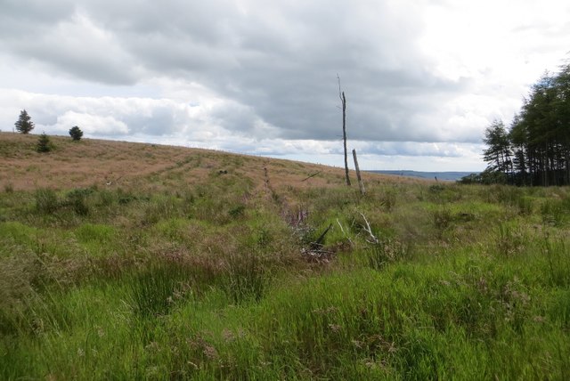
Drumtochty Forest is a picturesque woodland located in the region of Kincardineshire, Scotland. Spanning over an area of approximately 700 hectares, it is one of the largest forests in the area and is renowned for its natural beauty and diverse range of wildlife.

The forest is predominantly made up of native Scottish trees, including oak, birch, and pine, which create a rich and varied landscape. Walking through Drumtochty Forest, visitors are treated to an enchanting experience, with the sunlight filtering through the dense canopy above, casting dappled shadows on the forest floor.

The forest is crisscrossed by a network of well-maintained trails, making it an ideal destination for outdoor enthusiasts and nature lovers. These trails offer opportunities for hiking, cycling, and horseback riding, allowing visitors to explore the forest at their own pace and immerse themselves in the tranquility of nature.

Drumtochty Forest is also home to a wide array of wildlife. Birdwatchers can spot a number of species, including woodpeckers, owls, and various songbirds. Deer are often seen roaming through the forest, adding to its wild and untamed charm. In addition, the forest is home to a diverse range of flora and fauna, with vibrant wildflowers and moss-covered rocks adding pops of color to the landscape.

Overall, Drumtochty Forest is a haven of natural beauty and tranquility. Whether visitors are seeking a peaceful walk through nature, a challenging hike, or a chance to observe wildlife in its natural habitat, this forest offers something for everyone.

If you have any feedback on the listing, please let us know in the comments section below.

Drumtochty Forest Images

Images are sourced within 2km of 56.943449/-2.4933948 or Grid Reference NO7083. Thanks to Geograph Open Source API. All images are credited.

Forestry, Shoolbraid Wood
Mid Hill wind farm Turbines on the site of a large conifer plantation.
Mid Hill wind farm
Turbines on the site of a large conifer plantation.
Pines, Drumtochty Forest A small group of trees amongst a large area of denser plantations.
Pines, Drumtochty Forest
A small group of trees amongst a large area of denser plantations.
Drumtochty forest road There were no signs as shown in 2009 <a href="https://www.geograph.org.uk/photo/1453542">NO7082 : Trackside sign in Fetteresso</a>.
Drumtochty forest road
There were no signs as shown in 2009 NO7082 : Trackside sign in Fetteresso.
Larch, Drumtochty Forest A more open bit of forest than along the road to the north.
Larch, Drumtochty Forest
A more open bit of forest than along the road to the north.
Felled area, Drumtochty Forest A small hill was not replanted after the last crop of trees was taken out.
Felled area, Drumtochty Forest
A small hill was not replanted after the last crop of trees was taken out.
Felled area, Drumtochty Forest Felled a while ago and not replanted.
Felled area, Drumtochty Forest
Felled a while ago and not replanted.
Cleared area of forest Cleared area of Drumtochty Forest near the track up Goyle Hill.
Cleared area of forest
Cleared area of Drumtochty Forest near the track up Goyle Hill.
Borrow pit, Mid Hill wind farm Obtrusive notice in an obtrusive landscape.  On the southern side of the Builg road.
Borrow pit, Mid Hill wind farm
Obtrusive notice in an obtrusive landscape. On the southern side of the Builg road.
Felled area, Tire Beggar Felled a while back and not replanted.
Felled area, Tire Beggar
Felled a while back and not replanted.
View to Mid Rig wind farm A large area of Fettresso/Drumtochty Forest was felled a few years back and not replanted.  Later more was cut down for the wind farm.
View to Mid Rig wind farm
A large area of Fettresso/Drumtochty Forest was felled a few years back and not replanted. Later more was cut down for the wind farm.
Forest road junction,Drumtochty Forest A sharp bend on the north side of the Bervie Water.    Compare with 2009: <a href="https://www.geograph.org.uk/photo/1551633">NO6983 : Track junction near Bervie Water in Fetteresso Forest</a>
Forest road junction,Drumtochty Forest
A sharp bend on the north side of the Bervie Water. Compare with 2009: NO6983 : Track junction near Bervie Water in Fetteresso Forest
Logging road, Drumtochty Forest The road forms a long loop around the upper reaches of the Bervie Water.
Logging road, Drumtochty Forest
The road forms a long loop around the upper reaches of the Bervie Water.
Drumtochty Forest Mature conifers on the south side of the Bervie Water.
Drumtochty Forest
Mature conifers on the south side of the Bervie Water.
Drumtochty Forest I could not find the track marked on the 1:50,000 map.  The road loops around the Bervie Water and climbs gently on the southern side.
Drumtochty Forest
I could not find the track marked on the 1:50,000 map. The road loops around the Bervie Water and climbs gently on the southern side.
Greens of Luchray A steep slope in Drumtochty Forest
Greens of Luchray
A steep slope in Drumtochty Forest
Heathery forest track Track heading westwards, high up in Drumtochty Forest.
Heathery forest track
Track heading westwards, high up in Drumtochty Forest.
Track in Drumtochty Forest
Show me another place!

Drumtochty Forest is located at Grid Ref: NO7083 (Lat: 56.943449, Lng: -2.4933948)

Unitary Authority: Aberdeenshire

Police Authority: North East

What 3 Words

///cookies.fiery.agenda. Near Banchory, Aberdeenshire

Nearby Locations

Drumtochty Forest Gaerlie

Related Wikis

Drumtochty Forest

Drumtochty Forest is a coniferous woodland in Kincardineshire, Scotland. In earlier times this forest was associated with Drumtochty Castle. Other notable...

Kincardineshire

Kincardineshire, also known as the Mearns (from the Scottish Gaelic A' Mhaoirne meaning "the Stewartry"), is a historic county, registration county and...

Drumtochty Castle

Drumtochty Castle is a neo-gothic style castellated mansion erected in 1812 approximately three kilometres north-west of Auchenblae, Kincardineshire, Scotland...

Craiginour

Craiginour is a hill located near Cowie Water in Stonehaven, Aberdeenshire, Scotland. Its summit is at 355 metres (1,165 ft). == References ==

Have you been to Drumtochty Forest?

Leave your review of Drumtochty Forest below (or comments, questions and feedback).