Beals Wood

Wood, Forest in Roxburghshire

Scotland

Beals Wood

Ordnance Survey 1GL Bolt This OS Bolt can be found on the north face of Edgerston Church. It marks a point 235.165m above mean sea level.
Ordnance Survey 1GL Bolt Credit: Adrian Dust

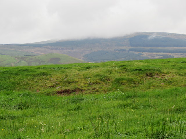
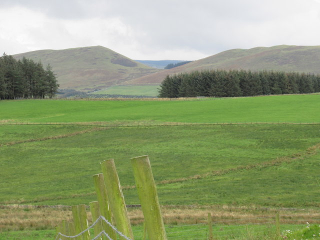
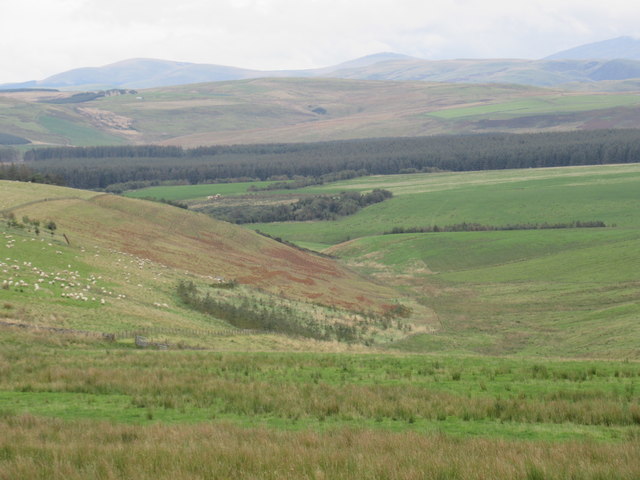
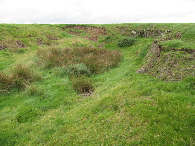
Beals Wood is a beautiful forest located in Roxburghshire, Scotland. Covering a vast area of woodland, Beals Wood is known for its diverse range of flora and fauna, making it a popular destination for nature enthusiasts and hikers.

The forest is home to a variety of tree species, including oak, beech, and birch, which provide a rich canopy overhead. The forest floor is covered with a carpet of ferns, mosses, and wildflowers, creating a serene and tranquil atmosphere.

Beals Wood is also home to a variety of wildlife, including deer, squirrels, and a wide array of bird species. Birdwatchers can spot species such as woodpeckers, thrushes, and owls in the forest.

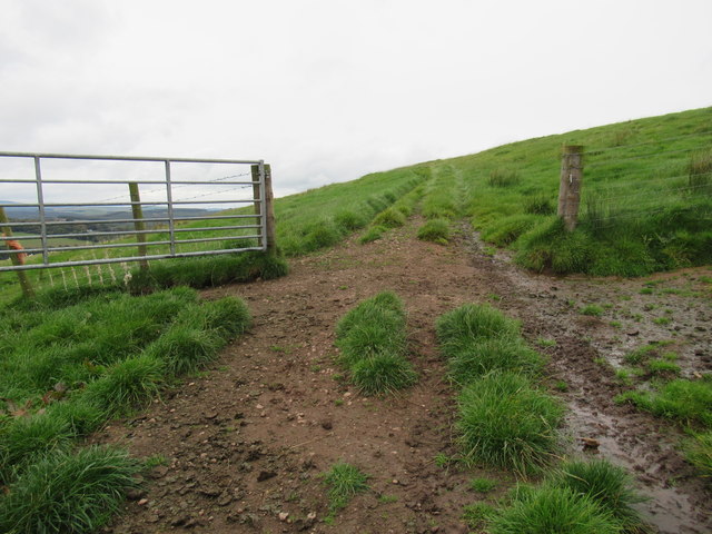
Visitors to Beals Wood can enjoy a network of walking trails that wind through the forest, offering stunning views of the surrounding countryside. The forest is also a popular spot for picnicking, birdwatching, and photography.

Overall, Beals Wood is a picturesque and peaceful forest that offers a chance to connect with nature and escape the hustle and bustle of everyday life.

If you have any feedback on the listing, please let us know in the comments section below.

Beals Wood Images

Images are sourced within 2km of 55.401781/-2.4889713 or Grid Reference NT6912. Thanks to Geograph Open Source API. All images are credited.

Ordnance Survey 1GL Bolt This OS Bolt can be found on the north face of Edgerston Church. It marks a point 235.165m above mean sea level.
Ordnance Survey 1GL Bolt
This OS Bolt can be found on the north face of Edgerston Church. It marks a point 235.165m above mean sea level.
A68, Edgerston Towards Jedburgh
A68, Edgerston
Towards Jedburgh
Entering Camptown
Entering Camptown
Camptown from the air Viewed from an Edinburgh bound flight from Prague.
Camptown from the air
Viewed from an Edinburgh bound flight from Prague.
Road to Falla A dead end to motorised traffic on the north side of the Cheviot Hills.
Road to Falla
A dead end to motorised traffic on the north side of the Cheviot Hills.
Fields, Falla Frosty slopes of Dod Hill.
Fields, Falla
Frosty slopes of Dod Hill.
Road from Falla Road out from the farm at Falla, passing some cattle.
Road from Falla
Road out from the farm at Falla, passing some cattle.
A68 near Trotter Wood
A68 lay-by near Haas Lochs
Minor road at Quarry Hill Looking westward.
Minor road at Quarry Hill
Looking westward.
Minor road at Dovesford rising to join the A68 road Looking southward.
Minor road at Dovesford rising to join the A68 road
Looking southward.
Old Milestone by the A68, Edgerston church, Jedburgh parish Stone post by the A68, in parish of Jedburgh (Roxburgh District), Edgerston Church, on verge 10m North of church wall.

Inscription reads:-
JEDBURGH
7
MILES

Surveyed

Milestone Society National ID: BD_JBNC07
Old Milestone by the A68, Edgerston church, Jedburgh parish
Stone post by the A68, in parish of Jedburgh (Roxburgh District), Edgerston Church, on verge 10m North of church wall. Inscription reads:- JEDBURGH 7 MILES Surveyed Milestone Society National ID: BD_JBNC07
Dod Hill summit in the Scottish Borders Carter Bar in the background with an HGV at nine seven in photo contouring its way to Jedburgh.
Dod Hill summit in the Scottish Borders
Carter Bar in the background with an HGV at nine seven in photo contouring its way to Jedburgh.
View south off Dod Hill near Edgerston in the Scottish Borders
View east off Dod Hill near Edgerston in the Scottish Borders
View north off Dod Hill in the Scottish Borders
Wee quarry on Dod Hill near Edgerston in the Scottish Borders I suspect this has played its part providing hard tracks on very sloppy hill fields.
Wee quarry on Dod Hill near Edgerston in the Scottish Borders
I suspect this has played its part providing hard tracks on very sloppy hill fields.
Open gateway in new fenceline on Dod Hill
Show me another place!

Beals Wood is located at Grid Ref: NT6912 (Lat: 55.401781, Lng: -2.4889713)

Unitary Authority: The Scottish Borders

Police Authority: The Lothians and Scottish Borders

What 3 Words

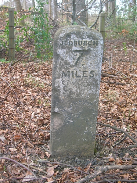
///stud.clustered.avocado. Near Jedburgh, Scottish Borders

Related Wikis

Edgerston

Edgerston is a village and an estate about 4 miles (6.4 km) north of the Anglo-Scottish border, and 8 miles (13 km) south of Jedburgh in the Scottish Borders...

Camptown, Scottish Borders

Camptown is a small settlement on the A68, in the Scottish Borders area of Scotland, 5m (8 km) south of Jedburgh, and the same distance south to Carter...

Scottish Borders

The Scottish Borders (Scots: the Mairches, lit. 'the Marches'; Scottish Gaelic: Crìochan na h-Alba) is one of 32 council areas of Scotland. It is bordered...

Raid of the Redeswire

The Raid of the Redeswire, also known as the Redeswire Fray, was a border skirmish between England and Scotland on 7 July 1575 which took place at Carter...

Nearby Amenities

Located within 500m of 55.401781,-2.4889713
Power: pole
Lat/Long: 55.4042844/-2.4924131
Power: pole
Lat/Long: 55.4051791/-2.4902939
Power: pole
Lat/Long: 55.4055461/-2.4895034
Power: pole
Lat/Long: 55.4061235/-2.4904021
The data included in this document is from www.openstreetmap.org. The data is made available under ODbL.

Have you been to Beals Wood?

Leave your review of Beals Wood below (or comments, questions and feedback).