Brick-kiln Wood

Wood, Forest in Roxburghshire

Scotland

Brick-kiln Wood

Young trees, Green Knowes A recent plantation amongst more established trees.
Young trees, Green Knowes Credit: Richard Webb

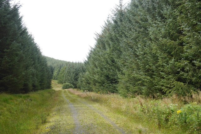
Brick-kiln Wood is a picturesque forest located in Roxburghshire, a historic county in the southern part of Scotland. Covering an area of approximately 100 acres, it is a captivating natural haven that attracts nature enthusiasts and outdoor lovers alike.

The wood is predominantly made up of native broadleaf trees, with a rich variety including oak, birch, and beech. The dense canopy provides a sheltered and tranquil environment, ideal for wildlife to thrive. Visitors can expect to encounter a diverse range of species, including birds such as woodpeckers, owls, and various songbirds, as well as mammals like red squirrels and deer.

An extensive network of well-maintained footpaths and trails meander through the wood, allowing visitors to explore and immerse themselves in its beauty. The paths are suitable for walkers of all abilities, providing a leisurely stroll or a more challenging hike.

For those interested in the history of the area, Brick-kiln Wood gets its name from the brick kilns that were once in operation here during the 19th century. The remains of these kilns can still be seen, adding an intriguing historical dimension to the woodland experience.

Visiting Brick-kiln Wood offers a chance to escape the hustle and bustle of everyday life and connect with nature. The peaceful ambiance, combined with its diverse flora and fauna, make it an enchanting destination for anyone seeking serenity and a deeper appreciation for the natural world.

If you have any feedback on the listing, please let us know in the comments section below.

Brick-kiln Wood Images

Images are sourced within 2km of 55.396639/-2.5004018 or Grid Reference NT6811. Thanks to Geograph Open Source API. All images are credited.

Young trees, Green Knowes A recent plantation amongst more established trees.
Young trees, Green Knowes
A recent plantation amongst more established trees.
Young trees near Hass One of the more recent plantings around here.
Young trees near Hass
One of the more recent plantings around here.
Road, Hass Through mainly forested land between the A68 and A6088.
Road, Hass
Through mainly forested land between the A68 and A6088.
Edgerston from the air Looking up the A68 road, past Hass towards Edgerston.
Edgerston from the air
Looking up the A68 road, past Hass towards Edgerston.
Rough grazing and woodland near Hass
A68 near Hass Towards Corbridge.
A68 near Hass
Towards Corbridge.
Road over Hareshaw Knowe Quite a few timber trucks on it today.
Road over Hareshaw Knowe
Quite a few timber trucks on it today.
Track to Shaw Craigs Now grassed over and a pleasant walk.
Track to Shaw Craigs
Now grassed over and a pleasant walk.
Track, Shaw Craigs Now grassed over. It is easy to get up to the triangulation point from further along.
Track, Shaw Craigs
Now grassed over. It is easy to get up to the triangulation point from further along.
Moorland and fields east of A68 As the A68 descends north from Carter Bar into Scotland moorland begins to give way to agricultural land. Goshen Hill with Philip Law behind lie at the right side of the image whilst in the distance, left of centre, is The Cheviot.
Moorland and fields east of A68
As the A68 descends north from Carter Bar into Scotland moorland begins to give way to agricultural land. Goshen Hill with Philip Law behind lie at the right side of the image whilst in the distance, left of centre, is The Cheviot.
Ordnance Survey Cut Mark This OS cut mark can be found on the south angle of Hass House. It marks a point 245.769m above mean sea level.
Ordnance Survey Cut Mark
This OS cut mark can be found on the south angle of Hass House. It marks a point 245.769m above mean sea level.
Ordnance Survey 1GL Bolt This OS Bolt can be found on the north face of Edgerston Church. It marks a point 235.165m above mean sea level.
Ordnance Survey 1GL Bolt
This OS Bolt can be found on the north face of Edgerston Church. It marks a point 235.165m above mean sea level.
Upper Hass Loch One of a pair of dammed lochs used as a fishery.
Upper Hass Loch
One of a pair of dammed lochs used as a fishery.
Lower Hass Loch A view from the dam.  This is one of a pair of lochs in a fishery.
Lower Hass Loch
A view from the dam. This is one of a pair of lochs in a fishery.
The Hass View along the Broombauks Burn from the lower dam.
The Hass
View along the Broombauks Burn from the lower dam.
Forest road, The Hass The road runs along the route of what is marked on older roads as a drove road.
Forest road, The Hass
The road runs along the route of what is marked on older roads as a drove road.
A68, Edgerston Towards Jedburgh
A68, Edgerston
Towards Jedburgh
Camptown from the air Viewed from an Edinburgh bound flight from Prague.
Camptown from the air
Viewed from an Edinburgh bound flight from Prague.
Show me another place!

Brick-kiln Wood is located at Grid Ref: NT6811 (Lat: 55.396639, Lng: -2.5004018)

Unitary Authority: The Scottish Borders

Police Authority: The Lothians and Scottish Borders

What 3 Words

///listen.rebounded.poets. Near Jedburgh, Scottish Borders

Related Wikis

Nearby Amenities

Located within 500m of 55.396639,-2.5004018
Bus Stop
Edgerston Church
Bench: no
Bin: no
Bus: yes
Naptan AtcoCode: 69001233
Naptan Bearing: S
Naptan CommonName: Church
Naptan Indicator: opp
Naptan Landmark: Church
Naptan NaptanCode: 72725343
Naptan Street: A68
Operator: Scottish Borders Council
Public Transport: platform
Ref: 69001233
Shelter: no
Source: NaPTAN
Lat/Long: 55.3974863/-2.4989232
Bus Stop
Church
Bench: no
Bin: no
Naptan AtcoCode: 6900281
Naptan Bearing: N
Naptan CommonName: Church
Naptan Indicator: near
Naptan Landmark: Edgerston Church
Naptan NaptanCode: 72723238
Naptan Street: A68
Naptan Verified: no
Shelter: no
Source: naptan_import
Lat/Long: 55.397476/-2.4992388
Natural: peak
Lat/Long: 55.3945246/-2.5
Edgerston
Place: village
Wikidata: Q5337809
Wikipedia: en:Edgerston
Lat/Long: 55.3978062/-2.4992141
Noexit: yes
Lat/Long: 55.3949203/-2.4991885
Give Way
Direction: forward
Lat/Long: 55.3950979/-2.4987707
Give Way
Direction: forward
Lat/Long: 55.3958152/-2.4987243
Noexit: yes
Lat/Long: 55.3975543/-2.4994395
Noexit: yes
Lat/Long: 55.397848/-2.5000187
Give Way
Direction: backward
Lat/Long: 55.3983318/-2.4990911
Noexit: yes
Lat/Long: 55.3997283/-2.5011977
Give Way
Direction: forward
Lat/Long: 55.39992/-2.5002596
Give Way
Direction: forward
Lat/Long: 55.3949093/-2.4989098
Power: pole
Lat/Long: 55.3947369/-2.5066727
Power: pole
Lat/Long: 55.3946492/-2.5057611
Power: pole
Lat/Long: 55.3945497/-2.5048522
Power: pole
Lat/Long: 55.3943655/-2.502939
Power: pole
Lat/Long: 55.3941607/-2.5010798
Material: wood
Power: pole
Lat/Long: 55.3939428/-2.4988937
Power: pole
Lat/Long: 55.3939399/-2.4970526
Power: pole
Lat/Long: 55.3946126/-2.4970255
Power: pole
Lat/Long: 55.3941344/-2.4961398
Power: pole
Lat/Long: 55.3936357/-2.4952231
Power: pole
Lat/Long: 55.3932453/-2.497032
Power: pole
Lat/Long: 55.3952751/-2.4952166
Power: pole
Lat/Long: 55.3957474/-2.4940836
The data included in this document is from www.openstreetmap.org. The data is made available under ODbL.

Have you been to Brick-kiln Wood?

Leave your review of Brick-kiln Wood below (or comments, questions and feedback).