Bennachie Forest

Wood, Forest in Aberdeenshire

Scotland

Bennachie Forest

Forest roads of Bennachie
Forest roads of Bennachie Credit: Ralph Greig

Bennachie Forest is a picturesque woodland located in Aberdeenshire, Scotland. Situated on the southern slopes of the iconic Bennachie range, this forest covers an area of approximately 1,000 hectares. It is easily accessible, situated just off the A96 road, making it a popular destination for locals and tourists alike.

The forest is predominantly made up of native Scottish trees, including Scots pine, birch, and oak. These trees create a beautiful and diverse habitat for numerous species of wildlife, including red squirrels, roe deer, and a variety of bird species. Nature enthusiasts will be delighted by the opportunity to spot and observe these animals in their natural environment.

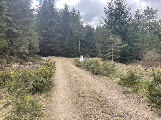
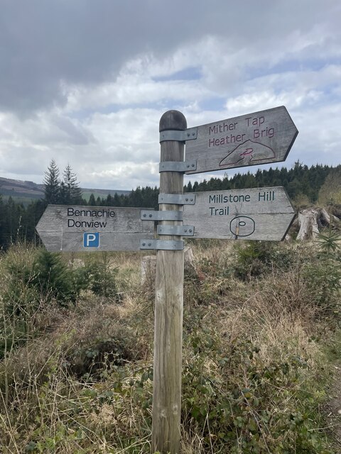
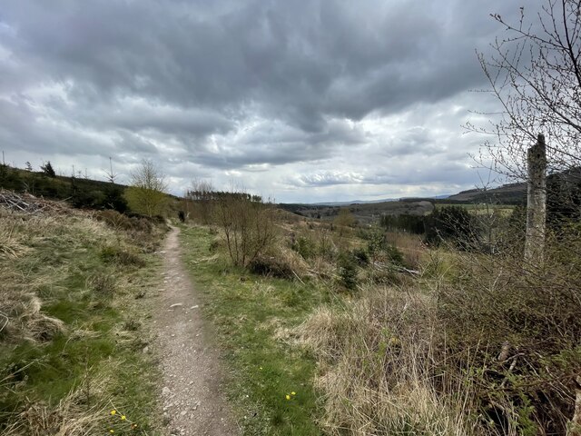
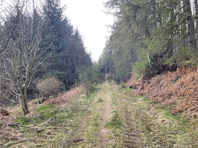
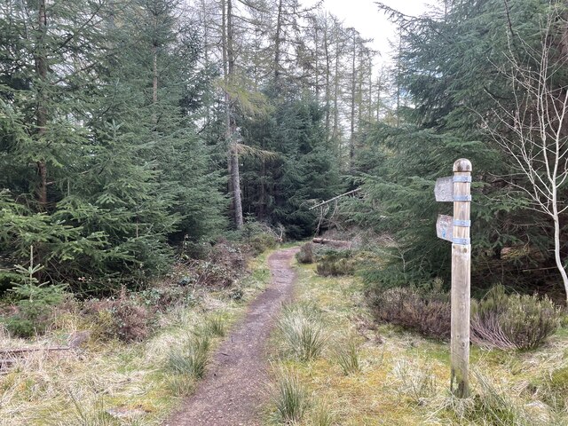
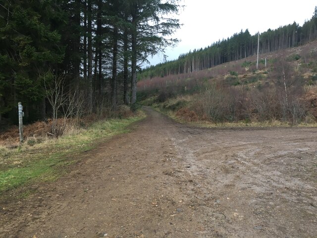
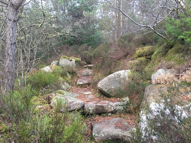
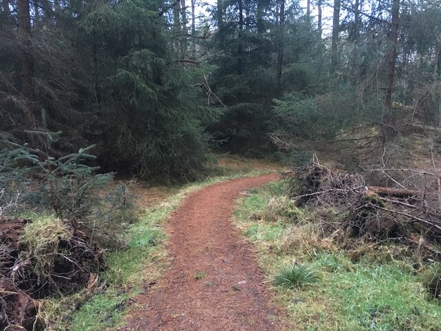
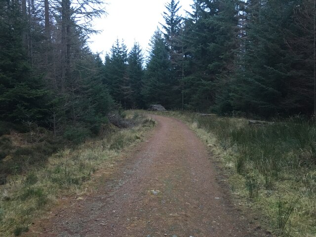
Bennachie Forest offers a range of walking trails and paths, catering to all levels of fitness and ability. From leisurely strolls to more challenging hikes, there is something for everyone. The trails wind through the forest, offering stunning views of the surrounding countryside and the distant peaks of the Bennachie range.

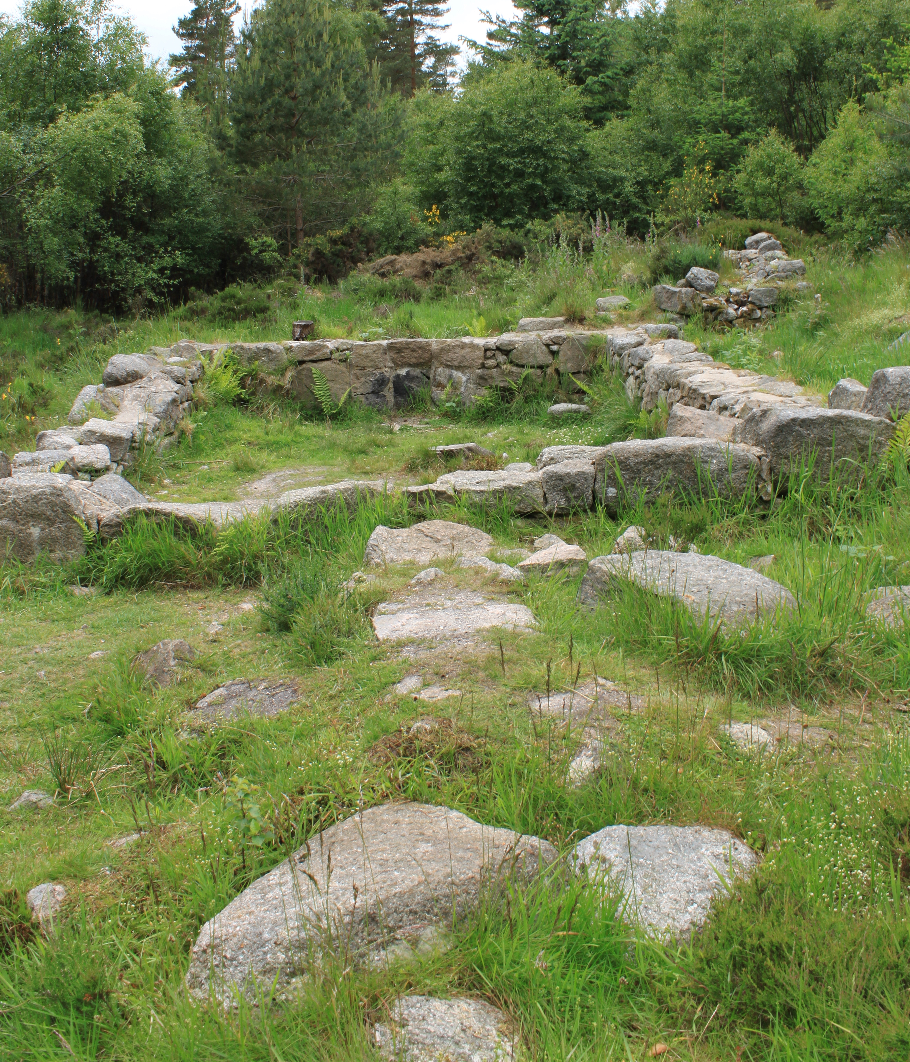
For those interested in history and archaeology, Bennachie Forest is home to several ancient sites, including the Mither Tap, an ancient hill fort that dates back to the Iron Age. Exploring these sites adds an additional layer of fascination to a visit to the forest.

Overall, Bennachie Forest is a beautiful and diverse woodland that offers a range of activities for visitors. Whether it's a peaceful walk, a wildlife-spotting adventure, or an exploration of ancient history, this forest has something for everyone to enjoy.

If you have any feedback on the listing, please let us know in the comments section below.

Bennachie Forest Images

Images are sourced within 2km of 57.277319/-2.535104 or Grid Reference NJ6720. Thanks to Geograph Open Source API. All images are credited.

Forest roads of Bennachie
Which way? Bennachie is a range of hills in Aberdeenshire, Scotland.It has several tops, the highest of which, Oxen Craig, has a height of 528 metres (1,732 ft). Though not particularly high, compared to other peaks within Scotland, the mountain is very prominent, owing to its isolation and the relative flatness of the surrounding terrain, and dominates the skyline from several viewpoints.
Which way?
Bennachie is a range of hills in Aberdeenshire, Scotland.It has several tops, the highest of which, Oxen Craig, has a height of 528 metres (1,732 ft). Though not particularly high, compared to other peaks within Scotland, the mountain is very prominent, owing to its isolation and the relative flatness of the surrounding terrain, and dominates the skyline from several viewpoints.
A path on Bennachie Bennachie is a range of hills in Aberdeenshire, Scotland.It has several tops, the highest of which, Oxen Craig, has a height of 528 metres (1,732 ft). Though not particularly high, compared to other peaks within Scotland, the mountain is very prominent, owing to its isolation and the relative flatness of the surrounding terrain, and dominates the skyline from several viewpoints.
A path on Bennachie
Bennachie is a range of hills in Aberdeenshire, Scotland.It has several tops, the highest of which, Oxen Craig, has a height of 528 metres (1,732 ft). Though not particularly high, compared to other peaks within Scotland, the mountain is very prominent, owing to its isolation and the relative flatness of the surrounding terrain, and dominates the skyline from several viewpoints.
Harvest time for trees Bennachie is a range of hills in Aberdeenshire, Scotland.It has several tops, the highest of which, Oxen Craig, has a height of 528 metres (1,732 ft). Though not particularly high, compared to other peaks within Scotland, the mountain is very prominent, owing to its isolation and the relative flatness of the surrounding terrain, and dominates the skyline from several viewpoints.
Harvest time for trees
Bennachie is a range of hills in Aberdeenshire, Scotland.It has several tops, the highest of which, Oxen Craig, has a height of 528 metres (1,732 ft). Though not particularly high, compared to other peaks within Scotland, the mountain is very prominent, owing to its isolation and the relative flatness of the surrounding terrain, and dominates the skyline from several viewpoints.
Around the back of Scare hill Bennachie is a range of hills in Aberdeenshire, Scotland.It has several tops, the highest of which, Oxen Craig, has a height of 528 metres (1,732 ft). Though not particularly high, compared to other peaks within Scotland, the mountain is very prominent, owing to its isolation and the relative flatness of the surrounding terrain, and dominates the skyline from several viewpoints.
Around the back of Scare hill
Bennachie is a range of hills in Aberdeenshire, Scotland.It has several tops, the highest of which, Oxen Craig, has a height of 528 metres (1,732 ft). Though not particularly high, compared to other peaks within Scotland, the mountain is very prominent, owing to its isolation and the relative flatness of the surrounding terrain, and dominates the skyline from several viewpoints.
Only one way to go
Only one way to go
Forestry road near Donview
Path up Millstone Hill
Path in Bennachie Forest
Forestry road in Bennachie Forest
Douchries and Millstone Farmland to Douchries Farm with Millstone Hill behind.
Douchries and Millstone
Farmland to Douchries Farm with Millstone Hill behind.
Farmland to Scarehill Open farmland between Whitehill Wood and Scare Hill.
Farmland to Scarehill
Open farmland between Whitehill Wood and Scare Hill.
Wildlife pond A simple pond for watching the wildlife in the area
Wildlife pond
A simple pond for watching the wildlife in the area
Almost at the top Signpost just short of the top of the Mither Tap
Almost at the top
Signpost just short of the top of the Mither Tap
The Gouk Stone
The Gouk Stone
The Gordon Way The Gordon Way starts at the Bennachie Centre and runs for 11.5 miles (18.5 km) along the southern side of Bennachie and on to the Suie car park, 3 miles south east of Rhynie. You walk through forests, farmland and open moorland, stout boots are recommended as some sections are muddy.
The Gordon Way
The Gordon Way starts at the Bennachie Centre and runs for 11.5 miles (18.5 km) along the southern side of Bennachie and on to the Suie car park, 3 miles south east of Rhynie. You walk through forests, farmland and open moorland, stout boots are recommended as some sections are muddy.
Gordon Way Sign The Gordon Way starts at the Bennachie Centre and runs for 11.5 miles (18.5 km) along the southern side of Bennachie and on to the Suie car park, 3 miles south east of Rhynie. You walk through forests, farmland and open moorland, stout boots are recommended as some sections are muddy.
Gordon Way Sign
The Gordon Way starts at the Bennachie Centre and runs for 11.5 miles (18.5 km) along the southern side of Bennachie and on to the Suie car park, 3 miles south east of Rhynie. You walk through forests, farmland and open moorland, stout boots are recommended as some sections are muddy.
The Gordon Way The Gordon Way starts at the Bennachie Centre and runs for 11.5 miles (18.5 km) along the southern side of Bennachie and on to the Suie car park, 3 miles south east of Rhynie. You walk through forests, farmland and open moorland, stout boots are recommended as some sections are muddy.
The Gordon Way
The Gordon Way starts at the Bennachie Centre and runs for 11.5 miles (18.5 km) along the southern side of Bennachie and on to the Suie car park, 3 miles south east of Rhynie. You walk through forests, farmland and open moorland, stout boots are recommended as some sections are muddy.
Show me another place!

Bennachie Forest is located at Grid Ref: NJ6720 (Lat: 57.277319, Lng: -2.535104)

Unitary Authority: Aberdeenshire

Police Authority: North East

What 3 Words

///deranged.shadow.eggs. Near Kemnay, Aberdeenshire

Related Wikis

Bennachie

Bennachie ( ben-ə-HEE; Scottish Gaelic: Beinn na Cìche) is a range of hills in Aberdeenshire, Scotland. It has several tops, the highest of which, Oxen...

The Colony (Bennachie)

The Colony was a squatters' community on "commonty", or common land, on one side of Bennachie, a range of hills near Aberdeen, in Scotland.From the beginning...

Bograxie

Bograxie is a farm in Aberdeenshire, Scotland. == References ==

Blairdaff

Blairdaff is a parish in Garioch, Aberdeenshire, Scotland, next to the villages of Kemnay and Monymusk. Blairdaff had a grocery store, a post office, and...

Have you been to Bennachie Forest?

Leave your review of Bennachie Forest below (or comments, questions and feedback).