Backhill Wood

Wood, Forest in Berwickshire

Scotland

Backhill Wood

Road to Scarlaw Although tarmacked this is not a public road. Part of the Southern Upland Way and also the most easterly route of the Herring Road. This is the view west just after leaving the fishery at Watch Water Reservoir, and in the distance you can just make out Twin Law, though not the cairns on this hill.
Road to Scarlaw Credit: Adam Ward

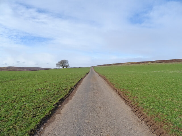
Backhill Wood is a picturesque woodland located in the region of Berwickshire, Scotland. Stretching over an area of approximately 100 hectares, it is a haven for nature enthusiasts and outdoor adventurers alike.

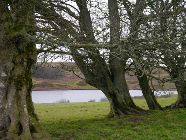
Dominated by a diverse range of tree species, including oak, birch, and Scots pine, Backhill Wood boasts a rich and flourishing ecosystem. The woodland floor is covered in a thick carpet of moss and ferns, creating a lush and verdant environment. The tranquil atmosphere is further enhanced by the presence of a meandering stream that runs through the heart of the wood, offering a soothing soundtrack of babbling water.

The wood holds great significance in terms of wildlife conservation. It serves as a habitat for various bird species, including woodpeckers, owls, and songbirds, which fill the air with their melodic tunes. Squirrels can also be spotted darting between the branches, while rabbits and deer are occasionally seen grazing in the undergrowth.

Backhill Wood provides a range of recreational opportunities for visitors. A network of well-maintained trails offers walkers and hikers the chance to explore the wood at their own pace. These paths lead to enchanting viewpoints, providing breathtaking vistas of the surrounding countryside. Additionally, the wood is home to a picnic area, allowing visitors to relax and enjoy a meal amidst nature's beauty.

With its idyllic setting and abundant wildlife, Backhill Wood offers a truly immersive experience in the heart of Berwickshire. Whether one seeks tranquility, adventure, or a deeper connection with nature, this woodland is a must-visit destination for all.

If you have any feedback on the listing, please let us know in the comments section below.

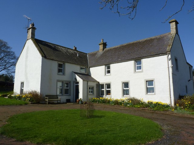
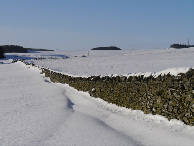
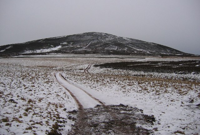
Backhill Wood Images

Images are sourced within 2km of 55.805705/-2.5162798 or Grid Reference NT6757. Thanks to Geograph Open Source API. All images are credited.

Road to Scarlaw Although tarmacked this is not a public road. Part of the Southern Upland Way and also the most easterly route of the Herring Road. This is the view west just after leaving the fishery at Watch Water Reservoir, and in the distance you can just make out Twin Law, though not the cairns on this hill.
Road to Scarlaw
Although tarmacked this is not a public road. Part of the Southern Upland Way and also the most easterly route of the Herring Road. This is the view west just after leaving the fishery at Watch Water Reservoir, and in the distance you can just make out Twin Law, though not the cairns on this hill.
Benchmark on wall near Rawburn Farm Ordnance Survey benchmark. For database entry, see <span class="nowrap"><a title="https://www.bench-marks.org.uk/bm189613" rel="nofollow ugc noopener" href="https://www.bench-marks.org.uk/bm189613">Link</a><img style="margin-left:2px;" alt="External link" title="External link - shift click to open in new window" src="https://s1.geograph.org.uk/img/external.png" width="10" height="10"/></span>.
Benchmark on wall near Rawburn Farm
Ordnance Survey benchmark. For database entry, see LinkExternal link.
Benchmark, Longformacus House Lodge Ordnance Survey benchmark, described on database at <span class="nowrap"><a title="https://www.bench-marks.org.uk/bm85346" rel="nofollow ugc noopener" href="https://www.bench-marks.org.uk/bm85346">Link</a><img style="margin-left:2px;" alt="External link" title="External link - shift click to open in new window" src="https://s1.geograph.org.uk/img/external.png" width="10" height="10"/></span>.
Benchmark, Longformacus House Lodge
Ordnance Survey benchmark, described on database at LinkExternal link.
Sign at Rawburn Farm
Rawburn Farm, near Longformacus Apparently a Covenanter, Margaret Tunnock, lived here in the seventeenth century.
Rawburn Farm, near Longformacus
Apparently a Covenanter, Margaret Tunnock, lived here in the seventeenth century.
Longformacus House Once home of Sir Robert Sinclair, a supporter of the Covenanters.
Longformacus House
Once home of Sir Robert Sinclair, a supporter of the Covenanters.
Gnarled Beeches At Watch Water Reservoir A small stand of Beeches north of Watch Water Reservoir on a cold December afternoon.
Gnarled Beeches At Watch Water Reservoir
A small stand of Beeches north of Watch Water Reservoir on a cold December afternoon.
Water Bowser Near The Watch A water bowser for sheep near Watch Water Reservoir.
Water Bowser Near The Watch
A water bowser for sheep near Watch Water Reservoir.
Spillway At Watch Water Reservoir The spillway at Watch Water Reservoir.
Spillway At Watch Water Reservoir
The spillway at Watch Water Reservoir.
Valve Tower At Watch Water Reservoir A view looking across Watch Water Reservoir from near the valve tower.
Valve Tower At Watch Water Reservoir
A view looking across Watch Water Reservoir from near the valve tower.
Wetland, Rawburn The air is damp too, thanks to a haar.
Wetland, Rawburn
The air is damp too, thanks to a haar.
Road junction Left for Rawburn Cottage, straight on for some fields within the moorland.
Road junction
Left for Rawburn Cottage, straight on for some fields within the moorland.
Woodland, Rawburn Cottage A sheltering conifer wood.
Woodland, Rawburn Cottage
A sheltering conifer wood.
Watch Water Reservoir Dam At the northern end of the reservoir.
Watch Water Reservoir Dam
At the northern end of the reservoir.
Rawburn Farm The minor road from Longformacus to Watch Water Reservoir passes through the farm.
Rawburn Farm
The minor road from Longformacus to Watch Water Reservoir passes through the farm.
Road Bridge on the minor road from Longformacus to Watch Water Reservoir Spans Watch Water.
Road Bridge on the minor road from Longformacus to Watch Water Reservoir
Spans Watch Water.
Longformacus Entering Longformacus from the north.
Longformacus
Entering Longformacus from the north.
Snow Off A Dyke Melting snow on a drystone dyke north of Longformacus on the slope of Sinclair's Hill.
Snow Off A Dyke
Melting snow on a drystone dyke north of Longformacus on the slope of Sinclair's Hill.
Show me another place!

Backhill Wood is located at Grid Ref: NT6757 (Lat: 55.805705, Lng: -2.5162798)

Unitary Authority: The Scottish Borders

Police Authority: The Lothians and Scottish Borders

What 3 Words

///down.skirting.pitching. Near Duns, Scottish Borders

Related Wikis

Longformacus

Longformacus (Scottish Gaelic: Longphort Mhacais) is a small village in Berwickshire in the Scottish Borders area of Scotland. It is around 10 kilometres...

Watch Water

The Watch Water is a river in the Scottish Borders area of Scotland. It rises in the Lammermuir Hills, around 8 kilometres (5.0 mi) west of Longformacus...

Longformacus House

Longformacus House is a mansion near the village of Longformacus, Scottish Borders, Scotland. == History == The estate was once owned by the Earls of...

Dirrington Great Law

Dirrington Great Law is a hill in the Scottish Borders area of Scotland, in the former county of Berwickshire. The summit is around 2.5 kilometres (1.6...

Related Videos

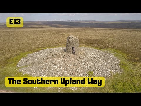
13 The Southern Upland Way Scottish National trail Scotland UK Twin Law Cairns Watch Water Reservoir

Filmed 28th May 2018 Day Thirteen on the The Southern Upland Way a 212-mile (341 km) coast-to-coast walk From Portpatrick in ...

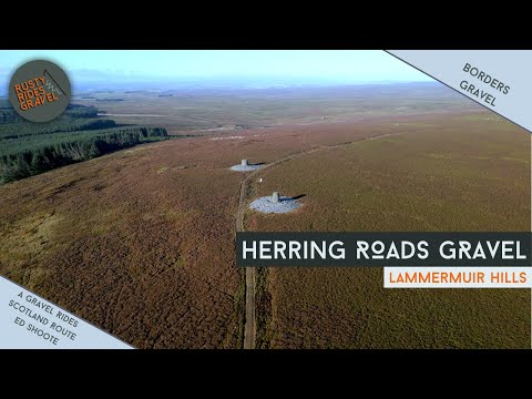
The Herring Roads of the Lammermuirs | A 'Gravel Rides Scotland' Route

Ed's Book: https://www.adventurebooks.com/products/gravel_rides_scotland All my socials and links: ...

Nearby Amenities

Located within 500m of 55.805705,-2.5162798
Noexit: yes
Lat/Long: 55.8054674/-2.5087914
The data included in this document is from www.openstreetmap.org. The data is made available under ODbL.

Have you been to Backhill Wood?

Leave your review of Backhill Wood below (or comments, questions and feedback).