Auchravie Belt

Wood, Forest in Aberdeenshire

Scotland

Auchravie Belt

Clyan's dam - Reflections
Clyan's dam - Reflections Credit: Doug Mortimer

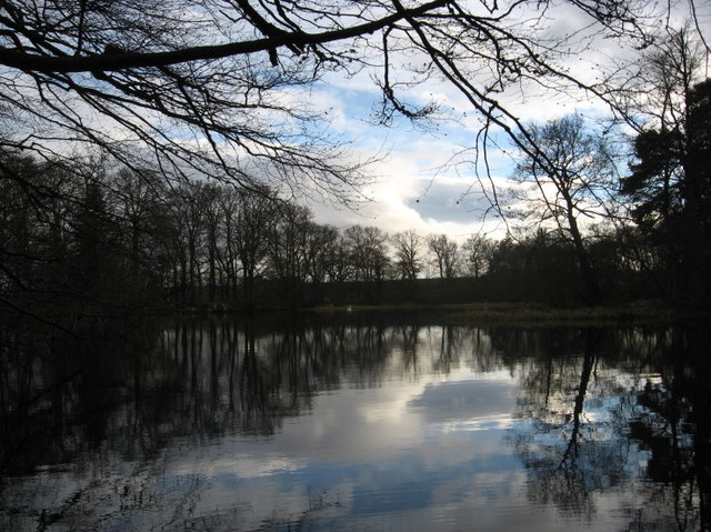
Auchravie Belt is a picturesque wood located in Aberdeenshire, Scotland. Nestled amidst the stunning landscape of the region, this forest is a beloved natural attraction for locals and tourists alike.

Covering an area of approximately 100 hectares, Auchravie Belt is characterized by its diverse range of tree species. The wood is predominantly composed of native trees, including oak, birch, and rowan, which provide a rich and vibrant habitat for various wildlife.

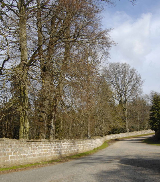
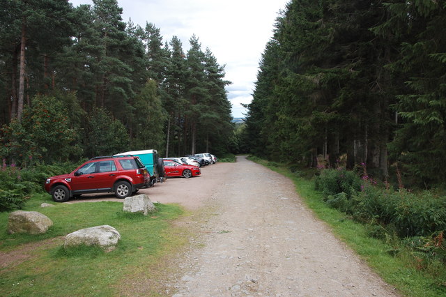
As visitors explore the forest, they are greeted by a network of well-maintained trails that wind through the trees, offering a serene and peaceful environment for walking, jogging, or simply enjoying the tranquility of nature. The paths are accessible to people of all ages and abilities, making Auchravie Belt a popular destination for families.

Throughout the wood, there are also several picnic areas and benches where visitors can relax and take in the scenic surroundings. These spots are ideal for enjoying a packed lunch or simply sitting back and appreciating the beauty of the forest.

Due to its diverse ecosystem, Auchravie Belt is home to a wide range of bird species, making it a haven for birdwatchers. Additionally, the forest is inhabited by various mammals, including red squirrels and roe deer, which can often be spotted by lucky visitors.

Overall, Auchravie Belt is a natural gem in Aberdeenshire, offering a tranquil escape from the hustle and bustle of everyday life. Its stunning scenery, diverse wildlife, and well-maintained trails make it a must-visit destination for nature enthusiasts and those seeking a peaceful retreat.

If you have any feedback on the listing, please let us know in the comments section below.

Auchravie Belt Images

Images are sourced within 2km of 57.211464/-2.5435702 or Grid Reference NJ6713. Thanks to Geograph Open Source API. All images are credited.

Clyan's dam - Reflections
Fraser mausoleum, Cluny Old Kirkyard Yet another view of the A-listed (see: <span class="nowrap"><a title="http://data.historic-scotland.gov.uk/pls/htmldb/f?p=2200:15:0::::BUILDING:2947" rel="nofollow ugc noopener" href="http://data.historic-scotland.gov.uk/pls/htmldb/f?p=2200:15:0::::BUILDING:2947">Link</a><img style="margin-left:2px;" alt="External link" title="External link - shift click to open in new window" src="https://s1.geograph.org.uk/img/external.png" width="10" height="10"/></span> ) "pepper pot" mausoleum from ca. 1808 with the Fraser arms (Quarterly, 1st and 4th, azure three frases argent; 2nd and 3rd, argent three antique crowns gules; over the quarters a crescent argent) above the gated doorway.  Compare: <a title="https://www.geograph.org.uk/photo/3688733" href="https://www.geograph.org.uk/photo/3688733">Link</a> .
Fraser mausoleum, Cluny Old Kirkyard
Yet another view of the A-listed (see: LinkExternal link ) "pepper pot" mausoleum from ca. 1808 with the Fraser arms (Quarterly, 1st and 4th, azure three frases argent; 2nd and 3rd, argent three antique crowns gules; over the quarters a crescent argent) above the gated doorway. Compare: Link .
The Old Manse, Cluny C-listed (see: <span class="nowrap"><a title="http://data.historic-scotland.gov.uk/pls/htmldb/f?p=2200:15:0::::BUILDING:147" rel="nofollow ugc noopener" href="http://data.historic-scotland.gov.uk/pls/htmldb/f?p=2200:15:0::::BUILDING:147">Link</a><img style="margin-left:2px;" alt="External link" title="External link - shift click to open in new window" src="https://s1.geograph.org.uk/img/external.png" width="10" height="10"/></span> ) from about 1850.
The Old Manse, Cluny
C-listed (see: LinkExternal link ) from about 1850.
The Great Wall A small section of the wall that surrounds most of the grounds of Cluny Castle.
The Great Wall
A small section of the wall that surrounds most of the grounds of Cluny Castle.
Linton burial enclosure, Cluny Old Kirkyard The A-listed Linton House is a few km away, near the village of Sauchen.
Linton burial enclosure, Cluny Old Kirkyard
The A-listed Linton House is a few km away, near the village of Sauchen.
Lonesome Pine This solitary Scots Pine looks as if it has a bit of a history. It may have been part of a plantation, but if so it was left standing when its fellows were felled. It was then able to grow out a bit, as Scots Pines will do when not competing with others too close to them. Then it has lost some of its lower branches, leaving bare stumps near the base of the tree, but it still has a green crown.
Lonesome Pine
This solitary Scots Pine looks as if it has a bit of a history. It may have been part of a plantation, but if so it was left standing when its fellows were felled. It was then able to grow out a bit, as Scots Pines will do when not competing with others too close to them. Then it has lost some of its lower branches, leaving bare stumps near the base of the tree, but it still has a green crown.
Westside The snow in the foreground field is shaded by the forest in this view across the Todlachie Burn to Westside.
Westside
The snow in the foreground field is shaded by the forest in this view across the Todlachie Burn to Westside.
Woodland, Tillyfourie Hill Mature conifers beside the Pitfichie Forest car park.
Woodland, Tillyfourie Hill
Mature conifers beside the Pitfichie Forest car park.
Logging road, Tillyfourie Hill Near the car park.
Logging road, Tillyfourie Hill
Near the car park.
Track out of Pitfichie Forest There is a large boulder in the field on the right.
Track out of Pitfichie Forest
There is a large boulder in the field on the right.
Grazing sheep, Todlachie
Road, Pitmunie Passing Brankinetum Wood on the left.
Road, Pitmunie
Passing Brankinetum Wood on the left.
Road to Tillyfourie The farm access road clips the corner of Forestry Commission woodland.
Road to Tillyfourie
The farm access road clips the corner of Forestry Commission woodland.
Car park, Pitfichie Forest Many of the cars probably belong to mountain bikers.
Car park, Pitfichie Forest
Many of the cars probably belong to mountain bikers.
Track, Pitfichie Forest Beware of mountain bikes hurtling past...
Track, Pitfichie Forest
Beware of mountain bikes hurtling past...
Former mill, Monymusk Nicely converted to residential use, although the large ground-floor windows are rather exposed.  Note the former mill wheel in the garden.
Former mill, Monymusk
Nicely converted to residential use, although the large ground-floor windows are rather exposed. Note the former mill wheel in the garden.
Cluny parish kirk Dating from 1789 in typical rectangular design for the time and B-listed (LB2946): <span class="nowrap"><a title="http://portal.historicenvironment.scot/designation/LB2946" rel="nofollow ugc noopener" href="http://portal.historicenvironment.scot/designation/LB2946">Link</a><img style="margin-left:2px;" alt="External link" title="External link - shift click to open in new window" src="https://s1.geograph.org.uk/img/external.png" width="10" height="10"/></span> .  Note that the east wall facing the drive from Cluny Castle is of higher quality grey granite ashlar whereas the south end (with bellcote) and rest of the kirk is constructed from cruder granite blocks.  The utilitarian concrete church hall stands beside it.
Cluny parish kirk
Dating from 1789 in typical rectangular design for the time and B-listed (LB2946): LinkExternal link . Note that the east wall facing the drive from Cluny Castle is of higher quality grey granite ashlar whereas the south end (with bellcote) and rest of the kirk is constructed from cruder granite blocks. The utilitarian concrete church hall stands beside it.
Cluny war memorial. Situated just east of the kirk: 29 men lost in WW1, eight in WW2.  Unlike many war memorials, it does not state rank or regiment.
Cluny war memorial.
Situated just east of the kirk: 29 men lost in WW1, eight in WW2. Unlike many war memorials, it does not state rank or regiment.
Show me another place!

Auchravie Belt is located at Grid Ref: NJ6713 (Lat: 57.211464, Lng: -2.5435702)

Unitary Authority: Aberdeenshire

Police Authority: North East

What 3 Words

///nanny.weaved.abstracts. Near Sauchen, Aberdeenshire

Related Wikis

Monymusk railway station

Monymusk railway station was a station on the Alford Valley Railway in Monymusk, Aberdeenshire, Scotland. The station opened on 25 March 1859 and closed...

Monymusk

Monymusk (Scottish Gaelic: Monadh Musga) is a planned village in the Marr area of Aberdeenshire, Scotland. == History == Malcolm Canmore first established...

Monymusk Parish Church

Monymusk Parish Church (also known as the Church of the Blessed Mary) is located in Monymusk, Aberdeenshire, Scotland. It is of Church of Scotland denomination...

Tillycairn Castle

Tillycairn Castle is an L-plan castle, dating from the 16th century, standing on high ground around 2.0 miles (3.2 km) south-east of Cluny in Aberdeenshire...

Nearby Amenities

Located within 500m of 57.211464,-2.5435702
Power: pole
Lat/Long: 57.2142013/-2.5378442
Power: pole
Lat/Long: 57.2138846/-2.538831
Power: pole
Lat/Long: 57.2135828/-2.5398012
Power: pole
Lat/Long: 57.2131881/-2.5410985
Power: pole
Lat/Long: 57.2130192/-2.5420382
Power: pole
Lat/Long: 57.2128421/-2.5430513
Power: pole
Lat/Long: 57.2126439/-2.544192
Power: pole
Lat/Long: 57.2124345/-2.5453341
Power: pole
Lat/Long: 57.2121906/-2.5467062
Power: pole
Lat/Long: 57.2119332/-2.5481448
Power: pole
Lat/Long: 57.2115354/-2.5490444
Power: pole
Lat/Long: 57.2111315/-2.5499369
Power: pole
Lat/Long: 57.2108148/-2.5506701
Power: pole
Lat/Long: 57.2104838/-2.5513714
Power: pole
Lat/Long: 57.2094495/-2.5445149
Power: pole
Lat/Long: 57.2092806/-2.5466119
Power: pole
Lat/Long: 57.2096777/-2.5478385
Power: pole
Lat/Long: 57.2103892/-2.5471566
Power: pole
Lat/Long: 57.2099914/-2.5460201
Power: pole
Lat/Long: 57.2100987/-2.5484567
Power: pole
Lat/Long: 57.2093226/-2.5471747
Power: pole
Lat/Long: 57.2106054/-2.5491816
The data included in this document is from www.openstreetmap.org. The data is made available under ODbL.

Have you been to Auchravie Belt?

Leave your review of Auchravie Belt below (or comments, questions and feedback).