Carter Forest

Wood, Forest in Roxburghshire

Scotland

Carter Forest

Carter Fell A view down Redesdale from Carter Fell. In the distance three of the resident feral goats can be seen running away.
Carter Fell Credit: Quentin Groom

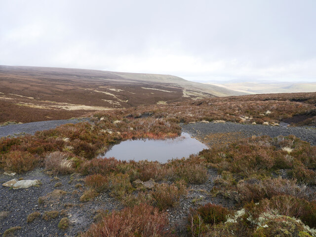
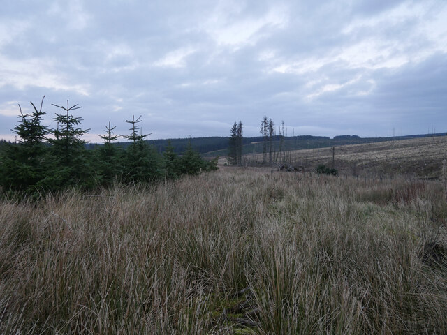
Carter Forest, located in Roxburghshire, is a stunning woodland area that covers approximately 1,500 hectares. Situated in the southern part of Scotland, this forest offers visitors a tranquil and picturesque setting to explore and enjoy the natural beauty of the area.

The forest is primarily composed of mixed woodland, with a variety of tree species including oak, beech, and Scots pine. The diverse range of trees creates a rich and vibrant habitat for an array of wildlife, making it a haven for nature enthusiasts. Visitors to Carter Forest can expect to spot deer, red squirrels, and various species of birds, among other animals.

There are several walking trails within the forest, catering to different levels of fitness and interests. These trails allow visitors to immerse themselves in the serene environment, providing opportunities to observe and appreciate the flora and fauna. The forest also features designated picnic areas, providing a perfect spot for visitors to relax and enjoy a meal amidst the peaceful surroundings.

Carter Forest is easily accessible, with a car park available for visitors. The forest is open year-round, and during autumn, the changing colors of the leaves create a breathtaking spectacle. The forest is also a popular destination for photographers, who can capture the beauty of the landscape in all seasons.

Overall, Carter Forest in Roxburghshire offers a wonderful experience for those seeking a peaceful retreat in nature. With its diverse woodland, abundant wildlife, and various amenities, it is a must-visit destination for nature lovers and outdoor enthusiasts alike.

If you have any feedback on the listing, please let us know in the comments section below.

Carter Forest Images

Images are sourced within 2km of 55.338499/-2.5204788 or Grid Reference NT6705. Thanks to Geograph Open Source API. All images are credited.

Carter Fell A view down Redesdale from Carter Fell. In the distance three of the resident feral goats can be seen running away.
Carter Fell
A view down Redesdale from Carter Fell. In the distance three of the resident feral goats can be seen running away.
Rock outcrops by the Bateinghope mine track There are a number of outcrops in this area, some of which appear to have been quarried, possibly for a surfacing for the mine track although there appears to be little evidence remaining of this.

This photograph was taken during the Coronavirus (COVID-19) pandemic of 2020.
Rock outcrops by the Bateinghope mine track
There are a number of outcrops in this area, some of which appear to have been quarried, possibly for a surfacing for the mine track although there appears to be little evidence remaining of this. This photograph was taken during the Coronavirus (COVID-19) pandemic of 2020.
On a firmer track The former mine track from Carter Bar to near the head of the Bateinghope Burn was rather waterlogged along most of its course, this section was somewhat firmer.  An excellent view was afforded towards the Cheviot massif in the distance.

This photograph was taken during the Coronavirus (COVID-19) pandemic of 2020.
On a firmer track
The former mine track from Carter Bar to near the head of the Bateinghope Burn was rather waterlogged along most of its course, this section was somewhat firmer. An excellent view was afforded towards the Cheviot massif in the distance. This photograph was taken during the Coronavirus (COVID-19) pandemic of 2020.
An outcrop near Buzzard Crags As shower clouds pass overhead this photograph was taken just off the former Bateinhope mine track.

This photograph was taken during the Coronavirus (COVID-19) pandemic of 2020.
An outcrop near Buzzard Crags
As shower clouds pass overhead this photograph was taken just off the former Bateinhope mine track. This photograph was taken during the Coronavirus (COVID-19) pandemic of 2020.
Coal mine spoil above the Bateinghope Burn Remains of early to mid 19th century coal mining activity above the Bateinghope Burn.

This photograph was taken during the Coronavirus (COVID-19) pandemic of 2020.
Coal mine spoil above the Bateinghope Burn
Remains of early to mid 19th century coal mining activity above the Bateinghope Burn. This photograph was taken during the Coronavirus (COVID-19) pandemic of 2020.
Triangulation pillar on Carter Fell The triangulation pillar on the north-east top of Carter Fell affords a view north to The Cheviot massif.  The Scotland/England border runs along the furthest fence line in the background.

This photograph was taken during the Coronavirus (COVID-19) pandemic of 2020.
Triangulation pillar on Carter Fell
The triangulation pillar on the north-east top of Carter Fell affords a view north to The Cheviot massif. The Scotland/England border runs along the furthest fence line in the background. This photograph was taken during the Coronavirus (COVID-19) pandemic of 2020.
Dilapidated 'Dilapidated' would be one word to describe the fence line on Carter Fell, just inside Scotland!  This is heather moorland, interspersed with boggy grassland and peat hags.  This image was taken as clouds rolled north after a beautiful start to a late November day.

This photograph was taken during the Coronavirus (COVID-19) pandemic of 2020.
Dilapidated
'Dilapidated' would be one word to describe the fence line on Carter Fell, just inside Scotland! This is heather moorland, interspersed with boggy grassland and peat hags. This image was taken as clouds rolled north after a beautiful start to a late November day. This photograph was taken during the Coronavirus (COVID-19) pandemic of 2020.
A view across the forestry A view across various stages of forestry north of Carter Fell.  The track in the foreground provides access to a communications mast further uphill.

This photograph was taken during the Coronavirus (COVID-19) pandemic of 2020.
A view across the forestry
A view across various stages of forestry north of Carter Fell. The track in the foreground provides access to a communications mast further uphill. This photograph was taken during the Coronavirus (COVID-19) pandemic of 2020.
A cold morning in the forest A cold late November morning in the forest, bound for Carter Fell.

This photograph was taken during the Coronavirus (COVID-19) pandemic of 2020.
A cold morning in the forest
A cold late November morning in the forest, bound for Carter Fell. This photograph was taken during the Coronavirus (COVID-19) pandemic of 2020.
A former mine track nearing the Wauchope Forest The term 'track' is used very loosely; it is little more than slightly different vegetation from the predominantly heather moorland characteristic of the area.  The mines were in use in the first half of the 19th century and provided coal for Jedburgh.

This photograph was taken during the Coronavirus (COVID-19) pandemic of 2020.
A former mine track nearing the Wauchope Forest
The term 'track' is used very loosely; it is little more than slightly different vegetation from the predominantly heather moorland characteristic of the area. The mines were in use in the first half of the 19th century and provided coal for Jedburgh. This photograph was taken during the Coronavirus (COVID-19) pandemic of 2020.
Sunset and Sitka The Wauchope Forest at sunset as viewed from a former access track for coal mines on Carter Fell.

This photograph was taken during the Coronavirus (COVID-19) pandemic of 2020.
Sunset and Sitka
The Wauchope Forest at sunset as viewed from a former access track for coal mines on Carter Fell. This photograph was taken during the Coronavirus (COVID-19) pandemic of 2020.
Dusk in the forest The route of the former Carter Fell coal mines access track heads down towards the Carter Burn.  

This photograph was taken during the Coronavirus (COVID-19) pandemic of 2020.
Dusk in the forest
The route of the former Carter Fell coal mines access track heads down towards the Carter Burn. This photograph was taken during the Coronavirus (COVID-19) pandemic of 2020.
Forestry, Green Law North side of Carter Fell.
Forestry, Green Law
North side of Carter Fell.
Logging road, north side of Carter Fell
New road near Carterhouse
Bateinghope Burn Bateinghope Burn is seen running downstream from a public footpath; the path can be seen rounding the hill slope at the left side of the image.
Bateinghope Burn
Bateinghope Burn is seen running downstream from a public footpath; the path can be seen rounding the hill slope at the left side of the image.
Carter Fell NE Top Lovely breeze at Carter Bar to cool me on this lovely summer's day at end of September, 25 degrees C. Still boggy on top. Is this top really just in Scotland?
Name: Carter Fell NE Top
Hill number: 3541
Height: 579m / 1900ft
Area: 33: The Scottish Border to the River Tyne
Class: Hu,5,5D
Grid ref: NT 68244 05239
Summit feature: no feature: 12m E of trig point
Drop: 102m
Col: 477m  NT647028
Carter Fell NE Top
Lovely breeze at Carter Bar to cool me on this lovely summer's day at end of September, 25 degrees C. Still boggy on top. Is this top really just in Scotland? Name: Carter Fell NE Top Hill number: 3541 Height: 579m / 1900ft Area: 33: The Scottish Border to the River Tyne Class: Hu,5,5D Grid ref: NT 68244 05239 Summit feature: no feature: 12m E of trig point Drop: 102m Col: 477m NT647028
Show me another place!

Carter Forest is located at Grid Ref: NT6705 (Lat: 55.338499, Lng: -2.5204788)

Unitary Authority: The Scottish Borders

Police Authority: The Lothians and Scottish Borders

What 3 Words

///porch.sway.practical. Near Jedburgh, Scottish Borders

Nearby Locations

Carter Forest

Related Wikis

Scottish Borders

The Scottish Borders (Scots: the Mairches, lit. 'the Marches'; Scottish Gaelic: Crìochan na h-Alba) is one of 32 council areas of Scotland. It is bordered...

Whitelee Moor

Whitelee Moor is nature reserve of the Northumberland Wildlife Trust, in Northumberland, England, near Carter Bar. A large part of the moor is blanket...

Carter Bar

Carter Bar is a pass in the Cheviot Hills, on the Anglo-Scottish border. It lies east of Carter Fell at the head of Redesdale, and is crossed by the A68...

Raid of the Redeswire

The Raid of the Redeswire, also known as the Redeswire Fray, was a border skirmish between England and Scotland on 7 July 1575 which took place at Carter...

Have you been to Carter Forest?

Leave your review of Carter Forest below (or comments, questions and feedback).